Category:San Francisquito Creek
river in the United States of America  | |||||
| Upload media | |||||
| Instance of | |||||
|---|---|---|---|---|---|
| Location |
| ||||
| Tributary |
| ||||
 | |||||
English: San Francisquito Creek - flowing from the Santa Cruz Mountains into southwestern San Francisco Bay.
- The confluence of Bear Creek and Corte Madera Creek forms San Francisquito Creek.
- Located in San Mateo and Santa Clara Counties, Northern California.
Media in category "San Francisquito Creek"
The following 20 files are in this category, out of 20 total.
-
 San Francisquito Creek Watershed Map 2002 Joint Powers Authority.jpg 1,102 × 852; 278 KB
-
 San Francisquito Watershed Satellite Map USGS.jpg 786 × 550; 77 KB
-
 Bear Creek Joins San Francisquito Creek July 2011.jpg 2,593 × 2,592; 6.21 MB
-
 El Palo Alto 2006-2.jpg 800 × 1,066; 500 KB
-
 El Palo Alto 2006.jpg 800 × 1,066; 98 KB
-
 El Palo Alto by the railroad.jpg 3,024 × 4,032; 3.06 MB
-
 El Palo Alto Tree August 2004.jpg 1,022 × 1,363; 810 KB
-
 El-palo-alto-tree-california.jpg 403 × 632; 32 KB
-

-
 Redwoods on hillside San Francisquito Creek Jasper Ridge 2011.jpg 3,872 × 2,592; 8.54 MB
-
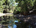 San Francisquito Creek epa.jpg 2,248 × 1,741; 3.03 MB
-
 San Francisquito Creek in East Palo Alto.jpg 4,032 × 3,024; 1.92 MB
-
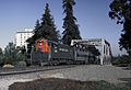 SP 3034 at Palo Alto High Stick tree 9 70x - Flickr - drewj1946.jpg 1,740 × 1,196; 1.11 MB
-

-
 Corte Madera Creek (San Francisquito Creek) in Jasper Ridge July 2011.jpg 3,070 × 2,592; 5.45 MB
-
 Hemiphoto stream1.jpg 250 × 254; 20 KB
-
 Hemiphoto stream2.jpg 250 × 254; 14 KB
-
 Searsville Reservoir July 2011.jpg 3,872 × 2,592; 7.24 MB
-
 Upper Watershed with Russian Ridge on Right and Montello Ridge on Left July 2011.jpg 3,198 × 2,592; 4.51 MB
-
 Columbia Tiger Lily on San Francisquito Creek July 2011.jpg 2,055 × 1,594; 2.75 MB


_in_Jasper_Ridge_July_2011.jpg)


