Category:Sawtooth National Forest
national forest located in Idaho and Utah in the United States   | |||||
| Upload media | |||||
| Instance of | |||||
|---|---|---|---|---|---|
| Named after | |||||
| Location | |||||
| IUCN protected areas category | |||||
| Inception |
| ||||
| Area |
| ||||
| official website | |||||
 | |||||
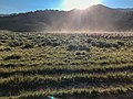
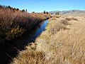
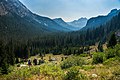
English: Sawtooth National Forest — a federally-protected area that covers 2,102,451 acres (850,832 ha) of the states of Idaho (~96%) and Utah (~4%).
- Originally named the Sawtooth Forest Reserve, and established by President Theodore Roosevelt in 1905.
Subcategories
This category has the following 20 subcategories, out of 20 total.
A
B
- Bald Mountain (Idaho) (7 F)
- Boulder Mountains (Idaho) (19 F)
C
- Castilleja christii (5 F)
F
- Fourth of July Lake (13 F)
I
K
- Ketchum Ranger District (1 F)
M
P
R
S
- Sawtooth Hotshots (4 F)
- Soldier Mountains (11 F)
W
Pages in category "Sawtooth National Forest"
This category contains only the following page.
Media in category "Sawtooth National Forest"
The following 200 files are in this category, out of 407 total.
(previous page) (next page)-
 (IDAHO-C-0006) Red Fish Lake (5599550380).jpg 1,613 × 1,024; 417 KB
-

-
 190704-FS-Sawtooth-EPM-003 (48938106906).jpg 3,000 × 2,250; 1.78 MB
-
 190710-FS-Sawtooth-EPM-009 (48938296007).jpg 3,000 × 4,000; 3.55 MB
-
 190730-FS-Sawtooth-EPM-005 (48937562353).jpg 3,000 × 2,250; 2.24 MB
-

-

-

-

-

-
 20161011-FS-Sawtooth-RNM-004 (43852403770).jpg 4,608 × 3,456; 3.29 MB
-
 2017-08-21-FS-Salmon-Challis NF KW 5386 (36366397190).jpg 5,760 × 3,840; 22.46 MB
-
 2017-08-21-FS-Salmon-Challis NF KW 5389 (36366393540).jpg 1,904 × 2,488; 1.88 MB
-
 2017-08-21-FS-Salmon-Challis NF KW 5398 (36763085655).jpg 5,760 × 3,840; 23.52 MB
-
 2017-08-21-FS-Salmon-Challis NF KW 5399 (36763073685).jpg 2,152 × 2,544; 2.53 MB
-
 20170727-FS-SNF-BH-Setting Sun and Rising Fish-01 001 (37401917970).jpg 2,832 × 3,775; 2.44 MB
-
 20170818-FS-PAF-KM-Eclipse Lunkers-06 IMG 2366 (48943688337).jpg 2,784 × 1,856; 844 KB
-
 20170818-FS-PAF-KM-Fly Fishing in the Depths-05 IMG 2377 (48943688172).jpg 2,784 × 1,856; 1.31 MB
-
 20170902-FS-Sawtooth NF-NL-Redfish Lake Canyon (23807290098).jpg 6,000 × 4,000; 20.91 MB
-
 20170902-FS-Sawtooth NF-NL-Redfish Lake Ferry (37610899386).jpg 5,642 × 4,000; 13.92 MB
-
 20170903-FS-Sawtooth NF-NL-Alpine Lake (37660674501).jpg 3,635 × 4,451; 13.3 MB
-
 20170929-FS-Sawtooth NF-NB-Mountain View-01 DSC 0849 (37637484251).jpg 3,264 × 2,878; 4.68 MB
-
 20170929-FS-Sawtooth NF-NB-Pike Mountain-01 DSC 0651 (23784000738).jpg 4,928 × 3,264; 4.59 MB
-
 20170929-FS-Sawtooth NF-NB-VC-01 DSC 0899 (37637482641).jpg 3,264 × 4,928; 9.74 MB
-
 2018-05-15-FS Sawtooth NF (40478194390).jpg 1,296 × 864; 185 KB
-
 2018-05-15-FS Sawtooth NF (40478194560).jpg 1,920 × 909; 344 KB
-
 2018-05-15-FS Sawtooth NF (41382864405).jpg 1,012 × 768; 155 KB
-
 2018-05-15-FS Sawtooth NF (41382864545).jpg 1,193 × 615; 159 KB
-
 20180904-FS-Sawtooth NF-DB-bringing fire IMG 162805 (31779181068).jpg 3,916 × 2,211; 4.44 MB
-
 20190811-FS-Sawtooth NF-NL-Little Redfish Lake-01 (48937209543).jpg 6,000 × 4,000; 16.15 MB
-
 20190811-FS-Sawtooth NF-NL-Ponderosa Pine Scenic Byway-01 (48937941022).jpg 6,000 × 4,000; 13.45 MB
-
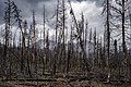 20190811-FS-Sawtooth NF-NL-Sawtooth Burn-01 (48937204698).jpg 6,000 × 4,000; 16.58 MB
-
 20190913-FS-STF NF-DMH-001 (48938029686).jpg 4,031 × 2,658; 2.38 MB
-
 2020 04 08 FS TeleworkingTeamMeeting JT IMG 1315 (49750611267).jpg 4,032 × 3,024; 1.73 MB
-
 A Rest With A View (20799848283).jpg 1,938 × 1,938; 1.29 MB
-
 A-10A Idaho ANG over Sawtooth Range 2009.jpg 3,000 × 2,008; 1.2 MB
-
 Abe's Armchair SNRA.JPG 2,816 × 2,112; 3.06 MB
-
 Above Jimmy Smith Lake.JPG 1,600 × 1,200; 449 KB
-
 Above Sunbeam Dam.jpg 1,600 × 1,200; 271 KB
-
 Albion Range Sunrise (11877199313).jpg 2,592 × 1,944; 1.66 MB
-
 ALL ROCK IMG 0398 (20799972153).jpg 4,608 × 3,456; 6.51 MB
-
 Alpine Lake (15182207351).jpg 4,000 × 3,000; 2.71 MB
-
 Alpine Lake (15184857212).jpg 4,000 × 3,000; 3.88 MB
-
 Alpine Meadow (14998544580).jpg 4,000 × 3,000; 3.05 MB
-
 Alpine Meadow (15162183746).jpg 3,868 × 2,901; 1.75 MB
-
 Alpine Meadow (15220814842).jpg 4,000 × 3,000; 3.67 MB
-
 Alpine Meadow (15220815432).jpg 4,000 × 3,000; 2.91 MB
-
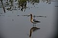 American Avocet 2 Sawtooth NF Tony Davis (11875880755).jpg 2,928 × 1,952; 2.92 MB
-
 American Avocet Sawtooth NF Tony Davis (11875879935).jpg 2,928 × 1,952; 2.44 MB
-
 Anaphalis margaritacea (14891605670).jpg 2,984 × 2,984; 819 KB
-
 Anaphalis margaritacea (15078249535).jpg 3,266 × 2,449; 721 KB
-
 Arnica latifolia (15034510100).jpg 2,229 × 2,972; 857 KB
-
 Around the Bend (11876220754).jpg 2,272 × 1,704; 1.52 MB
-
 Aspens and sun star (10199314684).jpg 1,000 × 1,500; 2.88 MB
-
 Asters SNRA.JPG 2,048 × 1,536; 2.95 MB
-
 Balsamroot in SNRA.JPG 2,048 × 1,536; 2.88 MB
-
 Beaver reintro Sawtooth NF Caleb Browning (48132891742).jpg 4,000 × 3,000; 4.43 MB
-
 Beavers Sawtooth NF Caleb Browning (48132797106).jpg 4,608 × 3,456; 3.59 MB
-
 Behind Stanley Lake 1.JPG 1,600 × 1,200; 430 KB
-
 Behind Stanley Lake 2.JPG 1,600 × 1,200; 438 KB
-
 Bench Lake Sunrise.jpg 1,000 × 669; 423 KB
-
 Big Indianhead Rock (11952843444).jpg 2,816 × 2,112; 3.7 MB
-
 Big Lake Creek.JPG 1,600 × 1,200; 453 KB
-
 Blue Penstemon (15077903052).jpg 2,819 × 2,819; 855 KB
-
 Boxeldercounty.png 1,024 × 633; 144 KB
-
 Buckwheat SNRA.JPG 2,048 × 1,536; 3.37 MB
-
 Burn zone Sawtooth NF.jpg 1,680 × 945; 932 KB
-
 By Alaskan standards this is a real sorry - and goofy looking bear.jpg 2,123 × 3,262; 937 KB
-
 Cache Peak seen from Cassia Division (11877198663).jpg 2,816 × 2,112; 3.27 MB
-
 Calochortus eurycarpus (14891546349).jpg 4,000 × 3,000; 1.38 MB
-
 Calochortus eurycarpus (14891595600).jpg 2,952 × 2,952; 916 KB
-
 Calochortus eurycarpus (14891600260).jpg 2,876 × 2,876; 968 KB
-
 Calochortus eurycarpus (14891601200).jpg 4,000 × 3,000; 2.36 MB
-
 Calochortus eurycarpus (14891651788).jpg 4,000 × 3,000; 1.55 MB
-
 Calochortus eurycarpus (14891691337).jpg 2,976 × 2,976; 1,004 KB
-
 Calochortus eurycarpus (14891694977).jpg 3,529 × 2,647; 939 KB
-
 Calochortus eurycarpus (15075220531).jpg 3,251 × 2,438; 664 KB
-
 Calochortus eurycarpus (15077892162).jpg 3,354 × 2,515; 725 KB
-
 Calochortus eurycarpus (15078242135).jpg 3,532 × 2,649; 758 KB
-
 Calochortus eurycarpus on Alpine Lake trail in Sawtooth Wilderness 2.jpg 3,648 × 2,736; 1.83 MB
-
 Calochortus eurycarpus on Alpine Lake trail in Sawtooth Wilderness.jpg 2,736 × 3,648; 1.75 MB
-
 Camas Prairie Wildflowers (11876170633).jpg 2,928 × 1,952; 3.6 MB
-
 Cascade on Jumbo Creek - panoramio.jpg 801 × 1,600; 380 KB
-
 Castilleja christii TPrendusi lg.jpg 542 × 800; 184 KB
-
 Castilleja miniata (14891558859).jpg 2,980 × 2,980; 1.13 MB
-
 Castilleja miniata (15075232931).jpg 4,000 × 3,000; 2.07 MB
-
 Castilleja miniata (15218120811).jpg 3,394 × 2,546; 2.04 MB
-
 Castilleja miniata (15220821452).jpg 2,232 × 2,976; 1.21 MB
-

-
 Central Idaho Peaks (11877337514).jpg 2,816 × 2,112; 1.55 MB
-
 Chocolate Gulch Panorama.jpg 7,817 × 2,481; 4.81 MB
-
 City of Rocks looking east.jpg 3,888 × 2,592; 1.65 MB
-
 City of Rocks National Reserve map 2006.07.png 3,303 × 3,358; 2.45 MB
-
 Creeping Barberry (14891703667).jpg 4,000 × 3,000; 2.81 MB
-
 Crooked Creek 1.JPG 1,600 × 1,200; 387 KB
-
 Crooked Creek 2.JPG 1,600 × 1,200; 370 KB
-
 Curlew 2 Sawtooth NF Tony Davis (11876315694).jpg 2,928 × 1,952; 3.63 MB
-
 Cymopterus davisii.JPG 691 × 1,014; 425 KB
-
 Darner - unidentified (15220736639).jpg 2,898 × 2,173; 1.57 MB
-
 Dasiphora fruticosa (15034412179).jpg 3,176 × 2,382; 2.18 MB
-
 Dasiphora fruticosa (15034507710).jpg 2,233 × 2,977; 730 KB
-
 Dasiphora fruticosa (15198179156).jpg 3,480 × 2,610; 1.35 MB
-
 Dasiphora fruticosa (15396612872).jpg 3,362 × 2,521; 1.08 MB
-
 DIGGIN’ DEEP IMG 0396 (21410150032).jpg 4,608 × 3,456; 6.01 MB
-
 Douglas' Spiraea (15373908416).jpg 2,083 × 2,777; 832 KB
-
 Dry Gulch Willows Sawtooth NF Mark Dallon (11877197353).jpg 2,048 × 1,536; 1.66 MB
-
 Ducklings Sawtooth NF Tony Davis (11876313964).jpg 2,928 × 1,952; 3.59 MB
-
 Elk Creek (15197224850).jpg 4,000 × 3,000; 3.61 MB
-
 Elk Creek (15197399627).jpg 3,463 × 2,597; 2.16 MB
-
 Elk Creek (15197403697).jpg 4,000 × 3,000; 3.42 MB
-
 Elk Creek (15360933766).jpg 4,000 × 3,000; 2.55 MB
-
 Elk Creek (15380723311).jpg 4,000 × 3,000; 2.82 MB
-
 Elk Creek (15383595572).jpg 4,000 × 3,000; 2.96 MB
-
 Elk Creek (15383921645).jpg 2,680 × 2,680; 1.44 MB
-
 Elk Meadow (15197253070).jpg 4,000 × 3,000; 2.88 MB
-
 Elk Meadow (15197260340).jpg 3,917 × 2,771; 2.78 MB
-
 Elk Meadow (15197323178).jpg 4,000 × 3,000; 2.01 MB
-
 Elk Meadow (15197324988).jpg 4,000 × 3,000; 2.69 MB
-
 Elk Meadow (15197331338).jpg 4,000 × 3,000; 3.65 MB
-
 Elk Meadow (15197341688).jpg 3,932 × 2,949; 3.01 MB
-
 Elk Meadow (15197349078).jpg 4,000 × 3,000; 2.35 MB
-
 Elk Meadow (15197411777).jpg 4,000 × 3,000; 1.91 MB
-
 Elk Meadow (15197416137).jpg 3,586 × 2,458; 1.83 MB
-
 Elk Meadow (15197418057).jpg 3,574 × 2,543; 2.12 MB
-
 Elk Meadow (15197422607).jpg 4,000 × 3,000; 3.69 MB
-
 Elk Meadow (15360907926).jpg 4,000 × 3,000; 2.58 MB
-
 Elk Meadow (15360923556).jpg 4,000 × 3,000; 2.77 MB
-
 Elk Meadow (15360931046).jpg 2,884 × 2,884; 2.52 MB
-
 Elk Meadow (15380735571).jpg 4,000 × 3,000; 2.54 MB
-
 Elk Meadow (15383617172).jpg 4,000 × 3,000; 3.36 MB
-
 Elk Meadow (15383618772).jpg 4,000 × 3,000; 3.34 MB
-
 Elk Meadow (15383625912).jpg 4,000 × 3,000; 3.49 MB
-
 Elk Meadow (15383628192).jpg 4,000 × 3,000; 3.73 MB
-
 Elk Meadow (15383906755).jpg 4,000 × 3,000; 3.38 MB
-
 Elk Meadow (15383913055).jpg 4,000 × 3,000; 2.44 MB
-
 Elk Meadow Lake (15197230990).jpg 4,000 × 3,000; 1.75 MB
-
 Elk Meadow Lake (15197351638).jpg 4,000 × 3,000; 3.24 MB
-
 Elk Meadow Lake (15360901326).jpg 4,000 × 3,000; 1.39 MB
-
 Elk Meadow Lake (15383603172).jpg 4,000 × 3,000; 2.05 MB
-
 Elk Meadow Pond 1.JPG 1,600 × 1,200; 431 KB
-
 Elk Meadow Pond 2.JPG 1,600 × 1,200; 401 KB
-
 Elk Meadow stream 1.JPG 1,600 × 1,200; 397 KB
-
 Elk Meadow Stream 2.JPG 1,600 × 1,200; 374 KB
-
 Entrance to Sawtooth National Recreation Area Headquarters.jpg 1,280 × 960; 320 KB
-
 Fall Colors (11875779475).jpg 2,272 × 1,704; 1.98 MB
-
 Fall Colors on the Ketchum Ranger District Sawtooth NF USDA FS (29957252966).jpg 4,032 × 3,024; 1.52 MB
-
 Fall colors on the Raft River Range (11877336754).jpg 4,000 × 3,000; 4.14 MB
-
 Felwort (15210265730).jpg 2,239 × 2,985; 788 KB
-
 FINDING A BIGHT IMG 0383 (21421054895).jpg 4,608 × 3,456; 6.51 MB
-
 Fire School 2011-1 (11875872435).jpg 2,928 × 1,952; 3.51 MB
-
 Fire School 2011-2 (11875871545).jpg 2,928 × 1,952; 3.49 MB
-
 Fire School 2011-3 (11876717056).jpg 2,928 × 1,952; 3.76 MB
-
 Fire School 2011-4 (11876162593).jpg 2,928 × 1,952; 3.21 MB
-
 Fire School 2011-5 (11875868845).jpg 2,928 × 1,952; 3.57 MB
-
 Fire School 2011-6 (11875868305).jpg 2,928 × 1,952; 3.75 MB
-
 Fire School 2011-7 (11876307504).jpg 2,928 × 1,952; 3.49 MB
-
 Fire School 2011-8 (11876158243).jpg 2,928 × 1,952; 3.75 MB
-
 Fire School 2011-9 (11876304944).jpg 2,928 × 1,952; 3.47 MB
-
 Fireweed (14891659098).jpg 2,883 × 3,844; 1.61 MB
-
 Fireweed (15077899532).jpg 2,984 × 2,984; 1,008 KB
-
 Fireweed (15078254005).jpg 3,333 × 2,500; 814 KB
-
 First Bench Lake 1.JPG 1,600 × 1,200; 380 KB
-
 First Bench Lake 2.JPG 1,600 × 1,200; 384 KB
-
 Fisher Creek Trail.JPG 2,816 × 2,112; 4.62 MB
-
 Flora blooming in the burn zone and trail.jpg 1,680 × 945; 798 KB
-
 Flora blooming in the burn zone.jpg 1,680 × 945; 939 KB
-

-
 Forest along Alpine Lake Trail (15184854032).jpg 4,000 × 3,000; 3.57 MB
-
 Forest Meadow (14998648097).jpg 4,000 × 3,000; 3.31 MB
-
 Fourth Fork Rock Creek (11876898955).jpg 1,600 × 1,200; 1.46 MB
-
 Fungus SNRA.JPG 2,816 × 2,112; 4.56 MB
-
 FWS Idaho 150 (10963438496).jpg 1,333 × 750; 818 KB
-
 Garter Snake and Shiner.JPG 2,816 × 2,112; 2.06 MB
-
 George Peak in Raft River Range (11877192463).jpg 4,000 × 3,000; 2.72 MB
-
 George Peak in Raft River Range (11877748326).jpg 2,816 × 2,112; 3.5 MB
-
 George Peak Wildflowers (11877743396).jpg 2,816 × 2,112; 2.45 MB
-
 Geum triflorum (15210273470).jpg 2,844 × 2,133; 858 KB
-
 Geum triflorum (15210433297).jpg 2,964 × 2,964; 1.05 MB
-
 Goldenrod (15396606112).jpg 2,230 × 2,974; 1.2 MB
-
 Goose Creek view from Deadline Ridge (11877747196).jpg 1,600 × 1,200; 451 KB
-
 Goshawk profile Sawtooth NF Tony Davis (11876303824).jpg 2,928 × 1,952; 2.01 MB
-
 Goshawk Sawtooth NF Tony Davis (11876303324).jpg 2,928 × 1,952; 2.07 MB
-
 Granite Wall (15162194946).jpg 4,000 × 3,000; 3.04 MB
-
 Grouseberry (15077884912).jpg 3,289 × 2,467; 1.33 MB
-
 Grouseberry (15077893702).jpg 2,976 × 2,976; 1.1 MB
-
 Grouseberry Patch (15034625657).jpg 3,656 × 2,742; 3.44 MB
-
 Hell Roaring Creek Sawtooth NRA.JPG 2,816 × 2,112; 5.39 MB
-
 Hello Wilderness! (14871518600).jpg 4,000 × 3,000; 3.04 MB
-
 Herd Lake (27518156320).jpg 667 × 1,000; 900 KB
-
 Hiking - Riding - Idaho - DPLA - eb3a3efde3f4f2072641e7a363227c76.jpg 4,711 × 3,786; 2.62 MB
-
 Hoary Arnica (15034622738).jpg 4,000 × 3,000; 2.93 MB
-
 Hoary Arnica (15198181896).jpg 4,000 × 3,000; 2.09 MB
-
 Holstein Ranger Station.jpg 392 × 225; 19 KB
-
 Hwy 152 near Upper Gallinas Campground (9023739513) (2).jpg 960 × 720; 525 KB
-
 IA Trapper Fire. Wasatch Helitack (21396078506).jpg 2,048 × 1,536; 1.03 MB
-
 IA Trapper Fire. Wasatch Helitack (21411381242).jpg 2,048 × 1,536; 1.61 MB
-
 IA Trapper Fire. Wasatch Helitack (21411455482).jpg 2,048 × 1,536; 684 KB
-
 IA Trapper Fire. Wasatch Helitack (21411560122).jpg 2,048 × 1,536; 1.56 MB
-
 IDAHO-B-0007 Salmon River - Stanley.jpg 1,601 × 1,030; 221 KB
-
 Independence Lakes Trailhead Sawtooth NF USDA FS (29993020525).jpg 6,138 × 2,990; 7.45 MB
_Red_Fish_Lake_(5599550380).jpg)
.jpg)
.jpg)
.jpg)
.jpg)
.jpg)
.jpg)
.jpg)
.jpg)
.jpg)
.jpg)
.jpg)
.jpg)
.jpg)
.jpg)
.jpg)
.jpg)
.jpg)
.jpg)
.jpg)
.jpg)
.jpg)
.jpg)
.jpg)
.jpg)
.jpg)
.jpg)
.jpg)
.jpg)
.jpg)
.jpg)
.jpg)
.jpg)
.jpg)
.jpg)


.jpg)
.jpg)
.jpg)
.jpg)
.jpg)
.jpg)
.jpg)
.jpg)
.jpg)
.jpg)
.jpg)
.jpg)
.jpg)
.jpg)
.jpg)


.jpg)
.jpg)


.jpg)

.jpg)


.jpg)
.jpg)
.jpg)
.jpg)
.jpg)
.jpg)
.jpg)
.jpg)
.jpg)
.jpg)
.jpg)


.jpg)


.jpg)
.jpg)
.jpg)
.jpg)
.jpg)


.jpg)


.jpg)

.jpg)
.jpg)
.jpg)
.jpg)
.jpg)
.jpg)
.jpg)
.jpg)
.jpg)
.jpg)
.jpg)
.jpg)
.jpg)
.jpg)
.jpg)
.jpg)
.jpg)
.jpg)
.jpg)
.jpg)
.jpg)
.jpg)
.jpg)
.jpg)
.jpg)
.jpg)
.jpg)
.jpg)
.jpg)
.jpg)
.jpg)
.jpg)
.jpg)
.jpg)
.jpg)
.jpg)
.jpg)
.jpg)
.jpg)
.jpg)
.jpg)


.jpg)
.jpg)
.jpg)
.jpg)
.jpg)
.jpg)
.jpg)
.jpg)
.jpg)
.jpg)
.jpg)
.jpg)
.jpg)
.jpg)
.jpg)
.jpg)
.jpg)


.jpg)
.jpg)
.jpg)

.jpg)

.jpg)
.jpg)
.jpg)
.jpg)
.jpg)
.jpg)
.jpg)
.jpg)
.jpg)
.jpg)
.jpg)
.jpg)
.jpg)

.jpg)
.jpg)

.jpg)
.jpg)

_(2).jpg)
.jpg)
.jpg)
.jpg)
.jpg)

.jpg)