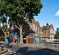
Category:Schools in the London Borough of Haringey
Wikimedia category | |||||
| Upload media | |||||
| Instance of | |||||
|---|---|---|---|---|---|
| Category combines topics | |||||
| London | |||||
capital and largest city of England and the United Kingdom | |||||
| Pronunciation audio | |||||
| Instance of |
| ||||
| Location |
| ||||
| Located in or next to body of water | |||||
| Official language | |||||
| Head of government |
| ||||
| Inception |
| ||||
| Significant event |
| ||||
| Highest point |
| ||||
| Population |
| ||||
| Area |
| ||||
| Elevation above sea level |
| ||||
| IATA airport code |
| ||||
| Different from | |||||
| official website | |||||
 | |||||
Subcategories
This category has the following 8 subcategories, out of 8 total.
Media in category "Schools in the London Borough of Haringey"
The following 65 files are in this category, out of 65 total.
-
Banner, Noel Park Primary School, Wood Green (50720906782).jpg 3,178 × 1,906; 2.42 MB
-
Bounds Green Children's Centre.JPG 4,000 × 3,000; 4.15 MB
-
Bruce Grove Primary School - geograph.org.uk - 1298467.jpg 640 × 480; 77 KB
-
Campsbourne School, Hornsey - geograph.org.uk - 5138893.jpg 1,600 × 1,496; 659 KB
-
Channing School and Cholmeley Court, Highgate - geograph.org.uk - 2733066.jpg 1,600 × 1,200; 403 KB
-
Channing School, Highgate - geograph.org.uk - 3312578.jpg 4,288 × 3,216; 5.38 MB
-
Channing School, The Bank, Highgate, August 2022.jpg 4,032 × 3,024; 4.6 MB
-
Chestnuts Primary School on St Ann's Road - geograph.org.uk - 3873199.jpg 1,200 × 798; 371 KB
-
Cottages on Avenue Road, N15 - geograph.org.uk - 756001.jpg 640 × 480; 100 KB
-
Crowland Primary School - geograph.org.uk - 4079872.jpg 1,024 × 627; 174 KB
-
Detail, gates, South Harringay School, Mattison Road (50645067353).jpg 1,705 × 2,727; 2.71 MB
-
Downhills Primary School - David Lammy MP (6687213735).jpg 2,607 × 1,955; 876 KB
-
Former High Cross School, Tottenham - geograph.org.uk - 2191642.jpg 1,592 × 2,575; 859 KB
-
Former school building, Tottenham - geograph.org.uk - 3516843.jpg 2,318 × 2,656; 6.2 MB
-
Garman Road N17 Bulgarian school.jpg 2,304 × 3,072; 1.27 MB
-
Greig City Academy.jpg 3,537 × 2,385; 2.29 MB
-
Hartsbrook Primary School, South Tottenham - geograph.org.uk - 3324048.jpg 4,288 × 3,216; 4 MB
-
Hartsbrook Primary School, South Tottenham.jpg 4,288 × 3,216; 6.88 MB
-
Highgate Primary School - geograph.org.uk - 5197431.jpg 640 × 426; 52 KB
-
Highgate, Channing School - geograph.org.uk - 3069713.jpg 1,024 × 1,017; 251 KB
-
Holy Trinity Primary School, Tottenham - geograph.org.uk - 3518697.jpg 640 × 447; 340 KB
-
Markfield Park TQ3488 037.JPG 2,048 × 1,536; 807 KB
-
Muswell Hill Primary School - geograph.org.uk - 18911.jpg 640 × 480; 171 KB
-
Muswell Hill Primary School - geograph.org.uk - 4903177.jpg 1,600 × 1,070; 483 KB
-
Muswell Hill Primary School, London N10, from the Muswell Hill entrance to Alexandra Palace.jpg 4,155 × 3,116; 10.38 MB
-
Mystery dumping?.jpg 3,846 × 2,606; 2.53 MB
-
Noel Park School.JPG 3,261 × 2,255; 2.86 MB
-
OSM Fortismere School site plan.png 919 × 871; 235 KB
-
Our Lady of Muswell School - geograph.org.uk - 201240.jpg 640 × 480; 134 KB
-
Park View School 1.jpg 4,096 × 2,818; 4.1 MB
-
Park View School 2.jpg 3,863 × 2,579; 5.18 MB
-
Primary school security fence - geograph.org.uk - 2869021.jpg 1,024 × 768; 140 KB
-
Risley Avenue Primary School - geograph.org.uk - 4779.jpg 640 × 480; 119 KB
-
Rokesly School.jpg 2,611 × 1,564; 1.33 MB
-
Save Our Schools March - 28 January 2012.webm 12 s, 1,280 × 720; 10.18 MB
-
School bell tower, St Ann's Road - geograph.org.uk - 4284429.jpg 864 × 1,504; 468 KB
-
Seven Sisters Primary School, South Grove - geograph.org.uk - 4284525.jpg 930 × 1,224; 431 KB
-
Seven Sisters Primary School, South Grove - geograph.org.uk - 4284547.jpg 939 × 1,124; 327 KB
-
South Harringay School, Mattison Road - geograph.org.uk - 4868610.jpg 1,067 × 1,600; 528 KB
-
South Harringay School, Mattison Road - geograph.org.uk - 4868639.jpg 1,283 × 1,600; 518 KB
-
St Ann’s Church of England Primary School - geograph.org.uk - 4284478.jpg 1,376 × 959; 577 KB
-
St Gildas Catholic Junior School, Crouch End - geograph.org.uk - 3374429.jpg 4,288 × 3,216; 6.43 MB
-
St Mary's CE Primary School, Hornsey - geograph.org.uk - 3593546.jpg 1,300 × 867; 1.25 MB
-
St Mary's Junior School, Hornsey, London N8 - geograph.org.uk - 1716065.jpg 3,008 × 2,000; 3.72 MB
-
St Mary's primary school, Hornsey High Street - geograph.org.uk - 4800127.jpg 2,304 × 1,728; 798 KB
-
St Michael's Primary School, Highgate - geograph.org.uk - 4833300.jpg 4,896 × 3,264; 3.4 MB
-
St Michael's School (49445669321).jpg 5,184 × 3,888; 3.73 MB
-
St Michaels Primary School, Highgate.jpg 2,496 × 1,080; 1.36 MB
-
St Peter in Chains Primary School, Crouch End - geograph.org.uk - 3374441.jpg 4,288 × 3,216; 4.72 MB
-
Stroud Green and Hornsey High School for Girls (site of).JPG 2,816 × 2,112; 1.21 MB
-
Stroud Green Primary School - geograph.org.uk - 1959056.jpg 3,456 × 2,304; 5.53 MB
-
Stroud Green Primary School - geograph.org.uk - 2253178.jpg 1,600 × 1,068; 542 KB
-
Stroud Green Primary School - geograph.org.uk - 3236793.jpg 640 × 428; 157 KB
-
The Chocolate Factory - geograph.org.uk - 3816597.jpg 640 × 430; 61 KB
-
The College of North East London - geograph.org.uk - 2767171.jpg 1,024 × 768; 205 KB
-
The College of North East London - geograph.org.uk - 2767172.jpg 1,024 × 768; 201 KB
-
Tottenham Grammar School blazer badge, Bruce Castle Museum.jpg 3,614 × 4,518; 3.78 MB
-
Wisdom Tutorial School, Tottenham - geograph.org.uk - 734226.jpg 640 × 480; 116 KB
-
Woodstock Road School Boys Entrance.jpg 3,024 × 4,032; 3.86 MB


