Category:September 2006 in Essex
Ceremonial counties of England: Bedfordshire · Berkshire · Buckinghamshire · Cambridgeshire · Cheshire · Cornwall · Cumbria · Derbyshire · Devon · Dorset · Durham · East Riding of Yorkshire · East Sussex · Essex · Gloucestershire · Greater London · Greater Manchester · Hampshire · Herefordshire · Hertfordshire · Isle of Wight · Kent · Lancashire · Leicestershire · Lincolnshire · Merseyside · Norfolk · North Yorkshire · Northamptonshire · Northumberland · Nottinghamshire · Oxfordshire · Rutland · Shropshire · Somerset · South Yorkshire · Staffordshire · Suffolk · Surrey · Tyne and Wear · Warwickshire · West Midlands · West Sussex · West Yorkshire · Wiltshire · Worcestershire
City-counties: Bristol ·
Former historic counties:
Other former counties:
City-counties: Bristol ·
Former historic counties:
Other former counties:
Deutsch: Bilder, die im September 2006 in Essex aufgenommen worden sind. Bitte beachten Sie, dass dies weder das Datum des Uploads noch das Datum des Scannens eines Fotos ist.
English: Images/pictures taken in Essex during September 2006. Note this is not the date of the upload, nor the date a photo was scanned.
Español: Fotografías o imágenes tomadas en Essex durante septiembre 2006. No es la fecha de subida ni escaneo, sino la fecha en que las fotografías o imágenes se crearon.
Esperanto: Bildoj faritaj en Essex en septembro 2006. Tio ne estas la dato, kiam la bildoj estis alŝutitaj aŭ skanitaj.
Français : Photographies ou images prises en Essex durant septembre 2006. Ce n'est pas la date du téléchargement ou du scan.
Galego: Fotografías ou imaxes tomadas en Essex durante setembro 2006. Non é a data de subida nin escaneamento, senón a data na que se crearon as fotografías ou imaxes.
Italiano: Fotografie o immagini scattate a Essex nel settembre 2006. Nota bene: la data non si riferisce né a quella di upload né a quella in cui la foto è stata digitalizzata.
Norsk bokmål: Bilder tatt i Essex i løpet av september 2006. Merk at dette ikke er datoen for opplasting, eller når et bilde har blitt skannet.
Norsk nynorsk: Bilete teke i Essex i løpet av september 2006. Merk at dette ikkje er datoen for opplasting, eller når eit bilete har vorte skanna.
Русский: Изображения, сделанные в Essex в течение сентябрь 2006 (не дата загрузки изображения).
Українська: Зображення, зроблені в Essex протягом вересень 2006. Зауважте, що це не дата завантаження чи дата сканування фотографії.
| September 2005 | ← | September 2006 | → | September 2007 | |||||||
| Jan | Feb | Mar | Apr | May | Jun | Jul | Aug | Sep | Oct | Nov | Dec |
| 43 | 47 | 23 | 42 | 42 | 48 | 27 | 69 | 45 | 45 | 26 | 54 |
|---|---|---|---|---|---|---|---|---|---|---|---|
Subcategories
This category has only the following subcategory.
Media in category "September 2006 in Essex"
The following 44 files are in this category, out of 44 total.
-

-

-

-
 101661 east anglian railway museum.jpg 1,280 × 960; 150 KB
-
 A12 underpass near Langham, Essex - geograph.org.uk - 238025.jpg 640 × 427; 72 KB
-

-
 Beth Chatto garden, Elmstead Market 1.jpg 3,456 × 2,304; 1.57 MB
-
 Car Park at Hatfield Forest, Essex - geograph.org.uk - 231746.jpg 640 × 415; 53 KB
-
 Chalkwell railway station in 2006.jpg 516 × 640; 80 KB
-
 Cricketers Arms, Rickling Green - geograph.org.uk - 241882.jpg 640 × 480; 128 KB
-
 Curling Tye Green - geograph.org.uk - 230649.jpg 640 × 427; 96 KB
-

-
 GER coach number 553 east anglian railway museum.jpg 1,280 × 960; 148 KB
-
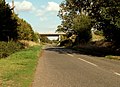
 Goose Lane bridge - geograph.org.uk - 242758.jpg 640 × 480; 105 KB
-

-
 High St., Old Harlow - geograph.org.uk - 305525.jpg 640 × 427; 86 KB
-
 Hilton Hotel, Stansted Airport - geograph.org.uk - 244656.jpg 640 × 480; 118 KB
-
 Langford Cut - geograph.org.uk - 230869.jpg 640 × 480; 91 KB
-
 Leigh Creek and Two Tree Island - geograph.org.uk - 243489.jpg 640 × 480; 55 KB
-

-

-
 Power lines - geograph.org.uk - 248362.jpg 640 × 480; 128 KB
-
 Pricketts Hall - geograph.org.uk - 244408.jpg 640 × 480; 104 KB
-
 Southend-on-Sea Crematorium - geograph.org.uk - 362778.jpg 500 × 375; 143 KB
-
 Southend-on-Sea Crematorium - geograph.org.uk - 362780.jpg 500 × 375; 116 KB
-
 The beach at Tip Head - geograph.org.uk - 240589.jpg 640 × 380; 86 KB
-
 The Ferriers - geograph.org.uk - 244395.jpg 640 × 480; 127 KB
-
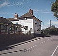 The Queen Victoria, Woodham Walter - geograph.org.uk - 230565.jpg 640 × 625; 89 KB
-
 The Round Lodge - geograph.org.uk - 242764.jpg 640 × 480; 110 KB
-
 The Willow Beauty - geograph.org.uk - 900427.jpg 640 × 480; 77 KB
-
 Three Decades On - geograph.org.uk - 246938.jpg 640 × 640; 187 KB
-
 Tractor and new hedge - geograph.org.uk - 244417.jpg 640 × 480; 75 KB
-
 Tye Green Road - geograph.org.uk - 242393.jpg 640 × 444; 138 KB
-
 Village sign at Pebmarsh, Essex - geograph.org.uk - 244479.jpg 640 × 480; 98 KB
-

-
 Whitbreads Farm Lane - geograph.org.uk - 248652.jpg 640 × 463; 89 KB
-
 White Hart Plus Thirty Years - geograph.org.uk - 246972.jpg 640 × 426; 110 KB
-
 Bridge on the saltings - geograph.org.uk - 240692.jpg 640 × 461; 85 KB
-

-
 Creek and saltings - geograph.org.uk - 240777.jpg 480 × 640; 90 KB
-
 Grange Outfall - Seaward side - geograph.org.uk - 415055.jpg 485 × 640; 98 KB
-
 Marsh House Pumping Station - geograph.org.uk - 415340.jpg 640 × 539; 96 KB
-
 Sandbeach Outfall - geograph.org.uk - 241026.jpg 492 × 640; 116 KB
-
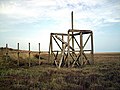 Timbers on the saltings - geograph.org.uk - 240769.jpg 640 × 480; 76 KB


