Category:September 2006 in North Yorkshire
Ceremonial counties of England: Bedfordshire · Berkshire · Buckinghamshire · Cambridgeshire · Cheshire · Cornwall · Cumbria · Derbyshire · Devon · Dorset · Durham · East Riding of Yorkshire · East Sussex · Essex · Gloucestershire · Greater London · Greater Manchester · Hampshire · Herefordshire · Hertfordshire · Isle of Wight · Kent · Lancashire · Leicestershire · Lincolnshire · Merseyside · Norfolk · North Yorkshire · Northamptonshire · Northumberland · Nottinghamshire · Oxfordshire · Rutland · Shropshire · Somerset · South Yorkshire · Staffordshire · Suffolk · Surrey · Tyne and Wear · Warwickshire · West Midlands · West Sussex · West Yorkshire · Wiltshire · Worcestershire
City-counties: Bristol ·
Former historic counties:
Other former counties:
City-counties: Bristol ·
Former historic counties:
Other former counties:
Deutsch: Bilder, die im September 2006 in North Yorkshire aufgenommen worden sind. Bitte beachten Sie, dass dies weder das Datum des Uploads noch das Datum des Scannens eines Fotos ist.
English: Images/pictures taken in North Yorkshire during September 2006. Note this is not the date of the upload, nor the date a photo was scanned.
Español: Fotografías o imágenes tomadas en North Yorkshire durante septiembre 2006. No es la fecha de subida ni escaneo, sino la fecha en que las fotografías o imágenes se crearon.
Esperanto: Bildoj faritaj en North Yorkshire en septembro 2006. Tio ne estas la dato, kiam la bildoj estis alŝutitaj aŭ skanitaj.
Français : Photographies ou images prises en North Yorkshire durant septembre 2006. Ce n'est pas la date du téléchargement ou du scan.
Galego: Fotografías ou imaxes tomadas en North Yorkshire durante setembro 2006. Non é a data de subida nin escaneamento, senón a data na que se crearon as fotografías ou imaxes.
Italiano: Fotografie o immagini scattate a North Yorkshire nel settembre 2006. Nota bene: la data non si riferisce né a quella di upload né a quella in cui la foto è stata digitalizzata.
Norsk bokmål: Bilder tatt i North Yorkshire i løpet av september 2006. Merk at dette ikke er datoen for opplasting, eller når et bilde har blitt skannet.
Norsk nynorsk: Bilete teke i North Yorkshire i løpet av september 2006. Merk at dette ikkje er datoen for opplasting, eller når eit bilete har vorte skanna.
Русский: Изображения, сделанные в North Yorkshire в течение сентябрь 2006 (не дата загрузки изображения).
Українська: Зображення, зроблені в North Yorkshire протягом вересень 2006. Зауважте, що це не дата завантаження чи дата сканування фотографії.
| September 2005 | ← | September 2006 | → | September 2007 | |||||||
| Jan | Feb | Mar | Apr | May | Jun | Jul | Aug | Sep | Oct | Nov | Dec |
| 100 | 76 | 86 | 121 | 79 | 97 | 232 | 156 | 182 | 256 | 141 | 140 |
|---|---|---|---|---|---|---|---|---|---|---|---|
Subcategories
This category has only the following subcategory.
Y
Media in category "September 2006 in North Yorkshire"
The following 181 files are in this category, out of 181 total.
-
 Railway Bridge 1846-1968 - geograph.org.uk - 241156.jpg 640 × 479; 140 KB
-
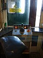 Scarborough Central Tramway - Control.jpg 450 × 600; 56 KB
-
 Scarborough Central Tramway - Top station exterior.jpg 600 × 450; 109 KB
-
 Scarborough Central Tramway - Top station interior.jpg 450 × 600; 64 KB
-
 Scarborough Central Tramway - Track.jpg 600 × 450; 62 KB
-
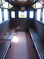 Scarborough Central Tramway - Tramcar.jpg 450 × 600; 82 KB
-
 Scarborough South Cliff Lift - Adult single down ticket.jpg 2,228 × 676; 419 KB
-
 Scarborough South Cliff Lift - Adult single up ticket.jpg 1,112 × 670; 180 KB
-
 Scarborough South Cliff Lift - Bottom station.jpg 600 × 450; 81 KB
-
 Scarborough South Cliff Lift - Top station.jpg 600 × 450; 71 KB
-
 Scarborough South Cliff Lift - Track.jpg 442 × 600; 118 KB
-
 Scarborough South Cliff Lift - Tramcar.jpg 450 × 600; 72 KB
-
 Scarborough St Nicholas Cliff Lift - Adult single down ticket.jpg 2,204 × 676; 411 KB
-
 Scarborough St Nicholas Cliff Lift - Bottom station.jpg 600 × 450; 95 KB
-
 Scarborough St Nicholas Cliff Lift - Top station.jpg 600 × 450; 63 KB
-
 Scarborough St Nicholas Cliff Lift - Track.jpg 600 × 450; 101 KB
-
 Scarborough St Nicholas Cliff Lift - Tramcar.jpg 450 × 600; 92 KB
-
 Kettlewell and Wharfedale - geograph.org.uk - 242307.jpg 640 × 232; 87 KB
-
 Castle Arms, Snape - geograph.org.uk - 249619.jpg 640 × 480; 108 KB
-
 Gate into the churchyard, Scalby - geograph.org.uk - 247941.jpg 480 × 640; 111 KB
-
 St Laurence's Church, Scalby - geograph.org.uk - 247947.jpg 640 × 480; 101 KB
-
 Foulsyke Farm, Scalby - geograph.org.uk - 247967.jpg 640 × 480; 98 KB
-
 Town Road, Richmond - geograph.org.uk - 242920.jpg 640 × 384; 88 KB
-
 60007 Sir Nigel Gresley above rear.jpg 2,576 × 1,952; 1.54 MB
-
 A1 Cabbage Field - geograph.org.uk - 243036.jpg 640 × 480; 40 KB
-
 A169 Looking North at Wykeham - geograph.org.uk - 245948.jpg 640 × 426; 301 KB
-
 A169 Looking West, Wykeham - geograph.org.uk - 247897.jpg 640 × 426; 311 KB
-
 Above the Sea Wall, Robin Hood's Bay - geograph.org.uk - 772944.jpg 640 × 480; 187 KB
-
 Approaching Hollins House - geograph.org.uk - 249607.jpg 640 × 480; 70 KB
-
 Arrival at Goathland Station. - geograph.org.uk - 401957.jpg 457 × 640; 107 KB
-
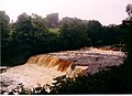
 Aysgarth Falls - geograph.org.uk - 3172190.jpg 640 × 456; 87 KB
-
 Aysgarth Middle falls - geograph.org.uk - 3172185.jpg 1,600 × 1,166; 387 KB
-
 Back Lane, Carthorpe - geograph.org.uk - 250163.jpg 640 × 480; 99 KB
-
 Bales next to the Cowthorpe road - geograph.org.uk - 249091.jpg 640 × 479; 99 KB
-

-
 Barn below High Houses - geograph.org.uk - 244565.jpg 640 × 480; 103 KB
-
 Baytown from the Beach - geograph.org.uk - 772866.jpg 623 × 415; 170 KB
-
 Birkin Post Office and general Store - geograph.org.uk - 244146.jpg 640 × 480; 100 KB
-
 Boats in Baytown - geograph.org.uk - 772957.jpg 640 × 477; 232 KB
-

-
 Bridleway and sign - geograph.org.uk - 244209.jpg 640 × 480; 119 KB
-
 Chapel House Farm - geograph.org.uk - 232279.jpg 640 × 480; 107 KB
-
 Cleft in Valley Wall at Red Gait Head. - geograph.org.uk - 233147.jpg 640 × 480; 110 KB
-
 Clint House Farm - geograph.org.uk - 237611.jpg 640 × 480; 70 KB
-
 Dry stone wall - geograph.org.uk - 230648.jpg 480 × 640; 86 KB
-

-
 Dry Stone Wall on Proctor High Mark. - geograph.org.uk - 240087.jpg 640 × 480; 80 KB
-
 Drystone Wall, Muker Side - geograph.org.uk - 435595.jpg 640 × 384; 109 KB
-

-
 Fairburn Junior School - geograph.org.uk - 243408.jpg 640 × 480; 93 KB
-

-
 Farmland near North Deighton - geograph.org.uk - 249064.jpg 640 × 479; 80 KB
-

-
 Farnham Lake - geograph.org.uk - 234228.jpg 640 × 479; 88 KB
-
 Fell Lane. - geograph.org.uk - 233112.jpg 640 × 480; 99 KB
-
 Fell Lane. - geograph.org.uk - 233117.jpg 640 × 480; 90 KB
-
 Fell Lane. - geograph.org.uk - 233119.jpg 640 × 480; 82 KB
-
 Fell Lane. - geograph.org.uk - 233120.jpg 640 × 480; 73 KB
-
 Field between Snape and Well - geograph.org.uk - 249612.jpg 640 × 480; 114 KB
-

-
 Field by Whin Lane - geograph.org.uk - 244491.jpg 640 × 480; 50 KB
-
 Field margin east of Great Habton - geograph.org.uk - 248628.jpg 640 × 480; 131 KB
-
 Field margin north of Hutton Buscel - geograph.org.uk - 249476.jpg 640 × 480; 120 KB
-
 Field Near Allerston Looking North - geograph.org.uk - 245913.jpg 640 × 426; 241 KB
-
 Field Near Fowgill - geograph.org.uk - 250667.jpg 640 × 384; 100 KB
-
 Field Near Wilton Carr - geograph.org.uk - 245899.jpg 640 × 426; 245 KB
-
 Field Near Wilton Carr - geograph.org.uk - 245903.jpg 640 × 426; 258 KB
-
 Field north of Camps Hill - geograph.org.uk - 249627.jpg 640 × 480; 89 KB
-
 Field opposite Squires Cafe - geograph.org.uk - 241457.jpg 640 × 480; 47 KB
-
 Field, Newthorpe - geograph.org.uk - 241448.jpg 640 × 480; 48 KB
-
 Fields Aligning Skeb Skeugh - geograph.org.uk - 242644.jpg 640 × 384; 96 KB
-
 Fields falling away to Camp Hill - geograph.org.uk - 249379.jpg 640 × 480; 70 KB
-
 Fields in Langwith - geograph.org.uk - 248803.jpg 640 × 480; 67 KB
-
 Fields Near Grindstone Crook - geograph.org.uk - 252810.jpg 640 × 480; 71 KB
-
 Fields near Low Grange - geograph.org.uk - 241499.jpg 640 × 480; 55 KB
-
 Fields to the North of Lumby - geograph.org.uk - 244485.jpg 640 × 428; 29 KB
-
 Gascoigne Wood Mine - geograph.org.uk - 235107.jpg 640 × 480; 128 KB
-
 Gascoine Wood Mine from the south. - geograph.org.uk - 250975.jpg 640 × 480; 70 KB
-
 Goathland Station and Footbridge. - geograph.org.uk - 401940.jpg 640 × 426; 155 KB
-
 Great Catrigg Pasture - geograph.org.uk - 233600.jpg 640 × 480; 46 KB
-
 Haugh Rigg - geograph.org.uk - 246137.jpg 640 × 426; 210 KB
-
-
 Helks Wood - geograph.org.uk - 243756.jpg 640 × 480; 100 KB
-
 Hensall Railway Station.jpg 640 × 480; 124 KB
-

-
 Horton in ribblesdale railway station sep 06.jpg 1,600 × 1,200; 554 KB
-
 Howe Farm Wykeham - geograph.org.uk - 245954.jpg 640 × 426; 281 KB
-
 Howe Farm Wykeham - geograph.org.uk - 245956.jpg 640 × 426; 282 KB
-
 Hulleys3.jpg 392 × 523; 50 KB
-
 Sundial on the church, Hutton Buscel - geograph.org.uk - 245503.jpg 640 × 434; 111 KB
-
 Kirk Hill Settrington - geograph.org.uk - 245982.jpg 640 × 426; 259 KB
-
 Langcliffe War Memorial - geograph.org.uk - 251446.jpg 348 × 640; 104 KB
-
 Leven Bridge. - geograph.org.uk - 232150.jpg 640 × 479; 110 KB
-
 Looking NW over River Derwent Near Gunby - geograph.org.uk - 248355.jpg 640 × 426; 402 KB
-
 Low Moor - geograph.org.uk - 239765.jpg 640 × 480; 29 KB
-
 Marton Burn Road Roundabout - geograph.org.uk - 239752.jpg 640 × 480; 69 KB
-
 Muker Side - geograph.org.uk - 435593.jpg 640 × 384; 72 KB
-
 National Trust sign at Port Mulgrave - geograph.org.uk - 247164.jpg 480 × 640; 127 KB
-
 New growth - geograph.org.uk - 244296.jpg 640 × 480; 94 KB
-
 New Pasture - geograph.org.uk - 238144.jpg 640 × 480; 109 KB
-
 Opposite Marston Grange - geograph.org.uk - 249130.jpg 640 × 479; 109 KB
-
 Ox Close Farm - geograph.org.uk - 249072.jpg 640 × 479; 71 KB
-

-
 Pasture between Burneston and Snape - geograph.org.uk - 250173.jpg 640 × 480; 78 KB
-
 Playing Fields - geograph.org.uk - 239760.jpg 640 × 480; 63 KB
-
 Ploughed Field Ebberston Ings - geograph.org.uk - 245924.jpg 640 × 426; 285 KB
-

-
 Pylons, Parsley Beck Rigg - geograph.org.uk - 251061.jpg 640 × 384; 57 KB
-
 Pylons, Sneaton Moor - geograph.org.uk - 251950.jpg 640 × 384; 44 KB
-
 Railway Bridge, Near North Skelton - geograph.org.uk - 235025.jpg 640 × 384; 83 KB
-
 Railway Bridge, Stanghow Road - geograph.org.uk - 235018.jpg 640 × 384; 96 KB
-
 Road Into Wykeham - geograph.org.uk - 387084.jpg 640 × 480; 167 KB
-
 Robin Hoods Bay from the Cleveland Way.jpg 2,560 × 1,920; 2.34 MB
-

-
 Rough Pasture, Muker Side - geograph.org.uk - 242314.jpg 640 × 384; 68 KB
-
 Round Bales at Snainton Ings - geograph.org.uk - 245930.jpg 640 × 426; 305 KB
-
 Roundabout near Whitby - geograph.org.uk - 247131.jpg 640 × 480; 143 KB
-
 RoundhillReservoir.jpg 640 × 480; 103 KB
-
 Royalist Lines - geograph.org.uk - 249133.jpg 640 × 479; 97 KB
-
 Sea Front Path, Robin Hood's Bay - geograph.org.uk - 660232.jpg 640 × 480; 124 KB
-

-
 Sheep along Brearton bridleway - geograph.org.uk - 234253.jpg 640 × 479; 108 KB
-
 Sheep near Brearton - geograph.org.uk - 234259.jpg 640 × 479; 125 KB
-
 Sheep near Feizor - geograph.org.uk - 249736.jpg 640 × 480; 108 KB
-
 Sheep Pasture - geograph.org.uk - 250700.jpg 640 × 480; 86 KB
-
 Silage teamwork - geograph.org.uk - 236572.jpg 640 × 480; 120 KB
-
 Skipton Castle Gatehouse - geograph.org.uk - 605132.jpg 640 × 444; 91 KB
-
 Skipton Railway Station.jpg 640 × 480; 116 KB
-
 St. James' Retail Park - geograph.org.uk - 248299.jpg 640 × 479; 89 KB
-
 Straw bales off Rudcarr Lane - geograph.org.uk - 242056.jpg 640 × 479; 109 KB
-
 Studfold Low Pasture - geograph.org.uk - 233588.jpg 640 × 480; 60 KB
-

-
 Swinehaw Bottom - geograph.org.uk - 238659.jpg 640 × 480; 77 KB
-
 Swinner Gill Lead Mine Buildings - geograph.org.uk - 247137.jpg 640 × 480; 149 KB
-
 The Duke of York - geograph.org.uk - 242009.jpg 640 × 479; 87 KB
-
 The Grapes Inn - geograph.org.uk - 239832.jpg 640 × 416; 57 KB
-
 The Marrs - geograph.org.uk - 245972.jpg 640 × 426; 286 KB
-
 The Red Rose Pub - geograph.org.uk - 274131.jpg 640 × 480; 51 KB
-
 The Rose House Wykeham - geograph.org.uk - 245960.jpg 640 × 426; 276 KB
-
 The school, Wykeham - geograph.org.uk - 248015.jpg 640 × 480; 100 KB
-

-

-
 The Vicarage, Hutton Buscel - geograph.org.uk - 246022.jpg 640 × 441; 76 KB
-
 Top of Malham Cove - geograph.org.uk - 535983.jpg 640 × 482; 106 KB
-
 Towards Scotton - geograph.org.uk - 234268.jpg 640 × 479; 98 KB
-
 Tractor at work - geograph.org.uk - 244220.jpg 640 × 480; 99 KB
-

-
 View to Monk Fryston Lodge - geograph.org.uk - 244468.jpg 640 × 480; 40 KB
-
 Wall Corner on Hawkswick Clowder. - geograph.org.uk - 239973.jpg 640 × 480; 83 KB
-
 Wall Corner on Hawkswick Clowder. - geograph.org.uk - 239984.jpg 640 × 480; 60 KB
-
 Wall Crossroads on Hawkswick Clowder. - geograph.org.uk - 239977.jpg 640 × 480; 62 KB
-
 Wall junction dividing fields - geograph.org.uk - 238111.jpg 640 × 480; 90 KB
-
 Wall Junction on High Kilnsey Moor. - geograph.org.uk - 240080.jpg 640 × 480; 79 KB
-
 Wall on Carperby Moor - geograph.org.uk - 239072.jpg 640 × 480; 88 KB
-
 Wall on Longside Moor - geograph.org.uk - 243987.jpg 640 × 480; 90 KB
-
 Weir on the Nidd - geograph.org.uk - 234208.jpg 640 × 479; 175 KB
-
 Wet-weather ford, Scalby - geograph.org.uk - 243030.jpg 640 × 480; 102 KB
-
 Wykeham - geograph.org.uk - 245962.jpg 640 × 426; 267 KB
-
 Ye Dolphin Inn, Robin Hood's Bay - geograph.org.uk - 523785.jpg 640 × 522; 95 KB
-
 York5.jpg 2,896 × 1,944; 1 MB
-
 Above How Beck - geograph.org.uk - 233584.jpg 640 × 480; 75 KB
-
 Arkle Beck - geograph.org.uk - 430172.jpg 480 × 640; 135 KB
-

-
 Bridleway Between Keld and Gunnerside - geograph.org.uk - 242350.jpg 640 × 384; 83 KB
-
 Bull at Street Gate. - geograph.org.uk - 240127.jpg 640 × 480; 77 KB
-
 Cattle at Street Gate. - geograph.org.uk - 239928.jpg 640 × 480; 76 KB
-

-
 Cow in Mist. - geograph.org.uk - 240068.jpg 640 × 480; 51 KB
-
 Disused Whinestone Quarry, Pike Hill - geograph.org.uk - 251085.jpg 480 × 640; 124 KB
-
 Gate, Off Forestry Road - geograph.org.uk - 252595.jpg 640 × 384; 52 KB
-

-
 Marine Drive North Bay - geograph.org.uk - 656271.jpg 640 × 427; 49 KB
-
 Newstead Grange - geograph.org.uk - 252186.jpg 640 × 480; 107 KB
-

-
 Public Footpath - geograph.org.uk - 252208.jpg 640 × 480; 79 KB
-
-
 Selley Bridge - geograph.org.uk - 252185.jpg 640 × 480; 108 KB
-
 SW of Wykeham - geograph.org.uk - 252183.jpg 640 × 480; 138 KB
-
 The beginning (end) of the Wolds Way - geograph.org.uk - 250598.jpg 480 × 640; 121 KB
-

-
 Towards Warren Farm - geograph.org.uk - 234252.jpg 640 × 479; 120 KB


_of_the_Wolds_Way_-_geograph.org.uk_-_250598.jpg)


.jpg)