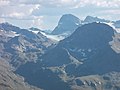
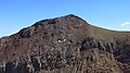
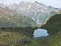
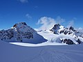
Category:Silvretta
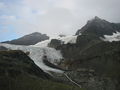
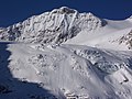
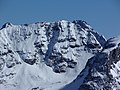
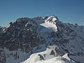
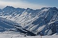
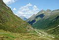
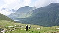
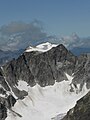
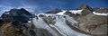
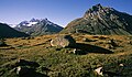
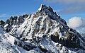
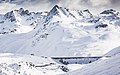
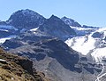
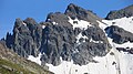
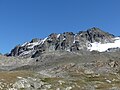
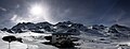
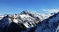
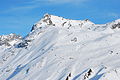
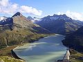
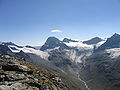
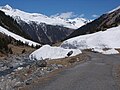
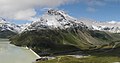
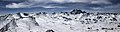
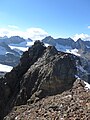
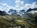
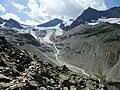
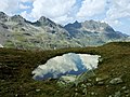
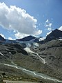
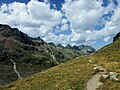
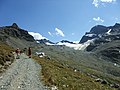
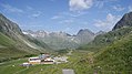
Deutsch: Die Silvretta ist eine Gebirgsgruppe in den Zentralalpen der Ostalpen. Anteil haben Österreich mit den Bundesländern Tirol und Vorarlberg und die Schweiz mit dem Kanton Graubünden.
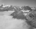
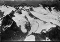
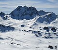
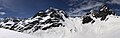
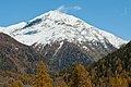
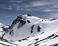
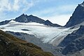
English: The Silvretta is a mountain range of the Central Eastern Alps shared by Tirol, Vorarlberg (both in Austria) and Graubünden (Switzerland).
mountain range in the Alps   | |||||
| Upload media | |||||
| Instance of |
| ||||
|---|---|---|---|---|---|
| Subclass of |
| ||||
| Made from material | |||||
| Location |
| ||||
| Mountain range |
| ||||
| Highest point | |||||
| Area |
| ||||
| Elevation above sea level |
| ||||
 | |||||
Subcategories
This category has the following 101 subcategories, out of 101 total.
A
B
- Ballunspitze (38 F)
- Bieltalkopf (1 F)
- Bodmerspitze (1 F)
- Breite Krone (6 F)
- Breitspitz (Silvretta) (8 F)
C
- Chamonna Linard (17 F)
- Chapütschin (Silvretta) (1 F)
- Chessihorn (1 F)
D
- Dreiländerspitze (11 F)
E
- Egghorn (Silvretta) (5 F)
F
- Fimberpass (2 F)
- Piz Fliana (13 F)
- Futschölbach (7 F)
G
- Gamspleisspitze (3 F)
- Getschnerspitzen (1 F)
- Piz Glims (6 F)
- Glötterspitze (3 F)
- Gorfenspitze (17 F)
- Grenzeckkopf (9 F)
- Großlitzner (18 F)
H
- Hennebergspitzen (1 F)
- Hochnörderer (5 F)
- Hohes Rad (26 F)
I
- Isentällispitz (14 F)
J
- Jamtalferner (9 F)
- Jöriflüelafurgga (4 F)
K
- Kleiner Piz Buin (10 F)
- Kleines Seehorn (3 F)
- Klostertaler Bach (14 F)
- Klostertaler Gletscher (6 F)
- Knoten (Silvretta) (9 F)
- Kresperspitze (3 F)
- Krone (Silvretta) (11 F)
L
- Lobspitzen (20 F)
M
- Madlenerspitze (1 F)
- Madrisella (14 F)
- Piz Minschun (5 F)
- Motta Naluns (41 F)
O
- Ochsentaler Gletscher (1 P, 38 F)
P
- Panoramics of Silvretta (5 F)
- Pass Futschöl (11 F)
- Pischahorn (9 F)
- Piz Jeramias (2 F)
R
- Radsattel (5 F)
- Rauer Kopf (Silvretta) (6 F)
- Rauher Kopf (Paznaun) (9 F)
- Ritzenspitzen (14 F)
S
- Schattenspitze (13 F)
- Schlappiner Joch (28 F)
- Schlappinerspitze (7 F)
- Schneeglocke (12 F)
- Seehorn (Davos) (38 F)
- Signalhorn (36 F)
- Silvretta Hochalpenstraße (51 F)
- Silvretta Nova (skiing area) (18 F)
- Silvretta-Stausee (104 F)
- Silvrettaweg (München) (2 F)
- Stausee Kops (56 F)
T
- Piz Tasna (13 F)
- Tiroler Kopf (7 F)
V
- Vadret Futschöl (4 F)
- Vallüla (10 F)
- Vallülasee (5 F)
- Verhupfspitze (2 F)
- Vermuntbach (2 F)
- Vermuntbahn (4 F)
- Vermuntgletscher (10 F)
- Vermuntsee (39 F)
- Verstanclahorn (20 F)
W
- Winterlücke (4 F)
Z
- Zeinis See (4 F)
Media in category "Silvretta"
The following 200 files are in this category, out of 251 total.
(previous page) (next page)-
De-Silvretta.ogg 1.6 s; 16 KB
-
 02MontafonOchsental.jpg 4,917 × 3,250; 1.56 MB
-
 04 Augstenberge von Chalausfurka.jpg 3,264 × 2,448; 1.79 MB
-
 05 Reste des Larainferners.jpg 2,272 × 1,704; 1.03 MB
-
 070901 Privat 01 Silvretta.jpg 1,600 × 1,200; 797 KB
-
 08 - Gewittterpilz über der Zentralsilvretta.jpg 3,264 × 2,448; 1.91 MB
-
 09 Berner Alpen vom Nordgipfel.jpg 4,608 × 3,456; 2.56 MB
-
 10 Blick über Pfannknechtsattel ins Jamtal.jpg 3,264 × 2,448; 1.84 MB
-
 13-Bielerhöhe-S.jpg 4,240 × 2,832; 7.07 MB
-
 16 Signalhorn.jpg 3,648 × 2,736; 1.64 MB
-
 18 Signalhorn und Silvrettahorn von Grüner Kuppe.jpg 3,648 × 2,736; 1.64 MB
-
 19 Blick vom Süd- zum Nordgipfel.jpg 3,264 × 2,448; 1.97 MB
-
 2 Piz Buin durch die Lücke zwischen Ochsenkopf und Vermuntkopf.jpg 2,272 × 1,704; 845 KB
-
 2014-Kops-N.jpg 6,016 × 3,384; 8.16 MB
-
 22 Schattenspitze, Schattenkopf, KE.jpg 4,608 × 2,592; 2.63 MB
-
 31 Buinlücke.jpg 3,648 × 2,736; 1.79 MB
-
 37 Tiroler Köpfe, Fluchthorn rechts dahinter.jpg 3,648 × 2,736; 1.57 MB
-
 4 Vordere Jamspitze (links), Dreiländerspitze und Ochsenscharten (rechts).jpg 2,272 × 1,704; 1 MB
-
 55 Abstürze von Knoten und Schneeglocke.jpg 3,648 × 2,736; 1.65 MB
-
 Alpen 1939 001.jpg 1,410 × 940; 329 KB
-
 Alpkogel, Zeinisjoch.jpg 961 × 686; 377 KB
-
 Aufstieg zur Schesaplana, Blick auf die Silvretta-Gruppe, DSCF6284.jpg 4,896 × 3,264; 3.74 MB
-
 Aufstieg über die Grasflanke rechts.jpg 4,608 × 3,456; 3.53 MB
-
 Augstenberge beim Aufstieg zum Grenzeckkopf.jpg 2,272 × 1,704; 999 KB
-
 Augstenbergstock.jpg 6,091 × 2,131; 6 MB
-
 Ausblick vom Pardorama, Mitten auf dem Pardatschgrat in 2600 Metern - panoramio.jpg 3,072 × 2,032; 2.81 MB
-
 B 147 Amboß ist ganz abgeschert.jpg 4,608 × 3,456; 3.58 MB
-

-
 Bergsturzgebiet Fluchthorn Südgipfel im Bereiche Breites Wasser im Futschöltal.jpg 8,386 × 3,926; 13.65 MB
-
 Bielerhoehe.jpg 640 × 424; 33 KB
-
 Bielerhöhe Schild.jpg 2,816 × 2,112; 3.61 MB
-
 Bielerhöhe und Silvrettastausee.jpg 3,072 × 2,304; 2.03 MB
-
 Bieltal-Silvretta01.jpg 2,690 × 1,980; 3.86 MB
-
 Bieltal-Silvretta02.jpg 2,816 × 2,112; 3.53 MB
-
 Bieltal-Silvretta03.jpg 2,816 × 2,112; 3.75 MB
-
 Bieltal-Silvretta04.jpg 2,718 × 1,953; 3.89 MB
-
 Bieltal-Silvretta05.jpg 2,389 × 1,695; 1.89 MB
-
 Bieltal-Silvretta06.jpg 3,852 × 2,912; 7.41 MB
-
 Bieltal-Silvretta08.jpg 2,816 × 2,112; 4.59 MB
-
 Bieltal-Silvretta09.jpg 2,670 × 1,950; 4.18 MB
-
 Bieltal-Silvretta11.jpg 3,600 × 2,428; 5.04 MB
-
 Bieltal-Silvrettasee-Wanderer-01.jpg 4,592 × 2,576; 4.22 MB
-
 Biwakhütte überm Plattenjoch, Piz Kesch hinten.jpg 4,608 × 3,456; 3.35 MB
-
 Blick oberhalb von Ischgl Hochnörderer li der Tanne, Gorfen Mitte, hi evtl Vallüla.jpg 2,272 × 1,704; 1.07 MB
-
 Blick vom Südgipfel des Fluchthorns nach Südwesten..jpg 3,264 × 2,448; 1.26 MB
-
 Buine von Rotfluh.jpg 4,608 × 2,592; 2.48 MB
-
 Buinlücke mit Schuttflanke vom Kleinen Piz Buin.jpg 3,648 × 2,736; 1.73 MB
-
 CH-NB - Klosters, Hotel Silvretta - Collection Gugelmann - GS-GUGE-BACH-A-1.tif 5,906 × 4,848, 2 pages; 81.94 MB
-

-
 Chapütschin (auch Schwarzkopf) (3'232m).jpg 1,920 × 2,560; 2.04 MB
-
 Cinedoku Vorarlberg Filmteam im Ochsentaler Gletscher Panorama.jpg 1,893 × 633; 163 KB
-

-
-

-
 Curuna Lada (Breite Krone) und Piz Faschalba (Grenzeckkopf) sowie Falsches Kronenjoch.jpg 5,016 × 3,021; 4.39 MB
-
 Der gesamte Klostertaler-Egghorn - Stock, rechts Punkt 2897 m.jpg 3,648 × 2,736; 3.8 MB
-
 Der Grenzeckkopf ist nahe.jpg 2,272 × 1,704; 985 KB
-
 Drei Zinnen 3075 m, Egghorn, Schattenkopf, Schattenspitze mit Spur in Schattenlücke.jpg 4,608 × 2,592; 3.53 MB
-
 Dreilaenderspitze and Vermuntgletscher.jpg 2,048 × 1,536; 903 KB
-
 Entrance of Verbellatal.jpg 3,968 × 2,976; 2.57 MB
-
 ETH-BIB-Berneralpen, Islot. Berna-Inlandflüge-LBS MH05-10-05.tif 2,335 × 3,508; 23.48 MB
-
 ETH-BIB-Berneralpen, Islot. Berna-Inlandflüge-LBS MH05-10-06.tif 3,508 × 2,351; 23.65 MB
-
 ETH-BIB-Berneralpen, Islot. Berna-Inlandflüge-LBS MH05-10-08.tif 3,508 × 2,334; 23.48 MB
-
 ETH-BIB-Prättigau, Silvrettagruppe v. Nord-West-LBS H1-020545.tif 6,008 × 4,758; 81.86 MB
-
-
 ETH-BIB-Silvretta, Fluchthorn v. S. aus 3300 m-Inlandflüge-LBS MH01-007960.tif 4,731 × 5,468; 74.16 MB
-
 ETH-BIB-Silvretta, Gletscher, Egghorn, Piz Buin v. S. aus 3300 m-Inlandflüge-LBS MH01-007961.tif 4,312 × 4,947; 61.18 MB
-
-

-

-

-
 ETH-BIB-Silvrettagruppe v. Westen-LBS H1-020544.tif 6,015 × 4,773; 82.21 MB
-
 ETH-BIB-Silvrettagruppe, v. N.-LBS H1-020293.tif 6,385 × 5,023; 91.82 MB
-
 ETH-BIB-Silvrettagruppe-LBS H1-020294.tif 6,382 × 5,031; 91.91 MB
-
-
 ETH-BIB-Teil der Alpen zwischen der Schweiz, Österreich und Italien-Weitere-LBS MH02-32-0022.tif 4,927 × 3,292; 46.54 MB
-
 ETH-BIB-Teil der Alpen zwischen der Schweiz, Österreich und Italien-Weitere-LBS MH02-32-0025.tif 4,960 × 3,292; 46.83 MB
-
 Fluchthorn aus dem Laraintal mit Rest vom Larain-Hängegletscher.jpg 4,608 × 2,592; 2.86 MB
-
 Fluchthorn südgipfel von süden nach bergsturz.jpg 4,036 × 2,586; 4.46 MB
-
 Fluchthorn vom Krone - Südwestgrat.jpg 3,264 × 2,448; 1.79 MB
-
-
 Fluchthorn von südosten oktober 2023.jpg 5,177 × 3,256; 8.05 MB
-
 Formarinsee RoteWand 1.JPG 4,272 × 2,848; 6.83 MB
-
 Formarinsee RoteWand 2.JPG 4,272 × 2,848; 7.6 MB
-
 Gaschurn Saarbrückner Hütte Winter.jpg 5,000 × 3,163; 6.19 MB
-
 Gaschurn Silvretta-Stausee Staumauer.jpg 5,000 × 3,122; 6.8 MB
-
 Gaschurn Wiesbadner Hütte.jpg 5,000 × 3,004; 9.24 MB
-
 Getschnerspitzen.JPG 3,094 × 1,926; 4.5 MB
-
 Gletscherlehrpfad Silvretta Tafel 1.jpg 3,741 × 2,350; 1.34 MB
-
 Gletscherwelt.jpg 4,794 × 1,776; 2.36 MB
-
 Greitspitze-K.jpg 6,000 × 3,376; 8.61 MB
-
 Grenzeckkopf von westen.jpg 3,018 × 2,057; 2.29 MB
-
 Groß Seehorn und Großlitzner von Rotfluh.jpg 4,608 × 2,592; 3.33 MB
-
 Grüne Kuppe, Silvretta 2.jpg 923 × 702; 94 KB
-
 Haagspitze aus Bieltal.jpg 4,608 × 2,592; 3.5 MB
-
 Haagspitze und Rauher Kopf von Westen.jpg 4,000 × 3,000; 6.82 MB
-
-
 Heidelbergerhütte2.jpg 4,031 × 2,587; 3.74 MB
-
 Heimspitz-Valisera-Gruppe vom Schafberg.jpg 4,320 × 2,400; 1.32 MB
-
 Hennekogel.JPG 3,022 × 2,112; 3.8 MB
-
 Hennekopf und Bodmerspitze vorn.jpg 4,608 × 2,592; 2.4 MB
-
 Hennespitze.JPG 3,872 × 2,592; 4.2 MB
-
 HlMariaMagdalenaGargellen.jpg 3,449 × 2,388; 1.81 MB
-
 Hochalpilabahn - panoramio.jpg 2,048 × 1,536; 1.32 MB
-
 Hohes Rad und Stausee.jpg 3,072 × 2,304; 1.98 MB
-
 Hohes Rad vorn, Walserkamm rechts hinten, Zamangsp. ganz rechts.jpg 3,264 × 2,448; 1.81 MB
-
 HohesRad BuinsFromN.jpg 1,000 × 672; 46 KB
-
 Ill-Ursprung vom Hohen Rad.JPG 1,600 × 1,200; 519 KB
-
 Ill-Ursprung.JPG 2,048 × 1,536; 691 KB
-
 Ischgl Austria (134163699).jpeg 2,048 × 1,155; 626 KB
-
 Jamtalhaus und Fluchthörner vom Rauhen Kopf.jpg 3,264 × 2,448; 1.65 MB
-
 Jamtalhütte jamtal winter jamtalferner jamspitzen augstenberg pfannknecht.jpg 4,807 × 2,155; 4.71 MB
-
 Jamtalhütte winter.jpg 3,990 × 2,433; 5.26 MB
-
 Klosters Silvretta 1927.jpg 1,600 × 968; 445 KB
-
 Klostertaler Egghorn von Rotfluh.jpg 4,608 × 2,592; 3.44 MB
-
 KlPizBuin-Fuorcla del Cunfin-Signalhorn-Silvrettahorn-Hohes Rad-mP-06.jpg 4,592 × 1,929; 1.17 MB
-
 Knoten, Fluchthorn links dahinter.jpg 4,608 × 2,592; 2.22 MB
-
 Kronenjoch Bischofspitze piz faschalba mit grat von nordwesten.jpg 8,956 × 2,593; 9.1 MB
-
 L'arète du Chaputschin - panoramio - nico.lefeb.jpg 2,560 × 1,920; 1.16 MB
-

-
 Laraintal mit Fluchthorn, Tasna links hinten.jpg 4,608 × 2,592; 2.22 MB
-
 Lavin Unterengadin.JPG 5,045 × 3,460; 7.14 MB
-
 Lawine von P 2727 auf Jamtalstraße, Gaisspitze 2779 m oben links.jpg 2,272 × 1,704; 1.03 MB
-
 Linard 86 edit.jpg 600 × 879; 212 KB
-
 Linard 86.jpg 600 × 879; 68 KB
-
 Lobspitzen NE.jpg 2,233 × 1,175; 1.54 MB
-
 Lobspitzen.jpg 4,608 × 2,592; 4.38 MB
-
 Lovely sunshine at the mountainridge West of Galtur - panoramio.jpg 4,288 × 2,848; 5.14 MB
-
 Madlener Spitze.JPG 3,016 × 1,902; 4.25 MB
-
 Matschuner joch.JPG 3,072 × 2,304; 3.41 MB
-
 Montafon 075 Gargellen Kuratiekirche St Maria Magdalena (fcm).jpg 2,811 × 2,403; 4.02 MB
-
 Montafon 206 Gantekopf Blick auf Schruns (fcm).jpg 5,184 × 3,456; 10.06 MB
-
 Montafon 207 Gantekopf Blick auf Schruns (fcm).jpg 5,184 × 3,456; 9.38 MB
-
 Novai Vereinatal LBS R1-764803.jpg 3,072 × 3,009; 1.68 MB
-
 Nördliche Valgraggesspitze E.JPG 3,615 × 2,076; 5.86 MB
-
 Oberer Vallüla-Bach Stefan-W-Wolf Wikipedia.jpg 2,048 × 1,356; 1.83 MB
-
Oberer Vallüla-Bach Zeitlupe Stefan-W-Wolf Wikipedia.webm 20 s, 1,920 × 1,080; 10.88 MB
-
 Oberes fimbatal mit curuna lada piz davo lais fluchthörner heidelberger hütte.jpg 9,650 × 2,573; 9.89 MB
-
 OberesLareintal.jpg 6,000 × 3,376; 4.71 MB
-
 Ochsenkopf(Silvretta).jpg 3,000 × 4,000; 4.2 MB
-
 Ochsental01.jpg 2,816 × 2,112; 3.84 MB
-
 Ochsental02.jpg 2,816 × 2,112; 3.65 MB
-
 Ochsental03.jpg 4,000 × 3,000; 6.29 MB
-
 Ochsental06.jpg 3,000 × 4,000; 9.66 MB
-
 Ochsental08.jpg 2,816 × 2,112; 3.38 MB
-
 Ochsental09.jpg 2,816 × 2,112; 3.53 MB
-
 Ochsental11.jpg 2,816 × 2,112; 3.61 MB
-
 Ochsental12.jpg 2,112 × 2,816; 3.13 MB
-
 Ochsental13.jpg 4,000 × 3,000; 6.3 MB
-
 Ochsental14.jpg 4,000 × 3,000; 6.05 MB
-
 Ochsental15.jpg 2,816 × 2,112; 3.42 MB
-
 Ochsental16.jpg 3,000 × 4,000; 2.83 MB
-
 Ochsental18.jpg 2,816 × 2,112; 3.78 MB
-
 Ochsentaler Gletscher.jpg 4,272 × 2,848; 4.05 MB
-
 Ortler vom Pizz Linnard gesehen.JPG 2,077 × 1,340; 298 KB
-
 Pano Wiesb.jpg 7,980 × 2,749; 6.7 MB
-
 Partenen-Silvrettadorf-01.jpg 4,592 × 2,576; 4.72 MB
-
 Pischahhorn.jpg 800 × 600; 46 KB
-
 Pischahorn und Tambo.jpg 4,608 × 2,592; 5.43 MB
-
 Piz blaisch lunga grate grenzeckkopf futschöltal krone fluchthorn piz linard.jpg 8,858 × 2,876; 10.99 MB
-
 Piz Buin Ostflanke mit Gipfelkreuz.jpg 3,266 × 3,216; 4.81 MB
-
 Piz Buin vom Ochsentaler Gletscher HQ.jpg 738 × 478; 35 KB
-

-
 Piz Buin.jpg 738 × 478; 148 KB
-
-
 Piz Champatsch.jpg 3,264 × 2,448; 4.03 MB
-
 Piz Chapisun from S.jpg 3,519 × 2,356; 5.76 MB
-
 Piz faschalba von norden mit lai da faschalba.jpg 2,349 × 1,869; 1.59 MB
-
 Piz futschöl vadret da futschöl süd- und nordgipfel piz blaisch lunga (augstenberg).jpg 4,476 × 2,356; 4.08 MB
-
 Piz Jeramias vom Silvretta-Stausee.jpg 800 × 600; 94 KB
-
 Piz Linard Spherical Panorama.jpg 28,672 × 14,336; 263.01 MB
-
 Piz linard von Nordosten.jpg 5,087 × 3,056; 7.18 MB
-
 Piz Linard.jpg 1,850 × 1,536; 317 KB
-
 Piz Mon, Vermuntpass from N.jpg 3,008 × 2,000; 784 KB
-
 PizBuin 3.JPG 3,008 × 2,000; 995 KB
-
 Radsattel vorm Kleinen Piz Buin.jpg 4,608 × 2,592; 2.92 MB
-
 Radsee unterm Vermuntkopf.jpg 3,648 × 2,736; 1.72 MB
-
 Ritzenjoch-OSO.jpg 6,000 × 3,376; 8.36 MB
-
 Rotbühelspitze summit view Silvretta.jpg 2,272 × 1,704; 1.55 MB
-
 Rotpleiskopf (See).jpg 4,608 × 3,456; 7.06 MB
-
 Schattenkopf (rechts) und Klostertaler Egghorn (Mitte) von der Rotfluh.jpg 4,608 × 3,456; 3.54 MB
-
 Schattenkopf 3120 m von Süden.jpg 4,608 × 2,592; 2.78 MB
-
 Schattenkopf von der Rotfluh.jpg 1,720 × 1,290; 292 KB
-
 Schattenkopf.JPG 3,872 × 2,592; 4.5 MB
-
 Schesaplana - Blick nach Osten.jpg 4,000 × 3,000; 3.31 MB
-
 Schnapfenspitze und Fluchthorn.jpg 4,608 × 2,592; 5.25 MB
-
 Schneeglocke (Silvretta).JPG 2,048 × 1,536; 264 KB
-
 Schneeglocke aus Bereich Großlitzner.jpg 4,608 × 2,592; 3.26 MB
-
 Schneeglocke view to Silvrettahorn.JPG 2,272 × 1,704; 1.51 MB
-
 Schneeglocke von der Rotfluh.jpg 4,608 × 2,592; 2.98 MB
-
 Schweizer Alpen Richtung Westen.JPG 3,179 × 2,176; 5.67 MB
-
 See südlich des Breitspitz entwässert in Oberen Vallülabach.jpg 3,648 × 2,736; 5 MB
-
 Seehorn + Litzner von Rote Furka.jpg 4,608 × 2,592; 2.41 MB
-
 Signalhorn, Silvrettahorn, Schattenspitze.jpg 1,024 × 768; 343 KB
-
 Silvretta ab Fluchthorn im Abendlicht.jpg 4,608 × 2,592; 4.45 MB
-
 Silvretta Egghorn von Nordosten, vom Ochsentaler Gletscher.jpg 3,648 × 2,736; 1.92 MB
-
 Silvretta Egghorn, Linard guckt rechts darüber hervor.jpg 3,648 × 2,736; 1.65 MB
-
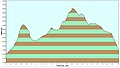 Silvretta Gletscherlehrpfad Höhenprofil.JPG 926 × 526; 40 KB
-
 Silvretta Gletscherlehrpfad Verlauf.JPG 528 × 409; 47 KB
-
 Silvretta im Abendlicht.jpg 4,608 × 2,592; 2.75 MB


,_Dreil%C3%A4nderspitze_und_Ochsenscharten_(rechts).jpg)


_(3%27232m).jpg)


.jpg)
_und_Piz_Faschalba_(Grenzeckkopf)_sowie_Falsches_Kronenjoch.jpg)


.jpeg)


.jpg)
.jpg)
.jpg)


.jpg)


,_rechts_Dreil%C3%A4nderspitze_(davor_unten_der_Vadret_Tuoi).jpg)


.jpg)


.jpg)
_und_Klostertaler_Egghorn_(Mitte)_von_der_Rotfluh.jpg)


.JPG)


,_Cronsel,_Kleiner_Piz_Buin_und_Gro%C3%9Fer_Piz_Buin.jpg)