Category:Sint Catharinakerk (Hengstdijk)
| Object location | | View all coordinates using: OpenStreetMap |
|---|
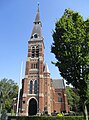
church building in Hulst, Netherlands  | |||||
| Upload media | |||||
| Instance of | |||||
|---|---|---|---|---|---|
| Location | Hengstdijk, Hulst, Zeeland, Netherlands | ||||
| Street address |
| ||||
| Located on street |
| ||||
| Architect | |||||
| Heritage designation |
| ||||
| Inception |
| ||||
| Religion or worldview | |||||
 | |||||
Nederlands: Catharinakerk - anno 1892
|
This is a category about rijksmonument number 22219
|
| Address |
|
Media in category "Sint Catharinakerk (Hengstdijk)"
The following 12 files are in this category, out of 12 total.
-
 Exterieur naar het zuid-oosten - Hengstdijk - 20108739 - RCE.jpg 1,200 × 877; 252 KB
-
 Exterieur vanuit het zuid-westen - Hengstdijk - 20108738 - RCE.jpg 882 × 1,200; 168 KB
-
 Hengstdijk - Heilige Catharinakerk 1.jpg 1,728 × 2,304; 418 KB
-
 Interieur naar het koor - Hengstdijk - 20108742 - RCE.jpg 1,200 × 957; 280 KB
-
 Interieur naar het orgel - Hengstdijk - 20108743 - RCE.jpg 1,200 × 951; 255 KB
-
 Overzicht kerk - Hengstdijk - 20108741 - RCE.jpg 934 × 1,200; 180 KB
-
 Overzicht toren - Hengstdijk - 20108740 - RCE.jpg 964 × 1,200; 211 KB
-
 Overzicht zuidoostgevel met kerkhof - Hengstdijk - 20352972 - RCE.jpg 953 × 1,200; 249 KB
-
 Overzicht zuidwestgevel met kerktoren - Graauw - 20352999 - RCE.jpg 943 × 1,200; 199 KB
-
 Schilderij "De Aanbidding der Wijzen" - Hengstdijk - 20108744 - RCE.jpg 1,200 × 957; 216 KB
-

-
 Sinte Catharina Hengstdijk.jpg 2,686 × 3,615; 7.92 MB


