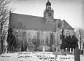
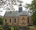
Category:Slotkapel, Egmond aan den Hoef
| Object location | | View all coordinates using: OpenStreetMap |
|---|
church in Egmond aan den Hoef, Netherlands  | |||||
| Upload media | |||||
| Instance of | |||||
|---|---|---|---|---|---|
| Location | Egmond aan den Hoef, Bergen, North Holland, Netherlands | ||||
| Street address |
| ||||
| Located on street |
| ||||
| Heritage designation |
| ||||
| Inception |
| ||||
 | |||||
Nederlands: Slotkapel - anno 1633
|
This is a category about rijksmonument number 14600
|
| Address |
|
Subcategories
This category has only the following subcategory.
Media in category "Slotkapel, Egmond aan den Hoef"
The following 60 files are in this category, out of 60 total.
-

-
 Egmond aan den Hoef 01.jpg 3,264 × 2,448; 3.06 MB
-
 Egmond aan den Hoef 02.jpg 3,264 × 2,448; 3.6 MB
-
 Egmond aan den Hoef 03.jpg 3,264 × 2,448; 3.55 MB
-
 Egmond aan den Hoef 04.jpg 2,448 × 3,264; 3.57 MB
-
 Egmond aan den Hoef 05.jpg 3,264 × 2,448; 3.33 MB
-
 Egmond aan den Hoef 06.jpg 2,448 × 3,264; 3.12 MB
-
 Egmond aan den Hoef 07.jpg 2,448 × 3,264; 3.3 MB
-
 Egmond aan den Hoef 08.jpg 2,448 × 3,264; 3.19 MB
-
 Egmond aan den Hoef 09.jpg 2,448 × 3,264; 3.59 MB
-
 Egmond aan den Hoef- .jpg 3,290 × 4,511; 4.17 MB
-
 Egmond aan den Hoef-.jpg 3,222 × 4,219; 5.56 MB
-
 Egmond kerk.jpg 480 × 640; 155 KB
-
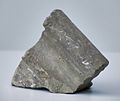
 Elleboog van een manfiguur - Egmond aan de Hoef - 20374178 - RCE.jpg 1,200 × 758; 161 KB
-
 Exterieur - Egmond aan den Hoef - 20068102 - RCE.jpg 1,200 × 884; 256 KB
-
 Exterieur GEDENKSTEEN BOVEN INGANG - Egmond aan den Hoef - 20267254 - RCE.jpg 1,195 × 1,200; 473 KB
-

-
 Exterieur naar het noord-oosten - Egmond aan den Hoef - 20068103 - RCE.jpg 937 × 1,200; 332 KB
-
 Exterieur naar het noord-westen - Egmond aan den Hoef - 20068105 - RCE.jpg 1,200 × 947; 321 KB
-
 Exterieur naar het zuid-oosten - Egmond aan den Hoef - 20068104 - RCE.jpg 1,200 × 952; 266 KB
-
 Fragment van een leeuw - Egmond aan de Hoef - 20374189 - RCE.jpg 1,200 × 1,025; 151 KB
-
 Fragment van een leeuw - Egmond aan de Hoef - 20374191 - RCE.jpg 1,200 × 1,049; 175 KB
-

-
-

-
 Fragment van een pilaster, voorzijde - Egmond aan de Hoef - 20374169 - RCE.jpg 1,200 × 834; 154 KB
-

-

-
 Fragment van kogel - Egmond aan de Hoef - 20374183 - RCE.jpg 1,200 × 1,033; 203 KB
-
 Fragment van kogel - Egmond aan de Hoef - 20374185 - RCE.jpg 1,200 × 846; 139 KB
-
 Fragment van kogel - Egmond aan de Hoef - 20374186 - RCE.jpg 1,200 × 1,118; 207 KB
-
 Interieur naar het oosten - Egmond aan den Hoef - 20068109 - RCE.jpg 1,200 × 977; 255 KB
-
 Interieur naar het westen - Egmond aan den Hoef - 20068108 - RCE.jpg 1,200 × 964; 251 KB
-
 Interieur van kerk - Egmond aan den Hoef - 20408791 - RCE.jpg 1,200 × 878; 166 KB
-

-
 INTERIEUR, GRAFMONUMENT DE WITT - Egmond - 20279254 - RCE.jpg 960 × 1,200; 187 KB
-
 Klauw van een leeuw, rechterzijde - Egmond aan de Hoef - 20374174 - RCE.jpg 1,200 × 885; 152 KB
-
 Klauw van een leeuw, voorzijde - Egmond aan de Hoef - 20374172 - RCE.jpg 1,200 × 886; 156 KB
-
 Klein maalsteentje - Egmond aan de Hoef - 20374187 - RCE.jpg 1,200 × 794; 160 KB
-
 Klein maalsteentje, onderzijde - Egmond aan de Hoef - 20374188 - RCE.jpg 1,200 × 907; 139 KB
-
 Lamoraalweg, Egmond aan den Hoef.jpg 1,867 × 1,343; 905 KB
-

-

-

-
 Profiel met gotisch bladmotief - Egmond aan de Hoef - 20374179 - RCE.jpg 1,200 × 794; 132 KB
-
 Profiel met gotisch bladmotief - Egmond aan de Hoef - 20374180 - RCE.jpg 1,053 × 1,200; 173 KB
-
 Slot-Egmond.jpg 900 × 420; 429 KB
-
 Slotkapel Egmond (28019795392).jpg 1,510 × 1,798; 547 KB
-
 Slotkapel Egmond aan den Hoef.jpg 2,000 × 1,335; 172 KB
-
 Slotkapel Egmond ShiftN.jpg 2,524 × 2,072; 1.44 MB
-
 Slotkapel Egmond.JPG 3,072 × 2,304; 2.91 MB
-
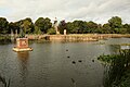
 Slotweg met Ned.Herv.Kerk - Egmond aan den Hoef - 20068081 - RCE.jpg 1,200 × 1,193; 393 KB
-
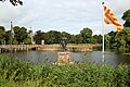
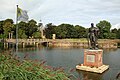
 Standbeeld van Lamoraal van Egmont, Slot op den Hoef - Kasteel Egmond 01.jpg 5,472 × 3,648; 17.28 MB
-
 Standbeeld van Lamoraal van Egmont, Slot op den Hoef - Kasteel Egmond 02.jpg 5,472 × 3,648; 19.88 MB
-
 Standbeeld van Lamoraal van Egmont, Slot op den Hoef - Kasteel Egmond 04.jpg 5,472 × 3,648; 20.25 MB
-
 Standbeeld van Lamoraal van Egmont, Slot op den Hoef - Kasteel Egmond 06.jpg 5,472 × 3,648; 19.83 MB
-
 Standbeeld van Lamoraal van Egmont, Slot op den Hoef - Kasteel Egmond 12.jpg 5,472 × 3,648; 19.15 MB
-
 Standbeeld van Lamoraal van Egmont, Slot op den Hoef - Kasteel Egmond 13.jpg 5,472 × 3,648; 18.58 MB
-
 Standbeeld van Lamoraal van Egmont, Slot op den Hoef - Kasteel Egmond 15.jpg 3,648 × 5,472; 18.94 MB
-
 Vaas - Egmond aan den Hoef - 20068120 - RCE.jpg 862 × 1,200; 362 KB


.jpg)


