Category:Spitalfields, London
area in the East End of London  | |||||
| Upload media | |||||
| Instance of | |||||
|---|---|---|---|---|---|
| Location | London Borough of Tower Hamlets, Greater London, London, England | ||||
 | |||||
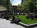
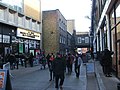
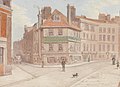
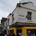
Spitalfields is an inner city district in the East End of London, Central London in the London Borough of Tower Hamlets and is near Liverpool Street station and Brick Lane. The area straddles Commercial Street and is home to several markets, including the historic Old Spitalfields Market, Brick Lane Market and Cheshire Street. Petticoat Lane Market lies on the area's south-western boundaries.
Subcategories
This category has the following 33 subcategories, out of 33 total.
A
- Allen Gardens, Shoreditch (13 F)
- Artillery Passage, London (22 F)
B
C
- Charnel House, St Mary Spital (15 F)
- Corbet Place, London (2 F)
- Crispin Street, London (5 F)
F
- Fashion Street, London (77 F)
G
- Grey Eagle Street, London (6 F)
- Gun Street, London (3 F)
H
J
- Jerome Street, London (16 F)
K
N
- Norton Folgate Almshouses (3 F)
O
- Old Spitalfields Market (42 F)
P
S
- Spital Street, London (13 F)
T
- Toynbee Street, London (23 F)
W
- Wheler Street, London (4 F)
- White's Row, London (3 F)
- Wilkes Street, London (50 F)
- Woodseer Street, London (9 F)
Media in category "Spitalfields, London"
The following 49 files are in this category, out of 49 total.
-
De-Spitalfields.ogg 2.0 s; 20 KB
-

-
 AnnieChapman29HanburyStreet1888JackTheEstripador.jpg 277 × 399; 55 KB
-
 Bishops Square 001 by Townshend Landscape Architects.JPG 2,048 × 1,536; 1.09 MB
-
 Brune House, Spitalfields (01).jpg 4,414 × 3,207; 13.65 MB
-
 ChrisDysonJeremyFreedman2021.jpg 2,000 × 1,546; 1.25 MB
-

-
 Dray Walk, Spitalfields - geograph.org.uk - 4340538.jpg 2,272 × 1,704; 866 KB
-
 Former Truman's Brewery Cooperage.jpg 3,987 × 4,780; 14.29 MB
-

-
 Hawksmoor in Spitalfields.jpg 3,093 × 2,113; 1.25 MB
-
 Heneage Street, Spitalfields - geograph.org.uk - 4340578.jpg 1,704 × 2,272; 715 KB
-
 Job Today .jpg 3,264 × 2,448; 1.47 MB
-
-
 Jury (20099852166).jpg 7,120 × 4,005; 3.46 MB
-
 Kalliopi Lemos’ ‘Wooden Boat with Seven People’ (44581363631).jpg 2,676 × 4,000; 5.82 MB
-
 London Graffiti (10499400106).jpg 4,000 × 6,000; 15.67 MB
-
 London Graffiti (10499903274).jpg 6,000 × 4,000; 12.7 MB
-
 London Graffiti (10499937964).jpg 4,000 × 6,000; 13.6 MB
-
 London Graffiti (10499957125).jpg 6,000 × 4,000; 14.71 MB
-
 London Graffiti (10500183395).jpg 3,605 × 5,664; 11.17 MB
-
 London Graffiti (10500279005).jpg 4,000 × 6,000; 9.6 MB
-
 Londres, Cobb Street.jpg 3,263 × 3,263; 6.01 MB
-
 Lost Plaque LCC Strype Street 10 Leyden Street 1929.png 450 × 500; 138 KB
-
 Map of Spitalfields Area - 1787.jpg 557 × 418; 130 KB
-
 Market Street, Spitalfields - geograph.org.uk - 4563803.jpg 960 × 1,280; 231 KB
-
 Meeting collage artist Adrian Boswell.jpg 4,000 × 3,000; 2.42 MB
-
 Nearly Finished (222736079).jpeg 2,048 × 1,720; 1.37 MB
-
 Nellie Annie Lyons 1903A.jpg 397 × 567; 81 KB
-
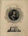 Nicholas Culpeper. Line engraving, 1827. Wellcome V0001387.jpg 2,533 × 3,209; 3.79 MB
-
 Norton Folgate almshouses (7442907590).jpg 2,368 × 2,961; 6.8 MB
-
 Old (19505257403).jpg 4,888 × 7,324; 13.81 MB
-
 Reading newspaper in a café (Unsplash).jpg 4,032 × 3,024; 2.52 MB
-
 Reflections (231896539).jpeg 2,048 × 1,365; 704 KB
-
 Reflections In Tunnel Murals (47590806).jpeg 2,048 × 1,536; 750 KB
-
 Shops on New Goulston Street, London, June 2023.jpg 4,608 × 3,456; 7.89 MB
-
 Space invader en Spitalfields (4952205316).jpg 800 × 600; 253 KB
-
 Spitalfields from the air - geograph.org.uk - 6255917.jpg 1,024 × 768; 518 KB
-
 Spitalfields indoor market (14060175).jpg 1,066 × 816; 337 KB
-
 Spitalfields London Flat April 2021.jpg 1,635 × 1,226; 438 KB
-
 Spitalfields Market, Spitalfields, United Kingdom (Unsplash).jpg 2,500 × 1,667; 2.42 MB
-
 Spitalfields Re-development, London - geograph.org.uk - 64144.jpg 480 × 640; 102 KB
-
 Spitalfields Symbol (8024385610).jpg 2,448 × 3,264; 2.3 MB
-
 Spitalfields, bicycle stands - geograph.org.uk - 3049512.jpg 1,024 × 764; 168 KB
-
 St Katharine's ^ Wapping, London, Wielka Brytania - panoramio.jpg 2,696 × 1,518; 1.85 MB
-
 Street life (4971753359).jpg 4,256 × 2,832; 1.86 MB
-
 The Illustrated London News - March 9, 1867 - Spitalfields soup kitchen.jpg 1,431 × 1,009; 778 KB
-
 Vibe Bar, Spitalfields, E1 (2404401388).jpg 960 × 1,280; 281 KB
-
 Wedding dress fashion (Unsplash).jpg 5,184 × 3,456; 3.34 MB


.jpg)


,_Spitalfields,_London,_England,_1775-1780,_silk_taffeta,_linen_bodice_lining,_F.252_-_Flynt_Center_of_Early_New_England_Life_-_Deerfield,_Massachusetts_-_DSC04864.jpg)


.jpg)
.jpg)
.jpg)
.jpg)
.jpg)
.jpg)
.jpg)
.jpg)


.jpeg)


.jpg)
.jpg)
.jpg)
.jpeg)
.jpeg)

.jpg)

.jpg)

.jpg)

.jpg)


.jpg)

.jpg)
.jpg)