Category:St Endellion
village and civil parish in Cornwall, England, UK  La collégiale de St Endellion | |||||
| Upload media | |||||
| Instance of | |||||
|---|---|---|---|---|---|
| Named after |
| ||||
| Location | Cornwall, South West England, England | ||||
| Population |
| ||||
 | |||||
العربية: سانت اندلين (كورنوال) هي قرية و أبرشية مدنية تقع في المملكة المتحدة في كورنوال. يقدر عدد سكانها بـ 987 نسمة . (→سانت اندلين (كورنوال))
Cymraeg: Pentref a chymuned yn Lloegr ydy St Endellion; saif yng Nghernyw, De Orllewin Lloegr. (→St Endellion)
English: St Endellion is a civil parish and village in north Cornwall, England, United Kingdom. The village and parish church are situated four miles (6.5 km) north of Wadebridge. (→St Endellion)
Français : St Endellion (Sen Endelyn en cornique) est un village et une paroisse civile situé sur la côte nord des Cornouailles, en Angleterre. Au moment du recensement de 2011, il comptait . (→St Endellion)

Subcategories
This category has the following 11 subcategories, out of 11 total.
C
M
- Minerals of St Endellion (2 F)
- Minerals of Wheal Boys (1 F)
P
R
- Roscarrock, St Endellion (1 F)
T
- Tresungers (2 F)
- Trewetha (1 F)
Media in category "St Endellion"
The following 187 files are in this category, out of 187 total.
-
 A daunting set of steps at Pine Haven - geograph.org.uk - 5837701.jpg 1,024 × 768; 382 KB
-
 A Quiet Road - geograph.org.uk - 1947138.jpg 1,024 × 682; 257 KB
-
 A view across the Port Gaverne inlet - geograph.org.uk - 6675989.jpg 1,024 × 768; 450 KB
-
 A view of the sea - geograph.org.uk - 4177362.jpg 640 × 480; 152 KB
-
 A work in progress - geograph.org.uk - 6590094.jpg 1,024 × 768; 156 KB
-
 Above the cliffs of Varley Head - geograph.org.uk - 2031467.jpg 819 × 614; 186 KB
-
 Arable field, Tolraggott Farm - geograph.org.uk - 2437773.jpg 640 × 452; 76 KB
-
 B3267 Junction With B3314 - geograph.org.uk - 6203025.jpg 640 × 480; 39 KB
-
 B3314 near Trecreege - geograph.org.uk - 2437931.jpg 640 × 413; 49 KB
-
 Back Gardens and Roof Tops - geograph.org.uk - 6252735.jpg 5,255 × 3,505; 3.66 MB
-
 Blocked footpath near Burrow Park - geograph.org.uk - 2437348.jpg 640 × 465; 103 KB
-
 Buildings at Port Quin - geograph.org.uk - 4177369.jpg 640 × 480; 175 KB
-
 Car park - Port Isaac - geograph.org.uk - 3953844.jpg 640 × 470; 64 KB
-
 Car park at Port Isaac - geograph.org.uk - 4177255.jpg 640 × 480; 134 KB
-
 Carolina Cellar, Port Quin - geograph.org.uk - 6211257.jpg 4,937 × 3,291; 3.89 MB
-
 Cattle above Pine Haven - geograph.org.uk - 2390757.jpg 640 × 422; 64 KB
-
 Cattle and Sea - geograph.org.uk - 2228835.jpg 1,024 × 682; 211 KB
-
 Cattle grid, Treswarrow Farm - geograph.org.uk - 2437942.jpg 640 × 392; 72 KB
-
 Cattle near Tregaverne - geograph.org.uk - 5679062.jpg 2,980 × 1,992; 504 KB
-
 Church hall, St Endellion - geograph.org.uk - 3067964.jpg 1,600 × 1,064; 451 KB
-
 Church Hill - geograph.org.uk - 6252724.jpg 5,472 × 3,648; 6.72 MB
-
 Church Hill in Port Isaac - geograph.org.uk - 6444462.jpg 1,024 × 683; 604 KB
-
 Coast at Downgate Cove - geograph.org.uk - 2391360.jpg 640 × 480; 110 KB
-
 Coast near Pine Haven - geograph.org.uk - 2438702.jpg 640 × 480; 119 KB
-
 Coast path above above St Illickswell Gug - geograph.org.uk - 5749557.jpg 4,288 × 2,848; 1.68 MB
-
 Coast path above Bounds Cliff - geograph.org.uk - 5748413.jpg 4,288 × 2,678; 2.15 MB
-
 Coast path above Bounds Cliff - geograph.org.uk - 5748433.jpg 4,260 × 2,641; 2.1 MB
-
 Coast path above Downgate Cove - geograph.org.uk - 2391429.jpg 640 × 480; 134 KB
-
 Coast path above Greengarden Cove - geograph.org.uk - 2391339.jpg 640 × 480; 96 KB
-
 Coast Path at Pine Haven - geograph.org.uk - 2438671.jpg 480 × 640; 132 KB
-
 Coast path near Fox Hole - geograph.org.uk - 2391461.jpg 640 × 480; 126 KB
-
 Coast path on Kellan Head - geograph.org.uk - 2391484.jpg 640 × 449; 96 KB
-
 Coast path on Kellan Head - geograph.org.uk - 2391501.jpg 640 × 480; 110 KB
-
 Coast path on Kellan Head - geograph.org.uk - 2438815.jpg 640 × 480; 104 KB
-
 Coast path on Kellan Head - geograph.org.uk - 2438825.jpg 640 × 444; 92 KB
-
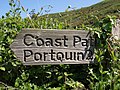 Coast path sign, Pine Haven - geograph.org.uk - 2391270.jpg 640 × 480; 118 KB
-
 Coast path west of Lobber Point - geograph.org.uk - 2438641.jpg 640 × 464; 100 KB
-
 Coastal slope above Pigeon's Cove - geograph.org.uk - 5747890.jpg 4,288 × 2,848; 2.38 MB
-
 Cornish Lane - geograph.org.uk - 2111817.jpg 640 × 425; 72 KB
-
 Cove near Pine Haven - geograph.org.uk - 2438684.jpg 640 × 480; 120 KB
-

-
 Entrance to Scarrabine Farm - geograph.org.uk - 2437222.jpg 640 × 374; 62 KB
-
 Field at Long Cross - geograph.org.uk - 4177364.jpg 640 × 480; 167 KB
-
 Field boundary by the B3314 - geograph.org.uk - 5677189.jpg 3,486 × 2,156; 980 KB
-
 Field with a view, Port Gaverne - geograph.org.uk - 5679070.jpg 3,786 × 2,446; 1.19 MB
-
 Fields near Roscarrock - geograph.org.uk - 2228814.jpg 1,024 × 682; 202 KB
-
 Fields near Trelights - geograph.org.uk - 2437310.jpg 640 × 480; 91 KB
-
 Filly Horse - geograph.org.uk - 5747654.jpg 4,288 × 2,848; 2.61 MB
-
 First view of Pine Haven - geograph.org.uk - 2031464.jpg 717 × 538; 196 KB
-
 Flowers on Reedy Cliff (5209).jpg 4,288 × 2,848; 6.39 MB
-
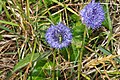 Flowers on Reedy Cliff (5210).jpg 4,288 × 2,848; 5.36 MB
-
 Flowers on Reedy Cliff (5211).jpg 4,288 × 2,848; 5.52 MB
-
 Flowers on Reedy Cliff (5213).jpg 4,288 × 2,848; 4.79 MB
-
 Footpath above St Illickswell Gug - geograph.org.uk - 5673223.jpg 4,288 × 2,848; 1.57 MB
-
 Footpath above St Illickswell Gug - geograph.org.uk - 5750101.jpg 4,067 × 2,572; 2.24 MB
-
 Footpath above St Illickswell Gug - geograph.org.uk - 5750206.jpg 4,271 × 2,400; 1.3 MB
-
 Footpath through Field - geograph.org.uk - 5101872.jpg 640 × 480; 66 KB
-
 Footpath to the coast path - geograph.org.uk - 5750239.jpg 4,288 × 2,848; 1.83 MB
-
 Inland to Trewethart - geograph.org.uk - 5748429.jpg 4,250 × 2,447; 1.46 MB
-
 Inlet at Port Gavernes - geograph.org.uk - 5095530.jpg 640 × 480; 58 KB
-
 Junction on the Road from Port Gaverne - geograph.org.uk - 1947153.jpg 1,024 × 682; 176 KB
-
 Kellan Head - geograph.org.uk - 5101880.jpg 640 × 480; 36 KB
-
 Kellan Head and Rumps Point (5201).jpg 4,288 × 2,848; 6.09 MB
-
 Lane at Tartars Farm - geograph.org.uk - 5750350.jpg 4,005 × 2,354; 1,011 KB
-
 Lane past Tregaverne - geograph.org.uk - 5750332.jpg 4,184 × 2,408; 1.14 MB
-
 Lane to China Down - geograph.org.uk - 5673225.jpg 2,662 × 1,679; 474 KB
-
 Lane to Tolraggott Farm - geograph.org.uk - 2437610.jpg 640 × 458; 79 KB
-
 Lane, Trelights - geograph.org.uk - 2437394.jpg 640 × 480; 76 KB
-
 Late afternoon, The Haven, Port Isaac - geograph.org.uk - 6428686.jpg 1,797 × 1,198; 414 KB
-
 Line of footpath, Scarrabine Farm - geograph.org.uk - 2437247.jpg 640 × 428; 69 KB
-
 Morris dancers - Port Isaac - geograph.org.uk - 3953866.jpg 640 × 480; 100 KB
-
 Morris men - Port Isaac - geograph.org.uk - 3953860.jpg 640 × 480; 109 KB
-
 Near Varley Head - geograph.org.uk - 6439592.jpg 1,200 × 803; 1.28 MB
-
 North Cornwall , Boat out to Sea - geograph.org.uk - 2493157.jpg 4,274 × 2,828; 4.79 MB
-
 North Cornwall , Looking Out to Sea - geograph.org.uk - 2491637.jpg 4,236 × 2,768; 4.74 MB
-
 North Cornwall , The B3314 - geograph.org.uk - 2493164.jpg 4,288 × 2,848; 5.83 MB
-
 North Cornwall Coast in the distance - geograph.org.uk - 2111811.jpg 640 × 427; 80 KB
-
-

-

-
 Old post office, Trelights - geograph.org.uk - 2437537.jpg 640 × 416; 90 KB
-
 Old Wayside Cross north of Trelights - geograph.org.uk - 6102398.jpg 566 × 800; 234 KB
-
 On the Ascent to Kellan Head - geograph.org.uk - 2228769.jpg 1,024 × 682; 202 KB
-
 Ordnance Survey Cut Mark - geograph.org.uk - 4450641.jpg 480 × 640; 146 KB
-
 Pasture near Tolraggott Farm - geograph.org.uk - 2437841.jpg 640 × 454; 99 KB
-
 Pasture near Tolraggott Farm - geograph.org.uk - 2437876.jpg 640 × 480; 111 KB
-
 Pasture near Treswarrow Farm - geograph.org.uk - 2437919.jpg 640 × 430; 86 KB
-
 Pasture near Trewethart - geograph.org.uk - 5750220.jpg 4,271 × 2,579; 1.14 MB
-
 Pasture, Tolraggott Farm - geograph.org.uk - 2437670.jpg 640 × 468; 88 KB
-
 Pasture, Tolraggott Farm - geograph.org.uk - 2437706.jpg 640 × 424; 89 KB
-
 Pasture, Tolraggott Farm - geograph.org.uk - 2437741.jpg 640 × 425; 83 KB
-
 Path near Roscarrock - geograph.org.uk - 2390695.jpg 640 × 469; 86 KB
-
 Path near Roscarrock - geograph.org.uk - 2438335.jpg 640 × 480; 91 KB
-
 Path on Kellan Head - geograph.org.uk - 5837730.jpg 1,024 × 768; 166 KB
-
 Path to oblivion, Pine Haven - geograph.org.uk - 2391279.jpg 640 × 480; 109 KB
-
 Phone box, St Endellion - geograph.org.uk - 4185915.jpg 1,200 × 1,600; 1.09 MB
-
 Pine Haven - geograph.org.uk - 6439589.jpg 1,200 × 809; 1.2 MB
-
 Port Gaverne - geograph.org.uk - 4663873.jpg 1,024 × 683; 227 KB
-
 Port Gaverne - geograph.org.uk - 5092672.jpg 640 × 480; 68 KB
-
 Port Gaverne - geograph.org.uk - 5101790.jpg 640 × 480; 61 KB
-
 Port Gaverne Cornwall - geograph.org.uk - 3644313.jpg 609 × 640; 113 KB
-
 Port Gaverne Village Sign - geograph.org.uk - 6203021.jpg 640 × 480; 44 KB
-
 Port Gaverne, Cornwall - geograph.org.uk - 4974017.jpg 2,048 × 1,536; 1.24 MB
-
 Port Isaac - Church Hill - geograph.org.uk - 6428640.jpg 1,198 × 1,797; 326 KB
-
 Port Isaac - Church Hill - geograph.org.uk - 6428643.jpg 1,800 × 1,200; 450 KB
-
 Port Quin - geograph.org.uk - 5322803.jpg 3,104 × 2,055; 1.07 MB
-
 Port Quin at low tide - geograph.org.uk - 4177367.jpg 640 × 480; 161 KB
-
 Port Quinn - geograph.org.uk - 6439594.jpg 1,200 × 800; 1.35 MB
-
 Post above Port Isaac - geograph.org.uk - 2390776.jpg 480 × 640; 49 KB
-
 Pump shelter - geograph.org.uk - 6590105.jpg 1,024 × 768; 219 KB
-
 Reedy Cliff - geograph.org.uk - 2228751.jpg 1,024 × 682; 187 KB
-
 Rocky Harbour and Quay Cottage, Portquin - geograph.org.uk - 6211277.jpg 5,044 × 3,362; 5.38 MB
-
 Roscarrock Farm track across the fields - geograph.org.uk - 2031543.jpg 896 × 672; 164 KB
-
 Scarnor Point - geograph.org.uk - 6439593.jpg 1,200 × 802; 1.24 MB
-
 Sharp Bend Sea Ahead Near Hendra - geograph.org.uk - 6202980.jpg 640 × 415; 31 KB
-
 Sign 4 UK.jpg 756 × 1,136; 151 KB
-
 Signpost and inscribed stone at Longcross - geograph.org.uk - 392521.jpg 640 × 480; 142 KB
-
 Skimming pebbles from the beach in 1977 - geograph.org.uk - 3353780.jpg 1,155 × 751; 181 KB
-
 Slate gravestones, St Endellion - geograph.org.uk - 3067966.jpg 1,600 × 1,064; 451 KB
-
 South West Coast Path - geograph.org.uk - 1578237.jpg 640 × 480; 77 KB
-
 South West Coast Path banner Reedy Cliff.jpg 3,903 × 558; 1.55 MB
-
 South West Coast Path on Kellan Head - geograph.org.uk - 2031499.jpg 819 × 614; 184 KB
-
 South West Coast Path on Kellan Head - geograph.org.uk - 2031528.jpg 973 × 730; 196 KB
-
 South West Coast Path on Reedy Cliff.jpg 4,272 × 2,848; 7.19 MB
-
 St Endelion tower from Chapel Amble.jpg 2,304 × 3,072; 819 KB
-
 St Endellion, above Tresungers Point - geograph.org.uk - 850874.jpg 640 × 427; 184 KB
-
 St Endillion Pillar.jpg 2,304 × 3,072; 2.66 MB
-
 St Endillion Village Sign - geograph.org.uk - 6203030.jpg 640 × 480; 42 KB
-
 St Peter's Church Rooms - geograph.org.uk - 6439587.jpg 1,200 × 802; 1.31 MB
-
 Step stile near Trewethart - geograph.org.uk - 5750264.jpg 4,288 × 2,848; 2.54 MB
-
 Stiff step stile on Bounds Cliff - geograph.org.uk - 5747690.jpg 3,092 × 2,521; 1.96 MB
-
 Stile near Trelights - geograph.org.uk - 2437359.jpg 459 × 640; 112 KB
-
 Stile near Trewinte - geograph.org.uk - 2437285.jpg 640 × 452; 104 KB
-
 Stone-built barn overlooking Port Quin in 1977 - geograph.org.uk - 3362396.jpg 1,085 × 631; 116 KB
-
 Stream below Trelights - geograph.org.uk - 2437335.jpg 640 × 480; 121 KB
-
 Stream near Ranie Point - geograph.org.uk - 5746904.jpg 2,848 × 4,288; 2.64 MB
-
 SW Coast Path at Reedy Cliff - geograph.org.uk - 2031481.jpg 742 × 557; 186 KB
-
 Tartars Farm - geograph.org.uk - 5750342.jpg 4,261 × 2,612; 1.21 MB
-

-
 The B3267 - geograph.org.uk - 4193016.jpg 4,000 × 2,664; 4.8 MB
-
 The B3267 - geograph.org.uk - 4193022.jpg 4,000 × 2,664; 6.64 MB
-
 The B3267 - geograph.org.uk - 4193027.jpg 4,000 × 2,664; 4.72 MB
-

-
 The Cliffs above Pigeon's Cove - geograph.org.uk - 1940723.jpg 1,024 × 682; 204 KB
-
 The Coast Path along Reedy Cliff - geograph.org.uk - 310387.jpg 640 × 629; 150 KB
-
 The Coast Path Traverses a Valley - geograph.org.uk - 1940699.jpg 1,024 × 682; 210 KB
-
 The Collegiate Church of St Endellion - geograph.org.uk - 5076774.jpg 1,024 × 827; 188 KB
-
 The Cornish Coast - geograph.org.uk - 2858843.jpg 1,024 × 680; 153 KB
-
 The Mouls and Rump Point (5221).jpg 4,288 × 2,848; 5.57 MB
-
 The Pride of Place - geograph.org.uk - 6079996.jpg 2,399 × 3,599; 1,014 KB
-
 The road to Port Gaverne - geograph.org.uk - 2587501.jpg 1,500 × 1,000; 173 KB
-
 The sea cliffs of Kellan Head - geograph.org.uk - 2031531.jpg 614 × 819; 197 KB
-
 The Southwest Coast Path to Port Gaverne - geograph.org.uk - 2587526.jpg 1,500 × 1,000; 145 KB
-
 The Southwest Coast Path to Port Gaverne - geograph.org.uk - 2587546.jpg 1,500 × 1,000; 151 KB
-
 The Southwest Coast Path to Port Isaac - geograph.org.uk - 2587540.jpg 1,500 × 1,000; 125 KB
-
 Tintagel Head from Port Isaac (5162).jpg 3,587 × 2,746; 3.71 MB
-
 Tintagel Head from Varley Head (5197).jpg 4,288 × 2,848; 6.99 MB
-
 Tolraggott Farm - geograph.org.uk - 2437637.jpg 640 × 458; 74 KB
-
 Tombstoning at Port Gaverne 2 - geograph.org.uk - 4973944.jpg 2,042 × 1,429; 1.28 MB
-
 Tombstoning at Port Gaverne, Cornwall 1 - geograph.org.uk - 4973978.jpg 1,235 × 968; 833 KB
-
 Towards the coast east of Port Gaverne - geograph.org.uk - 5677057.jpg 3,473 × 1,202; 1.32 MB
-
 Towards Tolraggott Farm - geograph.org.uk - 2437574.jpg 640 × 454; 83 KB
-
 Track to Port Quin - geograph.org.uk - 2390669.jpg 640 × 480; 87 KB
-
 Tregaverne - geograph.org.uk - 5750291.jpg 4,070 × 2,294; 1.11 MB
-
 Tresunger cattle - geograph.org.uk - 389561.jpg 640 × 480; 137 KB
-
 Tresungers Point - geograph.org.uk - 1940669.jpg 1,024 × 682; 265 KB
-
 Tumulus on Scarnor Point - geograph.org.uk - 2031476.jpg 896 × 672; 185 KB
-
 Unnamed Valley near Barrett's Zawn - geograph.org.uk - 1946912.jpg 1,024 × 682; 201 KB
-
 Valley above Pine Haven - geograph.org.uk - 2390704.jpg 640 × 440; 110 KB
-
 Valley east of St Minver - geograph.org.uk - 2437810.jpg 640 × 446; 93 KB
-
 Valley near Ranie Point - geograph.org.uk - 5747045.jpg 4,288 × 2,848; 2.24 MB
-
 Valley near Ranie Point - geograph.org.uk - 5747333.jpg 4,288 × 2,775; 2.15 MB
-
 Varley Head (5192).jpg 4,288 × 2,848; 5.2 MB
-
 Varley Head (5193).jpg 4,288 × 2,848; 6.82 MB
-
 Varley Head - geograph.org.uk - 2391323.jpg 640 × 480; 90 KB
-
 Varley Head - geograph.org.uk - 2910841.jpg 640 × 480; 107 KB
-
 Varley Head - geograph.org.uk - 5837674.jpg 1,024 × 768; 156 KB
-
 Varley Head - geograph.org.uk - 6439590.jpg 1,200 × 806; 1.08 MB
-
 Varley Head and Varley Sand (5196).jpg 4,288 × 2,848; 7.04 MB
-
 Varley Head from the south-west - geograph.org.uk - 2031469.jpg 870 × 653; 194 KB
-
 View from the path up to Lobber Point, Port Isaac - geograph.org.uk - 4973759.jpg 1,500 × 1,074; 333 KB
-
 View northeast from Kellan Head (5219).jpg 4,288 × 2,848; 6.18 MB
-
 View of Lobber Point from the SW Coast Path, Port Isaac - geograph.org.uk - 4973848.jpg 1,500 × 1,096; 305 KB
-
 Welcome to Port Isaac - geograph.org.uk - 3644293.jpg 640 × 376; 49 KB
-

-
 Wildlife haven. - panoramio.jpg 2,816 × 2,112; 4.34 MB
-
 Woodland above Pine Haven - geograph.org.uk - 2390751.jpg 640 × 480; 164 KB


.jpg)
.jpg)
.jpg)
.jpg)


.jpg)


.jpg)


.jpg)
.jpg)


.jpg)
.jpg)


.jpg)


.jpg)


