Category:St Mary, Gratwich
| Object location | | View all coordinates using: OpenStreetMap |
|---|
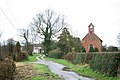
English: Wanted: Photograph of the chancel, which ist about 200 years older than the western parts of the church.
church building in Kingstone, East Staffordshire, England, UK  | |||||
| Upload media | |||||
| Instance of | |||||
|---|---|---|---|---|---|
| Location | Kingstone, East Staffordshire, Staffordshire, West Midlands, England | ||||
| Diocese | |||||
| Heritage designation |
| ||||
| Religion or worldview | |||||
 | |||||
Media in category "St Mary, Gratwich"
This category contains only the following file.
-
 Gratwich Church - geograph.org.uk - 354318.jpg 640 × 426; 115 KB