Category:St Mary the Virgin, Stoneleigh, Warwickshire
| Object location | | View all coordinates using: OpenStreetMap |
|---|
church in Warwickshire, UK  | |||||
| Upload media | |||||
| Instance of | |||||
|---|---|---|---|---|---|
| Location | Stoneleigh, Warwick, Warwickshire, West Midlands, England | ||||
| Diocese | |||||
| Heritage designation |
| ||||
| Inception |
| ||||
| Religion or worldview | |||||
 | |||||
Media in category "St Mary the Virgin, Stoneleigh, Warwickshire"
The following 47 files are in this category, out of 47 total.
-
 Church of St Mary, Stoneleigh.jpg 5,312 × 2,988; 3.92 MB
-
 Church of the Virgin Mary in Stoneleigh 6g06.JPG 2,592 × 1,944; 3.12 MB
-
 Coventry Way 04.jpg 1,600 × 1,200; 436 KB
-

-

-

-
-

-
 St Mary the Virgin Church - geograph.org.uk - 1241984.jpg 640 × 429; 69 KB
-
 St Mary the Virgin, Stoneleigh-in-Arden - 50917891643.jpg 5,472 × 3,648; 10.24 MB
-
 St Mary the Virgin, Stoneleigh-in-Arden - 50918579986.jpg 4,982 × 3,158; 8.55 MB
-
 St Mary the Virgin, Stoneleigh-in-Arden - 50918580531.jpg 5,472 × 3,648; 11.41 MB
-
 St Mary the Virgin, Stoneleigh-in-Arden - 50918712192.jpg 3,648 × 5,472; 8.28 MB
-
 St Mary the Virgin, Stoneleigh-in-Arden - 50918712752.jpg 5,472 × 3,006; 9 MB
-
 St Mary the Virgin, Stoneleigh-in-Arden - 50918713272.jpg 4,974 × 2,788; 9.83 MB
-
 St Mary the Virgin, Stoneleigh-in-Arden. C14 Lady.jpg 2,272 × 1,704; 923 KB
-
 St Mary the Virgin, Stoneleigh-in-Arden. Chancel Arch Detail.jpg 1,733 × 1,300; 1.15 MB
-
 St Mary the Virgin, Stoneleigh-in-Arden. Chancel Arch.jpg 1,118 × 839; 480 KB
-
 St Mary the Virgin, Stoneleigh-in-Arden. Churchyard.jpg 2,025 × 1,519; 1.9 MB
-
 St Mary the Virgin, Stoneleigh-in-Arden. Font Bowl.jpg 2,001 × 1,501; 1.62 MB
-
 St Mary the Virgin, Stoneleigh-in-Arden. Font.jpg 1,349 × 1,011; 790 KB
-
 St Mary the Virgin, Stoneleigh-in-Arden. From South East.jpg 2,085 × 1,564; 1.37 MB
-
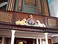
 St Mary the Virgin, Stoneleigh-in-Arden. Gallery and Organ.jpg 2,272 × 1,704; 1.26 MB
-
 St Mary the Virgin, Stoneleigh-in-Arden. Ivy, snow and gravestones.jpg 1,704 × 1,278; 1.33 MB
-
 St Mary the Virgin, Stoneleigh-in-Arden. Looking East.jpg 1,796 × 1,347; 1.31 MB
-
 St Mary the Virgin, Stoneleigh-in-Arden. North Doorway Tympanum.jpg 2,272 × 1,704; 1.87 MB
-
 St Mary the Virgin, Stoneleigh-in-Arden. North Doorway.jpg 2,272 × 1,704; 1.61 MB
-
 St Mary the Virgin, Stoneleigh-in-Arden. North East View.jpg 2,272 × 1,704; 1.5 MB
-
 St Mary the Virgin, Stoneleigh-in-Arden. North Side.jpg 2,272 × 1,704; 1.72 MB
-
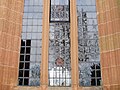 St Mary the Virgin, Stoneleigh-in-Arden. North Window.jpg 1,489 × 1,116; 910 KB
-
 St Mary the Virgin, Stoneleigh-in-Arden. Royal Arms.jpg 2,272 × 1,704; 1.74 MB
-
 St Mary the Virgin, Stoneleigh-in-Arden. South Side.jpg 2,272 × 1,704; 888 KB
-
 St Mary the Virgin, Stoneleigh-in-Arden. South Vestry Window.jpg 1,394 × 1,859; 1.27 MB
-
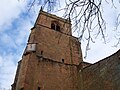 St Mary the Virgin, Stoneleigh-in-Arden. Tower from South.jpg 2,272 × 1,704; 1.49 MB
-
 St Mary the Virgin, Stoneleigh-in-Arden. Tower North.jpg 2,272 × 1,704; 872 KB
-
 St Mary the Virgin, Stoneleigh-in-Arden. West Door.jpg 2,272 × 1,704; 1.27 MB
-
 St Mary the Virgin, Stoneleigh-in-Arden. West Doorway.jpg 1,637 × 2,183; 1.56 MB
-
 St Mary the Virgin, Stoneleigh-in-Arden. West View.jpg 2,272 × 1,704; 1.72 MB
-
 St Mary the Virgin, Stoneleigh-in-Arden.jpg 3,648 × 2,736; 7.2 MB
-
 St. Mary, Stoneleigh - geograph.org.uk - 959363.jpg 640 × 480; 80 KB
-
 Stoneleigh Angel.jpg 1,536 × 2,048; 1.99 MB
-
 Stoneleigh Church - geograph.org.uk - 3092714.jpg 1,600 × 1,200; 526 KB
-
 Stoneleigh church - geograph.org.uk - 4827052.jpg 640 × 480; 55 KB
-
 Stoneleigh Church - geograph.org.uk - 5781379.jpg 800 × 600; 124 KB
-
 Stoneleigh, St. Mary the Virgin - geograph.org.uk - 6048610.jpg 1,024 × 768; 168 KB
-
 Stoneleigh, Warwickshire, St Mary the Virgin - geograph.org.uk - 5919599.jpg 4,608 × 3,456; 3.98 MB
-


