Category:Stockton, Worfield
village and civil parish near Bridgnorth, Shropshire, UK  Eglwys Sant Chad, Stockton | |||||
| Upload media | |||||
| Instance of | |||||
|---|---|---|---|---|---|
| Location | Shropshire, West Midlands, England | ||||
 | |||||
Subcategories
This category has the following 3 subcategories, out of 3 total.
A
- Apley Hall (7 F)
N
- Norton, Stockton, Shropshire (24 F)
Media in category "Stockton, Worfield"
The following 101 files are in this category, out of 101 total.
-
 13 ^ 14 Cheswardine Lane, Stockton - geograph.org.uk - 6299625.jpg 2,938 × 2,203; 1.99 MB
-
 17 Cheswardine Lane, Stockton - geograph.org.uk - 6299632.jpg 3,264 × 2,448; 1.98 MB
-
 Neale(1826) p3.122 - Apley Park, Shropshire.jpg 1,920 × 1,290; 781 KB
-
 21 Cheswardine Lane, Stockton - geograph.org.uk - 6299640.jpg 2,774 × 2,081; 2.19 MB
-
 24 Village Road, Norton - geograph.org.uk - 6296067.jpg 2,938 × 2,203; 1.98 MB
-
 A442 approaches the power lines - geograph.org.uk - 2713560.jpg 640 × 480; 123 KB
-
 A442 at Stockton Crossroads - geograph.org.uk - 2713383.jpg 640 × 480; 123 KB
-
 A442 at the Leavenhalls - geograph.org.uk - 2713399.jpg 640 × 480; 117 KB
-
 Apley Farm Shop - geograph.org.uk - 6067069.jpg 800 × 600; 76 KB
-
 Apley Fields - geograph.org.uk - 6333780.jpg 800 × 600; 200 KB
-
 Apley Hall from the east - geograph.org.uk - 2821837.jpg 1,142 × 857; 363 KB
-

-
 Apley Park - geograph.org.uk - 2492987.jpg 1,152 × 864; 286 KB
-
 Apley Park track in The Knolls Coppice - geograph.org.uk - 2492974.jpg 672 × 896; 334 KB
-
 Apley Park, Astley Abbotts - geograph.org.uk - 3435703.jpg 640 × 413; 218 KB
-
 Apley Pigs - geograph.org.uk - 6333744.jpg 800 × 600; 123 KB
-
 Barns at Crowgreaves - geograph.org.uk - 2281532.jpg 973 × 730; 219 KB
-
-
 Bridleway near Higford through woodland - geograph.org.uk - 3228885.jpg 4,608 × 3,072; 1.74 MB
-
 Church Scene - geograph.org.uk - 6333752.jpg 800 × 600; 159 KB
-
 Church View - geograph.org.uk - 6333756.jpg 600 × 800; 153 KB
-
 Churchyard Scene - geograph.org.uk - 6333760.jpg 800 × 600; 209 KB
-
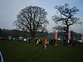
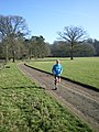
 Competitors in the 21km race - geograph.org.uk - 3335580.jpg 1,306 × 979; 335 KB
-
 Contrasts in stone - geograph.org.uk - 2492961.jpg 864 × 1,152; 301 KB
-
 Cottage by the A442 S-bend, Norton - geograph.org.uk - 2713555.jpg 640 × 480; 154 KB
-
 Cottages at Crowgreaves - geograph.org.uk - 2284393.jpg 1,024 × 768; 197 KB
-
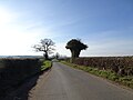
 Crop Fields near Stockton, Shropshire - geograph.org.uk - 429100.jpg 640 × 426; 140 KB
-
 Cross in Stockton churchyard - geograph.org.uk - 5888112.jpg 768 × 1,024; 327 KB
-
De-Stockton.ogg 1.7 s; 17 KB
-
 Disappearing pond near Astol - geograph.org.uk - 2276467.jpg 819 × 614; 316 KB
-
 Entering Norton from the south - geograph.org.uk - 2713548.jpg 640 × 480; 149 KB
-
 Entering Sutton Maddock - geograph.org.uk - 2439091.jpg 800 × 600; 189 KB
-
 Farm drive to The Leavenhalls - geograph.org.uk - 415875.jpg 600 × 450; 174 KB
-
 Gargoyle on the east side of the church - geograph.org.uk - 2492969.jpg 1,024 × 768; 328 KB
-
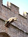 Gargoyle on the west side of the church (1) - geograph.org.uk - 2492964.jpg 864 × 1,152; 346 KB
-
 Gargoyle on the west side of the church (2) - geograph.org.uk - 2492966.jpg 1,152 × 864; 330 KB
-
 Grassy hills and sheep country in Apley Park - geograph.org.uk - 2821827.jpg 1,306 × 979; 355 KB
-
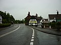 Hundred House Hotel, Norton - geograph.org.uk - 2439069.jpg 800 × 600; 226 KB
-
 Hundred House, Norton - geograph.org.uk - 3594598.jpg 1,024 × 857; 103 KB
-
 Interior of St Chad's church - geograph.org.uk - 2492971.jpg 1,280 × 960; 265 KB
-
 Lane off B4176 - geograph.org.uk - 6067084.jpg 800 × 600; 73 KB
-
 Lane View - geograph.org.uk - 6067079.jpg 800 × 600; 135 KB
-
 Looking downstream - geograph.org.uk - 2368490.jpg 1,152 × 864; 340 KB
-
 Mill Cottages, Higford, 1935 - geograph.org.uk - 2732576.jpg 812 × 530; 142 KB
-
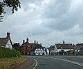
 Modern detached houses, Norton - geograph.org.uk - 2713556.jpg 640 × 480; 141 KB
-
 Norton Church - geograph.org.uk - 2713552.jpg 640 × 480; 181 KB
-
 Norton Village - geograph.org.uk - 4355579.jpg 640 × 450; 52 KB
-
 Norton Village Sign - geograph.org.uk - 4355578.jpg 640 × 470; 72 KB
-
 Nos 5 ^ 6 Village Road, Norton - geograph.org.uk - 6296071.jpg 2,448 × 1,836; 1.95 MB
-
 Not a gravestone^ - geograph.org.uk - 420977.jpg 600 × 450; 292 KB
-
 Not much chance of walking through there - geograph.org.uk - 2492959.jpg 1,280 × 960; 303 KB
-
-
-
 OS benchmark - Norton, South Lodge - geograph.org.uk - 4191162.jpg 857 × 1,142; 523 KB
-
 OS benchmark - Norton, the old school - geograph.org.uk - 4183902.jpg 857 × 1,142; 564 KB
-
 OS benchmark - Stockton, Apley Park lodge house - geograph.org.uk - 4183197.jpg 857 × 1,142; 549 KB
-
 OS benchmark - Stockton, St Chad church - geograph.org.uk - 4183190.jpg 857 × 1,142; 543 KB
-
 Parkland - Apley Park - geograph.org.uk - 2821820.jpg 979 × 734; 335 KB
-
 Pool in Apley Park - geograph.org.uk - 3335563.jpg 1,142 × 857; 436 KB
-
 Primrose Cottage at 1 Norton, Shropshire - geograph.org.uk - 6296057.jpg 2,448 × 1,836; 2.05 MB
-
 Remains of the moat at Old Park - geograph.org.uk - 1804404.jpg 819 × 614; 175 KB
-
 Sandstone gorge north of the Winscote Hills - geograph.org.uk - 3335615.jpg 857 × 1,142; 378 KB
-
 Severn Rapid - geograph.org.uk - 548942.jpg 640 × 480; 137 KB
-
 Signs for a farm shop near Stockton - geograph.org.uk - 3594619.jpg 1,024 × 769; 127 KB
-
 South Lodge, Norton - geograph.org.uk - 6296073.jpg 2,336 × 1,752; 1.89 MB
-
 St Chad's church, Stockton - geograph.org.uk - 5888108.jpg 1,024 × 768; 213 KB
-
 St Chad's churchyard walls - geograph.org.uk - 6299610.jpg 2,122 × 1,591; 1.88 MB
-

-
-
 Stile View - geograph.org.uk - 6333771.jpg 800 × 600; 121 KB
-
 Stocks, Norton - geograph.org.uk - 6181646.jpg 640 × 427; 136 KB
-
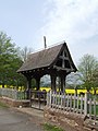 Lych Gate - geograph.org.uk - 420954.jpg 450 × 600; 224 KB
-
 Lych Gate at Stockton - geograph.org.uk - 723354.jpg 640 × 480; 100 KB
-
 Stockton Crossroads - geograph.org.uk - 6333776.jpg 800 × 600; 138 KB
-
 Stockton crossroads on A442 - geograph.org.uk - 3594614.jpg 1,024 × 683; 91 KB
-
 Stockton Grange house - geograph.org.uk - 6299620.jpg 2,774 × 2,081; 2.18 MB
-
 Stockton House (The Rectory) Stockton - geograph.org.uk - 6296077.jpg 2,285 × 1,714; 1.97 MB
-
 Stockton War Memorial - geograph.org.uk - 2492982.jpg 672 × 896; 324 KB
-
 The A442 at Norton - geograph.org.uk - 6181641.jpg 640 × 427; 105 KB
-

-
 The Crowgreaves - geograph.org.uk - 2281533.jpg 1,024 × 768; 189 KB
-
 The end is in sight - geograph.org.uk - 3335623.jpg 734 × 979; 315 KB
-
 The Hundred House Hotel, Norton - geograph.org.uk - 2653832.jpg 2,600 × 2,234; 2.06 MB
-
 The Hundred House, Norton.jpg 3,071 × 2,353; 408 KB
-
 The Mill House, Higford, 1935 - geograph.org.uk - 2732577.jpg 854 × 580; 134 KB
-
 The old school at Norton - geograph.org.uk - 2439060.jpg 800 × 600; 297 KB
-

-
 The River Severn at Hifnal - geograph.org.uk - 5487139.jpg 800 × 600; 98 KB
-
 The Thatch - near Norton village - geograph.org.uk - 1727934.jpg 717 × 538; 202 KB
-
 The very grandiose Apley Hall - geograph.org.uk - 2806751.jpg 979 × 1,306; 400 KB
-

-
 Towards Apley Park Farm - geograph.org.uk - 2492984.jpg 1,024 × 768; 313 KB
-
 Trail View - geograph.org.uk - 6067075.jpg 800 × 600; 134 KB
-
 Two rows of trees on the Apley Estate - geograph.org.uk - 2821846.jpg 979 × 734; 345 KB
-
 Upstream on the Severn - geograph.org.uk - 2368473.jpg 1,152 × 864; 308 KB
-
 View from Church - geograph.org.uk - 6333764.jpg 800 × 600; 146 KB
-
 Water in the moat at Old Park Farm - geograph.org.uk - 1804405.jpg 737 × 553; 182 KB
-
 Crops and shadows at Astol. - geograph.org.uk - 714753.jpg 640 × 480; 89 KB
-
 Driveway in Apley Park. - geograph.org.uk - 653440.jpg 640 × 480; 65 KB
-
 Old Park Farm - geograph.org.uk - 390275.jpg 640 × 480; 95 KB
-
 Stockton Buildings - geograph.org.uk - 415879.jpg 600 × 450; 236 KB


_p3.122_-_Apley_Park,_Shropshire.jpg)


_-_geograph.org.uk_-_2492964.jpg)
_-_geograph.org.uk_-_2492966.jpg)


_Stockton_-_geograph.org.uk_-_6296077.jpg)


