Category:Stoke-upon-Trent
component town of the city of Stoke-on-Trent  | |||||
| Upload media | |||||
| Instance of | |||||
|---|---|---|---|---|---|
| Location | City of Stoke-on-Trent, Staffordshire, West Midlands, England | ||||
| Different from | |||||
 | |||||
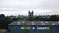
English: Stoke-upon-Trent, commonly called Stoke, is a component town of the city of Stoke-on-Trent, in the ceremonial county of Staffordshire, England.
Italiano: Stoke-upon-Trent è una delle sei comunità che, aggregate, formano la città di Stoke-on-Trent, nella contea dello Staffordshire, in Inghilterra.
Nederlands: Stoke-upon-Trent is een plaats in het bestuurlijke gebied Stoke-on-Trent, in het Engelse graafschap Staffordshire.
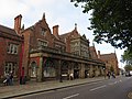
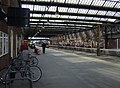
Svenska: Stoke, eller Stoke-upon-Trent, är en av de sex städer som bygger upp Stoke-on-Trent i det ceremoniella grevskapet Staffordshire, England. Här finns stadens järnvägsstation, byggd 1848 och även grevskapets universitet.
Subcategories
This category has only the following subcategory.
S
Media in category "Stoke-upon-Trent"
The following 200 files are in this category, out of 269 total.
(previous page) (next page)-

-
 A Man Can't Fly Statue, Stoke - geograph.org.uk - 5115454.jpg 1,125 × 1,500; 989 KB
-

-
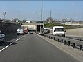
 A500 - Leek Road bridge (A52) - geograph.org.uk - 2343627.jpg 640 × 480; 58 KB
-
 A500 and buildings adjacent - geograph.org.uk - 3654820.jpg 2,592 × 1,936; 1.59 MB
-
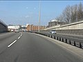
 A500 approaching Stoke Road junction - geograph.org.uk - 2343631.jpg 640 × 480; 61 KB
-
-
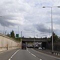
 A500 north of Stoke Road junction - geograph.org.uk - 2343641.jpg 640 × 480; 62 KB
-
 A500 southbound underpass beneath A5006 - geograph.org.uk - 5571036.jpg 1,600 × 1,597; 769 KB
-
 A5006 - geograph.org.uk - 4873550.jpg 640 × 426; 70 KB
-
 A52 bridge over A500 - geograph.org.uk - 5571039.jpg 1,600 × 1,333; 669 KB
-
 A52 in Stoke - geograph.org.uk - 2207414.jpg 640 × 430; 116 KB
-
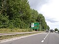 Advance warning on A500 for junction with A5006 - geograph.org.uk - 5571033.jpg 1,600 × 1,200; 795 KB
-
 Bell, Spode, Eleanora Street - geograph.org.uk - 4940325.jpg 640 × 480; 83 KB
-
 Bottle kiln base, Spode, Eleanora Street - geograph.org.uk - 4940316.jpg 640 × 480; 129 KB
-
 Bridges in Stoke-on-Trent, Staffordshire - geograph.org.uk - 4222853.jpg 1,024 × 768; 550 KB
-
 Building by the railway line - geograph.org.uk - 4745203.jpg 640 × 398; 53 KB
-
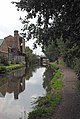
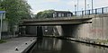
 Canal and bridges in Stoke-on-Trent - geograph.org.uk - 6088005.jpg 1,440 × 960; 1.54 MB
-
 Canal bridge in Stoke-on-Trent - geograph.org.uk - 2468244.jpg 640 × 487; 109 KB
-
 Canal bridges in Stoke-on-Trent - geograph.org.uk - 2468222.jpg 591 × 800; 354 KB
-
 Canal bridges in Stoke-on-Trent - geograph.org.uk - 5659307.jpg 960 × 1,280; 1.51 MB
-
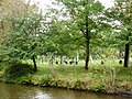
 Canal by the cemetery in Stoke-on-Trent - geograph.org.uk - 5659370.jpg 1,280 × 853; 1.63 MB
-
 Canal by the cemetery in Stoke-on-Trent - geograph.org.uk - 5659373.jpg 1,280 × 960; 1.26 MB
-
 Canal lock and footbridge in Stoke-on-Trent - geograph.org.uk - 5659328.jpg 960 × 1,280; 1.55 MB
-
 Canal lock and footbridge in Stoke-on-Trent - geograph.org.uk - 5659333.jpg 1,280 × 960; 1.62 MB
-
 Canal lock and railway in Stoke-on-Trent - geograph.org.uk - 6111300.jpg 1,440 × 960; 1.54 MB
-
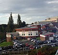
 Car park at the Clinical Education Centre - geograph.org.uk - 5876184.jpg 4,032 × 3,024; 3.3 MB
-
 Church Street, Stoke on Trent - geograph.org.uk - 2764826.jpg 1,280 × 960; 156 KB
-

-

-

-
 City General Hospital, Stoke, car park construction - geograph.org.uk - 4318677.jpg 2,592 × 1,944; 1.19 MB
-
 City General Hospital, Stoke, car park construction - geograph.org.uk - 4318683.jpg 2,592 × 1,944; 1.07 MB
-
 City General Hospital, Stoke, Clinical Education Centre - geograph.org.uk - 4261254.jpg 3,264 × 2,448; 2.33 MB
-
 City General Hospital, Stoke, Clinical Education Centre - geograph.org.uk - 4340284.jpg 2,592 × 1,944; 887 KB
-

-
 City General Hospital, Stoke, landscaping - geograph.org.uk - 4340151.jpg 2,592 × 1,944; 1.37 MB
-
 Cockshute Railway Bridge No 114A - geograph.org.uk - 4574609.jpg 1,024 × 748; 194 KB
-
 Cockshutts Lock - geograph.org.uk - 3020680.jpg 1,280 × 856; 338 KB
-

-

-
 Evening sun at car park 3 - geograph.org.uk - 5806259.jpg 4,032 × 3,024; 3.37 MB
-
 Factory site, Spode, Eleanora Street - geograph.org.uk - 4940310.jpg 640 × 480; 80 KB
-
 Façade of Stoke-on-Trent Railway Station - geograph.org.uk - 4293505.jpg 1,600 × 1,200; 368 KB
-
 Federation House, Stoke on Trent - geograph.org.uk - 4189637.jpg 3,264 × 2,448; 2.53 MB
-
 Football pitch in Lyme Valley Park - geograph.org.uk - 5818435.jpg 4,032 × 3,024; 3.23 MB
-
 Footpath alongside Newcastle Lane - geograph.org.uk - 4276410.jpg 1,600 × 1,200; 861 KB
-
 Footpath signpost in hospital grounds - geograph.org.uk - 4276385.jpg 1,600 × 1,200; 667 KB
-
 Former Minton Hollins Tile Works - geograph.org.uk - 6079491.jpg 1,024 × 683; 239 KB
-
 Glebe Street Bridge No 113A - geograph.org.uk - 4573537.jpg 1,024 × 729; 180 KB
-
 Glebe Street crossing the A500 Queensway - geograph.org.uk - 4569766.jpg 1,024 × 871; 166 KB
-

-
 Grassed area outside Clinical Education Centre, UHNS - geograph.org.uk - 4271082.jpg 1,600 × 1,200; 485 KB
-
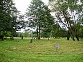
 Hanley Cemetery - geograph.org.uk - 5706226.jpg 640 × 480; 140 KB
-
 Hanley Cemetery - geograph.org.uk - 5706307.jpg 640 × 480; 135 KB
-
 Harplands Hospital - geograph.org.uk - 4151968.jpg 1,600 × 1,000; 225 KB
-
 Hospital staff car park - geograph.org.uk - 4276448.jpg 1,600 × 1,200; 501 KB
-
-
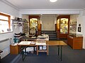 Inside the Spode Factory Museum - geograph.org.uk - 4935506.jpg 640 × 480; 60 KB
-
 Japanese Knotweed, Stoke-on-Trent - geograph.org.uk - 2472214.jpg 800 × 600; 374 KB
-
 Josiah Wedgwood in front of the North Stafford Hotel - geograph.org.uk - 5588352.jpg 3,776 × 2,520; 3.53 MB
-
-

-
 Kiln ^ Canal - geograph.org.uk - 2593145.jpg 429 × 640; 76 KB
-
 Large warehouse, Stoke - geograph.org.uk - 4378039.jpg 640 × 430; 42 KB
-
 Leek Road, Stoke on Trent - geograph.org.uk - 4189641.jpg 3,264 × 2,448; 1.82 MB
-
-
 Locomotive in a siding, Stoke - geograph.org.uk - 2205736.jpg 640 × 430; 58 KB
-
 London Road in Stoke-Upon-Trent - geograph.org.uk - 3676119.jpg 1,500 × 988; 153 KB
-
 Looking across Queensway - geograph.org.uk - 2764803.jpg 1,280 × 960; 147 KB
-
 Looking north-east in Glebe Street - geograph.org.uk - 4938239.jpg 640 × 480; 82 KB
-
 Looking north-east up Elenora Street - geograph.org.uk - 4940328.jpg 640 × 480; 40 KB
-
-
 Lyme Valley Park, car park on A34 - geograph.org.uk - 4301814.jpg 1,600 × 1,200; 364 KB
-
 Lyme Valley Park, football pitch - geograph.org.uk - 4301749.jpg 1,600 × 1,200; 359 KB
-
 Lyme Valley Park, footpath - geograph.org.uk - 4301760.jpg 1,200 × 1,600; 489 KB
-
 Manchester train at Stoke on Trent - geograph.org.uk - 3461830.jpg 1,024 × 768; 247 KB
-

-
 Motorcycle dealers, Stoke on Trent - geograph.org.uk - 4535356.jpg 640 × 434; 50 KB
-
 Moulds, Spode, Eleanora Street - geograph.org.uk - 4940299.jpg 640 × 480; 75 KB
-
 Mountain Ash ^ Trent ^ Mersey - geograph.org.uk - 3113379.jpg 640 × 429; 94 KB
-
 Narrowboat on the Trent ^ Mersey - geograph.org.uk - 2593129.jpg 429 × 640; 50 KB
-
 Near Stoke Station - geograph.org.uk - 4667838.jpg 800 × 432; 69 KB
-
 Newcastle-under-Lyme, Newcastle Road - geograph.org.uk - 5169707.jpg 3,264 × 2,448; 3.84 MB
-
 North Stafford Hotel - geograph.org.uk - 4293489.jpg 1,600 × 1,200; 511 KB
-
 North Stafford Hotel and statue - geograph.org.uk - 5958648.jpg 1,024 × 768; 226 KB
-
 Northern train at Stoke Station - geograph.org.uk - 4378037.jpg 640 × 430; 64 KB
-
 Northern train at Stoke Station - geograph.org.uk - 4378038.jpg 640 × 430; 65 KB
-
-
 Osborn Bridge No 113B - geograph.org.uk - 4574489.jpg 1,024 × 733; 129 KB
-
 Osborne Bridge - geograph.org.uk - 2396787.jpg 640 × 408; 62 KB
-
 Park - geograph.org.uk - 4116362.jpg 640 × 493; 113 KB
-
 Path in Lyme Valley Park - geograph.org.uk - 5818437.jpg 4,032 × 3,024; 4.66 MB
-
 Pinkstone's Used Car Centre - geograph.org.uk - 4276376.jpg 1,600 × 1,048; 333 KB
-
 Platform 2, southern end - geograph.org.uk - 5958308.jpg 1,024 × 766; 162 KB
-
 Play area - geograph.org.uk - 4116364.jpg 640 × 408; 71 KB
-
 Police sign at Stoke station - geograph.org.uk - 1910882.jpg 480 × 640; 44 KB
-
 Police, Stoke Station - geograph.org.uk - 4880863.jpg 640 × 363; 51 KB
-
 Railway bridge crossing Stoke Road - geograph.org.uk - 4535358.jpg 640 × 480; 72 KB
-
 Railway bridge over Stoke Road - geograph.org.uk - 4991191.jpg 640 × 431; 45 KB
-

-

-
-
 Railway line in Stoke-on-Trent - geograph.org.uk - 6088057.jpg 1,600 × 800; 1.26 MB
-
 Railway maintenance plant near Stoke-on-Trent - geograph.org.uk - 4199662.jpg 1,024 × 768; 186 KB
-
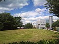
 Royal Stoke University Hospital - geograph.org.uk - 5160063.jpg 3,203 × 2,402; 1.95 MB
-
 Royal Stoke University Hospital - geograph.org.uk - 5160078.jpg 3,264 × 2,448; 2.14 MB
-

-

-
 Royal Stoke University Hospital, Cancer Centre - geograph.org.uk - 4337823.jpg 3,246 × 2,188; 2.6 MB
-

-
 Royal Stoke University Hospital, car park next to A34 - geograph.org.uk - 4328949.jpg 3,264 × 2,448; 3.01 MB
-
-
 Royal Stoke University Hospital, Courtyard Annexe - geograph.org.uk - 4539275.jpg 3,264 × 2,448; 2.51 MB
-
 Royal Stoke University Hospital, crane - geograph.org.uk - 4276392.jpg 1,600 × 1,200; 296 KB
-
 Royal Stoke University Hospital, cycle shelter - geograph.org.uk - 4715911.jpg 3,264 × 2,448; 2.23 MB
-

-
 Royal Stoke University Hospital, illuminated footbridge - geograph.org.uk - 5277741.jpg 4,032 × 3,024; 1.96 MB
-
 Royal Stoke University Hospital, internal courtyard - geograph.org.uk - 4457745.jpg 3,264 × 2,448; 3.26 MB
-
 Royal Stoke University Hospital, Lyme Building entrance - geograph.org.uk - 4337828.jpg 3,264 × 2,146; 1.96 MB
-
 Royal Stoke University Hospital, Lyme wards - geograph.org.uk - 4391786.jpg 3,217 × 1,933; 2.76 MB
-
 Royal Stoke University Hospital, Main Building - geograph.org.uk - 4337831.jpg 3,264 × 2,214; 2.3 MB
-
 Royal Stoke University Hospital, Maternity Centre - geograph.org.uk - 4317774.jpg 3,264 × 2,448; 2.15 MB
-
 Royal Stoke University Hospital, Maternity Centre - geograph.org.uk - 5160118.jpg 3,264 × 2,448; 1.75 MB
-
 Royal Stoke University Hospital, mobile MRI unit - geograph.org.uk - 4967635.jpg 3,264 × 2,448; 1.54 MB
-
 Royal Stoke University Hospital, mobile MRI unit - geograph.org.uk - 4967638.jpg 3,264 × 2,448; 1.78 MB
-
 Royal Stoke University Hospital, new Lyme wards - geograph.org.uk - 4327902.jpg 3,264 × 2,448; 2.09 MB
-
 Royal Stoke University Hospital, Old Admissions Block - geograph.org.uk - 4361011.jpg 3,264 × 2,448; 2.61 MB
-
 Royal Stoke University Hospital, old Chapel - geograph.org.uk - 4313109.jpg 2,864 × 1,900; 2.27 MB
-
 Royal Stoke University Hospital, Parish Buildings - geograph.org.uk - 4313095.jpg 3,264 × 2,448; 2.66 MB
-

-
 Royal Stoke University Hospital, refurbishment of footbridge - geograph.org.uk - 5162427.jpg 3,264 × 2,448; 2.83 MB
-
 Royal Stoke University Hospital, refurbishment of footbridge - geograph.org.uk - 5168627.jpg 2,883 × 2,289; 1.84 MB
-
 Royal Stoke University Hospital, Renal Unit - geograph.org.uk - 4337881.jpg 3,258 × 2,139; 1.79 MB
-
-
 Royal Stoke University Hospital, Supplies and Procurement - geograph.org.uk - 4313072.jpg 3,264 × 2,448; 2.35 MB
-
 Royal Stoke University Hospital, Trent Building - geograph.org.uk - 4361004.jpg 3,264 × 2,448; 2.14 MB
-
 Royal Stoke University Hospital, view from the bridge (1) - geograph.org.uk - 5144597.jpg 3,264 × 2,448; 2.64 MB
-
 Royal Stoke University Hospital, West Buildings - geograph.org.uk - 4313127.jpg 3,264 × 2,448; 2.34 MB
-
 Royal Train at Stoke on Trent Station - geograph.org.uk - 4808731.jpg 1,280 × 959; 305 KB
-
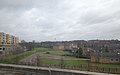
 Rural Urban Scene In Stoke' - geograph.org.uk - 3113373.jpg 640 × 429; 93 KB
-
 Scaffolding, Spode, Eleanora Street - geograph.org.uk - 4940318.jpg 640 × 480; 88 KB
-
 Service Bay 3, Royal Stoke University Hospital - geograph.org.uk - 4274436.jpg 1,600 × 1,200; 391 KB
-
 Shelton Old Road, Stoke-on-Trent - geograph.org.uk - 2395027.jpg 640 × 458; 50 KB
-
 Sidings north of Stoke Station - geograph.org.uk - 2205739.jpg 640 × 430; 46 KB
-
 Sidings, West Coast Main line, Stoke - geograph.org.uk - 2205720.jpg 640 × 374; 49 KB
-
 Single-car DMU at Stoke station - geograph.org.uk - 4282465.jpg 1,600 × 900; 244 KB
-
 Southern portal, Stoke-on-Trent Railway Station - geograph.org.uk - 6189052.jpg 1,024 × 683; 218 KB
-
 Spode Chimney, Eleanora Street - geograph.org.uk - 4940292.jpg 480 × 640; 44 KB
-
 Spode Factory, Eleanora Street - geograph.org.uk - 4935504.jpg 640 × 480; 54 KB
-
 Spode Yard, Eleanora Street - geograph.org.uk - 4940295.jpg 640 × 480; 52 KB
-

-
 Staffordshire University - geograph.org.uk - 4873541.jpg 640 × 426; 61 KB
-
 Staffordshire University - geograph.org.uk - 4880844.jpg 640 × 426; 65 KB
-
 Staffordshire University - geograph.org.uk - 4880848.jpg 640 × 386; 70 KB
-
 Staffordshire University - geograph.org.uk - 4880853.jpg 640 × 426; 66 KB
-

-
 Staffordshire University, Stoke - geograph.org.uk - 2205740.jpg 640 × 430; 54 KB
-
 Staffordshire University, Stoke - geograph.org.uk - 2207407.jpg 640 × 430; 120 KB
-
 Statue of Josiah Wedgwood outside North Stafford Hotel - geograph.org.uk - 5763490.jpg 2,866 × 3,826; 2.84 MB
-
 Stoke - North Stafford Hotel - geograph.org.uk - 2505189.jpg 1,600 × 1,164; 734 KB
-
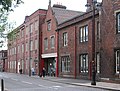 Stoke - railway buildings on Station Street - geograph.org.uk - 2514944.jpg 1,600 × 1,213; 635 KB
-
 Stoke Bottom Lock Bridge - geograph.org.uk - 2396793.jpg 640 × 316; 47 KB
-
 Stoke Minster, churchyard (8) - geograph.org.uk - 4938240.jpg 640 × 480; 138 KB
-

-

-

-

-

-

-

-

-

-

-

-

-

-
 Stoke on Trent 2022 Montage.jpg 3,264 × 3,264; 9.13 MB
-
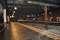
 Stoke on Trent Railway Station - geograph.org.uk - 2187683.jpg 800 × 531; 81 KB
-
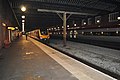
 Stoke on Trent Railway Station - geograph.org.uk - 2187686.jpg 800 × 531; 91 KB
-
 Stoke on Trent Railway Station - geograph.org.uk - 2187687.jpg 800 × 531; 89 KB
-
 Stoke On Trent SCC - geograph.org.uk - 4873552.jpg 640 × 426; 84 KB
-
 Stoke on Trent Station - geograph.org.uk - 4325101.jpg 640 × 430; 53 KB
-
 Stoke on Trent Station - geograph.org.uk - 4325102.jpg 640 × 430; 68 KB
-
 Stoke on Trent Station - geograph.org.uk - 4745172.jpg 640 × 426; 54 KB
-
 Stoke on Trent Station - geograph.org.uk - 4745177.jpg 640 × 426; 55 KB
-
 Stoke on Trent Station - geograph.org.uk - 4836668.jpg 640 × 426; 55 KB
-
 Stoke on Trent Station - geograph.org.uk - 4836672.jpg 640 × 426; 69 KB
-
 Stoke on Trent Station - geograph.org.uk - 4836674.jpg 640 × 426; 69 KB
-
 Stoke on Trent Station - geograph.org.uk - 4880859.jpg 640 × 426; 80 KB
-
 Stoke on Trent Station - geograph.org.uk - 4880867.jpg 640 × 426; 76 KB
-
 Stoke on Trent Station - geograph.org.uk - 5695975.jpg 640 × 425; 61 KB
-
 Stoke on Trent Station - geograph.org.uk - 5695978.jpg 640 × 425; 84 KB
-
 Stoke on Trent Station - geograph.org.uk - 5695981.jpg 640 × 426; 46 KB
-
 Stoke Railway Station - geograph.org.uk - 4189624.jpg 3,264 × 2,448; 2.8 MB
-
 Stoke-on-Trent alleyway - geograph.org.uk - 4569752.jpg 1,024 × 768; 233 KB
-
 Stoke-on-Trent Railway Station - geograph.org.uk - 2952030.jpg 640 × 480; 477 KB
-
 Stoke-on-Trent Railway Station - geograph.org.uk - 2952033.jpg 640 × 480; 532 KB
-
 Stoke-on-Trent Railway Station - geograph.org.uk - 3157596.jpg 640 × 480; 118 KB
-
 Stoke-on-Trent Railway Station - geograph.org.uk - 4068535.jpg 640 × 467; 90 KB


_-_geograph.org.uk_-_2343627.jpg)


_-_geograph.org.uk_-_5144597.jpg)


_-_geograph.org.uk_-_4938240.jpg)
_-_geograph.org.uk_-_4936441.jpg)
_-_geograph.org.uk_-_4936348.jpg)
_-_geograph.org.uk_-_4936360.jpg)
_-_geograph.org.uk_-_4936363.jpg)
_-_geograph.org.uk_-_4936371.jpg)
_-_geograph.org.uk_-_4936373.jpg)
_-_geograph.org.uk_-_4936381.jpg)
_-_geograph.org.uk_-_4936384.jpg)
_-_geograph.org.uk_-_4936388.jpg)
_-_geograph.org.uk_-_4936390.jpg)
_-_geograph.org.uk_-_4936394.jpg)
_-_geograph.org.uk_-_4936404.jpg)
_-_geograph.org.uk_-_4938225.jpg)


