Category:Stokesay
English: Stokesay is a small village in Shropshire, England just north of Ludlow on the A49 road, also fleetingly visible from the Shrewsbury to Hereford Welsh Marches railway line.
Polski: Stokesay – wieś w hrabstwie Shropshire na pograniczu Anglii i Walli w Wielkiej Brytanii, mieszcząca się pomiędzy Ludlow i Craven Arms. Słowo "stoke" tłumaczymy jako: "podległe osadnictwo" lub "mleczna farma", drugi człon nazwy wsi pochodzi od nazwiska rodziny Say, ktora przybyła w te rejony około 1105 roku.
village in Shropshire, United Kingdom  | |||||
| Upload media | |||||
| Instance of | |||||
|---|---|---|---|---|---|
| Location | Craven Arms, Shropshire, West Midlands, England | ||||
 | |||||
Subcategories
This category has the following 3 subcategories, out of 3 total.
Media in category "Stokesay"
The following 96 files are in this category, out of 96 total.
-
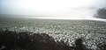
 "yellow sea" near Gorst Barn - geograph.org.uk - 691761.jpg 640 × 480; 128 KB
-
 20191006 Stokesay Castle farm.jpg 4,160 × 2,340; 2.56 MB
-
-
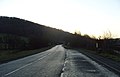
 A49 Craven Arms - geograph.org.uk - 1071207.jpg 640 × 418; 41 KB
-
 A49 north of Onibury - geograph.org.uk - 665849.jpg 640 × 480; 56 KB
-
 A49 South, Stokesay - geograph.org.uk - 1116908.jpg 640 × 409; 40 KB
-
 Barn near Stokesay Crossing Cottage - geograph.org.uk - 2291621.jpg 640 × 430; 49 KB
-
 Barn, Stockcastle Farm - geograph.org.uk - 2291846.jpg 640 × 430; 46 KB
-
 Barns, Stokecastle Farm - geograph.org.uk - 2291844.jpg 640 × 430; 63 KB
-
 Castle Farm, Stokesay - geograph.org.uk - 4444858.jpg 5,420 × 3,331; 2.4 MB
-
 Cattle and sheep near Stokesay - geograph.org.uk - 2291619.jpg 640 × 430; 62 KB
-

-
 Countryside near Stokesay - geograph.org.uk - 2290615.jpg 640 × 430; 38 KB
-
 Crossing the railway near Stokesay Castle - geograph.org.uk - 4705810.jpg 819 × 1,024; 1.21 MB
-
 Entrance track to Stokesay Castle Farm - geograph.org.uk - 3321975.jpg 640 × 503; 108 KB
-
 Farm near Stokesay Castle - geograph.org.uk - 2291351.jpg 800 × 338; 56 KB
-
 Farmhouse, Stokecastle Farm - geograph.org.uk - 2291848.jpg 640 × 430; 58 KB
-
 Farmland At Stokesay Castle.jpg 3,813 × 2,145; 1.71 MB
-
 Flower meadow west of Stokesay - geograph.org.uk - 5816661.jpg 5,184 × 3,888; 5.87 MB
-
 Footpath to Stokesay - geograph.org.uk - 502329.jpg 640 × 480; 102 KB
-
 Frozen pond at Stokesay - geograph.org.uk - 2291754.jpg 640 × 430; 38 KB
-
 Frozen pond at Stokesay - geograph.org.uk - 2291797.jpg 640 × 390; 36 KB
-
 Grazing Stokesay - geograph.org.uk - 6108386.jpg 800 × 556; 115 KB
-
 Junction for Stokesay Castle - geograph.org.uk - 2125405.jpg 640 × 480; 196 KB
-
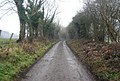
 Lane near Stokesay - geograph.org.uk - 618513.jpg 640 × 480; 118 KB
-
 Lane south of Stokesay - geograph.org.uk - 2293002.jpg 640 × 430; 100 KB
-
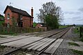 Level crossing at Stokesay - geograph.org.uk - 5760532.jpg 1,024 × 680; 271 KB
-
 Level crossing near Stokesay - geograph.org.uk - 4088031.jpg 4,000 × 3,000; 2.63 MB
-
 Lime kilns by the Shropshire Way - geograph.org.uk - 2295550.jpg 640 × 430; 92 KB
-
 Looking west from Stokesay Castle - geograph.org.uk - 2137966.jpg 640 × 425; 81 KB
-

-

-
 Norton Camp defences - geograph-2847806.jpg 640 × 480; 167 KB
-

-
 Oooops^ An upside down crane at Stokesay - geograph.org.uk - 2127452.jpg 640 × 480; 107 KB
-
 Pasture near Stokesay Castle - geograph.org.uk - 4763519.jpg 640 × 480; 60 KB
-
 Pond near Stokesay - geograph.org.uk - 4088034.jpg 4,000 × 3,000; 2.36 MB
-
 Pond near Stokesay Castle - geograph.org.uk - 5964877.jpg 640 × 480; 317 KB
-
 Pond, Stokesay - geograph.org.uk - 6231623.jpg 1,280 × 862; 626 KB
-
 Railway at Stokesay - geograph.org.uk - 5760539.jpg 1,024 × 680; 282 KB
-
 Railway from Stokesay Castle - geograph.org.uk - 3686260.jpg 1,600 × 907; 447 KB
-
 Railway Junk - geograph.org.uk - 619838.jpg 640 × 427; 116 KB
-
 Railway Line and Pond at Stokesay - geograph.org.uk - 5711132.jpg 1,280 × 800; 595 KB
-
 Railway near Stokesay - geograph.org.uk - 3682748.jpg 1,600 × 1,063; 416 KB
-
 Railway near Stokesay - geograph.org.uk - 3685303.jpg 1,600 × 994; 558 KB
-
 Reflections in the pond near Stokesay Castle - geograph.org.uk - 4511167.jpg 4,000 × 3,000; 2.58 MB
-
 Sewage Farm south of Stokesay - geograph.org.uk - 2287266.jpg 640 × 307; 26 KB
-
 Shrewsbury-Hereford Railway Line - geograph.org.uk - 619934.jpg 640 × 427; 79 KB
-

-
 Shropshire Way heads to Stokesay - geograph.org.uk - 2290608.jpg 640 × 430; 73 KB
-
 Signs for Stokesay Castle - geograph.org.uk - 2125401.jpg 602 × 400; 176 KB
-
 Small sideline at Stokesay - geograph.org.uk - 2127413.jpg 640 × 480; 123 KB
-
 Stokecastle Farm - geograph.org.uk - 1507248.jpg 640 × 480; 122 KB
-
 Stokecastle Farm - geograph.org.uk - 2137803.jpg 640 × 425; 112 KB
-
 Stokecastle Farm - geograph.org.uk - 2291807.jpg 640 × 430; 49 KB
-

-
 Stokesay - geograph.org.uk - 5222967.jpg 1,024 × 683; 445 KB
-
 Stokesay castle Field - panoramio.jpg 1,408 × 1,056; 312 KB
-
 Stokesay Castle Hotel, School Road - geograph.org.uk - 872892.jpg 640 × 393; 119 KB
-
 Stokesay Castle Hotel, School Road - geograph.org.uk - 872902.jpg 640 × 405; 93 KB
-
 Stokesay Castle pond - geograph.org.uk - 3322071.jpg 640 × 480; 84 KB
-
 Stokesay Castle, tea room - geograph.org.uk - 5729525.jpg 1,280 × 851; 396 KB
-
 Stokesay Castle-35 (5737626647).jpg 1,280 × 855; 664 KB
-
 Stokesay Castle-37 (5737628553).jpg 1,280 × 855; 764 KB
-
 Stokesay Castle-45 (5737633621).jpg 1,280 × 855; 920 KB
-
 Stokesay Crossing Cottage - geograph.org.uk - 2291622.jpg 640 × 430; 59 KB
-
 Stokesay Farm View - geograph.org.uk - 3700507.jpg 800 × 600; 151 KB
-
 Stokesay Gap - geograph.org.uk - 2054722.jpg 640 × 480; 85 KB
-
 Stokesay Primary School, Craven Arms - geograph.org.uk - 3120388.jpg 640 × 433; 79 KB
-
 Stokesay Sewage Farm - geograph.org.uk - 2295470.jpg 640 × 430; 70 KB
-
 Stokesay Sewage Farm - geograph.org.uk - 2295474.jpg 640 × 430; 57 KB
-
 Stokesay Shop - geograph.org.uk - 3700462.jpg 800 × 600; 125 KB
-
 Stokesay Train - geograph.org.uk - 3700486.jpg 800 × 600; 119 KB
-
 Stokesay, the railway and the Shropshire Way - geograph.org.uk - 4705796.jpg 819 × 1,024; 1.27 MB
-
 Stokewood Crossing - geograph.org.uk - 2293009.jpg 640 × 430; 76 KB
-
 Stokewood Crossing Cottage - geograph.org.uk - 2293013.jpg 640 × 430; 85 KB
-
 The Welsh Marches Line - geograph.org.uk - 2295494.jpg 640 × 430; 72 KB
-
 Track above Stokesay Wood - geograph.org.uk - 5761359.jpg 1,024 × 680; 281 KB
-
 Track and byway above Stokesay - geograph.org.uk - 5761367.jpg 1,024 × 680; 308 KB
-
 Track at Stokesay - geograph.org.uk - 5760542.jpg 1,024 × 680; 290 KB
-
-
 Tree in the grounds of Stokesay Castle - geograph.org.uk - 5964890.jpg 640 × 480; 383 KB
-
 View down from Stokesay Castle - geograph.org.uk - 5729585.jpg 1,280 × 851; 491 KB
-

-

-

-

-
 Welsh Marches Line near Stokesay - geograph.org.uk - 2291620.jpg 640 × 430; 53 KB
-

-

-
 Woodside, Stokesay - geograph.org.uk - 2293005.jpg 640 × 430; 49 KB
-

-

-
 Craven Arms fire station - geograph.org.uk - 266842.jpg 640 × 427; 188 KB
-
 Lane near Doctor's Coppice - geograph.org.uk - 655502.jpg 640 × 480; 91 KB
-
 Logging in Stoke Wood - geograph.org.uk - 619910.jpg 640 × 427; 110 KB


.jpg)
.jpg)
.jpg)


