Category:Styrrup
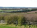
English: Styrrup is a village in the civil parish of Styrrup with Oldcotes on the B6463 road in the Bassetlaw District, in the English county of Nottinghamshire. It is near the small town of Harworth. The village is surrounded by farmland and is approximately 1 mile from the A1 motorway intersection at Blyth. The housing consists primarily of modern properties constructed in the 1970s and numerous barn conversions arranged off the Main Street. The local pub, The White Swan, has recently been demolished and replaced by modern housing. Styrrup Hall is an 18 hole golf course incorporating a club house, restaurant & driving range. (→Styrrup)
Polski: Styrrup – przysiółek w Anglii, w Nottinghamshire. Leży 11,8 km na zachód od miasta Worksop, 49,7 km na zachód od miasta Nottingham i 221,5 km na północny wschód od Londynu. W 1861 miejscowość liczyła 362 mieszkańców. Styrrup jest wspomniana w Domesday Book (1086) jako Estirape. (→Styrrup)

village in Nottinghamshire, UK  | |||||
| Upload media | |||||
| Instance of | |||||
|---|---|---|---|---|---|
| Location | Styrrup with Oldcotes, Bassetlaw, Nottinghamshire, East Midlands, England | ||||
 | |||||
Media in category "Styrrup"
The following 23 files are in this category, out of 23 total.
-

-
 A1M crossing Styrrup Road - geograph.org.uk - 1368227.jpg 640 × 480; 37 KB
-
 A1M road near Styrrup, Nottinghamshire - geograph.org.uk - 1226730.jpg 640 × 480; 130 KB
-
 B6463 junction, Styrrup - geograph.org.uk - 1368228.jpg 640 × 480; 73 KB
-
 Coal mine waste conveyor - geograph.org.uk - 1226684.jpg 640 × 480; 69 KB
-

-
 Coal tip and conveyor - geograph.org.uk - 1226651.jpg 640 × 480; 182 KB
-
 Colliery Conveyor - geograph.org.uk - 194755.jpg 640 × 480; 88 KB
-
 Colliery Conveyor 2 - geograph.org.uk - 194760.jpg 640 × 480; 86 KB
-
 Grange Farm, Styrup - geograph.org.uk - 3082179.jpg 800 × 600; 91 KB
-
 Industrial units, Harworth - geograph.org.uk - 1226715.jpg 640 × 480; 95 KB
-
 Sheep near Styrrup - geograph.org.uk - 210334.jpg 640 × 427; 72 KB
-
 Styrrup Carr - geograph.org.uk - 1212521.jpg 640 × 427; 57 KB
-
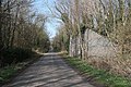
 Styrrup Lane - geograph.org.uk - 1212530.jpg 640 × 427; 71 KB
-
 Styrrup Lane - geograph.org.uk - 1691094.jpg 640 × 445; 66 KB
-
 Styrrup Lane bridge - geograph.org.uk - 1212534.jpg 640 × 427; 121 KB
-
 Tipper trucks in former quarry - geograph.org.uk - 713942.jpg 640 × 323; 42 KB
-
 What's in that^ - geograph.org.uk - 713933.jpg 640 × 399; 66 KB
-
 Yews Farmhouse - geograph.org.uk - 5063237.jpg 1,024 × 768; 160 KB
-
 Derelict farm buildings - geograph.org.uk - 210340.jpg 640 × 427; 98 KB
-

-
 The A1 motorway - geograph.org.uk - 586094.jpg 640 × 363; 84 KB
-
 The missing bridge on Styrrup Lane - geograph.org.uk - 637018.jpg 640 × 493; 158 KB


