Category:Styrrup with Oldcotes

civil parish in Bassetlaw, Nottinghamshire, England | |||||
| Upload media | |||||
| Instance of | |||||
|---|---|---|---|---|---|
| Location | Bassetlaw, Nottinghamshire, East Midlands, England | ||||
 | |||||
Subcategories
This category has the following 2 subcategories, out of 2 total.
Media in category "Styrrup with Oldcotes"
The following 125 files are in this category, out of 125 total.
-
 1 mile to J34, A1(M) - geograph.org.uk - 4811552.jpg 640 × 371; 28 KB
-
 A1 (M) heading north - geograph.org.uk - 2556821.jpg 1,600 × 1,200; 259 KB
-
 A1 (M) southbound - geograph.org.uk - 2556988.jpg 1,600 × 1,200; 386 KB
-
 A1(M) - Doncaster bypass - geograph.org.uk - 2645685.jpg 640 × 428; 76 KB
-
 A1(M) - Serlby Road bridge - geograph.org.uk - 2645729.jpg 640 × 428; 78 KB
-
 A1(M) 1 mile to junction 34 - geograph.org.uk - 4035018.jpg 1,600 × 1,014; 224 KB
-
 A1(M) near Styrrup - geograph.org.uk - 4260446.jpg 1,280 × 960; 198 KB
-
 A1(M) one and a half miles to Blyth Services - geograph.org.uk - 4035012.jpg 3,430 × 2,399; 3.22 MB
-
 A1(M) towards Styrrup - geograph.org.uk - 4962040.jpg 2,060 × 1,316; 1.42 MB
-
 A1(M), southbound - geograph.org.uk - 4811553.jpg 640 × 303; 23 KB
-
 A60 towards Worksop - geograph.org.uk - 2552713.jpg 1,600 × 1,200; 420 KB
-
 A614 Nook Flatt wood - geograph.org.uk - 1326946.jpg 640 × 480; 77 KB
-
 A614 towards Bawtry - geograph.org.uk - 2556995.jpg 1,600 × 1,200; 307 KB
-
 A614 towards Blyth - geograph.org.uk - 2556999.jpg 1,600 × 1,200; 458 KB
-
 A634 at Oldcotes village boundary - geograph.org.uk - 6071375.jpg 1,024 × 673; 131 KB
-
 A634 east of Oldcotes - geograph.org.uk - 6071368.jpg 1,024 × 724; 83 KB
-
 A634 near Fishpond Plantation - geograph.org.uk - 6071372.jpg 1,024 × 722; 102 KB
-
 A634 towards Maltby - geograph.org.uk - 2552660.jpg 1,600 × 1,200; 401 KB
-
 A634 towards Maltby - geograph.org.uk - 2552668.jpg 1,600 × 1,200; 377 KB
-
 A634 towards Maltby - geograph.org.uk - 2552677.jpg 1,600 × 1,200; 447 KB
-
 A634-A60 junction in Oldcotes - geograph.org.uk - 6071377.jpg 1,024 × 757; 127 KB
-
 Arable land and unnamed covert - geograph.org.uk - 1996855.jpg 640 × 480; 251 KB
-
 Ash Holt - geograph.org.uk - 5961584.jpg 1,024 × 768; 177 KB
-
 Ash Holt - geograph.org.uk - 5961587.jpg 1,024 × 768; 197 KB
-
 Ash Holt and spoil heap - geograph.org.uk - 5961597.jpg 1,024 × 768; 171 KB
-
 B6463 from Styrrup - geograph.org.uk - 1996887.jpg 640 × 481; 226 KB
-
 B6463 towards Styrrup - geograph.org.uk - 2552697.jpg 1,600 × 1,200; 351 KB
-
 Barley crop - geograph.org.uk - 1996876.jpg 640 × 480; 245 KB
-
 Barn at Manor Farm - geograph.org.uk - 4320231.jpg 1,280 × 872; 272 KB
-
 Bay window, East Lodge - geograph.org.uk - 4320228.jpg 853 × 1,280; 282 KB
-
 Blyth Road, Oldcotes - geograph.org.uk - 4320258.jpg 1,280 × 853; 203 KB
-
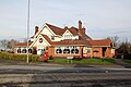 Brewers Fayre at Oldcotes - geograph.org.uk - 4320270.jpg 1,280 × 853; 217 KB
-
 Buildings at Manor Farm - geograph.org.uk - 5961063.jpg 1,024 × 768; 168 KB
-
 Buildings at Manor Farm - geograph.org.uk - 5961543.jpg 1,024 × 768; 126 KB
-
 Carrs by the River Torne - geograph.org.uk - 5063898.jpg 1,024 × 768; 169 KB
-
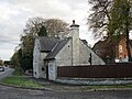 Cottage at Oldcotes - geograph.org.uk - 5961622.jpg 1,024 × 768; 209 KB
-
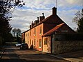 Cottages on Main Street, Oldcotes - geograph.org.uk - 5961251.jpg 1,024 × 768; 200 KB
-
 County boundary green lane - geograph.org.uk - 1996850.jpg 640 × 480; 264 KB
-
 Course of a former railway - geograph.org.uk - 5961019.jpg 1,024 × 768; 164 KB
-
 Crown of thorns - is execution pending^ - geograph.org.uk - 4319046.jpg 987 × 1,280; 110 KB
-
 Derelict Factory (2) - geograph.org.uk - 917056.jpg 640 × 480; 65 KB
-
 Derelict Factory - geograph.org.uk - 917047.jpg 640 × 480; 55 KB
-
 Doorway of the rectory, St Helen's Church - geograph.org.uk - 4320248.jpg 987 × 1,280; 279 KB
-
 Drain and spoil heap - geograph.org.uk - 5961585.jpg 1,024 × 768; 180 KB
-
 Drain and Whitewater Gorse - geograph.org.uk - 5961031.jpg 1,024 × 768; 196 KB
-
 Drain on Whitewater Common - geograph.org.uk - 5961578.jpg 1,024 × 768; 190 KB
-
 Drive to Hermeston Hall - geograph.org.uk - 4320240.jpg 947 × 1,280; 284 KB
-
 East Lodge, Oldcotes (geograph 5961568).jpg 1,024 × 764; 142 KB
-
 Farm buildings at Manor Farm - geograph.org.uk - 4320225.jpg 1,280 × 846; 227 KB
-
 Farmland off Styrrup Lane - geograph.org.uk - 2553329.jpg 1,600 × 1,200; 422 KB
-
 Farmland off the A614 - geograph.org.uk - 2556994.jpg 1,600 × 1,200; 415 KB
-
 Farmland off the A634 - geograph.org.uk - 2552658.jpg 1,600 × 1,200; 512 KB
-
 Farmland off the B6463 - geograph.org.uk - 2552694.jpg 1,600 × 1,200; 354 KB
-
 Field edge between Oldcotes and Blyth - geograph.org.uk - 5961366.jpg 1,024 × 768; 118 KB
-
 Field on the edge of Styrrup - geograph.org.uk - 5063916.jpg 1,024 × 768; 135 KB
-
 Footpath off Styrrup Road - geograph.org.uk - 2556978.jpg 1,600 × 1,200; 737 KB
-
 Footpath to Manor Farm - geograph.org.uk - 5961610.jpg 1,024 × 768; 304 KB
-
 Footpath with kissing gate - geograph.org.uk - 4320263.jpg 853 × 1,280; 305 KB
-
 Former glass factory site - geograph.org.uk - 4319054.jpg 1,280 × 853; 166 KB
-
 Gate and empty barns named Serlby Farm - geograph.org.uk - 877490.jpg 640 × 480; 126 KB
-
 Grazing land near the A1 (M) - geograph.org.uk - 2556986.jpg 1,600 × 1,200; 439 KB
-
 Hall Farm Cottage - geograph.org.uk - 5063229.jpg 1,024 × 768; 161 KB
-
 Harvested crop on Styrrup Carr - geograph.org.uk - 1996858.jpg 640 × 480; 282 KB
-
 Harworth Lodge Crossroads - geograph.org.uk - 1326928.jpg 640 × 480; 69 KB
-
 Harworth Lodge, Snape Lane, Serlby - geograph.org.uk - 4260455.jpg 1,280 × 960; 432 KB
-
 House on Main Street, Oldcotes - geograph.org.uk - 5961612.jpg 1,024 × 768; 219 KB
-
 Huge lay by off Blyth Road - geograph.org.uk - 910483.jpg 640 × 480; 77 KB
-

-
 Industrial Unit - geograph.org.uk - 2556990.jpg 1,600 × 1,200; 334 KB
-
 Lodge, Serlby Hall - geograph.org.uk - 2557003.jpg 1,600 × 1,200; 453 KB
-
 Long shadows across the gates - geograph.org.uk - 2164726.jpg 640 × 390; 41 KB
-
 Looking South on the A1 motorway - geograph.org.uk - 637019.jpg 640 × 445; 52 KB
-
 Main Street, Oldcotes - geograph.org.uk - 4320265.jpg 1,280 × 853; 287 KB
-
 Manor Farm (geograph 5961557).jpg 1,024 × 768; 215 KB
-
 Minor road towards Ranskill - geograph.org.uk - 2557006.jpg 1,600 × 1,200; 771 KB
-
 Minor road towards the A614 - geograph.org.uk - 2556991.jpg 1,600 × 1,200; 321 KB
-
 Motorway bridge over Styrrup Road - geograph.org.uk - 2556976.jpg 1,600 × 1,200; 356 KB
-
 Nook Flatt Wood - geograph.org.uk - 2556997.jpg 1,600 × 1,200; 641 KB
-

-
 Oldcotes Roman Villa Site - geograph.org.uk - 1924548.jpg 800 × 600; 81 KB
-
 Outbuildings at Oldcotes - geograph.org.uk - 5961608.jpg 1,024 × 768; 230 KB
-
 Outbuildings on Main Street, Styrrup - geograph.org.uk - 5063907.jpg 1,024 × 768; 181 KB
-
 Overbridge, A1(M) - geograph.org.uk - 2514696.jpg 640 × 430; 34 KB
-
 Pinfold Lane - geograph.org.uk - 5063238.jpg 1,024 × 768; 296 KB
-
 Pinfold Lane - geograph.org.uk - 5063911.jpg 1,024 × 768; 263 KB
-
 Public Footpath at Styrrup Hall Golf Club - geograph.org.uk - 4781868.jpg 4,370 × 3,271; 3.83 MB
-
 River Ryton at Serlby - geograph.org.uk - 2557016.jpg 1,600 × 1,200; 616 KB
-
 River Ryton in Serlby Park - geograph.org.uk - 4260461.jpg 1,280 × 960; 363 KB
-
 Roadhouse at Oldcotes - geograph.org.uk - 5961619.jpg 1,024 × 768; 139 KB
-
 Roman Catholic Church of St Helen, Oldcotes - geograph.org.uk - 4320246.jpg 1,280 × 853; 264 KB
-
 Serlby Road - geograph.org.uk - 877487.jpg 640 × 480; 122 KB
-
 Serlby Road Bridge, A1(M) - geograph.org.uk - 4790315.jpg 640 × 426; 43 KB
-
 Serlby Road Bridge, A1(M) - geograph.org.uk - 4811551.jpg 640 × 389; 25 KB
-
 Site of Oldcotes car boot sales - geograph.org.uk - 5961354.jpg 1,024 × 768; 164 KB
-
 Snape Lane bridge - geograph.org.uk - 4260464.jpg 1,280 × 915; 505 KB
-
 St. Mark's church and war memorial - geograph.org.uk - 5961615.jpg 1,024 × 768; 155 KB
-
 Styrrup Hall - geograph.org.uk - 2556982.jpg 1,600 × 1,200; 500 KB
-
 Styrrup Hall - geograph.org.uk - 5063904.jpg 1,024 × 768; 181 KB
-
 Styrrup Lane - geograph.org.uk - 1996859.jpg 640 × 480; 211 KB
-
 Styrrup Lane heading East - geograph.org.uk - 2553330.jpg 1,600 × 1,200; 436 KB
-
 Styrrup Road (B6483) - geograph.org.uk - 2556984.jpg 1,600 × 1,200; 545 KB
-
 Styrrup Village Main Street - geograph.org.uk - 4782821.jpg 4,502 × 3,313; 3.67 MB
-
 Sunday Market car park - geograph.org.uk - 2552666.jpg 1,600 × 1,200; 375 KB
-
 The A1M goes over Styrup Road - geograph.org.uk - 3082176.jpg 800 × 600; 89 KB
-
-
 The Laundry, Serlby Park - geograph.org.uk - 4260477.jpg 1,280 × 808; 339 KB
-
 The River Torne - geograph.org.uk - 5063221.jpg 1,024 × 768; 326 KB
-
 The River Torne from Styrrup Lane - geograph.org.uk - 4783023.jpg 4,368 × 3,268; 3.67 MB
-
 Tidying up - geograph.org.uk - 5961593.jpg 1,024 × 768; 195 KB
-
 Toll Bar Cottage - geograph.org.uk - 4320254.jpg 1,280 × 853; 311 KB
-
 View from Lords Wood - geograph.org.uk - 4319057.jpg 1,280 × 823; 415 KB
-

-
 View from Serlby Road crossroads - geograph.org.uk - 4319042.jpg 1,280 × 859; 170 KB
-
 View from the south east - geograph.org.uk - 4319051.jpg 906 × 1,280; 191 KB
-
 View from Triangle Wood - geograph.org.uk - 4319048.jpg 1,280 × 851; 161 KB
-
 View towards Park House - geograph.org.uk - 5961601.jpg 1,024 × 768; 158 KB
-

-
 Wheat crop - geograph.org.uk - 1996881.jpg 640 × 480; 228 KB
-
 Whitewater Common - geograph.org.uk - 1996870.jpg 640 × 480; 234 KB
-
 Whitewater Lane - geograph.org.uk - 1996872.jpg 640 × 480; 221 KB
-
 Whitewater Lane - geograph.org.uk - 5961026.jpg 1,024 × 768; 229 KB
-
 Whitewater Lane - geograph.org.uk - 5961572.jpg 1,024 × 768; 153 KB
-
 Woodland and drain - geograph.org.uk - 5969252.jpg 1,024 × 768; 157 KB
-
 Woodland off Styrrup Lane - geograph.org.uk - 5063218.jpg 1,024 × 768; 156 KB
-
 Woodland on the edge of a spoil heap - geograph.org.uk - 5969253.jpg 1,024 × 768; 165 KB
_-_geograph.org.uk_-_4811552.jpg)
_heading_north_-_geograph.org.uk_-_2556821.jpg)
_southbound_-_geograph.org.uk_-_2556988.jpg)
_-_Doncaster_bypass_-_geograph.org.uk_-_2645685.jpg)
_-_Serlby_Road_bridge_-_geograph.org.uk_-_2645729.jpg)
_1_mile_to_junction_34_-_geograph.org.uk_-_4035018.jpg)
_near_Styrrup_-_geograph.org.uk_-_4260446.jpg)
_one_and_a_half_miles_to_Blyth_Services_-_geograph.org.uk_-_4035012.jpg)
_towards_Styrrup_-_geograph.org.uk_-_4962040.jpg)
,_southbound_-_geograph.org.uk_-_4811553.jpg)


_-_geograph.org.uk_-_917056.jpg)


.jpg)


_-_geograph.org.uk_-_2556986.jpg)


.jpg)


,_Serlby_Road_Bridge,_near_to_Styrrup_-_geograph.org.uk_-_4888405.jpg)


_-_geograph.org.uk_-_2514696.jpg)


_-_geograph.org.uk_-_4790315.jpg)
_-_geograph.org.uk_-_4811551.jpg)


_-_geograph.org.uk_-_2556984.jpg)


