Category:Sutton, Herefordshire
civil parish in Herefordshire, England | |||||
| Upload media | |||||
| Instance of | |||||
|---|---|---|---|---|---|
| Location | Herefordshire, West Midlands, England | ||||
| Population |
| ||||
 | |||||

Subcategories
This category has the following 4 subcategories, out of 4 total.
O
S
- Sutton Walls Hill Fort (10 F)
Media in category "Sutton, Herefordshire"
The following 159 files are in this category, out of 159 total.
-
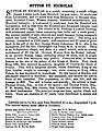
 1856 Sutton, Herefordshire, Post Office Directory of Herefordshire, 1856 p93.jpg 1,127 × 893; 770 KB
-
 Yazor Post Office Directory of Herefordshire 1856 p. 104.jpg 1,111 × 369; 190 KB
-

-
-
 1885 Sutton, Herefordshire, Kelly's Directory of Herefordshire, 1885 p12345.jpg 1,088 × 774; 723 KB
-

-

-

-
 1913 Sutton, Herefordshire Kelly's Directory of Herefordshire, 1913 p190-91.jpg 1,113 × 1,038; 934 KB
-

-

-
 Sutton, Herefordshire, OS 1 to 25,000 map of Great Britain, 1950.jpg 1,539 × 898; 1.39 MB
-
 A dangerous manoeuvre - geograph.org.uk - 4700397.jpg 800 × 451; 298 KB
-
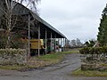
 Barn at Upper House Farm - geograph.org.uk - 4639968.jpg 4,000 × 3,000; 3.28 MB
-
 Beech, willow and ash - geograph.org.uk - 4700395.jpg 800 × 451; 209 KB
-
 Black and white cottage - geograph.org.uk - 5224441.jpg 1,600 × 901; 741 KB
-

-
 Bridge over the Little Lugg - geograph.org.uk - 1028815.jpg 640 × 480; 166 KB
-
 Bridleway along the Lugg flood plain - geograph.org.uk - 4701676.jpg 800 × 451; 210 KB
-
 Bridleway and drainage ditch - geograph.org.uk - 1028835.jpg 640 × 480; 200 KB
-

-
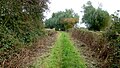
 Bridleway and green lane, 1 - geograph.org.uk - 4701714.jpg 800 × 451; 223 KB
-
 Bridleway and green lane, 2 - geograph.org.uk - 4701719.jpg 800 × 451; 198 KB
-
 Bridleway onto Sutton Marsh - geograph.org.uk - 4286041.jpg 800 × 451; 196 KB
-
 Bridleway to Thing-Hill Grange - geograph.org.uk - 4701710.jpg 800 × 451; 201 KB
-
 Churchyard, Sutton St Michael - geograph.org.uk - 5999089.jpg 1,024 × 576; 440 KB
-

-
 Combining, Sutton St Nicholas - geograph.org.uk - 5998987.jpg 1,024 × 683; 371 KB
-
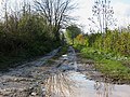
 Ditch and no through road - geograph.org.uk - 3388101.jpg 1,024 × 680; 291 KB
-
 Dry culvert - geograph.org.uk - 4700150.jpg 800 × 451; 244 KB
-
 Entrance to the eastern field in Sutton Walls hillfort - geograph.org.uk - 6724153.jpg 2,000 × 1,369; 1.1 MB
-
 Fallen tree - geograph.org.uk - 3250262.jpg 1,024 × 680; 369 KB
-
 Farm entrance and farm equipment - geograph.org.uk - 5688354.jpg 640 × 480; 164 KB
-
 Farm track, Franklands Gate - geograph.org.uk - 5998986.jpg 1,024 × 683; 526 KB
-
 Farmland to the west of Sutton Walls Fort - geograph.org.uk - 3250978.jpg 1,024 × 680; 265 KB
-
 Field edge near Wergin's Stone - geograph.org.uk - 4699901.jpg 800 × 451; 207 KB
-
 Field under Sutton Walls - geograph.org.uk - 5999094.jpg 1,024 × 576; 334 KB
-
 Field, Wyatt - geograph.org.uk - 6367732.jpg 1,024 × 683; 269 KB
-
-
-
 Footpath north - geograph.org.uk - 4701695.jpg 800 × 451; 215 KB
-
 Footpath sign, Sutton Marsh - geograph.org.uk - 854844.jpg 480 × 640; 50 KB
-
 Footpath to the Lugg meadows - geograph.org.uk - 5224438.jpg 1,600 × 901; 699 KB
-
 Fork In The Track - geograph.org.uk - 1370058.jpg 640 × 480; 199 KB
-
 Galanthus nivalis, Common Snowdrop - geograph.org.uk - 5224448.jpg 1,600 × 901; 748 KB
-
 Galanthus nivalis, Common Snowdrop - geograph.org.uk - 5224450.jpg 1,600 × 985; 761 KB
-

-
 Herefordshire farmland - geograph.org.uk - 4701688.jpg 800 × 451; 202 KB
-

-
 House at Sutton St Michael - geograph.org.uk - 5690926.jpg 640 × 480; 217 KB
-
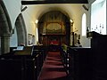
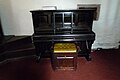
 Inside St. Nicholas Church (Organ ^ Sutton St. Nicholas) - geograph.org.uk - 5855079.jpg 3,648 × 2,736; 2.09 MB
-
 Lane and house west of Sutton St Michael - geograph.org.uk - 5690930.jpg 640 × 480; 130 KB
-
 Lane at Wyatt Farm - geograph.org.uk - 4701707.jpg 800 × 451; 255 KB
-
 Lane junction - geograph.org.uk - 4701702.jpg 800 × 451; 220 KB
-
 Lane to Sutton - geograph.org.uk - 4701697.jpg 800 × 451; 197 KB
-
 Lane To Sutton St Nicholas - geograph.org.uk - 1370053.jpg 640 × 480; 228 KB
-
 Lugg flood plain - geograph.org.uk - 5999037.jpg 1,024 × 576; 236 KB
-
 Lugg meadowland - geograph.org.uk - 3388056.jpg 1,024 × 680; 171 KB
-
 Lugg meadows - geograph.org.uk - 4700396.jpg 800 × 451; 179 KB
-
 Lugg meadows, 1 - geograph.org.uk - 4700391.jpg 800 × 451; 178 KB
-
 Lugg meadows, 2 - geograph.org.uk - 4700392.jpg 800 × 451; 186 KB
-
 Lugg meadows, 3 - geograph.org.uk - 4700393.jpg 800 × 451; 186 KB
-
 Marden Road - geograph.org.uk - 5224455.jpg 1,600 × 901; 551 KB
-
 Moreton Bridge Panorama - geograph.org.uk - 1377031.jpg 640 × 480; 165 KB
-
 Oast House at Pantalls Farm (Sutton St. Nicholas) - geograph.org.uk - 5853560.jpg 3,648 × 2,736; 4.23 MB
-
 Oast House at Pantalls Farm (Sutton St. Nicholas) - geograph.org.uk - 5853562.jpg 3,648 × 2,736; 4.14 MB
-
 Old orchard land - geograph.org.uk - 4701704.jpg 800 × 451; 211 KB
-
 Old orchard, Sutton St Nicholas - geograph.org.uk - 5999038.jpg 1,024 × 683; 370 KB
-
 Orchard, Wyatt - geograph.org.uk - 6367735.jpg 1,024 × 683; 329 KB
-
 Ploughed field below Sutton Walls Fort - geograph.org.uk - 3250250.jpg 1,024 × 680; 264 KB
-
 Potato field, Ridgeway Road - geograph.org.uk - 1029584.jpg 640 × 480; 108 KB
-
 Rapeseed Ocean - geograph.org.uk - 1370061.jpg 640 × 480; 255 KB
-
 Rheas, Sutton Marsh - geograph.org.uk - 146826.jpg 640 × 479; 104 KB
-
 Ridgeway Road - geograph.org.uk - 4286042.jpg 800 × 451; 180 KB
-
 Ridgeway Road near Sutton Marsh - geograph.org.uk - 5463926.jpg 640 × 474; 137 KB
-
 Ridgeway Road near Sutton St Nicholas - geograph.org.uk - 5463940.jpg 640 × 476; 129 KB
-
 River Lugg flood plain - geograph.org.uk - 1050295.jpg 640 × 449; 130 KB
-
 River Lugg from Wergin's Bridge - geograph.org.uk - 1050314.jpg 640 × 480; 141 KB
-

-
 Road heading towards Sutton St Nicholas - geograph.org.uk - 5688345.jpg 640 × 480; 136 KB
-
 Road North At The Wymm - geograph.org.uk - 1370121.jpg 640 × 480; 192 KB
-
 Road South At The Wymm - geograph.org.uk - 1370125.jpg 640 × 480; 140 KB
-
 Roofless ruin - geograph.org.uk - 1028839.jpg 640 × 480; 139 KB
-
 Roofless ruin, Ridgeway Road - geograph.org.uk - 1028844.jpg 640 × 480; 144 KB
-
 Shadows on the Little Lugg - geograph.org.uk - 1028806.jpg 480 × 640; 213 KB
-
 Shelter by St. Nicholas Church (Sutton St. Nicholas) - geograph.org.uk - 5855146.jpg 3,648 × 2,736; 4.76 MB
-
 Springtime in Herefordshire - geograph.org.uk - 2346192.jpg 640 × 480; 86 KB
-
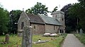
 St Michael Church, Sutton St Michael, Herefordshire - geograph.org.uk - 5368571.jpg 1,904 × 1,270; 832 KB
-
 St. Nicholas Church (Bell Tower ^ Sutton St. Nicholas) - geograph.org.uk - 5855020.jpg 3,648 × 2,736; 4.72 MB
-
 St. Nicholas Church (Bell Tower ^ Sutton St. Nicholas) - geograph.org.uk - 5855027.jpg 3,648 × 2,736; 4.4 MB
-
 St. Nicholas Church (Bell Tower ^ Sutton St. Nicholas) - geograph.org.uk - 5855034.jpg 3,648 × 2,736; 4.18 MB
-
 St. Nicholas Church (Bell Tower ^ Sutton St. Nicholas) - geograph.org.uk - 5855046.jpg 3,648 × 2,736; 4.54 MB
-
 St. Nicholas Church (Chancel ^ Sutton St. Nicholas) - geograph.org.uk - 5855094.jpg 2,048 × 1,536; 1.54 MB
-

-
 St. Nicholas Church (Font ^ Sutton St. Nicholas) - geograph.org.uk - 5855073.jpg 3,648 × 2,736; 2.42 MB
-
 St. Nicholas Church (Nave ^ Sutton St. Nicholas) - geograph.org.uk - 5855093.jpg 2,048 × 1,536; 1.38 MB
-
 St. Nicholas Church (Organ ^ Sutton St. Nicholas) - geograph.org.uk - 5855068.jpg 3,648 × 2,736; 2.59 MB
-
 St. Nicholas Church (Organ ^ Sutton St. Nicholas) - geograph.org.uk - 5855075.jpg 3,648 × 2,736; 2.62 MB
-
 St. Nicholas Church (Organ ^ Sutton St. Nicholas) - geograph.org.uk - 5855087.jpg 2,048 × 1,360; 1,007 KB
-
 St. Nicholas Church (Porch ^ Sutton St. Nicholas) - geograph.org.uk - 5855056.jpg 3,648 × 2,736; 4.66 MB
-
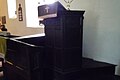 St. Nicholas Church (Pulpit ^ Sutton St. Nicholas) - geograph.org.uk - 5855089.jpg 2,048 × 1,360; 673 KB
-
 St. Nicholas Church (Screen ^ Sutton St. Nicholas) - geograph.org.uk - 5855098.jpg 2,048 × 1,152; 1,019 KB
-

-
 St. Nicholas Church (Sutton St. Nicholas) - geograph.org.uk - 5855008.jpg 3,648 × 2,736; 4.99 MB
-
 St. Nicholas Church (Sutton St. Nicholas) - geograph.org.uk - 5855013.jpg 3,648 × 2,736; 4.7 MB
-
 St. Nicholas Church (Sutton St. Nicholas) - geograph.org.uk - 5855083.jpg 1,920 × 1,080; 644 KB
-
 St. Nicholas Church (Sutton St. Nicholas) - geograph.org.uk - 5855104.jpg 1,920 × 1,080; 1.08 MB
-
 St. Nicholas Church (Sutton St. Nicholas) - geograph.org.uk - 5855128.jpg 1,920 × 1,080; 1.07 MB
-
 St. Nicholas Church (Sutton St. Nicholas) - geograph.org.uk - 5855145.jpg 3,648 × 2,736; 4.84 MB
-
 St. Nicholas Church (Sutton St. Nicholas) - geograph.org.uk - 5855147.jpg 3,648 × 2,736; 4.91 MB
-
 St. Nicholas Church (War Memorial ^ Sutton St. Nicholas) - geograph.org.uk - 5855141.jpg 3,648 × 2,736; 4.38 MB
-

-

-

-
 Start of bridleway, Sutton Marsh - geograph.org.uk - 1028828.jpg 480 × 640; 198 KB
-
 Straight Road South - geograph.org.uk - 1376948.jpg 640 × 480; 183 KB
-
 Sutton Rhea - geograph.org.uk - 4701674.jpg 800 × 451; 205 KB
-
 The Golden Cross (Sutton St. Nicholas) - geograph.org.uk - 5855149.jpg 3,648 × 2,736; 4.28 MB
-

-
 The Little Lugg, 1 - geograph.org.uk - 4286043.jpg 800 × 451; 206 KB
-
 The Little Lugg, 2 - geograph.org.uk - 4286044.jpg 800 × 600; 286 KB
-
 The Lugg meadows - geograph.org.uk - 3250255.jpg 1,024 × 680; 238 KB
-
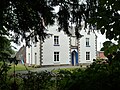 The Rectory (Sutton St. Nicholas) - geograph.org.uk - 5855031.jpg 3,648 × 2,736; 4.77 MB
-
 The Rectory (Sutton St. Nicholas) - geograph.org.uk - 5855041.jpg 3,648 × 2,736; 4.79 MB
-
 The rectory gate, Sutton St. Nicholas - geograph.org.uk - 4701673.jpg 800 × 800; 368 KB
-
 The Wergin's Stone - geograph.org.uk - 4699890.jpg 800 × 451; 220 KB
-
 Track And Ditch - geograph.org.uk - 1370064.jpg 640 × 480; 288 KB
-
 Track to deciduous wood - geograph.org.uk - 1050309.jpg 640 × 480; 203 KB
-
 Unknown House (Sutton St. Nicholas) - geograph.org.uk - 5853530.jpg 3,648 × 2,736; 4.79 MB
-
 Unknown Houses (Sutton St. Nicholas) - geograph.org.uk - 5853545.jpg 3,648 × 2,736; 4.23 MB
-
 Upper House Farmhouse (Sutton St. Nicholas) - geograph.org.uk - 5855113.jpg 1,920 × 1,080; 1.07 MB
-
-
 Victorian house - geograph.org.uk - 5224444.jpg 1,600 × 901; 631 KB
-
 View to Sutton Walls - geograph.org.uk - 5224446.jpg 1,600 × 901; 627 KB
-
 View upstream from Wergin's Bridge - geograph.org.uk - 1050320.jpg 640 × 480; 101 KB
-
 Village house at Ordis Farm - geograph.org.uk - 5224434.jpg 1,600 × 901; 711 KB
-
 Wergins Bridge - Builder's Plaque - geograph.org.uk - 1376940.jpg 640 × 480; 254 KB
-
 Wergins Bridge - centenary plaque - geograph.org.uk - 3621305.jpg 640 × 427; 128 KB
-
 Wergins Bridge - geograph.org.uk - 152559.jpg 640 × 480; 51 KB
-
 Wergins Bridge - geograph.org.uk - 3621299.jpg 640 × 425; 137 KB
-
 Wergins Bridge - View Downstream - geograph.org.uk - 1376945.jpg 640 × 480; 200 KB
-
 Wergins Bridge - View Upstream - geograph.org.uk - 1376943.jpg 640 × 480; 178 KB
-
 Wergins Bridge near Sutton St Nicholas - geograph.org.uk - 5462173.jpg 640 × 456; 193 KB
-
 Wheat - geograph.org.uk - 6367738.jpg 1,024 × 683; 309 KB
-
 Wheat, Sutton St Michael - geograph.org.uk - 5999098.jpg 1,024 × 576; 396 KB
-
 White House Farm, Sutton - geograph.org.uk - 2160566.jpg 3,375 × 2,331; 7.9 MB
-
 Willows along a field edge - geograph.org.uk - 4700170.jpg 800 × 451; 191 KB
-
 Willows and pasture - geograph.org.uk - 4701677.jpg 800 × 451; 211 KB
-

-

-

-
 Work in progress - geograph.org.uk - 1050305.jpg 640 × 480; 94 KB
-
 Wyatt Lane - geograph.org.uk - 6367736.jpg 1,024 × 683; 320 KB
-
 Wyatt Road, Withington - geograph.org.uk - 5398068.jpg 1,728 × 1,152; 838 KB
-

-
 Field - geograph.org.uk - 203116.jpg 640 × 480; 76 KB
-

-
 Old Road to Fromington - geograph.org.uk - 152309.jpg 479 × 640; 114 KB
-
 The Little Lugg near Withington Marsh - geograph.org.uk - 146797.jpg 640 × 426; 126 KB


_pp166-67.jpg)
_1898.jpg)


_-_geograph.org.uk_-_5855052.jpg)


_-_geograph.org.uk_-_5855079.jpg)


_-_geograph.org.uk_-_5853560.jpg)
_-_geograph.org.uk_-_5853562.jpg)


_-_geograph.org.uk_-_5855146.jpg)


_-_geograph.org.uk_-_5855020.jpg)
_-_geograph.org.uk_-_5855027.jpg)
_-_geograph.org.uk_-_5855034.jpg)
_-_geograph.org.uk_-_5855046.jpg)
_-_geograph.org.uk_-_5855094.jpg)
_-_geograph.org.uk_-_5855022.jpg)
_-_geograph.org.uk_-_5855073.jpg)
_-_geograph.org.uk_-_5855093.jpg)
_-_geograph.org.uk_-_5855068.jpg)
_-_geograph.org.uk_-_5855075.jpg)
_-_geograph.org.uk_-_5855087.jpg)
_-_geograph.org.uk_-_5855056.jpg)
_-_geograph.org.uk_-_5855089.jpg)
_-_geograph.org.uk_-_5855098.jpg)
_-_geograph.org.uk_-_5855008.jpg)
_-_geograph.org.uk_-_5855013.jpg)
_-_geograph.org.uk_-_5855083.jpg)
_-_geograph.org.uk_-_5855104.jpg)
_-_geograph.org.uk_-_5855128.jpg)
_-_geograph.org.uk_-_5855145.jpg)
_-_geograph.org.uk_-_5855147.jpg)
_-_geograph.org.uk_-_5855141.jpg)


_-_geograph.org.uk_-_5855149.jpg)


_-_geograph.org.uk_-_5855031.jpg)
_-_geograph.org.uk_-_5855041.jpg)


_-_geograph.org.uk_-_5853530.jpg)
_-_geograph.org.uk_-_5853545.jpg)
_-_geograph.org.uk_-_5855113.jpg)
_-_geograph.org.uk_-_5855090.jpg)


_-_geograph.org.uk_-_5855095.jpg)
_-_geograph.org.uk_-_5855096.jpg)


_-_geograph.org.uk_-_5855086.jpg)
_-_geograph.org.uk_-_5855091.jpg)