There is a discrepancy of 1203 meters between the above coordinates and the ones stored at Wikidata (52°45′0″N 13°43′0″E, precision: 30 m). Please reconcile them.
<nowiki>Sydower Fließ; Sydower Fließ; Sydower Fließ; Sydower Fließ; Sydower Fliess; Sydower Fließ; Зидовер-Флис; Зидовер Флис; 西多韦尔夫利斯; Sydower Fließ; Sydower Fließ; 西多韋爾夫利斯; Sydower Fließ; Зидовер-Фліс; Зидовер-Флис; 西多韋爾夫利斯; Sydower Fließ; Sydower Fließ; Зидовер Флис; Sydower Fließ; Sydower Fließ; Sydower Fließ; Zidover Flis; Sydower Fließ; Sydower Fließ; Sydower Fließ; Зидовер Флис; Sydower Fließ; Sydower Fließ; Зидовер-Флис; Զիդովեր Ֆլիս; Sydower Fließ; Sydower Fließ; Sydower Fließ; Sydower Fließ; Sydower Fließ; Sydower Fließ; زیدوور فلیس; ズュードウアー・フリース; Sydower Fließ; Sydower Fließ; 西多韦尔夫利斯; Sydower Fließ; comune tedesco; commune allemande; Gemeinde in Deutschland; komunë në Gjermani; 德国勃兰登堡州市镇; Şaredariyeke Almanyayê; gmina w Niemczech; громада в Німеччині, федеральна земля Бранденбург; gemeente in Brandenburg; kumun alaman; kommune i Tyskland; település Németországban; بلدية في ألمانيا; municipality in Brandenburg state, Germany; komunumo en Brandenburgio, Germanio; obec v zemském okresu Barnim v Německu; gmejna w Braniborskej; Sydower Fliess; Sydower FlieB; Сйдоwер Флиеß; Zidover Flis; Зидовер-Флис; Sydower Fliess; Zidover-Flis; Sydower Fließ; Sydower Fliess; Sydower Fliess; Sydower Fliess</nowiki>


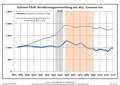 Bevölkerungsentwicklung Sydower Fließ.pdf 1,752 × 1,239; 121 KB
 Sydower Fließ in BAR.png 299 × 299; 8 KB