Category:Tatenhill
English: Tatenhill is an ancient village and a civil parish located in a deep valley, between two hills, which gradually descend from the eastern border of Needwood Forest, three and a half miles west-southwest of Burton upon Trent.
village in United Kingdom  | |||||
| Upload media | |||||
| Instance of | |||||
|---|---|---|---|---|---|
| Location | East Staffordshire, Staffordshire, West Midlands, England | ||||
 | |||||
Subcategories
This category has the following 4 subcategories, out of 4 total.
Media in category "Tatenhill"
The following 120 files are in this category, out of 120 total.
-
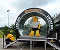 2014 World Cup Mascot - geograph.org.uk - 4033082.jpg 3,803 × 3,157; 4.89 MB
-
 All Saints Church at Rangemore - geograph.org.uk - 5053929.jpg 2,933 × 3,909; 1.63 MB
-
 All Saints Church, Rangemore - geograph.org.uk - 3556013.jpg 640 × 480; 35 KB
-
 All Saints School, Rangemore.jpg 640 × 428; 62 KB
-

-
 At Last a Working Farm - geograph.org.uk - 2609496.jpg 640 × 428; 53 KB
-

-
 B5017 heading east - geograph.org.uk - 3422893.jpg 640 × 480; 90 KB
-
 B5017 heading east - geograph.org.uk - 3422899.jpg 640 × 480; 71 KB
-
 B5234 approaching the A515 - geograph.org.uk - 2086994.jpg 640 × 480; 60 KB
-
 B5234 heading east - geograph.org.uk - 3422831.jpg 640 × 480; 73 KB
-
 B5234 near Tatenhill airfield - geograph.org.uk - 2086980.jpg 640 × 480; 75 KB
-
 Bass Millennium Wood - geograph.org.uk - 1133015.jpg 640 × 480; 95 KB
-
 Branston Road - geograph.org.uk - 3556056.jpg 640 × 553; 58 KB
-
 Branston Road, Tatenhill (geograph 2486932).jpg 1,496 × 1,122; 535 KB
-
 Bridleway leading to Highlands Park farm - geograph.org.uk - 3376946.jpg 3,776 × 2,520; 3.82 MB
-

-
 Burton Rugby Football Club's new ground - geograph.org.uk - 6201100.jpg 1,280 × 960; 322 KB
-
 Callingwood Gate Farm - geograph.org.uk - 3422888.jpg 640 × 480; 54 KB
-
 Canal west of Branston, Staffordshire - geograph.org.uk - 5594409.jpg 1,280 × 910; 1,022 KB
-
 Cottages on Tatenhill Common Road - geograph.org.uk - 2612261.jpg 640 × 428; 80 KB
-
 Crop field off near Rangemore Hall - geograph.org.uk - 3556003.jpg 640 × 480; 92 KB
-
 Crop field, Hill Farm - geograph.org.uk - 3556021.jpg 640 × 480; 75 KB
-
 Crossplain Poultry Farm - geograph.org.uk - 3422836.jpg 1,024 × 605; 146 KB
-
 Crossroads near Dunstall Cross - geograph.org.uk - 2617220.jpg 640 × 428; 48 KB
-
 Cuckoo Cage Farm - geograph.org.uk - 3376795.jpg 3,776 × 2,520; 4.02 MB
-
 Cuckoo Cage Lane leading off Tatenhill Lane - geograph.org.uk - 3376801.jpg 3,776 × 2,520; 4.16 MB
-

-

-
 Driveway to Deanery Farm - geograph.org.uk - 2617184.jpg 640 × 428; 103 KB
-
 Dunstall Cross - geograph.org.uk - 3555997.jpg 640 × 480; 67 KB
-
 Entering Tatenhill from Dunstall (geograph 2609467).jpg 640 × 411; 93 KB
-
 Entrance for Callingwood House - geograph.org.uk - 2610955.jpg 640 × 428; 105 KB
-
 Entrance Gates, Rangemore Hall.jpg 3,638 × 2,440; 3.98 MB
-
 Entrance to Lower Lynbrook Farm - geograph.org.uk - 2618637.jpg 640 × 428; 120 KB
-
 Entrance to Rangemore Hall - geograph.org.uk - 2618726.jpg 640 × 428; 107 KB
-
 Farm track near Black Plantation - geograph.org.uk - 3555166.jpg 640 × 480; 86 KB
-
 Farmland near Black Plantation - geograph.org.uk - 3555170.jpg 640 × 480; 76 KB
-
 Farmland near Deanery Farm - geograph.org.uk - 3555230.jpg 640 × 480; 65 KB
-
 Farmland near Lawns Farm Cottage - geograph.org.uk - 3556052.jpg 640 × 480; 71 KB
-
 Farmland near Tatenhill - geograph.org.uk - 3556027.jpg 640 × 480; 78 KB
-
 Farmland towards Stud Wood - geograph.org.uk - 3422862.jpg 640 × 453; 50 KB
-
 Farmland, Callingwood Gate Farm - geograph.org.uk - 3422884.jpg 640 × 480; 41 KB
-
 Farmland, Deanery Farm - geograph.org.uk - 3555998.jpg 640 × 480; 61 KB
-
 Flooded Pasturelands - geograph.org.uk - 319776.jpg 640 × 440; 52 KB
-
 Footpath north-west from Tatenhill - geograph.org.uk - 3373394.jpg 3,776 × 2,520; 4.21 MB
-
 Forest Road just north of Dunstall Cross - geograph.org.uk - 5842784.jpg 1,469 × 1,102; 532 KB
-
 Former farm cottages at Rangemore Hill - geograph.org.uk - 5842795.jpg 2,156 × 1,617; 1.29 MB
-

-
 Garage and MOT Bay, Needwood Island - geograph.org.uk - 2610832.jpg 640 × 428; 62 KB
-
 Gate Without a Footpath - geograph.org.uk - 2617785.jpg 640 × 428; 96 KB
-
 Gloucestershire Old Spot Piglet - geograph.org.uk - 4033073.jpg 4,445 × 2,882; 5.8 MB
-
 Gloucestershire Old Spot Pigs - Byrkley Garden Centre - geograph.org.uk - 4033069.jpg 4,608 × 3,456; 6.47 MB
-
 House on the Crossroads, Tatenhill (geograph 2609478).jpg 640 × 428; 66 KB
-
 House, Main Street, Tatenhill (geograph 2144018).jpg 640 × 480; 152 KB
-
 Houses at Gable Lodge Farm - geograph.org.uk - 2612219.jpg 640 × 374; 74 KB
-
 Houses on Rangemore Hill - geograph.org.uk - 3931220.jpg 2,944 × 2,074; 2.5 MB
-
 Just entering Tatenhill - geograph.org.uk - 5868180.jpg 2,000 × 1,333; 1.98 MB
-
 Knightley Farm - geograph.org.uk - 3422897.jpg 640 × 480; 44 KB
-
 Lane heading south - geograph.org.uk - 3555232.jpg 640 × 480; 72 KB
-
 Lane past Black Plantation - geograph.org.uk - 3555172.jpg 640 × 480; 77 KB
-
 Lane towards Barton Gate - geograph.org.uk - 3555178.jpg 640 × 480; 112 KB
-
 Lawnswood housing development - geograph.org.uk - 6201080.jpg 1,280 × 960; 402 KB
-
 Main Street, Tatenhill (geograph 3556041).jpg 640 × 480; 79 KB
-
 Main Street, Tatenhill (geograph 3556046).jpg 640 × 480; 96 KB
-
 Milepost at SK 173 243.jpg 640 × 480; 251 KB
-
 Milepost at SK 189 239.jpg 911 × 1,404; 201 KB
-
 Minor road heading north - geograph.org.uk - 3556000.jpg 640 × 480; 73 KB
-
 Minor road heading north - geograph.org.uk - 3556004.jpg 640 × 480; 85 KB
-
 Minor road heading south - geograph.org.uk - 3422865.jpg 1,200 × 900; 306 KB
-
 More development - geograph.org.uk - 5868177.jpg 2,000 × 1,333; 1.97 MB
-
 Narrow Boat on Trent-Mersey canal - geograph.org.uk - 64201.jpg 640 × 480; 60 KB
-
 New Inn, Needwood Roundabout - geograph.org.uk - 2610878.jpg 640 × 428; 70 KB
-
 Old village pump at Tattenhill - geograph.org.uk - 199025.jpg 480 × 640; 91 KB
-
 Ordnance Survey Flush Bracket 2471 - geograph.org.uk - 5053319.jpg 3,653 × 2,739; 1.89 MB
-
 Pitch 7A - St George's Park National Football Centre - geograph.org.uk - 6192536.jpg 4,608 × 3,072; 4.69 MB
-
 Public Footpath along Farm Track - geograph.org.uk - 2617837.jpg 640 × 428; 98 KB
-
 Rangemore Club - geograph.org.uk - 3556016.jpg 640 × 480; 90 KB
-
 Rangemore Hall Mews - geograph.org.uk - 3556005.jpg 640 × 480; 74 KB
-
 Rangemore Hall Mews - geograph.org.uk - 400287.jpg 640 × 421; 84 KB
-
 Rangemore Hall Mews - geograph.org.uk - 4455992.jpg 4,320 × 3,240; 4.06 MB
-
 Rangemore Hill road alongside Rangemore Hall - geograph.org.uk - 5842805.jpg 1,469 × 1,102; 671 KB
-
 Rangemore village signs - geograph.org.uk - 5842803.jpg 1,403 × 1,052; 536 KB
-
 Rangemore, Staffordshire. - geograph.org.uk - 212225.jpg 640 × 480; 90 KB
-

-
 Road (B5234) at Vicarshill Farm - geograph.org.uk - 5053325.jpg 4,000 × 3,000; 2.87 MB
-
 Road alongside Gable Lodge Farm - geograph.org.uk - 5842809.jpg 1,469 × 1,102; 564 KB
-
 Scotch Hill Plantation - geograph.org.uk - 5236486.jpg 1,600 × 1,066; 288 KB
-
 Service station, Needwood - geograph.org.uk - 3422871.jpg 640 × 480; 49 KB
-

-

-

-
 Staffordshire - Burton to Uttoxeter road milepost at SK189239, 2008.jpg 2,192 × 1,520; 448 KB
-
 Staffordshire farmland west of Branston - geograph.org.uk - 5594424.jpg 1,280 × 903; 1.24 MB
-
 Staffordshire farmland west of Branston - geograph.org.uk - 5594435.jpg 1,280 × 802; 1.24 MB
-
 Tatenhill Aerodrome - geograph.org.uk - 3923483.jpg 1,024 × 683; 112 KB
-
 Tatenhill Aerodrome - geograph.org.uk - 3923487.jpg 1,024 × 683; 105 KB
-
 Tatenhill Aerodrome, aerial 2014 - geograph.org.uk - 3926139.jpg 640 × 323; 37 KB
-

-
 Tatenhill Airfield Complex - geograph.org.uk - 2618712.jpg 640 × 428; 52 KB
-
 Tatenhill Common - geograph.org.uk - 3556023.jpg 640 × 480; 77 KB
-

-
 Tatenhill Lane - geograph.org.uk - 3556018.jpg 640 × 480; 67 KB
-
 Tatenhill Lane - geograph.org.uk - 3556033.jpg 640 × 480; 62 KB
-
 Tatenhill village - geograph.org.uk - 5868187.jpg 2,000 × 1,333; 2.78 MB
-
 Tatenhill, Staffordshire, St Michael ^ All Angels - geograph.org.uk - 5916833.jpg 4,608 × 3,456; 3.96 MB
-

-
 The Bridge over Lin Brook - geograph.org.uk - 2618626.jpg 640 × 428; 117 KB
-
 The entrance to St George's Park - geograph.org.uk - 5734468.jpg 640 × 480; 78 KB
-
-
 The New Inn, Needwood - geograph.org.uk - 3422867.jpg 640 × 525; 55 KB
-
 The road up Rangemore Hill - geograph.org.uk - 5842792.jpg 1,469 × 1,102; 517 KB
-
 Track to Deanery Farm - geograph.org.uk - 3555999.jpg 640 × 480; 99 KB
-
 View From Rangemore Churchyard - geograph.org.uk - 1971422.jpg 1,496 × 1,122; 1.02 MB
-
 Woods on the Dunstall estate - geograph.org.uk - 400953.jpg 640 × 421; 55 KB
-
 Home Farm - geograph.org.uk - 401008.jpg 640 × 426; 74 KB
-

-
 Oil seed rape awaiting harvesting - geograph.org.uk - 199010.jpg 640 × 480; 105 KB
-

-
 Road junction to the east of Dunstall - geograph.org.uk - 199006.jpg 480 × 640; 88 KB


.jpg)


.jpg)


.jpg)
.jpg)


.jpg)
.jpg)


_at_Vicarshill_Farm_-_geograph.org.uk_-_5053325.jpg)


_-_geograph.org.uk_-_3422841.jpg)


