Category:Teichland/Gatojce
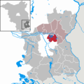
Deutsch: Teichland ist eine Gemeinde im Landkreis Spree-Neiße nördlich von Cottbus.
municipality of Germany    | |||||
| Upload media | |||||
| Instance of |
| ||||
|---|---|---|---|---|---|
| Location | Spree-Neiße District, Brandenburg, Germany | ||||
| Official language | |||||
| Population |
| ||||
| Area |
| ||||
| Elevation above sea level |
| ||||
| official website | |||||
 | |||||
Subcategories
This category has the following 8 subcategories, out of 8 total.
B
- Bahnhof Teichland (13 F)
- Bärenbrück/Barbuk (6 F)
C
K
- Kiessee Maust (18 F)
M
N
S
- Streckteich (17 F)
Media in category "Teichland/Gatojce"
The following 34 files are in this category, out of 34 total.
-
 Wappen Teichland.png 800 × 895; 63 KB
-
 Bevölkerungsentwicklung Teichland.pdf 1,752 × 1,239; 121 KB
-
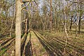
 Near Kiessee Maust 2021-04-24 01.jpg 8,368 × 5,584; 20.24 MB
-
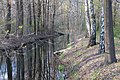
 Near Kiessee Maust 2021-04-24 02.jpg 8,368 × 5,584; 22.43 MB
-
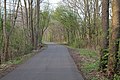
 Near Kiessee Maust 2021-04-24 03.jpg 8,368 × 5,584; 20.64 MB
-
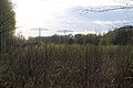
 Near Kiessee Maust 2021-04-24 04.jpg 8,368 × 5,584; 21.42 MB
-
 Near Kiessee Maust 2021-04-24 05.jpg 8,368 × 5,584; 21.92 MB
-
 Near Kiessee Maust 2021-04-24 06.jpg 8,368 × 5,584; 12.8 MB
-
 Near Kiessee Maust 2021-04-24 07.jpg 8,368 × 5,584; 23.36 MB
-
 Near Kiessee Maust 2021-04-24 08.jpg 8,368 × 5,584; 22.44 MB
-
 Near Kiessee Maust 2021-04-24 09.jpg 8,368 × 5,584; 25.1 MB
-
 Near Kiessee Maust 2021-04-24 10.jpg 8,368 × 5,584; 24.74 MB
-
 Near Kiessee Maust 2021-04-24 11.jpg 8,368 × 5,584; 24.8 MB
-
 Near Kiessee Maust 2021-04-24 12.jpg 8,368 × 5,584; 24.79 MB
-
 Near Kiessee Maust 2021-04-24 13.jpg 8,368 × 5,584; 22.55 MB
-
 Near Kiessee Maust 2021-04-24 14.jpg 8,368 × 5,584; 23.35 MB
-
 Near Kiessee Maust 2021-04-24 15.jpg 8,368 × 5,584; 25.02 MB
-
 Near Kiessee Maust 2021-04-24 16.jpg 8,368 × 5,584; 24.59 MB
-
 Near Kiessee Maust 2021-04-24 17.jpg 8,368 × 5,584; 24.21 MB
-
 Near Kiessee Maust 2021-04-24 18.jpg 8,368 × 5,584; 23.46 MB
-
 Near Kiessee Maust 2021-04-24 19.jpg 8,368 × 5,584; 24.68 MB
-
 Near Kiessee Maust 2021-04-24 20.jpg 8,368 × 5,584; 24.18 MB
-
 Near Kiessee Maust 2021-04-24 21.jpg 8,368 × 5,584; 24.69 MB
-
 Near Kiessee Maust 2021-04-24 22.jpg 8,368 × 5,584; 23.2 MB
-
 Near Kiessee Maust 2021-04-24 23.jpg 8,368 × 5,584; 22.42 MB
-
 Near Kiessee Maust 2021-04-24 24.jpg 8,368 × 5,584; 24.38 MB
-
 Near Kiessee Maust 2021-04-24 25.jpg 8,368 × 5,584; 22.93 MB
-
 Near Kiessee Maust 2021-04-24 26.jpg 8,368 × 5,584; 22.62 MB
-
 Near Kiessee Maust 2021-04-24 27.jpg 8,368 × 5,584; 20.68 MB
-
 Near Kiessee Maust 2021-04-24 28.jpg 8,368 × 5,584; 19.42 MB
-
 Near Kiessee Maust 2021-04-24 29.jpg 8,368 × 5,584; 24.62 MB
-
 Sommerrodelbahn 2.jpg 3,264 × 2,448; 2.75 MB
-
 Teichland - panoramio.jpg 5,184 × 3,456; 8.86 MB
-
 Teichland in SPN.png 299 × 299; 8 KB


