Category:The Red Narrows
gap in Spanish Fork Canyon in Utah County, Utah, United States  | |||||
| Upload media | |||||
| Instance of |
| ||||
|---|---|---|---|---|---|
| Located in protected area |
| ||||
| Location | Utah County, Utah | ||||
| Located in or next to body of water | |||||
| Elevation above sea level |
| ||||
 | |||||
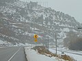
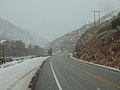
English: Media related to The Red Narrows, a narrow gap in Spanish Fork Canyon in southeastern Utah County, Utah, United States, through which Soldier Creek flows. The eastern end (and most narrow part) of the gap is within the Uinta-Wasatch-Cache National Forest.
Media in category "The Red Narrows"
The following 12 files are in this category, out of 12 total.
-
 410 MSS P 24 B3 F7.jpg 2,601 × 1,661; 747 KB
-
 East in east end of The Red Narrows at most narrow part, Dec 16.jpg 2,592 × 1,944; 2.44 MB
-
 East in east end of The Red Narrows, Dec 16.jpg 2,592 × 1,944; 2.42 MB
-
 East in west end of The Red Narrows, Dec 16.jpg 2,592 × 1,944; 2.43 MB
-
 Hoodoo in Spanish Fork Canyon, May 17.jpg 1,944 × 2,592; 1.97 MB
-
 Red Narrows, Spanish Fork Canon Utah D.& R.G.Ry. C.R. Savage, Photo..jpg 2,466 × 1,897; 990 KB
-
 US Highway 6 - Utah - 7688477066.jpg 3,072 × 2,304; 461 KB
-
 US Highway 6 - Utah - 7688477824.jpg 3,072 × 2,304; 468 KB
-
 US Highway 6 - Utah - 7688478536.jpg 3,072 × 2,304; 469 KB
-
 US Highway 6 - Utah - 7688478992.jpg 3,072 × 2,304; 479 KB
-
 West in east end of The Red Narrows, Dec 16.jpg 2,592 × 1,944; 2.35 MB
-
 West in very east end and most narrow part of The Red Narrows, Dec 16.jpg 2,592 × 1,944; 2.37 MB


