Category:Tibberton, Shropshire
English: Tibberton is a village in the borough of Telford and Wrekin and ceremonial county of Shropshire, England.
village in Shropshire, United Kingdom  | |||||
| Upload media | |||||
| Instance of |
| ||||
|---|---|---|---|---|---|
| Location | Tibberton and Cherrington, Telford and Wrekin, Shropshire, West Midlands, England | ||||
 | |||||
Media in category "Tibberton, Shropshire"
The following 39 files are in this category, out of 39 total.
-
 Beans. - geograph.org.uk - 424398.jpg 640 × 480; 78 KB
-
 Belcher P M ^ R E - panoramio (1).jpg 4,608 × 3,456; 4.11 MB
-
 Bobaston Cottage - geograph.org.uk - 425336.jpg 640 × 480; 133 KB
-
 Bridge - geograph.org.uk - 326720.jpg 640 × 480; 142 KB
-
 Caynton Manor - geograph.org.uk - 423487.jpg 640 × 480; 164 KB
-
 Caynton Mill from the east - geograph.org.uk - 1469442.jpg 640 × 480; 127 KB
-
 Caynton Mill. - geograph.org.uk - 629761.jpg 480 × 640; 135 KB
-
 Long plantation at Ercall Heath - geograph.org.uk - 644715.jpg 640 × 480; 33 KB
-
 Pipe Strine - geograph.org.uk - 420677.jpg 640 × 480; 132 KB
-
 Poly Tunnels - geograph.org.uk - 420718.jpg 640 × 480; 96 KB
-
 River Meese - geograph.org.uk - 423524.jpg 640 × 480; 176 KB
-
 Sunken Garden - geograph.org.uk - 999379.jpg 640 × 480; 87 KB
-
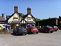 Sutherland Arms - geograph.org.uk - 423515.jpg 640 × 480; 116 KB
-
 The Grigg - geograph.org.uk - 423519.jpg 640 × 480; 124 KB
-
 This way to the church - geograph.org.uk - 821173.jpg 640 × 480; 77 KB
-
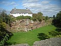
 Tibberton Manor. - geograph.org.uk - 424388.jpg 640 × 480; 122 KB
-
 Tibberton Methodist Chapel - geograph.org.uk - 4292408.jpg 1,142 × 857; 372 KB
-
 Tibberton Moor - geograph.org.uk - 423494.jpg 640 × 480; 132 KB
-
 Tibberton trig and the B5062 - geograph.org.uk - 4285151.jpg 857 × 1,142; 503 KB
-
 Access road to The Birch Moors - geograph.org.uk - 999380.jpg 640 × 480; 58 KB
-
 Bridge - geograph.org.uk - 326748.jpg 640 × 480; 122 KB
-
 Common Farm - geograph.org.uk - 644701.jpg 640 × 480; 56 KB
-
 Common Farm at Bolas Heath - geograph.org.uk - 570197.jpg 640 × 480; 156 KB
-
 Conquermoor Heath - geograph.org.uk - 425799.jpg 640 × 480; 127 KB
-
 Crossroads. - geograph.org.uk - 424396.jpg 640 × 480; 63 KB
-
 Farm Buildings. - geograph.org.uk - 424400.jpg 640 × 480; 54 KB
-
 Farm Track. - geograph.org.uk - 424390.jpg 640 × 480; 82 KB
-
 House and Trees. - geograph.org.uk - 420728.jpg 640 × 480; 71 KB
-
 Howle Pond - geograph.org.uk - 227796.jpg 640 × 480; 120 KB
-
 Howle Pool Farm House - geograph.org.uk - 320033.jpg 640 × 512; 113 KB
-
 Junction at Holywell - geograph.org.uk - 227793.jpg 640 × 480; 100 KB
-
 Lane leading to Dodecote Grange - geograph.org.uk - 644704.jpg 640 × 480; 77 KB
-
 Lane through the Woodland. - geograph.org.uk - 420692.jpg 640 × 480; 95 KB
-
 Pheasant and Thatch. - geograph.org.uk - 424394.jpg 640 × 480; 75 KB
-
 Road Bridge. - geograph.org.uk - 630179.jpg 640 × 480; 130 KB
-
 Rodway Manor - geograph.org.uk - 417023.jpg 640 × 480; 138 KB
-
 Springfield Farm House - geograph.org.uk - 228321.jpg 640 × 480; 114 KB
-
 Standford Hall Farm. - geograph.org.uk - 424208.jpg 640 × 480; 73 KB
-
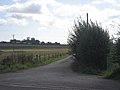
 The road forks at Conquermoor Heath - geograph.org.uk - 417028.jpg 640 × 480; 101 KB

.jpg)


