Category:Toponymic maps of Germany
Countries of Europe: France‡ · Germany · Netherlands‡ · Spain‡ · Sweden · Turkey‡ · United Kingdom
‡: partly located in Europe
‡: partly located in Europe
Subcategories
This category has only the following subcategory.
F
- Field name maps of Germany (20 F)
Media in category "Toponymic maps of Germany"
The following 18 files are in this category, out of 18 total.
-
 KOCH(1896) p024 Flurnamen.jpg 1,001 × 1,105; 633 KB
-
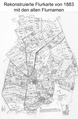 Flurkarte 1883.pdf 1,120 × 1,712; 1.18 MB
-
 Flurnamenkarte Ruethen.JPG 3,188 × 3,456; 4.69 MB
-
 Gottenheim Karte 1883.jpg 1,920 × 1,080; 434 KB
-
 HistorischeFlurnamenWendershagen.png 552 × 670; 183 KB
-

-
 Ortsnamen Dorf.png 1,492 × 1,171; 2.76 MB
-
 Ortsnamen Hausen Feld.png 1,492 × 1,171; 2.76 MB
-
 Ortsnamen Hausen.png 1,492 × 1,171; 2.74 MB
-
 Ortsnamen Ic.png 1,492 × 1,171; 2.75 MB
-
 Ortsnamen Ingen Ungen Heim.png 1,492 × 1,171; 2.76 MB
-
 Ortsnamen Leben.png 1,492 × 1,171; 2.74 MB
-
 Ortsnamen Roda.png 1,492 × 1,171; 2.75 MB
-
 Ortsnamen Städt.png 1,492 × 1,171; 2.74 MB
-
 Ortsnamenendung-itz.png 2,283 × 2,898; 9.16 MB
-
 Ortsnamenendung-ow.png 2,283 × 2,898; 9.19 MB
-
 Siedlungsstruktur Thüringen.png 1,492 × 1,171; 3.13 MB
-
 Verbreitung bestimmter Ortsnamen im mittleren Württemberg.png 9,094 × 6,431; 7.35 MB
_p024_Flurnamen.jpg)


.jpg)


