Category:Trails in Massachusetts
States of the United States: Alabama · Alaska · Arizona · Arkansas · California · Colorado · Connecticut · Delaware · Florida · Georgia · Hawaii · Idaho · Illinois · Indiana · Iowa · Kansas · Kentucky · Louisiana · Maine · Maryland · Massachusetts · Michigan · Minnesota · Mississippi · Missouri · Montana · Nebraska · Nevada · New Hampshire · New Jersey · New Mexico · New York · North Carolina · North Dakota · Ohio · Oklahoma · Oregon · Pennsylvania · Rhode Island · South Carolina · South Dakota · Tennessee · Texas · Utah · Vermont · Virginia · Washington · West Virginia · Wisconsin · Wyoming – Washington, D.C.
Puerto Rico
Puerto Rico
Subcategories
This category has the following 12 subcategories, out of 12 total.
A
- Alewife Greenway Path (10 F)
- Anawan Rock (9 F)
B
- Bay Circuit Trail (5 F)
C
E
G
H
L
M
P
- Province Lands Bike Trail (5 F)
R
Media in category "Trails in Massachusetts"
The following 45 files are in this category, out of 45 total.
-

-

-

-
 Appleton Farms Grass Rides, Hamilton MA.jpg 4,032 × 3,024; 6.07 MB
-
 Battle Road Trail boardwalk, Lincoln MA.jpg 3,264 × 2,448; 3.33 MB
-
 Blue Trail, Centre Street Conservation Corridor, Dover MA.jpg 4,032 × 3,024; 6.23 MB
-
 Broad Cove Coastal Access Trail, Somerset Massachusetts.jpg 3,000 × 2,250; 3.3 MB
-
 Chappaquiddick Island Trail.jpg 3,872 × 2,592; 5.13 MB
-
 Charles River Link Trail, Chase Woodlands, Dover MA.jpg 3,264 × 2,448; 3.8 MB
-
 Corridor 71, Spencer State Forest, Spencer MA.jpg 2,272 × 1,704; 2.22 MB
-
 Dingley Dell Opacum Land Trust, Brimfield MA.jpg 4,032 × 3,024; 5.62 MB
-
 Dolbear Trail, Cormier Woods, Uxbridge MA.jpg 3,072 × 2,304; 3.04 MB
-
 Dry Hill, New Marlborough MA.jpg 3,072 × 2,304; 2.67 MB
-
 Foss Farm, Carlisle MA.jpg 4,032 × 3,024; 7.24 MB
-
 Iron Horse Trail, Lincoln MA.jpg 4,032 × 3,024; 7.48 MB
-
 Laura's Tower - Stockbridge, Massachusetts - 10972454615.jpg 3,072 × 2,304; 1.73 MB
-
 Line of March of the Acton Minutemen, Acton MA.jpg 2,272 × 1,704; 1.89 MB
-
 Malcolm Preserve, Carlisle MA.jpg 2,272 × 1,704; 1.31 MB
-
 Malden River Walk, April 2017.JPG 4,320 × 2,884; 3.7 MB
-
 Meagherville Conservation Area, Lexington MA.jpg 4,032 × 3,024; 7.24 MB
-
 NPS cape-cod-biking-nauset-trail.jpg 1,194 × 594; 111 KB
-
 Woodland Path, Lenox, Mass (NYPL b12647398-75728).tiff 1,616 × 2,384; 11.03 MB
-
 Park at Salem station (2), December 2018.jpg 5,472 × 3,648; 9.37 MB
-
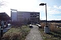
 Park at Salem station (4), December 2018.jpg 5,472 × 3,648; 6.89 MB
-
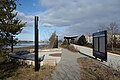 Park at Salem station (5), December 2018.jpg 5,472 × 3,648; 6.68 MB
-
 Park benches at Salem station, December 2018.jpg 5,472 × 3,648; 8.81 MB
-
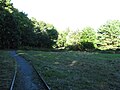
 Path, Halfway Pond, Plymouth MA.jpg 4,032 × 3,024; 7.57 MB
-
 Peabody Branch pedestrian crossing at Salem station, December 2018.jpg 5,472 × 3,648; 9.14 MB
-
 Pout Rock.jpg 4,032 × 3,024; 5.62 MB
-
 Questing, New Marlborough MA.jpg 3,072 × 2,304; 3.31 MB
-
 Red Line Path, Westford MA.jpg 4,032 × 3,024; 6.86 MB
-
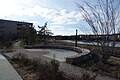
 Salem station garage and park, December 2018.jpg 5,472 × 3,648; 5.85 MB
-
 Sanborn and Lightning Tree Reservations sign, Andover MA.jpg 4,032 × 3,024; 4.74 MB
-
 Stone Arch Bridge Trail, Westford MA.jpg 4,032 × 3,024; 6.92 MB
-
 Trail C14 sign, Carlisle MA.jpg 4,032 × 3,024; 6.64 MB
-
 Trail C14, Carlisle MA.jpg 4,032 × 3,024; 7.16 MB
-
 Trail leading into Wilson Mountain Reservation, Dedham MA.jpg 2,272 × 1,704; 2.11 MB
-
 Trail off North St, Willards Woods, Lexington MA.jpg 3,264 × 2,448; 3.58 MB
-
 Trail signs, Mt Pisgah Conservation Area, Northborough MA.jpg 4,032 × 3,024; 7.09 MB
-
 Trail to Adams Woods, Lincoln MA.jpg 4,032 × 3,024; 6.14 MB
-
 Trail, Smith Conservation Land, Littleton MA.jpg 4,032 × 3,024; 6.59 MB
-
 Trail, Walden Pond, Concord MA.jpg 3,072 × 2,304; 2.67 MB
-
 Tully Mountain Massachusetts.jpg 873 × 581; 445 KB
-
 Tully Trail, Jacobs Hill, Royalston MA.jpg 3,072 × 2,304; 2.77 MB
-
 Warner Trail, Moose Hill Wildlife Sanctuary, Sharon MA.jpg 3,264 × 2,448; 3.43 MB


,_December_2018.jpg)
,_December_2018.jpg)
,_December_2018.jpg)


