Category:Travel maps of Georgia (U.S. state)
States of the United States: Alabama · Alaska · Arizona · Arkansas · California · Colorado · Delaware · Florida · Georgia · Hawaii · Idaho · Illinois · Indiana · Iowa · Kansas · Kentucky · Louisiana · Maine · Maryland · Massachusetts · Michigan · Minnesota · Mississippi · Missouri · Montana · Nebraska · Nevada · New Hampshire · New Jersey · New Mexico · New York · North Carolina · North Dakota · Ohio · Oklahoma · Oregon · Pennsylvania · Rhode Island · South Carolina · South Dakota · Tennessee · Texas · Utah · Virginia · Washington · Wisconsin · Wyoming – Washington, D.C.
American Samoa · Guam · Northern Mariana Islands · Puerto Rico
American Samoa · Guam · Northern Mariana Islands · Puerto Rico
Subcategories
This category has the following 2 subcategories, out of 2 total.
Media in category "Travel maps of Georgia (U.S. state)"
The following 5 files are in this category, out of 5 total.
-
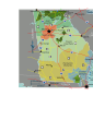
 Counties of Historic Highland Region of GA.png 611 × 351; 50 KB
-
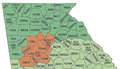
 Counties Sub Regions.png 494 × 309; 40 KB
-
 Cumberland Island National Seashore map 2007.08.jpg 1,723 × 3,123; 452 KB
-
 Georgia (state) regions map.png 1,800 × 1,896; 1.19 MB
-
 Georgia (state) regions map.svg 744 × 1,052; 1.04 MB


_regions_map.png)
_regions_map.svg)