Category:Travel maps of Illinois
States of the United States: Alabama · Alaska · Arizona · Arkansas · California · Colorado · Delaware · Florida · Georgia · Hawaii · Idaho · Illinois · Indiana · Iowa · Kansas · Kentucky · Louisiana · Maine · Maryland · Massachusetts · Michigan · Minnesota · Mississippi · Missouri · Montana · Nebraska · Nevada · New Hampshire · New Jersey · New Mexico · New York · North Carolina · North Dakota · Ohio · Oklahoma · Oregon · Pennsylvania · Rhode Island · South Carolina · South Dakota · Tennessee · Texas · Utah · Virginia · Washington · Wisconsin · Wyoming – Washington, D.C.
American Samoa · Guam · Northern Mariana Islands · Puerto Rico
American Samoa · Guam · Northern Mariana Islands · Puerto Rico
Subcategories
This category has the following 2 subcategories, out of 2 total.
T
- Travel maps of Chicago (74 F)
Media in category "Travel maps of Illinois"
The following 6 files are in this category, out of 6 total.
-
 GalenaMap.png 2,088 × 1,648; 725 KB
-
 Illinois regions map (ru).png 1,551 × 2,700; 648 KB
-
 Illinois regions map heb.png 1,972 × 3,377; 526 KB
-
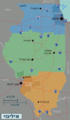
 Illinois regions map.png 1,551 × 2,700; 651 KB
-
 Illinois regions map.svg 744 × 1,052; 1.73 MB
-
 LittleEgyptSouthernIllinois.jpg 1,236 × 937; 178 KB

.png)


