Category:Tretire with Michaelchurch
civil parish in Herefordshire, England | |||||
| Upload media | |||||
| Instance of | |||||
|---|---|---|---|---|---|
| Location | Herefordshire, West Midlands, England | ||||
 | |||||

Subcategories
This category has the following 2 subcategories, out of 2 total.
M
T
Media in category "Tretire with Michaelchurch"
The following 99 files are in this category, out of 99 total.
-
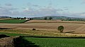
 Across the fields - geograph.org.uk - 6369052.jpg 1,600 × 1,200; 943 KB
-
 Approaching Tretire - geograph.org.uk - 4651311.jpg 640 × 480; 152 KB
-
 Ash trees by a footpath - geograph.org.uk - 1072693.jpg 640 × 480; 186 KB
-
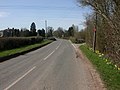
 B4521 at Tretire - geograph.org.uk - 6178622.jpg 1,024 × 767; 185 KB
-
 Barn at Crossways - geograph.org.uk - 947334.jpg 640 × 480; 188 KB
-
 Benchmark, Michaelchurch church - geograph.org.uk - 3399229.jpg 3,000 × 2,000; 5.46 MB
-
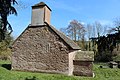
 Church of St Mary, Tretire - geograph.org.uk - 3399941.jpg 3,456 × 4,056; 6.56 MB
-
 Church of St Michael the Archangel, Michaelchurch - geograph.org.uk - 3398776.jpg 3,000 × 2,000; 5.96 MB
-
 Church of St Michael the Archangel, Michaelchurch - geograph.org.uk - 3399215.jpg 3,500 × 2,298; 7.27 MB
-
 Church of St Michael the Archangel, Michaelchurch - geograph.org.uk - 3399225.jpg 3,000 × 2,000; 5.08 MB
-
 Churchyard cross, Tretire - geograph.org.uk - 3400157.jpg 3,139 × 4,016; 7.71 MB
-
 Country lane to Treberon - geograph.org.uk - 1073289.jpg 640 × 457; 77 KB
-
 Country road heading east - geograph.org.uk - 948179.jpg 640 × 480; 179 KB
-
 Crossways - with approaching downpour - geograph.org.uk - 947332.jpg 640 × 480; 99 KB
-
 East Window, Tretire Church - geograph.org.uk - 3399843.jpg 2,909 × 4,074; 7.77 MB
-
 Fisher family tombs, Michaelchurch - geograph.org.uk - 3399622.jpg 3,000 × 2,000; 6.42 MB
-
 Footpath to Tretire - geograph.org.uk - 6369045.jpg 1,600 × 900; 513 KB
-
 Gamber Valley - geograph.org.uk - 1072608.jpg 640 × 480; 155 KB
-
 Harvest in at Michaelchurch - geograph.org.uk - 947337.jpg 640 × 480; 176 KB
-
 Heading east to Michaelchurch - geograph.org.uk - 1073286.jpg 640 × 480; 109 KB
-
 Here lies Matthew Davis ..... - geograph.org.uk - 5134040.jpg 3,248 × 2,160; 2.28 MB
-

-
 Inscription, roman altar , Michaelchurch church - geograph.org.uk - 3399656.jpg 5,184 × 3,456; 7.56 MB
-
 Interior of St Mary's church, Tretire - geograph.org.uk - 3399919.jpg 5,085 × 3,350; 7.54 MB
-
 Kneeling angel, Michaelchurch - geograph.org.uk - 5138620.jpg 2,161 × 3,251; 1.27 MB
-
 Lane from Tretire - geograph.org.uk - 6022532.jpg 1,600 × 901; 661 KB
-
 Marshy ground in the Gamber Valley - geograph.org.uk - 1072657.jpg 640 × 480; 128 KB
-
 Matchstick timber - geograph.org.uk - 3727246.jpg 600 × 800; 293 KB
-
 Michaelchurch House - geograph.org.uk - 5136409.jpg 3,284 × 2,183; 2.07 MB
-
 Narrow lane near Kilbreece - geograph.org.uk - 6007543.jpg 1,600 × 900; 413 KB
-
 Ordnance Survey Cut Mark - geograph.org.uk - 5209759.jpg 4,000 × 3,000; 4.51 MB
-
 Ordnance Survey Cut Mark - geograph.org.uk - 6128204.jpg 1,024 × 756; 372 KB
-
 Ordnance Survey Cut Mark - geograph.org.uk - 6128205.jpg 1,024 × 839; 442 KB
-
 Ordnance Survey Cut Mark - geograph.org.uk - 6128206.jpg 1,024 × 809; 165 KB
-
 Path to Michaelchurch - geograph.org.uk - 3399751.jpg 3,000 × 2,041; 5.06 MB
-
 Pond, churchyard, Michaelchurch - geograph.org.uk - 3399609.jpg 3,000 × 1,845; 6.01 MB
-
 Poplar plantation near Pencoyd Court Farm - geograph.org.uk - 4760792.jpg 1,600 × 1,202; 946 KB
-
 Poplar wood in the Gamber valley - geograph.org.uk - 3727241.jpg 800 × 450; 193 KB
-
 Poultry units at Aberhall Farm - geograph.org.uk - 3727235.jpg 800 × 450; 218 KB
-
 Red fields of Michaelchurch - geograph.org.uk - 3399732.jpg 3,000 × 2,000; 5.35 MB
-
 Roman altar , Michaelchurch church - geograph.org.uk - 3399720.jpg 2,087 × 3,355; 4.76 MB
-
 St Mary, Tretire - geograph.org.uk - 5038431.jpg 3,248 × 2,160; 2.98 MB
-
 St Mary, Tretire - geograph.org.uk - 5038444.jpg 3,248 × 2,160; 2.79 MB
-
 St Mary, Tretire - geograph.org.uk - 5038461.jpg 3,248 × 2,160; 1.45 MB
-
 St Mary, Tretire - geograph.org.uk - 5038467.jpg 2,160 × 3,248; 1.38 MB
-
 St Mary, Tretire - geograph.org.uk - 5038476.jpg 3,289 × 2,187; 1.54 MB
-
 St Mary, Tretire - geograph.org.uk - 5038481.jpg 2,160 × 3,248; 1.23 MB
-
 St Mary, Tretire - geograph.org.uk - 5038489.jpg 2,163 × 3,254; 1.56 MB
-
 St Mary, Tretire - geograph.org.uk - 5038494.jpg 3,257 × 2,140; 1.94 MB
-
 St Mary, Tretire - geograph.org.uk - 5038518.jpg 3,273 × 2,176; 2.13 MB
-
 St Mary, Tretire - geograph.org.uk - 5038523.jpg 3,273 × 2,176; 2.59 MB
-
 St Mary, Tretire - geograph.org.uk - 5038534.jpg 3,248 × 2,160; 1.53 MB
-
 St Michael the Archangel (interior), Michaelchurch - geograph.org.uk - 3398790.jpg 5,184 × 3,456; 6.31 MB
-
 St Michael ^ Serpent choir stall finial, Michaelchurch - geograph.org.uk - 3398383.jpg 2,472 × 4,338; 4.76 MB
-
 St Michael, Michaelchurch - geograph.org.uk - 5133855.jpg 3,248 × 2,160; 2.19 MB
-
 St Michael, Michaelchurch - geograph.org.uk - 5133872.jpg 3,248 × 2,160; 2.47 MB
-
 St Michael, Michaelchurch - geograph.org.uk - 5133879.jpg 3,248 × 2,160; 1.8 MB
-
 St Michael, Michaelchurch - geograph.org.uk - 5136407.jpg 2,184 × 1,132; 848 KB
-
 St Michael, Michaelchurch - geograph.org.uk - 5138402.jpg 3,248 × 2,160; 1.41 MB
-
 St Michael, Michaelchurch - geograph.org.uk - 5138424.jpg 3,297 × 2,192; 1.31 MB
-
 St Michael, Michaelchurch - geograph.org.uk - 5138461.jpg 2,160 × 3,248; 1.25 MB
-
 St Michael, Michaelchurch - geograph.org.uk - 5139200.jpg 3,174 × 2,051; 1.12 MB
-
 St Michael, Michaelchurch - geograph.org.uk - 5139502.jpg 3,248 × 2,160; 1.4 MB
-
 St Michael, Michaelchurch - geograph.org.uk - 5139619.jpg 5,523 × 3,671; 3.98 MB
-
 St Michael, Michaelchurch - geograph.org.uk - 5139720.jpg 3,248 × 2,160; 1,006 KB
-
 St Michael, Michaelchurch - geograph.org.uk - 5139751.jpg 2,191 × 3,296; 1.33 MB
-
 St Michael, Michaelchurch - geograph.org.uk - 5139766.jpg 2,144 × 3,225; 1.45 MB
-
 St Michael, Michaelchurch - geograph.org.uk - 5234809.jpg 2,160 × 3,248; 2.27 MB
-
 St Michael, Michaelchurch - geograph.org.uk - 5234812.jpg 3,294 × 2,190; 1.5 MB
-
 St Michael, Michaelchurch - geograph.org.uk - 5235084.jpg 3,248 × 2,160; 2.83 MB
-
 St Michael, Michaelchurch - geograph.org.uk - 5235088.jpg 3,248 × 2,160; 3.23 MB
-
 St Michael, Michaelchurch - geograph.org.uk - 5235094.jpg 3,306 × 2,197; 3.08 MB
-

-
 Strawberry rows near Trevase Farm - geograph.org.uk - 3772292.jpg 800 × 450; 205 KB
-
 The Church of St Mary at Tretire - geograph.org.uk - 5209762.jpg 4,000 × 3,000; 3.29 MB
-
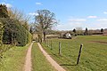 The lane from Tretire church - geograph.org.uk - 3400710.jpg 3,000 × 2,000; 5.7 MB
-
 Tretire Bridge - geograph.org.uk - 1810765.jpg 1,024 × 768; 223 KB
-
 Tretire House Farm - geograph.org.uk - 5038554.jpg 3,294 × 2,002; 1.63 MB
-
 Tretire war memorial - geograph.org.uk - 3400127.jpg 2,804 × 2,671; 3.88 MB
-
 Trevase Farm - geograph.org.uk - 946894.jpg 640 × 377; 69 KB
-
 Tympanum, Michaelchurch - geograph.org.uk - 3398752.jpg 4,000 × 2,801; 7.58 MB
-
 Upper Barn, Tretire - geograph.org.uk - 3400728.jpg 4,138 × 2,554; 5.59 MB
-
 Upper Barn, Tretire - geograph.org.uk - 3400748.jpg 3,983 × 2,820; 6.47 MB
-
 Upper Heath Wood - geograph.org.uk - 979038.jpg 640 × 351; 66 KB
-
 View across the 'Gambler' valley - geograph.org.uk - 6007545.jpg 1,600 × 900; 486 KB
-
 View east along the Gamber Valley - geograph.org.uk - 1072672.jpg 640 × 480; 145 KB
-
 View from the valley bottom - geograph.org.uk - 1072644.jpg 640 × 446; 72 KB
-
 View north to Crossways - geograph.org.uk - 979203.jpg 640 × 425; 149 KB
-
 View southwest to St Weonards - geograph.org.uk - 1073511.jpg 640 × 480; 145 KB
-
 View to Garway Hill - geograph.org.uk - 3727236.jpg 800 × 450; 226 KB
-
 View towards Tretire Court - geograph.org.uk - 1072684.jpg 640 × 480; 115 KB
-
 View west to Trevase Farm - geograph.org.uk - 947288.jpg 640 × 466; 129 KB
-
 Wheat field east of Trevase Farm - geograph.org.uk - 946899.jpg 640 × 395; 90 KB
-
 Whitehouse Farm, 2 - geograph.org.uk - 3727206.jpg 800 × 450; 221 KB
-
 Whitehouse Farm, 2020 - geograph.org.uk - 6369042.jpg 1,600 × 900; 447 KB
-
 Whitehouse Farm, five years on - geograph.org.uk - 3727205.jpg 800 × 450; 226 KB
-
 Winter treeline - geograph.org.uk - 1073497.jpg 640 × 447; 139 KB
-
 Farmhouse at the crossroads - geograph.org.uk - 713641.jpg 640 × 480; 129 KB
-
 Trevase Farm, Michaelchurch - geograph.org.uk - 128977.jpg 640 × 426; 105 KB


,_Michaelchurch_-_geograph.org.uk_-_3398790.jpg)


