Category:United Kingdom photographs taken on 2004-02-08
| ← | Sunday 8 February 2004 | → | ||
| ← | February 2004 | → | ||

United Kingdom photographs taken on 8 February 2004.
Image files should be categorized here automatically using {{taken on}} template. Direct categorisation is also possible, if automatic is impossible.
Subcategories
This category has only the following subcategory.
Media in category "United Kingdom photographs taken on 2004-02-08"
The following 45 files are in this category, out of 45 total.
-
 A snow plastered dyke - geograph.org.uk - 286163.jpg 640 × 480; 104 KB
-
 A127 - Southend bound carriageway - geograph.org.uk - 166134.jpg 480 × 640; 55 KB
-
 Caerphilly Castle - geograph.org.uk - 21681.jpg 640 × 480; 101 KB
-
 Canada water drum.jpg 450 × 600; 67 KB
-
 Carlavin Hill - geograph.org.uk - 286165.jpg 640 × 390; 89 KB
-
 Chelmorton 104398 137b3cea.jpg 640 × 480; 100 KB
-
 Church of St. Nicholas, Wilsford - geograph.org.uk - 1141679.jpg 640 × 512; 64 KB
-
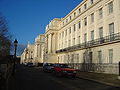 Cumberland Terrace.JPG 2,592 × 1,944; 2.2 MB
-
 Deepdale - geograph.org.uk - 39803.jpg 640 × 479; 93 KB
-
 All Saints church East Meon - geograph.org.uk - 431982.jpg 640 × 480; 198 KB
-
 Fabulous Tournai marble font East Meon - geograph.org.uk - 431985.jpg 640 × 480; 211 KB
-
 Fabulous Tournai marble font East Meon - geograph.org.uk - 431986.jpg 640 × 480; 215 KB
-
 Fabulous Tournai marble font East Meon - geograph.org.uk - 431989.jpg 640 × 480; 201 KB
-
 Felled Oaks - geograph.org.uk - 166096.jpg 480 × 640; 102 KB
-
 Formal garden Warnford Park - geograph.org.uk - 432100.jpg 640 × 480; 209 KB
-
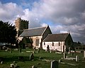
 Church of St. Mary, Freeby - geograph.org.uk - 73796.jpg 640 × 480; 92 KB
-
 Glentress. - geograph.org.uk - 12222.jpg 640 × 456; 89 KB
-
 Hucknall Tram terminus - geograph.org.uk - 23111.jpg 640 × 480; 107 KB
-
 Lane near Shobrooke Mill - geograph.org.uk - 965458.jpg 640 × 480; 171 KB
-

-
 Mercat Cross, Wester Pencaitland - geograph.org.uk - 11226.jpg 640 × 480; 88 KB
-
 New Hedge Planting - geograph.org.uk - 58063.jpg 640 × 479; 150 KB
-
 Organsdale fields - geograph.org.uk - 282733.jpg 640 × 480; 98 KB
-
 Outwood Windmill.jpg 640 × 425; 77 KB
-
 Patching Church - geograph.org.uk - 18770.jpg 640 × 480; 66 KB
-
 Primrosehill Wood - geograph.org.uk - 282730.jpg 640 × 480; 178 KB
-
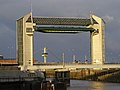 River Hull tidal barrier 1.jpg 640 × 481; 83 KB
-
 River Severn breaks its banks. - geograph.org.uk - 1079142.jpg 640 × 480; 82 KB
-
 Snowdrops at the Church at Howick Hall - geograph.org.uk - 1066696.jpg 640 × 480; 127 KB
-

-

-
 Sunset at Shobrooke, 8 February 2004 - geograph.org.uk - 943448.jpg 640 × 480; 19 KB
-
 Tay Rail bridge - geograph.org.uk - 8364.jpg 640 × 480; 93 KB
-

-
 Tweseldown Hill on Race Day - geograph.org.uk - 764845.jpg 640 × 480; 58 KB
-
 Worcester floods (2004) - geograph.org.uk - 1079180.jpg 640 × 480; 101 KB
-
 'Prehistoric' Ancient Monument sign - geograph.org.uk - 1085977.jpg 499 × 640; 141 KB
-
 Cutting on Torphichen Hill. - geograph.org.uk - 12225.jpg 640 × 480; 101 KB
-
 Elibank Forest - geograph.org.uk - 339993.jpg 640 × 480; 86 KB
-
 Hadleigh Gt. Wood - The Bomb Crater - geograph.org.uk - 150352.jpg 480 × 640; 165 KB
-
 Old Quarry, Rogate, West Sussex - geograph.org.uk - 52719.jpg 640 × 480; 130 KB
-
 Prittle Brook - geograph.org.uk - 166103.jpg 480 × 640; 162 KB
-
 The Breadstones at Great Wishford - geograph.org.uk - 84118.jpg 640 × 480; 129 KB
-
 The North Sea Ferries Terminal - geograph.org.uk - 9831.jpg 640 × 480; 85 KB
-
 The River Humber - geograph.org.uk - 271417.jpg 640 × 480; 44 KB


_-_geograph.org.uk_-_1079180.jpg)


