Category:United Kingdom photographs taken on 2004-09-22
Countries of Europe: Austria · Belarus · Belgium · France‡ · Germany · Greece · Republic of Ireland · Malta · Norway · Portugal‡ · Russia‡ · Spain‡ · Switzerland · United Kingdom
‡: partly located in Europe
‡: partly located in Europe
| ← | 22 September 2004 | → | ||
| ← | September 2004 | → | ||

United Kingdom photographs taken on 22 September 2004.
Image files should be categorized here automatically using {{taken on}} template. Direct categorisation is also possible, if automatic is impossible.
Media in category "United Kingdom photographs taken on 2004-09-22"
The following 73 files are in this category, out of 73 total.
-
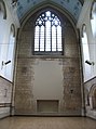
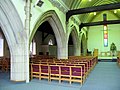
 All Saints, Old Church Road, Chingford - Chancel - geograph.org.uk - 1702154.jpg 741 × 1,000; 103 KB
-

-

-

-

-
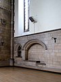
 All Saints, Old Church Road, Chingford - Indent - geograph.org.uk - 1702146.jpg 879 × 1,000; 431 KB
-
-

-

-

-

-

-
-

-
-

-

-

-

-
 All Saints, Old Church Road, Chingford - Window - geograph.org.uk - 1702101.jpg 1,000 × 998; 252 KB
-
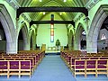
 Altar in St Laurence church, Catford - geograph.org.uk - 946275.jpg 640 × 480; 65 KB
-
 Arbor Low, Stone Circle and Henge - geograph.org.uk - 944630.jpg 640 × 480; 38 KB
-
 Barn at Yew Grange Farm, Glaisdale - geograph.org.uk - 77212.jpg 427 × 640; 127 KB
-
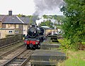 Black Five leaving Grosmont - geograph.org.uk - 795401.jpg 640 × 501; 107 KB
-
 Contorted slate at Hayle Bay - geograph.org.uk - 629405.jpg 640 × 480; 418 KB
-
 Digley Reservoir - geograph.org.uk - 21212.jpg 640 × 480; 88 KB
-
 Fenced in - geograph.org.uk - 902847.jpg 466 × 640; 100 KB
-
 Glaisdale Village - geograph.org.uk - 77124.jpg 640 × 427; 95 KB
-

-
 Glasidale Rigg Trig Point - geograph.org.uk - 77198.jpg 640 × 427; 112 KB
-
 Holy Trinity Church, Charlton - geograph.org.uk - 56996.jpg 640 × 480; 140 KB
-
 Interior of St Antony's church - geograph.org.uk - 946260.jpg 384 × 640; 69 KB
-
 Mallyan Spout, Goathland - geograph.org.uk - 548221.jpg 427 × 640; 79 KB
-
 Middlehill Down - geograph.org.uk - 57027.jpg 640 × 480; 165 KB
-
 Shiny Brook Clough - geograph.org.uk - 21215.jpg 640 × 480; 73 KB
-
 Skull and crossbones - geograph.org.uk - 205676.jpg 640 × 416; 71 KB
-

-

-

-

-

-

-
-
-

-

-

-
-

-
-

-

-

-
 St Stephen, Copeland Road, London E17 - geograph.org.uk - 1716695.jpg 1,000 × 656; 147 KB
-

-
 Stepping stones at Cuaig - geograph.org.uk - 64274.jpg 640 × 480; 96 KB
-
 The Local "Axe and Compass" - geograph.org.uk - 30891.jpg 640 × 451; 124 KB
-
 Ullagolf, Discgolf course Ullapool - geograph.org.uk - 39016.jpg 640 × 206; 50 KB
-
 West End Farm, Pembridge, Herefordshire - geograph.org.uk - 11236.jpg 640 × 480; 124 KB
-
 Arn Hill - geograph.org.uk - 57039.jpg 640 × 480; 176 KB
-
 Arnhill Plantation - geograph.org.uk - 57036.jpg 640 × 480; 155 KB
-
 Billberry Reservoir - geograph.org.uk - 21213.jpg 640 × 480; 60 KB
-

-
 Furzewick Farm - geograph.org.uk - 57034.jpg 640 × 480; 184 KB
-
 Gate Post at Wintergill, Glaisdale - geograph.org.uk - 77223.jpg 640 × 427; 119 KB
-
 Low Gill Beck Farm, Glaisdale - geograph.org.uk - 77240.jpg 640 × 427; 115 KB
-
 Pastoral scene, Glaisdale - geograph.org.uk - 77247.jpg 640 × 427; 96 KB
-
 Race horse gallops - geograph.org.uk - 57024.jpg 640 × 480; 131 KB
-
 Reservoir at Larkhill - geograph.org.uk - 57007.jpg 640 × 480; 135 KB
-
 Tumulus - geograph.org.uk - 57017.jpg 640 × 480; 142 KB
-
 Tumulus - geograph.org.uk - 57030.jpg 640 × 480; 151 KB
-
 Wessenden Head Reservoir - geograph.org.uk - 21214.jpg 640 × 480; 65 KB
-
 Wintergill Plantation, Glaisdale - geograph.org.uk - 77233.jpg 640 × 427; 130 KB


