Category:United Kingdom photographs taken on 2004-10-08
Countries of Europe: Croatia · Germany · Italy · Netherlands‡ · Poland · Portugal‡ · Russia‡ · Ukraine · United Kingdom
‡: partly located in Europe
‡: partly located in Europe
| ← | 8 October 2004 | → | ||
| ← | October 2004 | → | ||

United Kingdom photographs taken on 8 October 2004.
Image files should be categorized here automatically using {{taken on}} template. Direct categorisation is also possible, if automatic is impossible.
Media in category "United Kingdom photographs taken on 2004-10-08"
The following 40 files are in this category, out of 40 total.
-
 Antwicks Stud at Letcombe Regis. - geograph.org.uk - 67209.jpg 640 × 480; 179 KB
-
 Barrow - Broomhill Orchard Farm.jpg 640 × 480; 113 KB
-
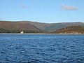 Big House Saddell Bay - geograph.org.uk - 56511.jpg 640 × 480; 104 KB
-
 Black Wood, Eisingrug - geograph.org.uk - 108118.jpg 640 × 480; 148 KB
-
 Carse of Kinneil - geograph.org.uk - 8900.jpg 640 × 480; 81 KB
-
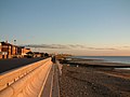 Cleveleys Promenade South - geograph.org.uk - 823217.jpg 640 × 480; 98 KB
-
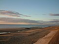 Cleveleys Sand - geograph.org.uk - 823198.jpg 640 × 480; 95 KB
-
 Crumpwood Weir - geograph.org.uk - 413004.jpg 640 × 480; 102 KB
-

-
 Footpath above Car Park in Glen Nevis - geograph.org.uk - 68450.jpg 640 × 480; 102 KB
-
 Gypsum train nr Helm Tunnel - geograph.org.uk - 1664169.jpg 640 × 432; 82 KB
-
 Harrods (230030248).jpg 2,080 × 1,544; 1,002 KB
-
 Hedon Road Hull - geograph.org.uk - 10396.jpg 640 × 480; 90 KB
-
 Kitchen Corner, Worm's Head - geograph.org.uk - 124158.jpg 640 × 480; 90 KB
-
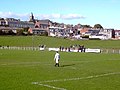 Ladywell Stadium, Maybole. Football ground - geograph.org.uk - 52506.jpg 640 × 481; 104 KB
-
 Lairig Ghru from Whitewell - geograph.org.uk - 269550.jpg 640 × 480; 101 KB
-
 Loch Gamhna - geograph.org.uk - 266593.jpg 640 × 480; 154 KB
-
 London Traffic (230032487).jpg 2,080 × 1,544; 1.09 MB
-
 Old Door - geograph.org.uk - 169894.jpg 480 × 640; 148 KB
-
 Rhossili Bay - geograph.org.uk - 124183.jpg 640 × 480; 65 KB
-
 Saddell Castle and Big House Saddell Bay - geograph.org.uk - 56509.jpg 640 × 480; 106 KB
-
 Seventy Bridge - geograph.org.uk - 413486.jpg 640 × 480; 135 KB
-

-
 The Devils Ridge, Sgurr a Mhaim - geograph.org.uk - 68418.jpg 640 × 480; 90 KB
-
 The Maid of the Loch at Balloch - geograph.org.uk - 866223.jpg 479 × 640; 77 KB
-
 The Sparrow at Letcombe Regis - geograph.org.uk - 67214.jpg 640 × 480; 128 KB
-
 Tiverton Church - geograph.org.uk - 109594.jpg 640 × 480; 88 KB
-
 Trench Point, Campbeltown Loch, Kintyre. - geograph.org.uk - 61193.jpg 640 × 480; 122 KB
-
 Treslea Cross - geograph.org.uk - 169896.jpg 640 × 480; 147 KB
-
 Warborough Farm - geograph.org.uk - 67215.jpg 640 × 480; 136 KB
-
 Wey Valley walks - geograph.org.uk - 31374.jpg 640 × 360; 88 KB
-
 Agilent Technologies - geograph.org.uk - 508401.jpg 640 × 480; 144 KB
-
 Barr Thormaid seen from Kilmory Ross - geograph.org.uk - 343185.jpg 640 × 615; 108 KB
-
 Falls - geograph.org.uk - 9774.jpg 640 × 480; 136 KB
-
 Manor Road Farm - geograph.org.uk - 67219.jpg 640 × 480; 129 KB
-
 Railway bridge near Long Green - geograph.org.uk - 109593.jpg 640 × 480; 147 KB
-
 Runway 07 Carlisle Airport - geograph.org.uk - 74464.jpg 640 × 469; 124 KB
-
 Sgurr an Iubhair, 3,284 feet (1001 m) - geograph.org.uk - 68433.jpg 640 × 480; 98 KB
-
 South West Ridge off Sgurr an Iubhair - geograph.org.uk - 68438.jpg 640 × 480; 128 KB
-
 Spike Lodge Farm - geograph.org.uk - 67218.jpg 640 × 480; 137 KB


.jpg)


.jpg)


_-_geograph.org.uk_-_68424.jpg)


_-_geograph.org.uk_-_68433.jpg)

