Category:United Kingdom photographs taken on 2005-05-10
Countries of Europe: Austria · Belgium · France‡ · Georgia‡ · Germany · Hungary · Republic of Ireland · Italy · Netherlands‡ · Norway · Poland · Russia‡ · Serbia · Spain‡ · Turkey‡ · Ukraine · United Kingdom
Specific status: Isle of Man
‡: partly located in Europe
Specific status: Isle of Man
‡: partly located in Europe
| ← | 10 May 2005 | → | ||
| ← | May 2005 | → | ||

United Kingdom photographs taken on 10 May 2005.
Image files should be categorized here automatically using {{taken on}} template. Direct categorisation is also possible, if automatic is impossible.
Media in category "United Kingdom photographs taken on 2005-05-10"
The following 198 files are in this category, out of 198 total.
-
 "Henry Warren" Village Hall, Nyewood. - geograph.org.uk - 8592.jpg 640 × 426; 82 KB
-
 A suburban Garden Flower - geograph.org.uk - 8935.jpg 640 × 480; 188 KB
-
 Acton Green - geograph.org.uk - 8967.jpg 640 × 480; 172 KB
-
 Acton Green, Playground Area - geograph.org.uk - 8973.jpg 640 × 381; 213 KB
-
 All Saints Church - geograph.org.uk - 11577.jpg 640 × 480; 146 KB
-
 All Saints, Berrington - geograph.org.uk - 119135.jpg 320 × 240; 51 KB
-
 Beach Huts and Walton Pier - geograph.org.uk - 880078.jpg 640 × 480; 67 KB
-
 Bedford Park, London in 2005.jpg 640 × 480; 240 KB
-
 Betting Shop - geograph.org.uk - 8939.jpg 640 × 480; 223 KB
-
 Bird Sculpture at Lake Farm Park, Hayes - geograph.org.uk - 8469.jpg 640 × 480; 73 KB
-

-
 Bolton Abbey 2.jpg 1,536 × 2,048; 1.34 MB
-
 Bolton Abbey 3.jpg 2,048 × 1,536; 1.16 MB
-
 Bolton Abbey 4.jpg 2,048 × 1,536; 1,020 KB
-
 Bolton Abbey 5.jpg 2,048 × 1,536; 1.19 MB
-
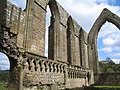 Bolton Abbey 6.jpg 2,048 × 1,536; 1.72 MB
-
 Bolton Abbey 8.jpg 2,048 × 1,536; 1.06 MB
-
 Bolton Abbey 9.jpg 1,177 × 588; 437 KB
-
 Bolton Abbey.jpg 2,048 × 1,536; 1.1 MB
-
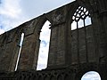
 Bolton Priory Church windows.jpg 2,048 × 1,536; 1.5 MB
-
 Bourtie Kirk - geograph.org.uk - 955700.jpg 640 × 396; 72 KB
-
 British plug.jpg 574 × 425; 60 KB
-
 British Standards Institute Building - geograph.org.uk - 8931.jpg 480 × 640; 251 KB
-
 British Whites - geograph.org.uk - 348148.jpg 640 × 480; 75 KB
-
 Brotherton Church and War Memorial - geograph.org.uk - 765114.jpg 402 × 640; 61 KB
-
 Building bridges between communities - geograph.org.uk - 767916.jpg 640 × 425; 64 KB
-
 Chalkhouse Green - geograph.org.uk - 9195.jpg 640 × 417; 107 KB
-
 Chalkhouse Green - geograph.org.uk - 9200.jpg 640 × 418; 72 KB
-
 Chiswick High Street - geograph.org.uk - 8970.jpg 640 × 480; 241 KB
-
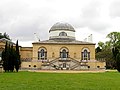 Chiswick House - geograph.org.uk - 8981.jpg 640 × 480; 155 KB
-
 Chiswick House Gardens - geograph.org.uk - 8980.jpg 640 × 480; 223 KB
-
 Chiswick Park - geograph.org.uk - 8932.jpg 640 × 480; 185 KB
-
 Chiswick Park Tube Station - geograph.org.uk - 8972.jpg 640 × 480; 175 KB
-
 Chiswick, Avenue of Trees Across the Park - geograph.org.uk - 8969.jpg 640 × 480; 325 KB
-
 Chiswick, Park - geograph.org.uk - 8968.jpg 640 × 480; 189 KB
-
 Clayfield Copse - geograph.org.uk - 9228.jpg 416 × 640; 146 KB
-
 Cleitir standing stones - geograph.org.uk - 967011.jpg 640 × 464; 129 KB
-
 Corran Lighthouse - geograph.org.uk - 199997.jpg 600 × 319; 63 KB
-
 Cosmopolitan Cuisine - geograph.org.uk - 8974.jpg 640 × 480; 201 KB
-
 Cottage in Grove Road, Annalong - geograph.org.uk - 217966.jpg 640 × 437; 47 KB
-
 Cross Farm - geograph.org.uk - 9182.jpg 640 × 418; 104 KB
-
 Dungonnell with the Sperrins behind. - geograph.org.uk - 777817.jpg 640 × 480; 68 KB
-
 Dunsden Green - geograph.org.uk - 9218.jpg 640 × 417; 117 KB
-
 East Hanney.jpg 640 × 479; 141 KB
-
 All Saints Edmonton.jpg 480 × 640; 120 KB
-
 Emmer Green - geograph.org.uk - 9230.jpg 640 × 452; 50 KB
-
 Evening over the Solway, 10 May 2005. - geograph.org.uk - 136917.jpg 640 × 480; 64 KB
-
 Exeter Cathedral from Bedford Street - geograph.org.uk - 1311435.jpg 640 × 451; 76 KB
-
 Farnhill Pinnacle (Jubilee Tower) - geograph.org.uk - 603145.jpg 640 × 425; 61 KB
-
 Flyford Flavell Church. - geograph.org.uk - 8707.jpg 640 × 480; 121 KB
-

-
 Former viaduct at Warren Dale - geograph.org.uk - 9540.jpg 640 × 480; 162 KB
-
 Fruit and Vegetables, Turnham Green - geograph.org.uk - 8937.jpg 640 × 435; 274 KB
-
 Glencoe Lochan - geograph.org.uk - 27554.jpg 640 × 426; 142 KB
-
 Goole Docks and Church - geograph.org.uk - 356828.jpg 640 × 477; 84 KB
-
 GSWR 186 passing Seagoe - geograph.org.uk - 334859.jpg 640 × 426; 139 KB
-
 Gunnersbury Cemetery - geograph.org.uk - 8933.jpg 640 × 480; 183 KB
-
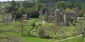
 Gunnersbury Park - geograph.org.uk - 8911.jpg 640 × 425; 160 KB
-
 Gunnersbury Park - geograph.org.uk - 8928.jpg 640 × 480; 227 KB
-
 Habin Bridge, over the River Rother. - geograph.org.uk - 8594.jpg 640 × 426; 116 KB
-
 Health and fitness - geograph.org.uk - 1206076.jpg 640 × 457; 287 KB
-
 Hele Bay - geograph.org.uk - 727466.jpg 640 × 427; 57 KB
-
 Hessay - geograph.org.uk - 11581.jpg 640 × 480; 113 KB
-
 High Street, Walsall - geograph.org.uk - 197595.jpg 640 × 480; 96 KB
-
 Hogarth's Country Residence - geograph.org.uk - 8929.jpg 640 × 480; 294 KB
-
 Horses descending Carn Enoch - geograph.org.uk - 284029.jpg 640 × 514; 100 KB
-
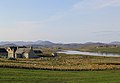 Houses at Breascleit - geograph.org.uk - 966893.jpg 640 × 441; 185 KB
-
 Humber Bridge Pier, North Bank - geograph.org.uk - 360272.jpg 640 × 480; 85 KB
-
 Industrial units - geograph.org.uk - 1206096.jpg 640 × 457; 296 KB
-
 Inside Staple Hill Tunnel - geograph.org.uk - 348725.jpg 640 × 479; 67 KB
-
 Johnston Gardens - bridge.jpg 640 × 480; 178 KB
-
 Kidmore House - geograph.org.uk - 9162.jpg 640 × 419; 109 KB
-
 Late Spring by the Kinness Burn - geograph.org.uk - 50585.jpg 640 × 480; 165 KB
-
 Liver Building Tower - geograph.org.uk - 9100.jpg 640 × 480; 73 KB
-
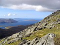
 Loch Seaforth - geograph.org.uk - 8721.jpg 640 × 289; 160 KB
-

-
 Loughgarve with Slievenanee behind - geograph.org.uk - 777810.jpg 640 × 480; 66 KB
-
 Milton Church with driveway to Manorhouse - geograph.org.uk - 8652.jpg 640 × 479; 197 KB
-
 Modern offices - geograph.org.uk - 9928.jpg 640 × 480; 69 KB
-
 Nature Reserve at Kiplingcotes chalk pit - geograph.org.uk - 8604.jpg 640 × 480; 127 KB
-
 Oil tanker entering Ferrybridge lock - geograph.org.uk - 789123.jpg 640 × 425; 91 KB
-
 Old and New side by side at Lisburn - geograph.org.uk - 334347.jpg 640 × 426; 120 KB
-
 On the southeast ridge of An Cliseam - geograph.org.uk - 966902.jpg 640 × 478; 157 KB
-
 Planting potatoes - geograph.org.uk - 8905.jpg 640 × 480; 125 KB
-
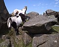
 Pony aloft^ - geograph.org.uk - 284026.jpg 640 × 480; 127 KB
-
 Poppleton railway station - geograph.org.uk - 11580.jpg 640 × 480; 96 KB
-
-
 Preserved Steam passing Kileen - geograph.org.uk - 334338.jpg 426 × 640; 147 KB
-
 Queen Anne's Parade, Bush Hill Park - geograph.org.uk - 8619.jpg 640 × 480; 147 KB
-
 Railway Bridge - geograph.org.uk - 1206049.jpg 640 × 457; 453 KB
-
 RapeFields.JPG 2,048 × 1,536; 533 KB
-
 River Lane - geograph.org.uk - 1206063.jpg 457 × 640; 296 KB
-
 Chalkhouse Green - geograph.org.uk - 9191.jpg 640 × 389; 89 KB
-

-
 Sister Dora Statue, The Bridge, Walsall - geograph.org.uk - 197611.jpg 640 × 514; 117 KB
-
 Somerset house.jpg 1,561 × 1,172; 590 KB
-
 Sonning Common - geograph.org.uk - 9147.jpg 640 × 418; 81 KB
-
 Sonning Common - geograph.org.uk - 9151.jpg 640 × 418; 94 KB
-
 Sonning Common - geograph.org.uk - 9157.jpg 640 × 419; 108 KB
-
 St Andrews Polish RC Church - geograph.org.uk - 8934.jpg 640 × 480; 192 KB
-
 St Mary's in Stamford Brook Road - geograph.org.uk - 8979.jpg 640 × 480; 354 KB
-
 Steventon Village Green - geograph.org.uk - 8653.jpg 640 × 417; 89 KB
-
 Stornoway Ferry and Fuelling Berth - geograph.org.uk - 8716.jpg 640 × 390; 275 KB
-
 Suburban street - geograph.org.uk - 8618.jpg 640 × 480; 145 KB
-
 Summit plateau of Carn Ghluasaid - geograph.org.uk - 1042106.jpg 800 × 600; 178 KB
-
 The Arnish Light - geograph.org.uk - 8717.jpg 426 × 640; 195 KB
-
 The Bandstand in Town Hall Park, Hayes - geograph.org.uk - 8467.jpg 640 × 480; 126 KB
-
 The Cascade, Chiswick House - geograph.org.uk - 8982.jpg 640 × 480; 342 KB
-
 The Conker Round - geograph.org.uk - 767891.jpg 640 × 425; 67 KB
-
 The Conservatory, Chiswick House - geograph.org.uk - 8983.jpg 640 × 480; 283 KB
-
 The French House Inn. - geograph.org.uk - 8705.jpg 640 × 480; 109 KB
-
 The Grangeway, Grange Park - geograph.org.uk - 8621.jpg 640 × 480; 157 KB
-
 The Orangery, Gunnersbury Park - geograph.org.uk - 8915.jpg 640 × 480; 201 KB
-
-
 The Tarka Trail near Weare Giffard - geograph.org.uk - 349414.jpg 640 × 480; 139 KB
-

-
 The village of Breascleit - geograph.org.uk - 966872.jpg 640 × 447; 145 KB
-
 The walls of Fort William - geograph.org.uk - 199998.jpg 600 × 374; 92 KB
-
 Traigh Bosta on Great Bernera - geograph.org.uk - 286169.jpg 640 × 480; 129 KB
-
 Turnham Green Tube Station - geograph.org.uk - 8936.jpg 640 × 480; 238 KB
-
 Christ Church in Chiswick Park - geograph.org.uk - 8971.jpg 640 × 480; 180 KB
-
 Turnham Green, Flower Seller - geograph.org.uk - 8942.jpg 640 × 480; 243 KB
-
 Under the Humber Bridge - geograph.org.uk - 356835.jpg 640 × 480; 71 KB
-
 View South East from Beinn Talaidh - geograph.org.uk - 503286.jpg 640 × 480; 74 KB
-
 View towards Sàil Chaorainn - geograph.org.uk - 1042114.jpg 640 × 480; 128 KB
-
 Vines Farm - geograph.org.uk - 9160.jpg 640 × 419; 91 KB
-
 Vines Farm - geograph.org.uk - 9167.jpg 640 × 418; 122 KB
-
 Warren Dale below Lairhill House - geograph.org.uk - 8564.jpg 640 × 480; 113 KB
-
 Waterside from Low Keirs - geograph.org.uk - 39711.jpg 640 × 480; 118 KB
-
 West Bridge, Leicester - geograph.org.uk - 30699.jpg 640 × 480; 137 KB
-
 West Hanney cottage - geograph.org.uk - 8661.jpg 640 × 479; 136 KB
-
 White Hart, Mile End Road, London - geograph.org.uk - 949517.jpg 640 × 480; 89 KB
-
 White Ladies Aston Church. - geograph.org.uk - 9125.jpg 480 × 640; 125 KB
-
 Winter wheat on Lund Wold - geograph.org.uk - 8569.jpg 640 × 480; 90 KB
-
 Bardolph's Wood - geograph.org.uk - 9186.jpg 640 × 418; 73 KB
-
 Bedd Morris standing stone - geograph.org.uk - 315049.jpg 640 × 480; 96 KB
-
 Beinn Enaiglair summit, looking SW - geograph.org.uk - 729096.jpg 640 × 480; 89 KB
-
 Berrow Hill. - geograph.org.uk - 8680.jpg 640 × 480; 127 KB
-
 Bishoplands Farm - geograph.org.uk - 9204.jpg 640 × 419; 101 KB
-
 Bishoplands Farm - geograph.org.uk - 9208.jpg 640 × 420; 75 KB
-
 Bolton Abbey ruins from a height - geograph.org.uk - 121880.jpg 640 × 480; 134 KB
-
 Bur Wood - geograph.org.uk - 9159.jpg 640 × 418; 127 KB
-
 Cafe and Conservatory Showroom - geograph.org.uk - 33267.jpg 640 × 426; 101 KB
-
 Canal Bridge, Cannock Rd. , Penkridge - geograph.org.uk - 196505.jpg 640 × 449; 106 KB
-
 Carn a' Mhadaidh-ruadh - geograph.org.uk - 481431.jpg 640 × 480; 127 KB
-
 Clacket Lane Anticlockwise - geograph.org.uk - 9053.jpg 640 × 480; 84 KB
-
 Comp Wood - geograph.org.uk - 9210.jpg 640 × 418; 93 KB
-
 Cotes Bridge, Loughborough - geograph.org.uk - 8685.jpg 640 × 398; 125 KB
-
 Cow Common - geograph.org.uk - 8906.jpg 640 × 448; 121 KB
-
 Creag a' Chaorain - geograph.org.uk - 481466.jpg 640 × 480; 111 KB
-
 Didcot Power Station from Sutton Road - geograph.org.uk - 8651.jpg 640 × 467; 94 KB
-
 Dyson's Wood Farm - geograph.org.uk - 9190.jpg 640 × 419; 107 KB
-
 Farmland and Birch Copse. - geograph.org.uk - 8579.jpg 640 × 426; 65 KB
-

-
 Footpath from Quebec to Goose Green - geograph.org.uk - 8578.jpg 640 × 426; 74 KB
-
 Glen Roy - geograph.org.uk - 347436.jpg 640 × 480; 95 KB
-

-
 Goosey Foot Tarn - geograph.org.uk - 105969.jpg 640 × 473; 108 KB
-
 Gunpowder factory. - geograph.org.uk - 23596.jpg 640 × 480; 191 KB
-
 Halecommon - geograph.org.uk - 8600.jpg 640 × 426; 56 KB
-
 Hightown, Bridgnorth - geograph.org.uk - 197788.jpg 640 × 469; 90 KB
-
 Kidmore End - geograph.org.uk - 9178.jpg 640 × 417; 91 KB
-
 Littlestead Green - geograph.org.uk - 9223.jpg 640 × 419; 81 KB
-
 Longford Lock, Penkridge - geograph.org.uk - 196510.jpg 640 × 499; 112 KB
-
 Looking down the Allt Teanga Bige - geograph.org.uk - 347428.jpg 640 × 480; 97 KB
-

-

-

-
 Mud and Sand flats - geograph.org.uk - 27551.jpg 640 × 426; 93 KB
-
 New Pays Farm grain store. - geograph.org.uk - 8587.jpg 640 × 426; 58 KB
-

-

-
 Rannoch Moor - geograph.org.uk - 27557.jpg 640 × 426; 87 KB
-
 Ridgetop view - geograph.org.uk - 315051.jpg 640 × 480; 131 KB
-
 Road Junction and house near "Quebec" - geograph.org.uk - 8576.jpg 640 × 426; 43 KB
-
 Rogate Village centre - geograph.org.uk - 8597.jpg 640 × 426; 42 KB
-
 Sallachan Point - geograph.org.uk - 410196.jpg 640 × 377; 65 KB
-
 Small industrial units beside the A272. - geograph.org.uk - 8590.jpg 640 × 426; 54 KB
-
 South western slopes of Creag a' Chaorain - geograph.org.uk - 481481.jpg 800 × 600; 221 KB
-
 Southridge Farm - geograph.org.uk - 8814.jpg 640 × 480; 460 KB
-
 Storage Depot - geograph.org.uk - 8657.jpg 640 × 576; 110 KB
-
 Strath Dores - geograph.org.uk - 372138.jpg 640 × 390; 89 KB
-
 The beach at Bosta - geograph.org.uk - 286171.jpg 640 × 480; 97 KB
-
 The cliffs of Creag a' Chaorainn - geograph.org.uk - 481446.jpg 640 × 480; 117 KB
-
 The March Hare at Broughton Hacket. - geograph.org.uk - 8711.jpg 640 × 480; 90 KB
-
 The Saltway - geograph.org.uk - 8687.jpg 480 × 640; 116 KB
-
 Tower silo at Moorend Barn. - geograph.org.uk - 8701.jpg 640 × 480; 80 KB
-
 Turning to Buriton at Stanbridge Farm - geograph.org.uk - 8572.jpg 640 × 426; 83 KB
-
 Uldale Valley - geograph.org.uk - 155726.jpg 640 × 480; 150 KB
-
 Vale of the White Horse - geograph.org.uk - 8659.jpg 640 × 426; 77 KB
-

-
 View across Steventon Field - geograph.org.uk - 8654.jpg 640 × 412; 79 KB
-
 View across Steventon Field - geograph.org.uk - 8655.jpg 640 × 438; 94 KB
-

-
 West Harting - geograph.org.uk - 8585.jpg 640 × 426; 86 KB
-
 West Harting - geograph.org.uk - 8586.jpg 640 × 426; 45 KB
-

-
 Woodlands Road - geograph.org.uk - 142819.jpg 480 × 640; 70 KB


_-_geograph.org.uk_-_603145.jpg)


