Category:United Kingdom photographs taken on 2005-06-07
Countries of Europe: Belarus · Belgium · Denmark · Finland · Germany · Greece · Hungary · Republic of Ireland · Italy · Netherlands‡ · Norway · Russia‡ · Spain‡ · Sweden · Turkey‡ · Ukraine · United Kingdom
Specific status: Isle of Man
‡: partly located in Europe
Specific status: Isle of Man
‡: partly located in Europe
| ← | 7 June 2005 | → | ||
| ← | June 2005 | → | ||

United Kingdom photographs taken on 7 June 2005.
Image files should be categorized here automatically using {{taken on}} template. Direct categorisation is also possible, if automatic is impossible.
Subcategories
This category has only the following subcategory.
L
Media in category "United Kingdom photographs taken on 2005-06-07"
The following 200 files are in this category, out of 266 total.
(previous page) (next page)-

-
 Airfield near Grazely - geograph.org.uk - 17661.jpg 640 × 480; 155 KB
-
 Apperley Bridge - geograph.org.uk - 16216.jpg 640 × 480; 84 KB
-

-
 St Bartholomews, Arborfield - geograph.org.uk - 17640.jpg 640 × 480; 242 KB
-
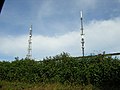 Beacon Hill Transmitter Facility.jpg 640 × 480; 109 KB
-
 Bempton Cliffs - geograph.org.uk - 263439.jpg 640 × 480; 103 KB
-
 Boat at Peterhead Harbour - geograph.org.uk - 96334.jpg 640 × 480; 106 KB
-
 Bourne airfield - geograph.org.uk - 16158.jpg 480 × 640; 117 KB
-
 Bowmore from opposite side of Loch Indaal - geograph.org.uk - 16870.jpg 640 × 330; 102 KB
-
 Bridge over River Usk at Crickhowell - geograph.org.uk - 609494.jpg 640 × 480; 90 KB
-
 Bridgefoot, near Dundee - geograph.org.uk - 16263.jpg 640 × 480; 179 KB
-
 Broad Haven Beach near Bosherston - geograph.org.uk - 321148.jpg 640 × 426; 85 KB
-
 Buckshaw Hall - geograph.org.uk - 18039.jpg 640 × 480; 197 KB
-
 Burghfield Bowls - geograph.org.uk - 17652.jpg 640 × 480; 175 KB
-
 Car repair shop in Hardwick - geograph.org.uk - 16148.jpg 640 × 450; 84 KB
-
 Carters Hill - geograph.org.uk - 17642.jpg 640 × 480; 204 KB
-

-
 Chalvey Road West, Slough - geograph.org.uk - 16246.jpg 640 × 480; 83 KB
-
 Charcoal burning at Heligan - geograph.org.uk - 699742.jpg 640 × 480; 135 KB
-
 Charteris Land - geograph.org.uk - 16192.jpg 526 × 640; 86 KB
-
 Cleevechapter.jpg 640 × 480; 115 KB
-
 Coastline between Bowmore and Bridgend - geograph.org.uk - 16866.jpg 640 × 231; 68 KB
-
 Coastline near Bowmore Power Station - geograph.org.uk - 16863.jpg 640 × 307; 93 KB
-

-
 Copthorne Hotel Slough - geograph.org.uk - 16253.jpg 640 × 480; 67 KB
-
 Corran Lighthouse from the ferry - geograph.org.uk - 107448.jpg 640 × 480; 127 KB
-
 Country Lane near Grazeley - geograph.org.uk - 17664.jpg 640 × 480; 300 KB
-
 Craigowl from near Jeanfield - geograph.org.uk - 16298.jpg 640 × 480; 99 KB
-
 Craigowl Hill - geograph.org.uk - 16296.jpg 640 × 480; 167 KB
-
 Craigowl Hill from North Mains of Baldovan - geograph.org.uk - 16250.jpg 640 × 480; 146 KB
-
 Cribyn and Pen-y-Fan.jpg 2,472 × 1,920; 1.15 MB
-
 Crossing Keepers Cottage, Teign Bridge - geograph.org.uk - 16324.jpg 634 × 422; 104 KB
-
 Cruden Bay beach - geograph.org.uk - 96310.jpg 640 × 480; 33 KB
-
 Cushat Law - geograph.org.uk - 394648.jpg 640 × 480; 58 KB
-
 Cutbush Manor - geograph.org.uk - 17638.jpg 640 × 480; 220 KB
-
 Demolition, Paris Street - geograph.org.uk - 1083088.jpg 640 × 480; 86 KB
-
 Dovecote, Dunster, Somerset - geograph.org.uk - 107679.jpg 640 × 427; 110 KB
-
 Drumkinnon Tower - geograph.org.uk - 1033213.jpg 640 × 481; 61 KB
-
 Dun Caan - geograph.org.uk - 606633.jpg 640 × 467; 79 KB
-
 Dusk in Solva - geograph.org.uk - 911437.jpg 640 × 425; 87 KB
-
 East Beaulieu Heath, near Holbury - geograph.org.uk - 24204.jpg 640 × 480; 70 KB
-
 Eilean nam Ban on Loch Leven - geograph.org.uk - 107465.jpg 640 × 480; 150 KB
-
 Engineers Arms, Whitley Wood - geograph.org.uk - 17629.jpg 640 × 480; 172 KB
-
 St. John the Baptist Church, Eton Wick - geograph.org.uk - 16273.jpg 640 × 480; 73 KB
-
 Euxton-rof.jpg 640 × 480; 153 KB
-
 Evening at the Pond by Tintern Cross - geograph.org.uk - 202906.jpg 640 × 480; 398 KB
-
 Fallburn Fort - geograph.org.uk - 1204770.jpg 640 × 480; 81 KB
-
 Farmland near Carters Hill - geograph.org.uk - 17648.jpg 640 × 480; 173 KB
-
 Farmland off Cutbush Lane - geograph.org.uk - 17633.jpg 640 × 480; 406 KB
-
 Fawley Power Station - geograph.org.uk - 23908.jpg 640 × 480; 60 KB
-

-
 Filling station at Childerley Gate - geograph.org.uk - 16155.jpg 640 × 480; 78 KB
-

-
 Footpath leading to Eyecote - geograph.org.uk - 60496.jpg 640 × 480; 93 KB
-
 Friden Station - geograph.org.uk - 17538.jpg 640 × 481; 126 KB
-
 Frinton on Sea - geograph.org.uk - 234475.jpg 640 × 480; 66 KB
-
 Gallox Bridge - Dunster, Somerset - geograph.org.uk - 116409.jpg 640 × 480; 153 KB
-
 Geldie Burn - geograph.org.uk - 99978.jpg 640 × 480; 52 KB
-
 Geldie Burn - geograph.org.uk - 99979.jpg 640 × 480; 59 KB
-
 Geldie Burn - geograph.org.uk - 99989.jpg 640 × 480; 69 KB
-
 Geldie Lodge - geograph.org.uk - 100026.jpg 640 × 480; 63 KB
-

-
 Gotham, Derbyshire - geograph.org.uk - 17544.jpg 640 × 481; 137 KB
-
 Granite outcrop on Ben Avon - geograph.org.uk - 139558.jpg 640 × 505; 100 KB
-
 Granton Harbour wall - geograph.org.uk - 16177.jpg 640 × 402; 65 KB
-
 Granton Harbour. - geograph.org.uk - 16174.jpg 640 × 407; 54 KB
-
 Grazeley Manor Farm - geograph.org.uk - 17669.jpg 640 × 480; 163 KB
-

-
 Halifax Road - geograph.org.uk - 16160.jpg 640 × 480; 131 KB
-
 Hanger Lane Gyratory on the North Circular - geograph.org.uk - 16150.jpg 640 × 480; 111 KB
-
 Heading west - geograph.org.uk - 99993.jpg 640 × 480; 51 KB
-
 Hemlington Lake - geograph.org.uk - 16249.jpg 640 × 480; 107 KB
-
 High Water - geograph.org.uk - 911444.jpg 640 × 426; 49 KB
-

-
 Hill Top, New Forest - geograph.org.uk - 210639.jpg 640 × 480; 130 KB
-
 Hoddom Bridge.jpg 640 × 480; 169 KB
-
 Hollins Cross - geograph.org.uk - 172627.jpg 640 × 480; 159 KB
-
 Hotel and Country Club - geograph.org.uk - 17657.jpg 640 × 480; 231 KB
-
 House repairs, Craigentinny - geograph.org.uk - 16189.jpg 640 × 480; 52 KB
-
 Hoveton Hall Gardens - geograph.org.uk - 24660.jpg 640 × 480; 139 KB
-
 Hoveton Hall gardens - geograph.org.uk - 24661.jpg 640 × 480; 110 KB
-
 Hoveton Hall gardens - geograph.org.uk - 24662.jpg 640 × 480; 154 KB
-
 Hoveton Park - geograph.org.uk - 24663.jpg 480 × 640; 76 KB
-
 Inside Teignmouth Pier - geograph.org.uk - 16229.jpg 640 × 425; 112 KB
-
 Kennacraig ferry terminal - geograph.org.uk - 16857.jpg 640 × 406; 121 KB
-
 Kestor Inn, Manaton - geograph.org.uk - 16327.jpg 629 × 418; 71 KB
-
 Kew Gardens, Dale Chihuly Exhibition - geograph.org.uk - 16299.jpg 480 × 640; 149 KB
-
 Longcliffe Station - High Peak Trail - geograph.org.uk - 17541.jpg 640 × 481; 114 KB
-
 M3 at Basingstoke - geograph.org.uk - 16459.jpg 427 × 640; 73 KB
-
 M4 Midday Jam - geograph.org.uk - 17632.jpg 640 × 480; 157 KB
-
 Main Street, Cruden Bay - geograph.org.uk - 96769.jpg 640 × 480; 109 KB
-
 Making silage - geograph.org.uk - 16289.jpg 640 × 480; 183 KB
-
 Making silage near Kirkton of Auchterhouse.jpg 640 × 480; 156 KB
-
 Milber - Newton Abbot - geograph.org.uk - 16242.jpg 640 × 425; 90 KB
-
 Mill Sindlesham - geograph.org.uk - 17650.jpg 640 × 480; 351 KB
-
 Milldale Bridge - geograph.org.uk - 72424.jpg 640 × 480; 163 KB
-
 Minninglow - High Peak Trail - geograph.org.uk - 17540.jpg 640 × 481; 127 KB
-
 Most of North Yorkshire - geograph.org.uk - 116721.jpg 620 × 640; 112 KB
-
 National Physical Laboratory - geograph.org.uk - 16240.jpg 640 × 480; 80 KB
-

-
 Sailors Bethel - geograph.org.uk - 16393.jpg 640 × 480; 110 KB
-
 North shore of Loch Indaal near Blackrock - geograph.org.uk - 16871.jpg 640 × 362; 107 KB
-
 Old Worden Hall - geograph.org.uk - 18575.jpg 640 × 480; 188 KB
-
 On the ridge up to Stob Coir an Albannaich - geograph.org.uk - 52950.jpg 640 × 480; 105 KB
-
 Paraglider - geograph.org.uk - 411453.jpg 532 × 640; 96 KB
-
 Pickering Tors, Dovedale - geograph.org.uk - 72452.jpg 480 × 640; 119 KB
-

-
 Pilton - geograph.org.uk - 16172.jpg 640 × 380; 62 KB
-

-
 Port of Leith - geograph.org.uk - 16182.jpg 640 × 435; 36 KB
-
 Railway - Canal Interchange, Teign Bridge - geograph.org.uk - 16325.jpg 636 × 424; 129 KB
-
-
 Redevelopment of Leith Docks. - geograph.org.uk - 16181.jpg 640 × 462; 56 KB
-
 Richard Dunn's sports centre - geograph.org.uk - 16164.jpg 640 × 480; 77 KB
-
 Rising Sun pub, Milland - geograph.org.uk - 17159.jpg 640 × 426; 79 KB
-

-
 River Teign near Newton Abbot - geograph.org.uk - 16237.jpg 640 × 425; 77 KB
-
 Road near Bridgend, Islay - geograph.org.uk - 16869.jpg 640 × 308; 83 KB
-
 Roman Milestone on Pateley Moor - geograph.org.uk - 116716.jpg 640 × 427; 93 KB
-
 Scaly Hills Bankfoot - geograph.org.uk - 16165.jpg 640 × 480; 145 KB
-
 Scottish Executive offices - geograph.org.uk - 16184.jpg 640 × 480; 64 KB
-
 Seafield. - geograph.org.uk - 16186.jpg 640 × 480; 57 KB
-
 Sheep, Metal and Not - geograph.org.uk - 16266.jpg 640 × 480; 102 KB
-
 Short-eared Owl (Asio flammeus) - geograph.org.uk - 929622.jpg 640 × 392; 56 KB
-
 Sign at Kinloch Hourn Car Park - geograph.org.uk - 1573579.jpg 640 × 480; 91 KB
-
 Silk Mill at Whitchurch - geograph.org.uk - 16461.jpg 427 × 640; 74 KB
-
 Skell Gill - geograph.org.uk - 116717.jpg 427 × 640; 136 KB
-
 Skell Gill Bridge - geograph.org.uk - 116718.jpg 640 × 427; 96 KB
-
 Slough Sewage Works and M4 Motorway - geograph.org.uk - 16284.jpg 640 × 480; 51 KB
-

-
 Spa Bridge near Spa Wood, Cragg Vale - geograph.org.uk - 16665.jpg 768 × 1,024; 289 KB
-
 St Mary's Lighthouse - geograph.org.uk - 31050.jpg 640 × 433; 276 KB
-
 St Michael's church, Bosherston - geograph.org.uk - 321161.jpg 640 × 426; 110 KB
-
 St Nons Bay - geograph.org.uk - 42356.jpg 640 × 426; 104 KB
-
 St Paul's C of E Church Wibsey - geograph.org.uk - 16157.jpg 640 × 480; 103 KB
-
 St Winefredes RC School Wibsey - geograph.org.uk - 16159.jpg 640 × 480; 82 KB
-
 St. Botolph's Church, Carlton-in-Cleveland - geograph.org.uk - 16245.jpg 480 × 640; 106 KB
-
 Strange rock - geograph.org.uk - 17439.jpg 640 × 480; 80 KB
-
 Summit of Corra' Bheinn - geograph.org.uk - 1277235.jpg 640 × 480; 39 KB
-
 Summit of Fan-y-Big.jpg 2,496 × 1,920; 1.11 MB
-
 Sunset over Carn Llidi - geograph.org.uk - 911431.jpg 640 × 427; 23 KB
-
 Teign Estuary - geograph.org.uk - 16234.jpg 640 × 425; 80 KB
-
 Teignmouth Docks - geograph.org.uk - 16232.jpg 640 × 425; 83 KB
-
 Teignmouth Pier - geograph.org.uk - 16227.jpg 640 × 425; 64 KB
-

-
 The Corran Ferry at Corran Narrows - geograph.org.uk - 107441.jpg 640 × 480; 148 KB
-
 The Cross, St Davids - geograph.org.uk - 267317.jpg 640 × 426; 84 KB
-
 The Flying Bull, on the A3 at Rake. - geograph.org.uk - 17157.jpg 640 × 426; 77 KB
-
 The Nunnery, Dunster, Somerset - geograph.org.uk - 117744.jpg 640 × 427; 84 KB
-
 The River Teign near Newton Abbot - geograph.org.uk - 170490.jpg 640 × 425; 96 KB
-
 The Road Beyond Kinloch Hourn - geograph.org.uk - 1577869.jpg 640 × 480; 101 KB
-
 The Royal Oak, Hill Top - geograph.org.uk - 210637.jpg 640 × 480; 135 KB
-
 The Salty - Teignmouth - geograph.org.uk - 16231.jpg 640 × 425; 87 KB
-
 The Spaniard, Bramshott Chase - geograph.org.uk - 17161.jpg 640 × 426; 50 KB
-
 The Three Tuns - geograph.org.uk - 16238.jpg 640 × 480; 55 KB
-
 Thorpe Edge Estate - geograph.org.uk - 16215.jpg 640 × 480; 124 KB
-
 Trent and Mersey Canal Stenson - geograph.org.uk - 444030.jpg 640 × 441; 93 KB
-
 Tynemouth - King Edward's Bay.jpg 640 × 435; 87 KB
-
 Ugborough Parish Church - geograph.org.uk - 16303.jpg 640 × 480; 107 KB
-

-
 War Memorial Plaques - geograph.org.uk - 32477.jpg 640 × 480; 102 KB
-
 Watership Down - geograph.org.uk - 16474.jpg 640 × 427; 102 KB
-
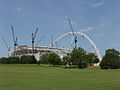 Wembley Stadium under construction - geograph.org.uk - 16167.jpg 640 × 480; 84 KB
-
 West Nottinghamshire College - geograph.org.uk - 16330.jpg 640 × 480; 89 KB
-
 West Pilton - geograph.org.uk - 16170.jpg 640 × 453; 65 KB
-
 White Cottage - geograph.org.uk - 17656.jpg 640 × 480; 247 KB
-
 Wibsey Park Lake - geograph.org.uk - 16131.jpg 640 × 480; 154 KB
-
 Wooley Grange, Bradford-on-avon - geograph.org.uk - 123691.jpg 640 × 480; 104 KB
-

-
 Wynton farm and Craigowl - geograph.org.uk - 16256.jpg 640 × 480; 93 KB
-

-
 Yarpole - geograph.org.uk - 60501.jpg 640 × 480; 155 KB
-
 York House - geograph.org.uk - 16214.jpg 640 × 480; 131 KB
-
 York Road Industrial Park, Malton - geograph.org.uk - 16390.jpg 640 × 307; 54 KB
-
 Youth Hostel at Capel-y-ffin - geograph.org.uk - 609473.jpg 640 × 480; 119 KB
-
 Above Elton - geograph.org.uk - 70677.jpg 640 × 480; 114 KB
-
 Above Richards Castle - geograph.org.uk - 70232.jpg 640 × 480; 68 KB
-
 Ballater - geograph.org.uk - 53711.jpg 480 × 360; 26 KB
-
-
 Bilsdale West Moor - geograph.org.uk - 16262.jpg 640 × 480; 76 KB
-
 Bircher Common - geograph.org.uk - 61097.jpg 640 × 480; 92 KB
-
 Bircher Common - geograph.org.uk - 70236.jpg 640 × 480; 78 KB
-
 Bonar Bridge War Memorial - geograph.org.uk - 46878.jpg 640 × 480; 69 KB
-
 Borough Mere, nr Malton - geograph.org.uk - 16401.jpg 640 × 416; 46 KB
-
 Bothy at Red Bridges - geograph.org.uk - 99988.jpg 640 × 480; 53 KB
-
 Bowmore Power Station - geograph.org.uk - 16860.jpg 640 × 323; 78 KB
-
 Bowmore, Isle of Islay - geograph.org.uk - 16858.jpg 640 × 450; 115 KB
-
 Bridge over Motorway - geograph.org.uk - 505694.jpg 640 × 480; 104 KB
-
 Builder's Merchant, Salamander Street - geograph.org.uk - 16185.jpg 640 × 407; 54 KB
-
 Burghfield Place - geograph.org.uk - 17667.jpg 640 × 480; 191 KB
-

-
 Camus Mor, Bornesketaig - geograph.org.uk - 29596.jpg 640 × 480; 88 KB
-
 Carn an Fhidhlier - geograph.org.uk - 99994.jpg 640 × 480; 84 KB
-
 Christmas tree nursery near North Auchray - geograph.org.uk - 16301.jpg 640 × 480; 130 KB
-
 Cippenham Moat - geograph.org.uk - 16291.jpg 640 × 480; 66 KB
-
 Coastline near Bowmore, Islay - geograph.org.uk - 16859.jpg 640 × 377; 109 KB
-
 Compton Down - geograph.org.uk - 127335.jpg 640 × 420; 79 KB
-
 Country Lanes - geograph.org.uk - 172636.jpg 640 × 480; 187 KB
-
 Craigowl from near South Fallaws - geograph.org.uk - 16270.jpg 640 × 480; 130 KB


_-_geograph.org.uk_-_929622.jpg)


