Category:United Kingdom photographs taken on 2005-06-28
Countries of Europe: Austria · Belarus · Belgium · Denmark · Germany · Republic of Ireland · Italy · Netherlands‡ · Norway · Poland · Russia‡ · Serbia · Sweden · Switzerland · United Kingdom
‡: partly located in Europe
‡: partly located in Europe
| ← | 28 June 2005 | → | ||
| ← | June 2005 | → | ||

United Kingdom photographs taken on 28 June 2005.
Image files should be categorized here automatically using {{taken on}} template. Direct categorisation is also possible, if automatic is impossible.
Subcategories
This category has only the following subcategory.
Media in category "United Kingdom photographs taken on 2005-06-28"
The following 200 files are in this category, out of 297 total.
(previous page) (next page)-
 "Abbot's Chair" - Monk's Road - geograph.org.uk - 22272.jpg 640 × 480; 167 KB
-
 143620 and 153302 coupled.jpg 1,280 × 960; 619 KB
-
 143620 and 153302 uncoupled.jpg 1,280 × 960; 596 KB
-
 A417 (T) near Cirencester - geograph.org.uk - 22357.jpg 640 × 480; 154 KB
-
 A417 to Lechlade - geograph.org.uk - 22504.jpg 640 × 480; 363 KB
-
 A624 Chunal - looking towards Glossop - geograph.org.uk - 22277.jpg 640 × 480; 93 KB
-
 All Souls Avenue, Willesden - geograph.org.uk - 22047.jpg 640 × 480; 106 KB
-
 Allt an Fhuar Locha - geograph.org.uk - 1289778.jpg 640 × 480; 72 KB
-
 Ampney Crucis, Village Hall - geograph.org.uk - 22378.jpg 640 × 480; 474 KB
-
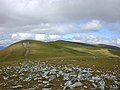
 Approaching the summit of Ben Wyvis - geograph.org.uk - 1046160.jpg 640 × 436; 67 KB
-
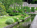
 Arlington Mill - geograph.org.uk - 22424.jpg 480 × 640; 528 KB
-
 Arlington Row - geograph.org.uk - 22434.jpg 480 × 640; 156 KB
-
 Arlington Row, Arlington - geograph.org.uk - 22431.jpg 640 × 480; 527 KB
-
 Arlington-Bibury, Cottages - geograph.org.uk - 22432.jpg 640 × 480; 567 KB
-
 Arriva Trains Wales DMU 153321 - 01.jpg 1,280 × 960; 589 KB
-
 Arriva Trains Wales DMU 153321 - 02.jpg 1,280 × 960; 566 KB
-
 Arriva Trains Wales DMU 153362.jpg 1,280 × 960; 550 KB
-
 Ascending towards Fuar Loch Beag - geograph.org.uk - 1289760.jpg 640 × 480; 64 KB
-
 Ashford International Station - geograph.org.uk - 22083.jpg 640 × 377; 59 KB
-
 Atlantic Shore, Shawbost - geograph.org.uk - 413082.jpg 640 × 483; 79 KB
-
 Barley Field and Windpump near Quenington - geograph.org.uk - 22467.jpg 640 × 480; 297 KB
-
 Barnard Castle - geograph.org.uk - 76645.jpg 640 × 480; 122 KB
-
 Bibury Swan Hotel front.jpg 640 × 480; 245 KB
-
 Boat Yard at Wyre Piddle - geograph.org.uk - 40502.jpg 640 × 311; 56 KB
-
 Boultenstone Outdoor Centre - geograph.org.uk - 28877.jpg 640 × 480; 114 KB
-
 Bridge - geograph.org.uk - 44262.jpg 640 × 427; 91 KB
-
 Bridge over the A417 T) near Cirencester - geograph.org.uk - 22359.jpg 640 × 480; 214 KB
-
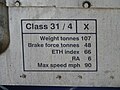 British Rail Class 31-4 dataplate.jpg 1,280 × 960; 606 KB
-
 Capital City Academy, Willesden - geograph.org.uk - 22045.jpg 640 × 481; 83 KB
-
 Carmarthen Ampitheatre.jpg 3,000 × 1,250; 445 KB
-
 Carnmore - geograph.org.uk - 1289737.jpg 640 × 384; 33 KB
-
 Carnousie Castle - geograph.org.uk - 617895.jpg 640 × 501; 77 KB
-
 Cattishall - geograph.org.uk - 22161.jpg 640 × 427; 76 KB
-
 Church in Ampney Crucis - geograph.org.uk - 22372.jpg 640 × 480; 410 KB
-

-
 Church, Preston - geograph.org.uk - 22362.jpg 640 × 480; 216 KB
-
 Class 150 DMU 150248 2005-06-28.jpg 1,280 × 960; 574 KB
-
 Class 150 DMU 150253 2005-06-28 1of2.jpg 1,280 × 960; 620 KB
-
 Class 150 DMU 150253 2005-06-28 2of2.jpg 1,280 × 960; 529 KB
-

-
 College Farm, Ampney St Mary's - geograph.org.uk - 22406.jpg 640 × 480; 141 KB
-

-
-
-
 Commando Memorial Spean Bridge - geograph.org.uk - 22799.jpg 640 × 480; 76 KB
-

-
 Craven Park Road, Harlesden - geograph.org.uk - 22040.jpg 640 × 480; 132 KB
-
 Cromar Parish Church - geograph.org.uk - 28870.jpg 640 × 480; 83 KB
-
 Cycleway, Portrack - geograph.org.uk - 22187.jpg 640 × 480; 59 KB
-
 Diesel Multiple Units 153301 and 150253.jpg 1,280 × 960; 561 KB
-

-
 Disused Water Tower, Fairford - geograph.org.uk - 22494.jpg 640 × 480; 130 KB
-
 DMU 158858 - 153373 2005-06-28.jpg 1,280 × 960; 550 KB
-
 DMU 158858 2005-06-28 02.jpg 960 × 1,280; 614 KB
-
 DMU 158858 2005-06-28 03.jpg 1,280 × 960; 570 KB
-
 DMU153305 approaching Bristol Temple Meads.jpg 1,280 × 960; 623 KB
-
 Dubh Loch and A'Mhaighdean - geograph.org.uk - 1290097.jpg 640 × 480; 77 KB
-
 Dun Dornaigil Broch. - geograph.org.uk - 1074084.jpg 640 × 427; 68 KB
-
 Dunston Hall Hotel - geograph.org.uk - 22536.jpg 640 × 485; 154 KB
-
 East Croydon station - geograph.org.uk - 23352.jpg 640 × 480; 94 KB
-
-
 Farmland From the Footpath near Quenington - geograph.org.uk - 22460.jpg 640 × 480; 537 KB
-
 Farmland near Ampney St Peter - geograph.org.uk - 22389.jpg 640 × 480; 201 KB
-
 Farmland near Ordie - geograph.org.uk - 28876.jpg 640 × 480; 67 KB
-
 Farmland near Poulton - geograph.org.uk - 22396.jpg 640 × 480; 178 KB
-
 Farmland near Quenington - geograph.org.uk - 22456.jpg 640 × 480; 477 KB
-
 FGW HST powercars 43136 and 43018.jpg 1,280 × 960; 493 KB
-
 FGW HST powercars 43156 approaching Bristol Temple Meads.jpg 1,280 × 960; 616 KB
-
-
 Flats in Willesden - geograph.org.uk - 22042.jpg 640 × 478; 112 KB
-
-
 Former Lodge for Carnousie Castle.jpg 640 × 574; 139 KB
-
 Freightliner Class 66-6 diesel locomotive 66603 01.jpg 1,280 × 960; 635 KB
-
 Freightliner Class 66-6 diesel locomotive 66603 02.jpg 960 × 1,280; 557 KB
-
 Freightliner Class 66-6 diesel locomotive 66603 03.jpg 1,280 × 960; 623 KB
-
 Fuar Loch Mòr - geograph.org.uk - 1289843.jpg 640 × 214; 28 KB
-
 GB Class 143 dmu 143603 front end.jpg 960 × 1,280; 599 KB
-
 GB-66603-143603.jpg 1,280 × 960; 588 KB
-
 Gb-demu-221113-dmu-143603.jpg 1,280 × 960; 621 KB
-
 Gb-dmu-153302-01.jpg 1,280 × 960; 627 KB
-
 Gb-dmu-153302-02.jpg 1,280 × 960; 566 KB
-
 Gb-dmu-153302-03.jpg 960 × 1,280; 605 KB
-
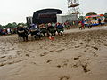 Glastonbury 2005 Mud at Other Stage.jpg 2,272 × 1,704; 1.67 MB
-

-
 Gravel Pit - geograph.org.uk - 22511.jpg 640 × 480; 398 KB
-
 Guildhall Square, Carmarthen.jpg 640 × 413; 55 KB
-
 Hargate Hill Lane - geograph.org.uk - 22036.jpg 640 × 480; 101 KB
-
 Haymaking - geograph.org.uk - 38831.jpg 640 × 427; 159 KB
-
 Hern Point Rock - geograph.org.uk - 23443.jpg 640 × 480; 99 KB
-
 Horncliffe Well gatepost - geograph.org.uk - 23702.jpg 640 × 480; 124 KB
-

-
 Hutton Rudby - geograph.org.uk - 22885.jpg 360 × 480; 44 KB
-
 Improving the path - geograph.org.uk - 1290082.jpg 480 × 640; 124 KB
-
 Intersection of the A417 and Witpit Lane - geograph.org.uk - 22367.jpg 640 × 480; 167 KB
-
 John Perryn Primary School, East Acton - geograph.org.uk - 336436.jpg 640 × 480; 118 KB
-
 Kempsey - geograph.org.uk - 22073.jpg 640 × 479; 81 KB
-
 Kempsey Church and War Memorial - geograph.org.uk - 22066.jpg 640 × 479; 122 KB
-
 Kempsey Ford - geograph.org.uk - 22068.jpg 640 × 479; 158 KB
-
 Kempsey Village Centre - geograph.org.uk - 22071.jpg 640 × 479; 91 KB
-
 Keswick MMB 01.jpg 1,600 × 1,200; 781 KB
-
 Keswick MMB 02.jpg 1,600 × 1,200; 786 KB
-
 Ladram Bay - geograph.org.uk - 23438.jpg 640 × 480; 69 KB
-
 Ladram Rocks - geograph.org.uk - 23436.jpg 640 × 480; 82 KB
-
 Late stages of the River Cam - geograph.org.uk - 132844.jpg 640 × 309; 98 KB
-
 Lawers Hydro Dam - geograph.org.uk - 74717.jpg 640 × 480; 90 KB
-
 Loch Bràigh na h-Aoidhe - geograph.org.uk - 923770.jpg 640 × 480; 41 KB
-
 Loch Gairloch.jpg 640 × 480; 89 KB
-

-
 Looking Down on the World - geograph.org.uk - 152032.jpg 640 × 480; 110 KB
-
 Lower Field Barn - geograph.org.uk - 22410.jpg 640 × 480; 393 KB
-
 M5 from Gallops Bridge - geograph.org.uk - 22095.jpg 640 × 479; 96 KB
-
 M5 from Green Street Bridge - geograph.org.uk - 22105.jpg 479 × 640; 56 KB
-
 MacBeth's Stone - geograph.org.uk - 1012767.jpg 403 × 583; 31 KB
-
 Manor Farmyard, Ampney St Mary's - geograph.org.uk - 22404.jpg 640 × 480; 127 KB
-
 Merlin's Hill near Carmarthen - geograph.org.uk - 22237.jpg 640 × 457; 55 KB
-
 Merrilhill Copse - geograph.org.uk - 22366.jpg 640 × 480; 181 KB
-
 Millennium Centre Cardiff - geograph.org.uk - 90088.jpg 640 × 480; 52 KB
-
 Millhouse- Coln St Aldwyns - geograph.org.uk - 22459.jpg 640 × 480; 371 KB
-
 Misty Fuar Loch Mòr - geograph.org.uk - 1289834.jpg 640 × 480; 40 KB
-
 Monk's Road - Hollinworth Head Farm - geograph.org.uk - 22275.jpg 640 × 480; 117 KB
-
 Monk's Road - looking North - geograph.org.uk - 22269.jpg 640 × 480; 102 KB
-
 Monk's Road - Looking SSE - geograph.org.uk - 22268.jpg 640 × 480; 101 KB
-
 Monk's Road over Whiteley Nab - geograph.org.uk - 22287.jpg 640 × 480; 103 KB
-
 Motorway maintenance above Dubh Loch - geograph.org.uk - 1290072.jpg 480 × 640; 125 KB
-

-
 Norcote Farm near Cirencester - geograph.org.uk - 22355.jpg 640 × 480; 231 KB
-
 Old Oak Common Sidings - geograph.org.uk - 22039.jpg 640 × 480; 113 KB
-
 Otter Estuary - geograph.org.uk - 23428.jpg 640 × 480; 75 KB
-
 Penistone Railway Station.jpg 2,032 × 1,524; 761 KB
-
 Pinchinthorpe - geograph.org.uk - 22882.jpg 640 × 480; 72 KB
-
 Pirton - geograph.org.uk - 22099.jpg 640 × 479; 122 KB
-
 Pirton Court - geograph.org.uk - 22097.jpg 640 × 479; 106 KB
-

-
 Poulton Main Street - geograph.org.uk - 22393.jpg 640 × 480; 119 KB
-
 Preston Street, Cotswolds - geograph.org.uk - 22364.jpg 640 × 480; 182 KB
-
 Quarry Farm Entrance near Ampney St Mary's - geograph.org.uk - 22399.jpg 640 × 480; 238 KB
-
 Red deer by Lochan Fèith Mhic'-ilean - geograph.org.uk - 1290039.jpg 640 × 520; 82 KB
-
 Red Lion at Intersection - geograph.org.uk - 22388.jpg 640 × 480; 180 KB
-
 Roadside near Coln St Aldwyns - geograph.org.uk - 22448.jpg 640 × 480; 380 KB
-
 Rooftop Repetition - geograph.org.uk - 22435.jpg 640 × 480; 575 KB
-
 Royal Navy war memorial Southsea - geograph.org.uk - 414501.jpg 480 × 640; 40 KB
-
 Sand hill at Sand - geograph.org.uk - 729432.jpg 640 × 480; 62 KB
-
 Scottish Parliament - geograph.org.uk - 922885.jpg 640 × 480; 66 KB
-
 Security Fence in Holyrood Park - geograph.org.uk - 987624.jpg 640 × 480; 53 KB
-
 Simmondley, The Green - geograph.org.uk - 22037.jpg 640 × 433; 95 KB
-
 Ski School at Cotswold Water Park - geograph.org.uk - 22508.jpg 640 × 480; 361 KB
-

-
 St Mary's Fairford - geograph.org.uk - 22501.jpg 640 × 480; 380 KB
-
 St Peter's Church, Carmarthen - geograph.org.uk - 22229.jpg 640 × 579; 80 KB
-
 St. Dunstan's Church, Cranbrook - geograph.org.uk - 37740.jpg 615 × 640; 112 KB
-
 St. Oswald, Parish Church of Newton - geograph.org.uk - 22193.jpg 360 × 480; 53 KB
-
 Statue in Nott Square Carmarthen - geograph.org.uk - 22232.jpg 501 × 640; 65 KB
-
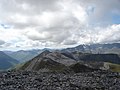
 Stob Ban, Grey Corries - geograph.org.uk - 22804.jpg 640 × 480; 78 KB
-
 Sugar beet factory, Bury St Edmunds - geograph.org.uk - 22170.jpg 640 × 427; 55 KB
-
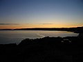 Sunset across Loch Gairloch - geograph.org.uk - 64285.jpg 640 × 480; 27 KB
-
 Telephone Box and post box - geograph.org.uk - 619253.jpg 361 × 640; 54 KB
-
 Telford's Bridge - geograph.org.uk - 1081112.jpg 640 × 479; 59 KB
-
 The Arboretum - Arboretum Lake - geograph.org.uk - 1066892.jpg 640 × 480; 129 KB
-
 The Clock Tower, Newtown, Ashford - geograph.org.uk - 22080.jpg 640 × 590; 63 KB
-
 The Grouse Inn - on A624 above Chunal. - geograph.org.uk - 22280.jpg 640 × 480; 94 KB
-
 The Grouse Inn near Glossop.jpg 529 × 305; 53 KB
-

-
 The Mayor of Casterbridge diesel locomotive 02.jpg 1,280 × 960; 626 KB
-
 The Mayor of Casterbridge diesel locomotive 04.jpg 1,280 × 960; 644 KB
-
 The Mayor of Casterbridge diesel locomotive 07.jpg 960 × 1,280; 587 KB
-

-
 The path to Ben Wyvis - geograph.org.uk - 1046191.jpg 800 × 549; 191 KB
-
 The Rectory, Ampney Crucis - geograph.org.uk - 22374.jpg 640 × 480; 473 KB
-
 The summit of Ben Wyvis - geograph.org.uk - 602861.jpg 800 × 600; 175 KB
-
 The West End of Arlington Row - geograph.org.uk - 22436.jpg 640 × 480; 481 KB
-
 TOG 2 Tank, Bovington Tank Museum - geograph.org.uk - 176085.jpg 640 × 458; 71 KB
-
 Track through Glen Tilt - geograph.org.uk - 97398.jpg 640 × 481; 121 KB
-
 Trafalgar 200 - geograph.org.uk - 22869.jpg 640 × 480; 121 KB
-
 Twopennyloaf Rock - geograph.org.uk - 23432.jpg 640 × 480; 98 KB
-
 View from "The Nab" - geograph.org.uk - 22285.jpg 640 × 480; 136 KB
-

-
 View north east from An Cabar - geograph.org.uk - 602853.jpg 800 × 600; 201 KB
-
 View northwest from Ben Wyvis - geograph.org.uk - 1046175.jpg 640 × 480; 69 KB
-
 View of A417 near Ampney St Peter - geograph.org.uk - 22391.jpg 640 × 480; 170 KB
-
 View south west from An Cabar - geograph.org.uk - 602865.jpg 800 × 528; 210 KB
-
 View up Loch Linnhe - geograph.org.uk - 22173.jpg 640 × 448; 114 KB
-
 View up Loch Linnhe - geograph.org.uk - 22174.jpg 640 × 439; 100 KB
-
 View up Loch Linnhe from near Creag Dhubh - geograph.org.uk - 22144.jpg 640 × 456; 120 KB
-
 View up Sound of Mull - geograph.org.uk - 22172.jpg 640 × 452; 117 KB
-
 View up Sound of Mull from Fishnish - geograph.org.uk - 22179.jpg 640 × 439; 78 KB
-
 View up the Sound of Mull - geograph.org.uk - 22154.jpg 640 × 454; 116 KB
-
 View up the Sound of Mull - geograph.org.uk - 22156.jpg 640 × 467; 105 KB
-

-
-
 View west northwest from Ben Wyvis - geograph.org.uk - 602860.jpg 800 × 600; 141 KB
-
 Virgin Voyager 221113 departing Bristol Temple Meads 01.jpg 1,280 × 960; 512 KB
-
 Virgin Voyager 221113 departing Bristol Temple Meads 02.jpg 1,280 × 960; 644 KB
-
 Virgin Voyager 221138 and Wessex Trains 153318 01.jpg 1,280 × 960; 479 KB
-
 Virgin Voyager 221139 at Bristol Temple Meads 2005-06-28.jpg 1,280 × 960; 622 KB
-
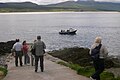 Waiting for the ferry. - geograph.org.uk - 1071769.jpg 640 × 427; 70 KB
-
 War Memorial at Ampney Crucis - geograph.org.uk - 22371.jpg 640 × 480; 572 KB
-
 Wessex Trains Class 143 DMU 143603 north of Bristol Temple Meads.jpg 1,280 × 960; 623 KB
-
 Wessex Trains Class 143 DMU 143620 at Bristol Temple Meads platform 5.jpg 1,280 × 960; 535 KB
-
 Wessex Trains Class 143 DMU 143620 at Bristol Temple Meads platform 7.jpg 1,280 × 960; 544 KB
-
 Wessex Trains Class 150 advertising liveries - Great Gardens of Cornwall 01.jpg 1,280 × 960; 626 KB


_near_Cirencester_-_geograph.org.uk_-_22357.jpg)


_near_Cirencester_-_geograph.org.uk_-_22359.jpg)


_-_geograph.org.uk_-_22138.jpg)


