Category:United Kingdom photographs taken on 2005-09-25
| ← | Sunday 25 September 2005 | → | ||
| ← | September 2005 | → | ||

United Kingdom photographs taken on 25 September 2005.
Image files should be categorized here automatically using {{taken on}} template. Direct categorisation is also possible, if automatic is impossible.
Subcategories
This category has the following 2 subcategories, out of 2 total.
L
Media in category "United Kingdom photographs taken on 2005-09-25"
The following 200 files are in this category, out of 388 total.
(previous page) (next page)-
 A leafy Surrey Lane - geograph.org.uk - 64471.jpg 640 × 480; 163 KB
-
 A1 Grand Prix Race Car of Great Britain 2005.jpg 1,600 × 1,200; 635 KB
-
 A1 Grand Prix Race Car of Ireland 2005.jpg 1,600 × 1,200; 638 KB
-
 A1 Grand Prix Race Car of Team RSA 2005.jpg 1,600 × 1,200; 637 KB
-
 A1GP race at Brands Hatch - geograph.org.uk - 267651.jpg 640 × 480; 89 KB
-
 A60 Mansfield Road - geograph.org.uk - 57471.jpg 640 × 480; 155 KB
-
 Aerial photograph of Old Sarum site, on departure from Old Sarum airfield.jpg 2,048 × 1,536; 815 KB
-

-

-
 Ardwell House, Ardwell, Wigtownshire - geograph.org.uk - 57466.jpg 640 × 480; 98 KB
-
 Arriva Bus and Coach Cleckheaton - geograph.org.uk - 58009.jpg 640 × 480; 61 KB
-
 Astley Independent Methodist Church - geograph.org.uk - 57422.jpg 640 × 480; 114 KB
-
 Bank protection - geograph.org.uk - 574969.jpg 640 × 423; 68 KB
-

-
 Bearhill Farm - geograph.org.uk - 57738.jpg 640 × 480; 101 KB
-
 Belfast West Power Station - geograph.org.uk - 328813.jpg 640 × 426; 112 KB
-
 Below the M4 - geograph.org.uk - 58194.jpg 640 × 480; 65 KB
-
 Bentley House - geograph.org.uk - 57643.jpg 640 × 480; 128 KB
-
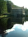
 Bocking mill.jpg 640 × 480; 96 KB
-
-
 Boundary Farm - geograph.org.uk - 57463.jpg 640 × 480; 108 KB
-
 Bow Lane, Durham - geograph.org.uk - 500446.jpg 480 × 640; 90 KB
-
 Boys Club, Stirling - geograph.org.uk - 57994.jpg 640 × 427; 114 KB
-
 Brabham 1982 BT49D Formula 1 Race Car.jpg 2,560 × 1,920; 1.78 MB
-
 Brampton Brierlow - Hoober Stand.jpg 640 × 480; 127 KB
-
 Brentford canal basin - geograph.org.uk - 58135.jpg 640 × 480; 66 KB
-
 Bridleway near Cottam - geograph.org.uk - 57498.jpg 640 × 480; 126 KB
-
 Bridleway near Cottam - geograph.org.uk - 57503.jpg 640 × 480; 98 KB
-
 Bridleway to Broadhurst - geograph.org.uk - 57872.jpg 640 × 480; 192 KB
-
 British Round House (Reconstruction) - geograph.org.uk - 57735.jpg 640 × 480; 50 KB
-
 Buckland Beacon - geograph.org.uk - 64909.jpg 640 × 425; 78 KB
-
 Burlescombe - church - geograph.org.uk - 57772.jpg 640 × 427; 109 KB
-
 Burlescombe, railway at Eastbrook - geograph.org.uk - 57777.jpg 640 × 427; 160 KB
-
 Cadder parish church in 2005.jpg 640 × 480; 174 KB
-
 Cambusnethan Priory - geograph.org.uk - 392333.jpg 640 × 427; 143 KB
-
 Cannich camp site - geograph.org.uk - 57826.jpg 640 × 480; 128 KB
-
 Cannich Youth Hostel - geograph.org.uk - 57822.jpg 640 × 480; 92 KB
-
 Canning Half Tide Dock - geograph.org.uk - 328728.jpg 600 × 443; 75 KB
-
 Castle Edge - geograph.org.uk - 57876.jpg 640 × 480; 145 KB
-
 Castle Fraser - geograph.org.uk - 96559.jpg 640 × 480; 96 KB
-
 Cawder Golf Course - geograph.org.uk - 57727.jpg 640 × 480; 191 KB
-
 Cawder House - geograph.org.uk - 57725.jpg 640 × 480; 120 KB
-
 Cemetery in Stirling, Scotland.jpg 718 × 696; 138 KB
-

-
 Chiselborough, Somerset - geograph.org.uk - 1706390.jpg 640 × 450; 89 KB
-
 Clarendon Dock - geograph.org.uk - 327787.jpg 640 × 169; 29 KB
-
 Close up of Hunslet mills. - geograph.org.uk - 119587.jpg 640 × 480; 131 KB
-
 Coast Road Shotton - geograph.org.uk - 57590.jpg 640 × 480; 139 KB
-
 Concrete Stile, Low Farm - geograph.org.uk - 80657.jpg 640 × 480; 69 KB
-
 Converted Oast Houses, Greathouse Farm - geograph.org.uk - 57494.jpg 640 × 479; 101 KB
-
 Coombe Hill Canal - geograph.org.uk - 59072.jpg 640 × 426; 143 KB
-
 Coombe Hill Canal - geograph.org.uk - 59078.jpg 426 × 640; 142 KB
-
 Coombe Hill Nature Reserve - geograph.org.uk - 59025.jpg 640 × 426; 156 KB
-
 Cothay Manor.jpg 640 × 427; 100 KB
-
 Cottage Farm - geograph.org.uk - 57591.jpg 640 × 480; 84 KB
-
 Country road near Redbrook - geograph.org.uk - 88736.jpg 640 × 480; 68 KB
-
 Coventry - Canley - geograph.org.uk - 57452.jpg 640 × 480; 120 KB
-
 Craigie - geograph.org.uk - 57835.jpg 640 × 453; 58 KB
-
 Craigie Hill - geograph.org.uk - 57832.jpg 640 × 443; 49 KB
-
 Cross Ness Treatment Tanks - geograph.org.uk - 57625.jpg 640 × 482; 76 KB
-
 Cullompton, Kingsmill Industrial Estate - geograph.org.uk - 57824.jpg 640 × 427; 105 KB
-
 Cwm Eigiau - geograph.org.uk - 80101.jpg 640 × 480; 105 KB
-
 D182 at Wansford (1).jpg 1,024 × 768; 470 KB
-
 D182 at Wansford.jpg 1,024 × 768; 545 KB
-
 D306 at Wansford.jpg 1,024 × 768; 531 KB
-
 Dacre Village Hall and Playpark - geograph.org.uk - 61070.jpg 640 × 480; 121 KB
-
 Dagenham Dock - geograph.org.uk - 57614.jpg 640 × 462; 43 KB
-
 DaleEndDerbys.jpg 640 × 480; 124 KB
-
 Dean Gallery Bourdelle.jpg 600 × 800; 106 KB
-
 Drainage, Rhynd. - geograph.org.uk - 57837.jpg 640 × 480; 87 KB
-
 Dunes, Tentsmuir. - geograph.org.uk - 58159.jpg 640 × 431; 71 KB
-
 Eagle City Road London 2005.jpg 1,920 × 2,560; 1.42 MB
-
 Easter Friarton - geograph.org.uk - 58845.jpg 640 × 480; 60 KB
-
 Elam Grange Farm - geograph.org.uk - 57524.jpg 640 × 480; 157 KB
-
 Electricity substation - geograph.org.uk - 57573.jpg 640 × 480; 123 KB
-
-
-
 Entrance to Wooson's Hill Inclosure - geograph.org.uk - 57454.jpg 640 × 427; 190 KB
-
 Estate houses at Sledmere - geograph.org.uk - 57543.jpg 640 × 480; 100 KB
-
 Farleigh Castle - geograph.org.uk - 57869.jpg 640 × 480; 67 KB
-
 Farm buildings at Inchmore - geograph.org.uk - 57885.jpg 640 × 480; 119 KB
-
 Farm buildings, The Leigh - geograph.org.uk - 61778.jpg 640 × 426; 123 KB
-
 Farmyard in The Leigh - geograph.org.uk - 61776.jpg 640 × 426; 193 KB
-
 Field of Maize at The Leigh - geograph.org.uk - 59089.jpg 640 × 426; 171 KB
-
 Fielding Primary School, London W13 - geograph.org.uk - 58954.jpg 640 × 480; 91 KB
-
 Firepower - geograph.org.uk - 57579.jpg 640 × 482; 75 KB
-
 Floral Display at Torquay - geograph.org.uk - 794092.jpg 640 × 480; 134 KB
-

-
 Footbridge over Princes Dock - geograph.org.uk - 328709.jpg 600 × 448; 85 KB
-
 Footpath beside Coombe Hill Canal - geograph.org.uk - 924030.jpg 640 × 426; 122 KB
-
 Ford's of Dagenham - geograph.org.uk - 57611.jpg 640 × 444; 75 KB
-
 Forestry near Cannich - geograph.org.uk - 57879.jpg 640 × 480; 147 KB
-
 Fountain in Postman's Park.jpg 2,048 × 1,536; 869 KB
-
 Fowler 4240015 at the Rutland Railway 05-09-25 32.jpeg 2,548 × 1,801; 766 KB
-
 Free Range Pig Farm - geograph.org.uk - 57479.jpg 640 × 480; 95 KB
-
 Free Range Pig Farm - geograph.org.uk - 57577.jpg 640 × 480; 118 KB
-
 Frog Farm, Wickham Field - geograph.org.uk - 64488.jpg 640 × 480; 82 KB
-
 Gibson Mill - geograph.org.uk - 81645.jpg 480 × 640; 92 KB
-
 Glendaruel Caravan Park. - geograph.org.uk - 413580.jpg 427 × 640; 164 KB
-
 Golden Pheasant - geograph.org.uk - 57764.jpg 640 × 480; 100 KB
-
 GOT Tram 4 Descending 05-07-17 04.jpeg 2,404 × 1,699; 709 KB
-
 GOT Tram 5 Ascending 05-07-17 10.jpeg 2,824 × 1,837; 586 KB
-
 Grand Living at Plymouth - geograph.org.uk - 794072.jpg 640 × 480; 89 KB
-
 Gratton Dale - peak District National Park - geograph.org.uk - 59766.jpg 640 × 480; 170 KB
-
 Gratton Dale and Long Dale Junction - geograph.org.uk - 59770.jpg 640 × 480; 168 KB
-
 Gratton Moor - geograph.org.uk - 59778.jpg 640 × 480; 132 KB
-
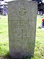 Gravestone AC2 H. Woods - geograph.org.uk - 57502.jpg 480 × 640; 171 KB
-
 Greenknowe Tower - geograph.org.uk - 58145.jpg 480 × 640; 238 KB
-
 Groynes near Barmouth at high tide - geograph.org.uk - 129456.jpg 640 × 457; 93 KB
-
 GSK HQ from Grand Union Canal - geograph.org.uk - 58121.jpg 480 × 640; 77 KB
-
 Harlow Wood, private housing estate - geograph.org.uk - 57474.jpg 640 × 480; 94 KB
-
 Harper-Collins Offices - geograph.org.uk - 57811.jpg 640 × 480; 97 KB
-
 Hayley Dingle - geograph.org.uk - 57487.jpg 640 × 479; 147 KB
-
 Hayley Dingle Viaduct - geograph.org.uk - 57460.jpg 479 × 640; 160 KB
-
 Holcombe Rogus, field near Broadways farm - geograph.org.uk - 57788.jpg 640 × 427; 106 KB
-
 Holcombe Rogus, lane near Redhill Farm - geograph.org.uk - 57782.jpg 427 × 640; 165 KB
-
 Holcombe Rogus, pond at Ford - geograph.org.uk - 57812.jpg 640 × 427; 92 KB
-
 Holy Isle, Arran - geograph.org.uk - 60051.jpg 640 × 480; 102 KB
-
 Hoober Observatory - geograph.org.uk - 57753.jpg 640 × 480; 149 KB
-
 House at Boghead - geograph.org.uk - 57742.jpg 640 × 480; 136 KB
-
 Hudswell D707 at the Rutland Railway 05-09-25 31.jpeg 2,326 × 1,670; 735 KB
-
 Hunslet 6688 at the Rutland Railway 05-09-25 38.jpeg 2,248 × 1,658; 577 KB
-
 Katyn Memorial - geograph.org.uk - 57530.jpg 640 × 480; 150 KB
-
 Keele University Observatory - geograph.org.uk - 58754.jpg 640 × 480; 79 KB
-
 King's Ransom on the Bridgewater Canal, Sale.jpg 640 × 480; 111 KB
-
 Kingfisher (Alcedo atthis) - geograph.org.uk - 1036139.jpg 640 × 480; 91 KB
-
 Kirkton - geograph.org.uk - 58841.jpg 640 × 480; 57 KB
-
 Kirkton Barns - geograph.org.uk - 58844.jpg 640 × 480; 74 KB
-
 Lady Lilliard's grave - geograph.org.uk - 58151.jpg 640 × 480; 277 KB
-
-
 Le Marchant Barracks - geograph.org.uk - 57733.jpg 640 × 461; 48 KB
-

-
 Leeds Liverpool canal, Bank Newton - geograph.org.uk - 1253438.jpg 640 × 480; 57 KB
-

-

-
 St Catherine's Church, The Leigh - geograph.org.uk - 59143.jpg 640 × 426; 131 KB
-
 Leigh Court - geograph.org.uk - 59149.jpg 640 × 426; 152 KB
-
 Links Wood. - geograph.org.uk - 58852.jpg 640 × 480; 138 KB
-
 Loch Farm - geograph.org.uk - 57785.jpg 640 × 480; 123 KB
-
 Loch Slapin shore - geograph.org.uk - 1053390.jpg 1,000 × 748; 287 KB
-
 Long Dale - Peak District National Park - geograph.org.uk - 59771.jpg 640 × 480; 147 KB
-
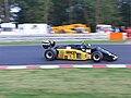
 Lotus 1981 87 Cosworth Johnny Player Special Number 17 .jpg 2,560 × 1,920; 1.84 MB
-
 Low Moss Prison - geograph.org.uk - 57731.jpg 640 × 480; 86 KB
-
 Lower Apperley - geograph.org.uk - 71405.jpg 640 × 426; 106 KB
-

-
 Lustleigh Cleave near Heaven's Gate - geograph.org.uk - 127078.jpg 640 × 480; 200 KB
-
 M25 hidden by trees - geograph.org.uk - 64484.jpg 640 × 480; 95 KB
-
 M62 Birkenshaw - geograph.org.uk - 58007.jpg 640 × 480; 73 KB
-
 MacDuff Circle detail.jpg 800 × 600; 125 KB
-
 Magpie Mine Sheldon - geograph.org.uk - 362601.jpg 426 × 640; 58 KB
-
 Mansfield By-pass - geograph.org.uk - 57496.jpg 640 × 480; 92 KB
-
 Meadowburn Parkland, Cadder - geograph.org.uk - 57819.jpg 640 × 480; 121 KB
-
 Mere End - geograph.org.uk - 58808.jpg 640 × 480; 191 KB
-
 Mere Sands Wood Visitor Centre - geograph.org.uk - 58787.jpg 640 × 480; 128 KB
-
 Middlebie Cemetery - geograph.org.uk - 670910.jpg 480 × 640; 80 KB
-
 Midley Crossing - geograph.org.uk - 57748.jpg 640 × 480; 125 KB
-
 Minardi 1985 M185 Formula 1 Race Car.jpg 2,560 × 1,920; 1.79 MB
-
 Morgan's Hill from Wessex Ridgeway - geograph.org.uk - 57843.jpg 640 × 480; 64 KB
-
 Motocross course - geograph.org.uk - 57648.jpg 640 × 480; 86 KB
-
 Motray Water. - geograph.org.uk - 57712.jpg 640 × 480; 112 KB
-
 Motte Stranraer.jpg 640 × 480; 129 KB
-
 Moulton Pack Horse bridge - geograph.org.uk - 829526.jpg 640 × 480; 93 KB
-
 New Mills Golf Course - geograph.org.uk - 57881.jpg 640 × 480; 129 KB
-
 Newly planted, Kirkland. - geograph.org.uk - 58170.jpg 640 × 480; 72 KB
-
 Newnham Park - geograph.org.uk - 58421.jpg 640 × 480; 100 KB
-
 Newport by-pass. - geograph.org.uk - 58849.jpg 640 × 480; 97 KB
-
 Newport Primary School. - geograph.org.uk - 58851.jpg 640 × 480; 73 KB
-
 NS6469 harvest.jpg 640 × 480; 140 KB
-
 Oaklined road. - geograph.org.uk - 57714.jpg 640 × 480; 113 KB
-
 Oxenton Hill viewed from Coombe Hill Canal - geograph.org.uk - 61783.jpg 640 × 426; 122 KB
-
 Penyclawdd Church - geograph.org.uk - 154120.jpg 640 × 427; 97 KB
-
 Pilgrim House - geograph.org.uk - 64476.jpg 640 × 480; 79 KB
-

-
 Pylons crossing meadows near The Leigh - geograph.org.uk - 59153.jpg 426 × 640; 88 KB
-
 Quarry near Twitton - geograph.org.uk - 64482.jpg 640 × 480; 89 KB
-
 Radar Station, RAF Fylingdales - geograph.org.uk - 384147.jpg 640 × 480; 63 KB
-
 Rathillet - geograph.org.uk - 57707.jpg 640 × 480; 94 KB
-
 River Bovey at Clam Bridge - geograph.org.uk - 127083.jpg 640 × 480; 172 KB
-
 River Ericht.jpg 640 × 480; 152 KB
-
 Row Boats for hire at Waterhead - geograph.org.uk - 453405.jpg 640 × 480; 112 KB
-
 Rutland Railway Demonstration Goods Train 05-09-25 73.jpeg 2,441 × 1,896; 616 KB
-
 Rutland Railway Passenger Train 05-09-25 54.jpeg 2,848 × 1,681; 514 KB
-
 Rutland Railway Row of diesel locomotives 05-09-25 42.jpeg 2,842 × 1,734; 765 KB
-

-
 Scott Speed's Yank Tank - Flickr - edvvc.jpg 1,600 × 1,200; 635 KB
-
 Sharpness river wall - geograph.org.uk - 574989.jpg 640 × 421; 51 KB
-
 Shotton Sports Ground - geograph.org.uk - 57574.jpg 640 × 480; 170 KB
-
 Shotton.jpg 640 × 480; 166 KB
-
 Site of Battle of Roundway Down (geograph 57827).jpg 640 × 480; 56 KB
-
 Spot the Ball - geograph.org.uk - 58329.jpg 640 × 480; 82 KB
-
 St Dingad's Church, Dingestow - geograph.org.uk - 153911.jpg 640 × 480; 95 KB
-
 St Mary's Church, Priors Norton - geograph.org.uk - 59160.jpg 640 × 426; 109 KB
-
 St Michael's Wood. - geograph.org.uk - 57722.jpg 640 × 480; 133 KB
-
 St Michaels - geograph.org.uk - 57717.jpg 640 × 480; 117 KB
-
 Stedham Bridge, West Sussex - geograph.org.uk - 57704.jpg 640 × 480; 119 KB
-
 Stile at Hammerslake, Lustleigh - geograph.org.uk - 127093.jpg 640 × 480; 184 KB
-
 Stirling - Pyramid - geograph.org.uk - 57912.jpg 640 × 427; 85 KB
-
 Straight from the horse's mouth - geograph.org.uk - 57760.jpg 640 × 480; 109 KB
-
 Strath Glass at Struy - geograph.org.uk - 57889.jpg 640 × 480; 90 KB
-
 Tattie field, Easter Friarton. - geograph.org.uk - 58848.jpg 640 × 480; 68 KB


_-_geograph.org.uk_-_57735.jpg)


.jpg)


_-_geograph.org.uk_-_1036139.jpg)


.jpg)


