Category:United Kingdom photographs taken on 2005-10-04
Countries of Europe: Austria · Belgium · Finland · France‡ · Germany · Greece · Republic of Ireland · Italy · Netherlands‡ · Norway · Poland · Russia‡ · Serbia · Spain‡ · Switzerland · Turkey‡ · Ukraine · United Kingdom
‡: partly located in Europe
‡: partly located in Europe
| ← | 4 October 2005 | → | ||
| ← | October 2005 | → | ||

United Kingdom photographs taken on 4 October 2005.
Image files should be categorized here automatically using {{taken on}} template. Direct categorisation is also possible, if automatic is impossible.
Subcategories
This category has only the following subcategory.
L
Media in category "United Kingdom photographs taken on 2005-10-04"
The following 200 files are in this category, out of 238 total.
(previous page) (next page)-
 "Brecon Carreg" water bottling plant - geograph.org.uk - 61633.jpg 640 × 434; 66 KB
-

-
 A Sheep Sale at Lairg Marketplace - geograph.org.uk - 61170.jpg 640 × 480; 173 KB
-
 A303 near Forton - geograph.org.uk - 62377.jpg 640 × 427; 74 KB
-
 Abattoir, Wiswell Moor - geograph.org.uk - 61505.jpg 640 × 480; 108 KB
-
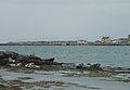
 Aberdeen Harbour - geograph.org.uk - 94634.jpg 640 × 481; 118 KB
-
 Access Road to Douglas Muir Quarry - geograph.org.uk - 61256.jpg 640 × 480; 145 KB
-
 Aerial Mast at Westbury on Trym - geograph.org.uk - 61543.jpg 640 × 480; 45 KB
-
 Amman Valley Hospital - geograph.org.uk - 61581.jpg 640 × 344; 61 KB
-
 Arrested Development - geograph.org.uk - 61346.jpg 640 × 480; 97 KB
-
 Astley Moss - geograph.org.uk - 61126.jpg 640 × 480; 80 KB
-
 Bachelors Cottage - geograph.org.uk - 61575.jpg 640 × 480; 124 KB
-
 Baldernock Mill - geograph.org.uk - 61274.jpg 640 × 480; 149 KB
-
 Barley Mow - geograph.org.uk - 61351.jpg 640 × 480; 123 KB
-
 St. Luke the Physician - geograph.org.uk - 61348.jpg 640 × 480; 101 KB
-
 Berneray Ruin Cemetery.jpg 640 × 480; 101 KB
-
 Berneray Seals.jpg 640 × 441; 50 KB
-
 Bicester Airfield - geograph.org.uk - 61552.jpg 640 × 480; 108 KB
-
 Bickton Mill - geograph.org.uk - 61358.jpg 640 × 481; 146 KB
-
 Bridgend. - geograph.org.uk - 61273.jpg 640 × 480; 87 KB
-
 Bridleway and farmland northeast of Castor - geograph.org.uk - 67499.jpg 640 × 427; 107 KB
-
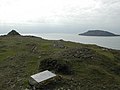 Cairn at the summit of Pen Y Cil - geograph.org.uk - 62561.jpg 640 × 480; 70 KB
-

-
 Carlisle - The Citadel - geograph.org.uk - 258060.jpg 640 × 480; 107 KB
-
 Carnedd y Ddelw - geograph.org.uk - 62481.jpg 640 × 480; 92 KB
-

-
 Chapel, Kirkby Stephen's cemetery - geograph.org.uk - 410980.jpg 640 × 426; 117 KB
-
 Church End, Ockham - geograph.org.uk - 61599.jpg 640 × 480; 106 KB
-

-
 Cottages - geograph.org.uk - 414781.jpg 640 × 480; 71 KB
-
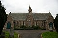
 Crathie Kirk - geograph.org.uk - 94688.jpg 481 × 640; 107 KB
-
 Crathie Kirk - geograph.org.uk - 94694.jpg 481 × 640; 117 KB
-
 Crathie Kirk - geograph.org.uk - 94695.jpg 640 × 481; 139 KB
-
 Disused leat - geograph.org.uk - 63604.jpg 640 × 480; 118 KB
-
 Disused quarry - geograph.org.uk - 62464.jpg 640 × 480; 132 KB
-
 Dougalston Loch - geograph.org.uk - 61279.jpg 640 × 480; 147 KB
-
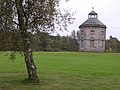 Dovecot on Dougalston Golf Course - geograph.org.uk - 61264.jpg 640 × 480; 132 KB
-
 Dovecote, Wichenford Court - geograph.org.uk - 61227.jpg 640 × 479; 86 KB
-
 Drum - geograph.org.uk - 63525.jpg 640 × 480; 116 KB
-
 Egbury hillfort - geograph.org.uk - 62246.jpg 640 × 427; 70 KB
-
 Egbury hillfort - geograph.org.uk - 62250.jpg 640 × 427; 141 KB
-
 Eroding cliffs near Aberdaron - geograph.org.uk - 62536.jpg 640 × 480; 62 KB
-
 Ettrick Water and fishing hut - geograph.org.uk - 1002508.jpg 640 × 480; 83 KB
-
 Ettrick Water and Salmon Angler - geograph.org.uk - 1002511.jpg 640 × 480; 80 KB
-
 Farm track to Ty Mawr - geograph.org.uk - 62679.jpg 640 × 480; 94 KB
-
 Farmland, Hillend. - geograph.org.uk - 61255.jpg 640 × 480; 76 KB
-
 Farmland, Little Ochiltree. - geograph.org.uk - 61268.jpg 640 × 480; 85 KB
-
 Fence-line, Foel Lwyd - geograph.org.uk - 63528.jpg 640 × 480; 144 KB
-
 Fetcham mill pond - geograph.org.uk - 61524.jpg 640 × 480; 76 KB
-

-
 Fields north of Ellington - geograph.org.uk - 67469.jpg 640 × 427; 123 KB
-
 Fields on Hungry Hill - geograph.org.uk - 61587.jpg 640 × 480; 82 KB
-
 Figsbury Ring car park - geograph.org.uk - 61355.jpg 640 × 481; 135 KB
-
 Finsbury Park - geograph.org.uk - 61277.jpg 640 × 482; 121 KB
-
 Garden at Langbank Holdings - geograph.org.uk - 61276.jpg 640 × 480; 154 KB
-
 Gdynia Way, Prince Rock, Plymouth - geograph.org.uk - 63643.jpg 640 × 480; 136 KB
-
 Green road (Bullock Road) - geograph.org.uk - 67486.jpg 640 × 427; 132 KB
-
 Green Road (Bullock Road) - geograph.org.uk - 67490.jpg 640 × 427; 120 KB
-
 Heaton Park - geograph.org.uk - 62688.jpg 640 × 480; 109 KB
-
 High Chapel URC, Ravenstonedale - geograph.org.uk - 224680.jpg 640 × 426; 152 KB
-
 Hill top reservoir. - geograph.org.uk - 61262.jpg 640 × 432; 49 KB
-
 Isle of Wight coast, England, 5 October 2005 (59160575).jpg 1,770 × 2,946; 5.84 MB
-
 Junction at Mynytho - geograph.org.uk - 62677.jpg 640 × 480; 85 KB
-
 King George V's Playing Fields, Elburton - geograph.org.uk - 63647.jpg 640 × 480; 111 KB
-
 Kirkby Stephen Parish Church - geograph.org.uk - 410978.jpg 640 × 426; 117 KB
-
 Kirklands. - geograph.org.uk - 61249.jpg 640 × 480; 105 KB
-
 St Mary's Church, Launton - geograph.org.uk - 61239.jpg 640 × 480; 116 KB
-
 Leat - geograph.org.uk - 63606.jpg 640 × 480; 115 KB
-
 Letterbox^ or Postbox^ - geograph.org.uk - 61206.jpg 640 × 488; 188 KB
-
 Little Ochiltree - geograph.org.uk - 61265.jpg 640 × 480; 77 KB
-
 Longparish station - geograph.org.uk - 62381.jpg 640 × 427; 118 KB
-
 Looking south to Ellington - geograph.org.uk - 67474.jpg 640 × 427; 134 KB
-
-
 Methodist Church, Kirkby Stephen - geograph.org.uk - 502350.jpg 640 × 426; 124 KB
-
 Methodist Church, Newbiggin-on-Lune - geograph.org.uk - 224686.jpg 640 × 426; 129 KB
-
 MethodistChurchNewbigginOnLune(AlexanderPKapp)Oct2005.jpg 640 × 426; 119 KB
-
 Middleton House - geograph.org.uk - 62274.jpg 640 × 427; 115 KB
-
 Nancy's Hill. - geograph.org.uk - 61281.jpg 640 × 480; 52 KB
-
 Natural arch near Aberdaron - geograph.org.uk - 62532.jpg 480 × 640; 116 KB
-
 New footpath works - geograph.org.uk - 1302189.jpg 640 × 479; 135 KB
-
 New River and West Reservoir - geograph.org.uk - 61272.jpg 482 × 640; 104 KB
-
 Outcrop at north end of Betws Mountain - geograph.org.uk - 64603.jpg 640 × 453; 177 KB
-
 Pen y Castell - geograph.org.uk - 63601.jpg 640 × 480; 104 KB
-
 Porth Simdde - geograph.org.uk - 62537.jpg 640 × 480; 77 KB
-
 Parish church, Pulloxhill, Beds - geograph.org.uk - 63248.jpg 600 × 450; 322 KB
-

-
 Railway line south of Oxshott - geograph.org.uk - 61538.jpg 640 × 480; 162 KB
-
-
 Rays - panoramio.jpg 1,280 × 960; 645 KB
-
 Ribblehead Viaduct - geograph.org.uk - 258090.jpg 640 × 480; 113 KB
-
 River Tweed at Kelso - geograph.org.uk - 1002518.jpg 640 × 480; 53 KB
-
 Salisbury District Hospital - geograph.org.uk - 61356.jpg 640 × 481; 105 KB
-
 Salisbury District Hospital, rear car park - geograph.org.uk - 61357.jpg 640 × 481; 104 KB
-
 Sandford Methodist Chapel - geograph.org.uk - 84052.jpg 640 × 426; 148 KB
-
 School, Kingscavil.jpg 640 × 480; 83 KB
-
 Sea caves near Aberdaron - geograph.org.uk - 62534.jpg 640 × 480; 148 KB
-
 Segsbury Camp - geograph.org.uk - 61183.jpg 640 × 427; 83 KB
-

-
 Smithy Lodge - geograph.org.uk - 62684.jpg 640 × 480; 130 KB
-
 St Lukes Parish Church Soulby - geograph.org.uk - 74714.jpg 640 × 426; 145 KB
-
 Southampton, England, 5 October 2005 (83677562).jpg 2,624 × 1,980; 7.01 MB
-
 Spoil heaps at disused quarry - geograph.org.uk - 61625.jpg 640 × 457; 68 KB
-
 St Michael's Church, Bongate, Appleby - geograph.org.uk - 542650.jpg 640 × 426; 141 KB
-
-
 St Oswald's Church, Ravenstonedale - geograph.org.uk - 224675.jpg 640 × 426; 123 KB
-
 St Theobald's Church, Great Musgrave - geograph.org.uk - 501253.jpg 640 × 426; 161 KB
-
 St. Mary's, Chilton - geograph.org.uk - 414775.jpg 640 × 452; 141 KB
-
 ST.Paul's R.C. High School - geograph.org.uk - 61347.jpg 640 × 480; 143 KB
-
 Station Inn and Ribblehead Viaduct - geograph.org.uk - 258070.jpg 640 × 480; 109 KB
-
 Steps at the Land's End of North Wales - geograph.org.uk - 62664.jpg 640 × 480; 101 KB
-
 Stubble. Kirklands. - geograph.org.uk - 61251.jpg 640 × 480; 60 KB
-
 Tachbrook St market, Pimlico - geograph.org.uk - 62224.jpg 640 × 480; 96 KB
-

-
 Thatched barn - geograph.org.uk - 62240.jpg 640 × 427; 107 KB
-
 Thatched cottages at Wherwell - geograph.org.uk - 62387.jpg 640 × 427; 133 KB
-

-
 The Castle Stoke Newington - geograph.org.uk - 61286.jpg 482 × 640; 77 KB
-
 The Hautboy, Ockham - geograph.org.uk - 61645.jpg 640 × 480; 120 KB
-
 The mill at Fullerton - geograph.org.uk - 62393.jpg 640 × 427; 131 KB
-
 The old and the new - geograph.org.uk - 62470.jpg 640 × 480; 103 KB
-
 The old Barton to Brigg Turnpike road - geograph.org.uk - 61208.jpg 640 × 480; 94 KB
-
 The Old Royal Station - geograph.org.uk - 93085.jpg 640 × 480; 81 KB
-
 The remains of Fullerton Junction - geograph.org.uk - 62391.jpg 640 × 427; 155 KB
-
 The Union Canal. - geograph.org.uk - 61284.jpg 640 × 480; 71 KB
-
 Thriplow Smithy - geograph.org.uk - 61427.jpg 640 × 480; 91 KB
-
 Tower of Derwent Dam - geograph.org.uk - 102759.jpg 640 × 480; 91 KB
-
 Trichrug seen from the southeast - geograph.org.uk - 61605.jpg 640 × 360; 153 KB
-
 Trig point on Trichrug - geograph.org.uk - 61588.jpg 640 × 475; 52 KB
-
 Trout Farm, Bickton - geograph.org.uk - 61359.jpg 640 × 481; 131 KB
-
 Upper Eden Baptist Church, Kirkby Stephen - geograph.org.uk - 502356.jpg 640 × 426; 129 KB
-
 Valley of the River Test - geograph.org.uk - 62384.jpg 640 × 427; 118 KB
-
 Viaduct - geograph.org.uk - 62262.jpg 640 × 427; 63 KB
-
 View from Chilton - geograph.org.uk - 414779.jpg 640 × 480; 166 KB
-
 Village street scene - geograph.org.uk - 62270.jpg 640 × 427; 106 KB
-
 West Lothian Stripes. - geograph.org.uk - 61258.jpg 640 × 480; 55 KB
-

-

-
 Youth Hostel, Kirkby Stephen - geograph.org.uk - 502100.jpg 426 × 640; 113 KB
-
 Allt a' Pholl-choire by the Tollie path - geograph.org.uk - 61758.jpg 640 × 480; 124 KB
-
 An entrance to the Yehudi Menuhin School - geograph.org.uk - 61526.jpg 640 × 480; 153 KB
-

-
 Arundle's Farm - geograph.org.uk - 61233.jpg 640 × 461; 107 KB
-
 Badsworth - Ackworth Hills - geograph.org.uk - 61209.jpg 640 × 479; 124 KB
-
 Blackthorn railway bridge - geograph.org.uk - 61232.jpg 640 × 480; 80 KB
-

-
 Bramley Farm - geograph.org.uk - 61497.jpg 640 × 467; 126 KB
-
 Bramley New Farm - geograph.org.uk - 61354.jpg 640 × 429; 76 KB
-
 Cairn at Foel gron , Mynytho - geograph.org.uk - 62673.jpg 640 × 480; 63 KB
-
 Cairn, Great Hogarh Moor - geograph.org.uk - 61636.jpg 640 × 480; 63 KB
-
 Capel Nant at Nanhoron - geograph.org.uk - 62680.jpg 640 × 480; 86 KB
-
 Carreg Ddu - geograph.org.uk - 62558.jpg 640 × 480; 48 KB
-
 Carreg Dwfn - geograph.org.uk - 61630.jpg 640 × 465; 48 KB
-
 Cliffs at Braich Y Noddfa - geograph.org.uk - 62668.jpg 480 × 640; 76 KB
-
 Cliffs at Pen Y Cil - geograph.org.uk - 62555.jpg 640 × 480; 82 KB
-
 Crossroads - geograph.org.uk - 62254.jpg 640 × 427; 81 KB
-
 Dalchork and the Allt Chaiseagail Burn - geograph.org.uk - 61341.jpg 640 × 480; 117 KB
-
 Dalchork Wood - geograph.org.uk - 61385.jpg 640 × 480; 141 KB
-
 East Aston House - geograph.org.uk - 62267.jpg 640 × 427; 135 KB
-
 Entrance to Bookham Common - geograph.org.uk - 61562.jpg 640 × 480; 138 KB
-
 Entrance to Seymours Garden Centre - geograph.org.uk - 61528.jpg 640 × 480; 110 KB
-
 Erisco - geograph.org.uk - 109283.jpg 640 × 480; 102 KB
-
 Ex Methodist Chapel, Newbiggin-on-Lune - geograph.org.uk - 224683.jpg 640 × 426; 133 KB
-
 Farmland near Moonshine Gap - geograph.org.uk - 67493.jpg 640 × 427; 104 KB
-
 Farmland, Flitton, Beds - geograph.org.uk - 63255.jpg 600 × 450; 306 KB
-
 Farmland, Pulloxhill, Beds - geograph.org.uk - 63244.jpg 600 × 450; 310 KB
-
 Farmland, Silsoe, Beds - geograph.org.uk - 63256.jpg 600 × 450; 210 KB
-
 Field - geograph.org.uk - 61228.jpg 640 × 480; 123 KB
-
 Field and gallops on Ridgeway - geograph.org.uk - 61173.jpg 640 × 427; 94 KB
-
 Field by Skimmingdish Lane, Bicester - geograph.org.uk - 61260.jpg 640 × 480; 108 KB
-
 Field near Blackthorn Hill - geograph.org.uk - 61234.jpg 640 × 480; 169 KB
-
 Field near Launton - geograph.org.uk - 61236.jpg 640 × 480; 150 KB
-
 Flitton Road, Pulloxhill, Beds - geograph.org.uk - 63252.jpg 600 × 450; 256 KB
-
 Footbridge over Great Hograh Beck - geograph.org.uk - 61624.jpg 640 × 480; 101 KB
-
 Footbridge over Nant Gwythwch - geograph.org.uk - 61604.jpg 640 × 443; 90 KB
-
 Footpath at the edge of Wisley airfield - geograph.org.uk - 61650.jpg 640 × 480; 161 KB
-
 Gardens of Longstock House - geograph.org.uk - 62395.jpg 640 × 427; 103 KB
-
 Great Hograh Head - geograph.org.uk - 61621.jpg 640 × 480; 68 KB
-
 Green Lane at Baguley - geograph.org.uk - 61349.jpg 640 × 480; 180 KB
-
 Greenstreet Farm - geograph.org.uk - 61224.jpg 640 × 271; 52 KB
-

-
 Incinerator at the abattoir - geograph.org.uk - 61511.jpg 480 × 640; 75 KB
-
 Junction of forest trails. - geograph.org.uk - 61606.jpg 640 × 383; 56 KB
-

-

-
 Large ploughed field - geograph.org.uk - 67478.jpg 640 × 427; 64 KB
-
 Lattin Down from Ridgeway - geograph.org.uk - 61178.jpg 640 × 427; 81 KB
-
 Ledard Burn - geograph.org.uk - 61764.jpg 480 × 640; 118 KB
-

-
 Loch an Aird-sheilg - geograph.org.uk - 61140.jpg 640 × 480; 124 KB
-
 Longparish village scene - geograph.org.uk - 62268.jpg 640 × 427; 95 KB
-
 Looking east on Southwold Lane - geograph.org.uk - 61559.jpg 640 × 480; 94 KB
-

-
 Looking towards Northwold Farm - geograph.org.uk - 61211.jpg 640 × 480; 119 KB
-
 Middle Moor trig looking northwest - geograph.org.uk - 67506.jpg 640 × 427; 130 KB
-
 Milner House - geograph.org.uk - 61523.jpg 640 × 480; 141 KB
-
 Misty lookout - geograph.org.uk - 61762.jpg 640 × 480; 46 KB
-
 Moonlight on Rollesby Broad, Norfolk - geograph.org.uk - 275384.jpg 640 × 480; 48 KB
-

-
 Ness Point - geograph.org.uk - 172356.jpg 640 × 428; 117 KB
-
 New Barn Farm - geograph.org.uk - 62256.jpg 640 × 427; 121 KB


_-_geograph.org.uk_-_288351.jpg)


_-_geograph.org.uk_-_67486.jpg)
_-_geograph.org.uk_-_67490.jpg)


.jpg)


Oct2005.jpg)


.jpg)


_with_Whitehill_Lane_(foreground)_and_Ockham_Road_North_-_geograph.org.uk_-_61572.jpg)
,_Furze_Field_(left)_and_Birds_Hill_Drive_(right)_-_geograph.org.uk_-_61536.jpg)


