Category:United Kingdom photographs taken on 2005-12-10
Countries of Europe: Austria · Belgium · Czech Republic · France‡ · Germany · Greece · Italy · Kazakhstan‡ · Netherlands‡ · Poland · Portugal‡ · Russia‡ · Spain‡ · Sweden · Turkey‡ · Ukraine · United Kingdom
‡: partly located in Europe
‡: partly located in Europe
| ← | 10 December 2005 | → | ||
| ← | December 2005 | → | ||

United Kingdom photographs taken on 10 December 2005.
Image files should be categorized here automatically using {{taken on}} template. Direct categorisation is also possible, if automatic is impossible.
Subcategories
This category has the following 2 subcategories, out of 2 total.
Media in category "United Kingdom photographs taken on 2005-12-10"
The following 200 files are in this category, out of 572 total.
(previous page) (next page)-
 "West Bank", Fossdyke - geograph.org.uk - 89170.jpg 640 × 426; 107 KB
-
 'Frost Damage' near Guiting Power - geograph.org.uk - 90259.jpg 640 × 426; 147 KB
-
 37411 near Ystrad Mynach - geograph.org.uk - 343182.jpg 640 × 439; 96 KB
-
 37419 at Coed Llanbradach - geograph.org.uk - 343179.jpg 640 × 427; 147 KB
-

-

-
 A muddy track - geograph.org.uk - 90386.jpg 398 × 600; 193 KB
-
 A14 road and farmland, Oakington, Cambs - geograph.org.uk - 89368.jpg 640 × 480; 293 KB
-
 Albany Terrace - geograph.org.uk - 91023.jpg 640 × 502; 81 KB
-
 Aldenham - geograph.org.uk - 89278.jpg 640 × 480; 147 KB
-
 Aldenham, A stile - geograph.org.uk - 93980.jpg 640 × 480; 172 KB
-
 Aldenham, Church of St John the Baptist - geograph.org.uk - 93970.jpg 640 × 480; 100 KB
-
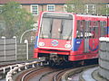
 All Saints DLR station 2005-12-10.jpg 1,600 × 1,200; 875 KB
-
 All Saints' church, Broxholme, Lincs. - geograph.org.uk - 89195.jpg 640 × 427; 118 KB
-
 Amen Corner Business Park - geograph.org.uk - 89818.jpg 640 × 480; 86 KB
-
 Apollo Cinema - geograph.org.uk - 107453.jpg 640 × 480; 46 KB
-
 Apollo Cinema, Portland Place - geograph.org.uk - 98322.jpg 640 × 480; 62 KB
-
 Arnold Lodge School - geograph.org.uk - 93544.jpg 640 × 480; 85 KB
-
 Arnold Lodge School, Kenilworth Road - geograph.org.uk - 127520.jpg 640 × 480; 49 KB
-
 Autumn on the Millennium Way - geograph.org.uk - 98925.jpg 640 × 480; 140 KB
-
 Autumn Tree colour in Botley Wood - geograph.org.uk - 89716.jpg 480 × 640; 135 KB
-
 Avenue of trees - near Ridge Farm - geograph.org.uk - 89643.jpg 480 × 640; 167 KB
-
 Barn Conversion, Stockadon, near Saltash - geograph.org.uk - 89288.jpg 640 × 427; 210 KB
-
 Barn with old signs, Buckland Common - geograph.org.uk - 90207.jpg 640 × 480; 81 KB
-
 Barton Haven - geograph.org.uk - 1377746.jpg 640 × 388; 70 KB
-
 Bay Horse Public House East Cowick.jpg 640 × 427; 104 KB
-
 Between Annfield and Branxton farms - geograph.org.uk - 89321.jpg 640 × 480; 158 KB
-
 Bieldside Station - geograph.org.uk - 90124.jpg 640 × 427; 138 KB
-
 Birtles Hall - geograph.org.uk - 89226.jpg 640 × 480; 75 KB
-
 Bockmer House and pond - geograph.org.uk - 89644.jpg 400 × 500; 27 KB
-
 Borehamwood, Aycliffe Road - geograph.org.uk - 93993.jpg 640 × 480; 115 KB
-

-
 Borehamwood, Gateshead Road - geograph.org.uk - 89401.jpg 640 × 480; 85 KB
-
 Borehamwood, Theobald Street - geograph.org.uk - 89394.jpg 640 × 480; 88 KB
-
 Borehamwood, Tykes Water - geograph.org.uk - 89397.jpg 640 × 480; 114 KB
-
 Church of St Mary the Virgin, Bosley.jpg 640 × 480; 155 KB
-
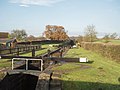 Bosley Locks, Macclesfield Canal - geograph.org.uk - 89205.jpg 640 × 480; 75 KB
-
 Bosley Locks, Macclesfield Canal - geograph.org.uk - 89209.jpg 640 × 480; 103 KB
-
 Bosley Reservoir (South east end) - geograph.org.uk - 89190.jpg 640 × 480; 74 KB
-
 Bow Road tube station 2005-12-10 02.jpg 1,600 × 1,200; 900 KB
-
 Bow Road tube station 2005-12-10 03.jpg 1,600 × 1,200; 858 KB
-
 Bow Road tube station 2005-12-10.jpg 1,600 × 1,200; 923 KB
-
 Bow Road tube station exterior 2005-12-10.jpg 1,600 × 1,200; 924 KB
-
 Bow Road tube station from footbridge 2005-12-10.jpg 1,600 × 1,200; 887 KB
-
 Braunston - geograph.org.uk - 89175.jpg 640 × 480; 113 KB
-
 Bromley-by-Bow tube station 2005-12-10.jpg 1,600 × 1,200; 853 KB
-
 Buckland Down - geograph.org.uk - 89476.jpg 640 × 480; 25 KB
-
 Buckland Wood by Leyland's Farm - geograph.org.uk - 89825.jpg 640 × 480; 166 KB
-
 Burnside of Cassendindilly - geograph.org.uk - 89274.jpg 640 × 480; 142 KB
-
 Burridge Post Office - geograph.org.uk - 89625.jpg 640 × 480; 131 KB
-
 C2c 357218 passes Shadwell DLR station 2005-12-10.jpg 1,600 × 1,200; 948 KB
-
 Cabbage Field - geograph.org.uk - 89347.jpg 640 × 446; 108 KB
-
 Calton Farm - geograph.org.uk - 89089.jpg 640 × 480; 228 KB
-
 Camilty Hill. - geograph.org.uk - 89221.jpg 640 × 480; 73 KB
-
 Camilty Plantation - geograph.org.uk - 89204.jpg 640 × 480; 112 KB
-
 Camilty Plantation - geograph.org.uk - 89225.jpg 640 × 480; 78 KB
-
 Camilty Plantation. - geograph.org.uk - 89214.jpg 640 × 480; 76 KB
-
 Camilty Plantation. - geograph.org.uk - 89217.jpg 480 × 640; 116 KB
-
 Canary Wharf DLR station from a train approaching Heron Quays 2005-12-10.jpg 1,200 × 1,600; 937 KB
-
 Canary Wharf DLR station from a train at Heron Quays station 2005-12-10.jpg 1,200 × 1,600; 882 KB
-
 Canary Wharf Jubilee line station from DLR 2005-12-10.jpg 1,600 × 1,200; 904 KB
-
 Car Park at Col-huw Point - geograph.org.uk - 89736.jpg 640 × 480; 114 KB
-
 Carrs, Hermand. - geograph.org.uk - 89269.jpg 640 × 480; 147 KB
-
 Cask and Bottle, Lansdowne Street - geograph.org.uk - 93535.jpg 640 × 511; 81 KB
-
 Castle Greg. - geograph.org.uk - 89231.jpg 640 × 480; 84 KB
-
 Castlegate Business Park, Portskewett - geograph.org.uk - 95624.jpg 640 × 480; 87 KB
-
 Ceres Packhorse bridge - geograph.org.uk - 89243.jpg 640 × 474; 167 KB
-
 Ceres village from the West - geograph.org.uk - 89257.jpg 640 × 496; 115 KB
-
 Cheddar Reservoir Birds - geograph.org.uk - 93959.jpg 640 × 426; 106 KB
-
 Cheddarreservoir.jpg 640 × 426; 116 KB
-
-
 Chiltern Railways Class 165 DMU 165007 viewed from LU1996ts train.jpg 1,600 × 1,200; 907 KB
-
 Cholesbury windmill.jpg 480 × 640; 68 KB
-
 CJ Motors, Hatt, near Saltash - geograph.org.uk - 89272.jpg 640 × 427; 194 KB
-
 Clock in the Jephson Gardens - geograph.org.uk - 98912.jpg 480 × 640; 94 KB
-

-

-
 Commercial Estate at Threemilestone - geograph.org.uk - 89363.jpg 640 × 402; 114 KB
-
 Cott Cross - geograph.org.uk - 89474.jpg 640 × 480; 23 KB
-
 Cowick Hall.jpg 640 × 427; 100 KB
-
 Crafts Way, Bar Hill, Cambs - geograph.org.uk - 89336.jpg 640 × 480; 333 KB
-

-
 Crosswood Burn. - geograph.org.uk - 89207.jpg 640 × 480; 77 KB
-
 Cults Parish Church. - geograph.org.uk - 90114.jpg 405 × 640; 73 KB
-
 D-stock at West Ham 2005-12-10.jpg 1,600 × 1,200; 949 KB
-
 Dagenham Heathway tube station 2005-12-10 01.jpg 1,600 × 1,200; 857 KB
-
 Dagenham Heathway tube station 2005-12-10 02.jpg 1,600 × 1,200; 904 KB
-
 Dagenham Heathway tube station 2005-12-10 03.jpg 1,600 × 1,200; 915 KB
-
 Dagenham Heathway tube station 2005-12-10 04.jpg 1,600 × 1,200; 957 KB
-
 Dagenham Heathway tube station 2005-12-10 05.jpg 1,600 × 1,200; 897 KB
-
 Dancers End Pumping Station - geograph.org.uk - 89838.jpg 480 × 640; 152 KB
-
 Dancersend Farm - geograph.org.uk - 90202.jpg 640 × 454; 100 KB
-
 December sunlight on the pines - geograph.org.uk - 1012331.jpg 640 × 480; 70 KB
-
 Deer behind Whiteley Cottages - geograph.org.uk - 89719.jpg 640 × 480; 126 KB
-
 Dennis' Cottages - geograph.org.uk - 89484.jpg 640 × 480; 54 KB
-
 Deptford Bridge DLR station 2005-12-10.jpg 1,600 × 1,200; 923 KB
-
 Devons Road DLR station 2005-12-10 01.jpg 1,600 × 1,200; 876 KB
-
 Devons Road DLR station 2005-12-10 02.jpg 1,600 × 1,200; 857 KB
-
 District Line D-stock train departs Bow Road westbound 2005-12-10 01.jpg 1,600 × 1,200; 885 KB
-
 District Line D-stock train departs Bow Road westbound 2005-12-10 02.jpg 1,600 × 1,200; 899 KB
-

-
 DLR and c2c 2005-12-10 01.jpg 1,600 × 1,200; 885 KB
-
 DLR bottom contact pickup shoe 01.jpg 1,600 × 1,200; 972 KB
-
 DLR bottom contact pickup shoe 02.jpg 1,600 × 1,200; 972 KB
-
 DLR system map at Elverson Road station 2005-12-10.jpg 1,200 × 1,600; 882 KB
-
 DLR train control desk-01.jpg 1,600 × 1,200; 869 KB
-
 DLR train control desk-02.jpg 1,600 × 1,200; 834 KB
-
 DLR tunnel at Bank.jpg 1,600 × 1,200; 927 KB
-
 Docklands Light Railway train 48 approaching Deptford Bridge 2005-12-10.jpg 1,600 × 1,200; 868 KB
-
 Docklands Light Railway train 49 (interior).jpg 1,200 × 1,600; 863 KB
-
 Docklands Light Railway train 49 at Elverson Road 2005-12-10 01.jpg 1,600 × 1,200; 903 KB
-
 Docklands Light Railway train 49 at Elverson Road 2005-12-10 02.jpg 1,600 × 1,200; 958 KB
-
 Docklands Light Railway train 59 approaching Grenwich 2005-12-10.jpg 1,600 × 1,200; 886 KB
-
 Dollis Hill tube station 2005-12-10 01.jpg 1,600 × 1,200; 979 KB
-
 Dollis Hill tube station 2005-12-10 02.jpg 1,600 × 1,200; 950 KB
-

-
 East Cults Church. - geograph.org.uk - 90116.jpg 443 × 640; 126 KB
-
 East Ham tube station 2005-12-10 01.jpg 1,600 × 1,200; 897 KB
-
 East Ham tube station 2005-12-10 02.jpg 1,200 × 1,600; 861 KB
-
 Eastbound D-stock train at Bow Road station 2005-12-10.jpg 1,600 × 1,200; 926 KB
-
 Electricity Pylon (detail) - geograph.org.uk - 89414.jpg 640 × 480; 57 KB
-
 Electricity Pylon above the Valley - geograph.org.uk - 89242.jpg 640 × 458; 91 KB
-
 Electricity Pylon in the Valley - geograph.org.uk - 89413.jpg 640 × 480; 151 KB
-
 Electricity Station, Landulph, Cornwall - geograph.org.uk - 89305.jpg 640 × 427; 250 KB
-
 Ellerby, North Yorkshire.jpg 640 × 480; 60 KB
-
 Elstree Aerodrome - geograph.org.uk - 89376.jpg 640 × 480; 84 KB
-

-
 Elstree, Footpath to Hilfield Lane - geograph.org.uk - 89290.jpg 640 × 480; 150 KB
-
 Elverson Road DLR station 2005-12-10.jpg 1,600 × 1,200; 378 KB
-
 Entrance to a Conservaton Walk - geograph.org.uk - 89339.jpg 640 × 480; 132 KB
-
 Entrance to Pentillie Castle, near Saltash - geograph.org.uk - 89277.jpg 640 × 427; 241 KB
-
 Entry to A41 services near Bourne End - geograph.org.uk - 89860.jpg 640 × 480; 82 KB
-
 Escalators at West Ham station 2005-12-10.jpg 1,600 × 1,200; 862 KB
-
 Farm building near Trimstone - geograph.org.uk - 89482.jpg 640 × 480; 50 KB
-

-
 Farmland and North Buckland - geograph.org.uk - 89475.jpg 640 × 480; 38 KB
-
 Farmland by Balcormo - geograph.org.uk - 89338.jpg 640 × 480; 133 KB
-
 Farmland near Little Marlow - geograph.org.uk - 89677.jpg 597 × 367; 33 KB
-
 Farmland near Stony Bridge - geograph.org.uk - 89472.jpg 640 × 480; 25 KB
-
 Farmland near Trimstone Lane - geograph.org.uk - 89481.jpg 640 × 480; 54 KB
-
 Farmland on Willingcott Hill - geograph.org.uk - 89478.jpg 640 × 480; 33 KB
-
 Farmland on Willingcott Hill - geograph.org.uk - 89479.jpg 640 × 480; 56 KB
-
 Fell Lane - geograph.org.uk - 91127.jpg 640 × 480; 85 KB
-
 FGW HST from Paddington H&C bridge 2005-12-10.jpg 1,600 × 1,200; 860 KB
-
 FGWL166205 and HEx332010 at Paddington 01.jpg 1,600 × 1,200; 856 KB
-
 FGWL166205 and HEx332010 at Paddington 02.jpg 1,600 × 1,200; 863 KB
-
 FGWL166205 and HEx332010 at Paddington 03.jpg 1,600 × 1,200; 870 KB
-
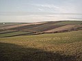
 Fields and Hedges in Winter Sunshine - geograph.org.uk - 89237.jpg 640 × 468; 98 KB
-
 Fields by Lower Largo - geograph.org.uk - 89348.jpg 640 × 476; 92 KB
-
 Fields East of Goldsborough - geograph.org.uk - 89504.jpg 640 × 480; 69 KB
-

-
 Fleecefaulds Farm - geograph.org.uk - 89289.jpg 640 × 480; 128 KB
-
 Flight pools at Harburn. - geograph.org.uk - 89234.jpg 640 × 480; 76 KB
-
 Footbridge over the Railway Line - geograph.org.uk - 89405.jpg 640 × 426; 68 KB
-
 Ford at New Mill - geograph.org.uk - 89230.jpg 640 × 480; 130 KB
-
 Ford near Ninniss Farm - geograph.org.uk - 89412.jpg 640 × 480; 125 KB
-
 Former entrance to the Regal Cinema - geograph.org.uk - 98324.jpg 640 × 480; 48 KB
-
 Former gravel pit, Marlow - geograph.org.uk - 89679.jpg 597 × 365; 34 KB
-
 Fort Perch Rock Lighthouse.jpg 1,914 × 2,536; 1.09 MB
-
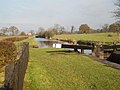
 Fossdyke Navigation - geograph.org.uk - 89194.jpg 640 × 426; 104 KB
-
 Gateway Cottage Shellow Lane - geograph.org.uk - 89215.jpg 640 × 480; 138 KB
-
 Gazebo, Jephson Gardens - geograph.org.uk - 107493.jpg 640 × 480; 75 KB
-
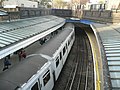
 Gb-LU-Barking.jpg 1,600 × 1,200; 876 KB
-
 Gilbert's Hill, St. Leonards - geograph.org.uk - 89816.jpg 640 × 445; 94 KB
-
 Gileston Parish Church - geograph.org.uk - 89774.jpg 480 × 640; 119 KB
-
 Girton Crossing, Histon, Cambs - geograph.org.uk - 89400.jpg 640 × 480; 315 KB
-
 Glaur, Harburn. - geograph.org.uk - 89238.jpg 640 × 480; 112 KB
-
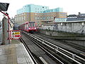
 Hackney Wick NLL station 2005-12-10.jpg 1,200 × 1,600; 869 KB
-
 Halifax Road, Smallbridge, Rochdale. - geograph.org.uk - 89123.jpg 640 × 424; 109 KB
-
 Hammersmith & City Line this way.jpg 1,600 × 1,200; 861 KB
-
 Hammersmith Bridge at night.jpg 2,560 × 1,920; 2.09 MB
-
 Harburn. - geograph.org.uk - 89248.jpg 640 × 453; 74 KB
-
 Harperrig Reservoir. - geograph.org.uk - 89189.jpg 639 × 454; 52 KB
-
 St Lukes Church - geograph.org.uk - 89114.jpg 640 × 426; 53 KB
-
 St Oswalds Church - geograph.org.uk - 89111.jpg 640 × 426; 76 KB
-
 Hastoe Cross - geograph.org.uk - 90113.jpg 640 × 437; 88 KB
-
 Hastoe hamlet - geograph.org.uk - 90120.jpg 640 × 480; 141 KB
-
 Hawling Church - geograph.org.uk - 90179.jpg 640 × 426; 124 KB
-
 Hawling church and manor house - geograph.org.uk - 90180.jpg 640 × 426; 128 KB
-
 Heath Wood - geograph.org.uk - 89642.jpg 400 × 597; 59 KB
-
 Heathrow Connect 360201-01.jpg 1,600 × 1,200; 860 KB
-
 Heathrow Connect 360201-02.jpg 1,600 × 1,200; 950 KB
-
 Hermand beech wood. - geograph.org.uk - 89256.jpg 640 × 480; 147 KB
-
 HEx332008-01.jpg 1,600 × 1,200; 974 KB
-
 HEx332010-01.jpg 1,600 × 1,200; 971 KB
-
 High Cross, Oakridge Lane - geograph.org.uk - 89404.jpg 640 × 480; 112 KB
-
 Higher or Lower Mullacott^ - geograph.org.uk - 89485.jpg 640 × 480; 54 KB
-
 Highwood Farm - geograph.org.uk - 89192.jpg 640 × 426; 111 KB
-
 Hillside east of Newmills Farm - geograph.org.uk - 89408.jpg 640 × 454; 96 KB
-
 Hinchwick Manor Farm - geograph.org.uk - 91115.jpg 640 × 426; 129 KB
-
 Homerton railway station 2005-12-10.jpg 1,600 × 1,200; 958 KB
-
 House near Roseworthy - geograph.org.uk - 89250.jpg 640 × 446; 91 KB
-
 Housing at Bosvigo, Truro - geograph.org.uk - 89228.jpg 640 × 488; 102 KB
-
 Jephson House - geograph.org.uk - 98338.jpg 640 × 480; 85 KB
-
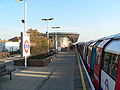
 Jubilee Line train arriving at West Hampstead tube station 2005-12-10.jpg 1,600 × 1,200; 880 KB
-

-
 Kilburn tube station 2005-12-10.jpg 1,600 × 1,200; 862 KB
-
 Kilsby - geograph.org.uk - 89249.jpg 640 × 480; 88 KB
-
 Lake near Nosehill Farm - geograph.org.uk - 91083.jpg 640 × 426; 90 KB
-
 Lamplugh Church. - geograph.org.uk - 89335.jpg 640 × 480; 61 KB


_-_geograph.org.uk_-_89190.jpg)


.jpg)


_-_geograph.org.uk_-_89414.jpg)


_-_geograph.org.uk_-_89367.jpg)


