Category:United Kingdom photographs taken on 2006-03-13
| ← | Monday 13 March 2006 | → | ||
| ← | March 2006 | → | ||

United Kingdom photographs taken on 13 March 2006.
Image files should be categorized here automatically using {{taken on}} template. Direct categorisation is also possible, if automatic is impossible.
Subcategories
This category has only the following subcategory.
Media in category "United Kingdom photographs taken on 2006-03-13"
The following 200 files are in this category, out of 251 total.
(previous page) (next page)-
-
 A Dead Tree, Bramerton - geograph.org.uk - 136945.jpg 480 × 640; 87 KB
-
 Afon Clywedog - geograph.org.uk - 136282.jpg 640 × 480; 107 KB
-

-
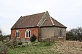 All Saints' church, Wilksby, Lincs. - geograph.org.uk - 136740.jpg 640 × 427; 83 KB
-

-

-
 Alltdruidhe Cottage - geograph.org.uk - 136906.jpg 640 × 480; 134 KB
-
 Bachymbyd Bach - geograph.org.uk - 136213.jpg 640 × 417; 77 KB
-
 Balk Moor - geograph.org.uk - 136709.jpg 640 × 480; 100 KB
-
 Ballynagarrick Gospel Hall - geograph.org.uk - 136322.jpg 640 × 480; 55 KB
-
 Nags Head, Bardney - geograph.org.uk - 136742.jpg 640 × 427; 84 KB
-
 Station Road, Bardney - geograph.org.uk - 136743.jpg 640 × 427; 73 KB
-
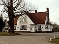
 Barford St. Michael pub.jpg 640 × 480; 92 KB
-
 Barn at Scargill - geograph.org.uk - 136725.jpg 640 × 427; 73 KB
-
 Barn near Rhyd y Cilgwyn, Rhewl - geograph.org.uk - 136205.jpg 640 × 404; 100 KB
-

-
 Blackwood Cottage - geograph.org.uk - 136919.jpg 640 × 480; 118 KB
-
 Boardmans farm barn - geograph.org.uk - 136350.jpg 640 × 480; 112 KB
-
 Boardmans farm cottages - geograph.org.uk - 136349.jpg 640 × 480; 101 KB
-
 Masonic Lodge - geograph.org.uk - 136737.jpg 640 × 427; 93 KB
-
 Broken Scar Waterworks. - geograph.org.uk - 147340.jpg 640 × 398; 75 KB
-
 Bubnell - geograph.org.uk - 136734.jpg 640 × 481; 134 KB
-

-
 Carmelite Monastery - geograph.org.uk - 136328.jpg 640 × 480; 115 KB
-
 Charltonbrook Cemetery - geograph.org.uk - 136444.jpg 640 × 480; 128 KB
-
 Christ Church, Smannell - geograph.org.uk - 156691.jpg 640 × 481; 70 KB
-
 Colethorp Court Farm - geograph.org.uk - 136433.jpg 640 × 480; 43 KB
-
 Cross Hands Inn, Chastleton - geograph.org.uk - 136600.jpg 640 × 480; 102 KB
-
 Dall House - geograph.org.uk - 136916.jpg 640 × 480; 56 KB
-
 Duke of Marlborough, Woodleys - geograph.org.uk - 136551.jpg 640 × 480; 48 KB
-
 EasyJet A319 wing spoilers.jpg 2,048 × 1,542; 336 KB
-
 The Crown, Church Enstone - geograph.org.uk - 136561.jpg 640 × 480; 128 KB
-
 Enstone pub.jpg 640 × 480; 70 KB
-
 Fallow Deer at Studley Royal Park - geograph.org.uk - 175757.jpg 640 × 480; 147 KB
-
 Farm track to Harry Fold - geograph.org.uk - 136347.jpg 640 × 480; 85 KB
-
 Farmland on Floodplain - geograph.org.uk - 136771.jpg 640 × 426; 58 KB
-
 Fields of Upper Holcombe Farm - geograph.org.uk - 136662.jpg 640 × 479; 62 KB
-
 Flood Defences - geograph.org.uk - 136340.jpg 640 × 480; 72 KB
-
 Ford to Swine Lairs Farm , River Tees - geograph.org.uk - 136360.jpg 640 × 479; 112 KB
-
 Fountains Abbey - geograph.org.uk - 175379.jpg 640 × 480; 138 KB
-
 Fowey, China clay jetties and quays - geograph.org.uk - 137007.jpg 640 × 427; 87 KB
-
 Fowey, China clay jetty - geograph.org.uk - 137008.jpg 640 × 427; 73 KB
-
 Foxcotte Church - geograph.org.uk - 156701.jpg 640 × 481; 44 KB
-
 Fulwood Barracks - geograph.org.uk - 137790.jpg 640 × 480; 112 KB
-
 Fulwood Leisure Centre - geograph.org.uk - 137783.jpg 640 × 480; 92 KB
-
 Hadlow Church.jpg 480 × 640; 85 KB
-
 Hadlow Manor Hotel - geograph.org.uk - 136987.jpg 640 × 480; 79 KB
-
 Harley Church - geograph.org.uk - 136457.jpg 640 × 480; 151 KB
-
 High Green Post Office - geograph.org.uk - 136425.jpg 640 × 480; 134 KB
-
 Holcombe Hey Fold farm - amusing signs - geograph.org.uk - 136353.jpg 640 × 480; 139 KB
-
 Sign at Holcombe Hey Fold farm - geograph.org.uk - 136356.jpg 640 × 480; 96 KB
-
 Horse and Groom, Milcombe - geograph.org.uk - 136613.jpg 640 × 480; 53 KB
-
 House by the Allt Madaig Bridge - geograph.org.uk - 137130.jpg 640 × 480; 107 KB
-
 Market Cross at Howbrook - geograph.org.uk - 136344.jpg 640 × 480; 172 KB
-
 Hyde Park.JPG 1,600 × 1,200; 618 KB
-
 Kings Arms Hotel, Chipping Norton - geograph.org.uk - 136577.jpg 640 × 480; 89 KB
-
 Kirkby Lane Postbox - geograph.org.uk - 136455.jpg 640 × 480; 160 KB
-
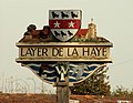 Layer de la Haye village sign, Essex - geograph.org.uk - 138137.jpg 640 × 496; 63 KB
-
 Little Bracebridge Pool, Sutton Park - geograph.org.uk - 137686.jpg 640 × 480; 117 KB
-
 Loch Kinardochy - geograph.org.uk - 136687.jpg 640 × 480; 57 KB
-
 M5 Motorway - geograph.org.uk - 136479.jpg 640 × 479; 62 KB
-
 Man of Kent.jpg 640 × 480; 103 KB
-

-

-
 Merrybent Village , Nr. Darlington - geograph.org.uk - 136362.jpg 640 × 479; 94 KB
-
 Moat Farm, Haresfield - geograph.org.uk - 136426.jpg 640 × 479; 64 KB
-
 Moor Nook Youth Centre - geograph.org.uk - 137795.jpg 640 × 480; 75 KB
-
 Mountcow Farm - geograph.org.uk - 525708.jpg 640 × 480; 50 KB
-
 North Road, Preston - geograph.org.uk - 137778.jpg 640 × 480; 61 KB
-
 North Stainmore Chapel - geograph.org.uk - 136762.jpg 640 × 427; 126 KB
-
 Northolme Estate, Earby, Yorkshire - geograph.org.uk - 136293.jpg 640 × 480; 74 KB
-
 Old Oast House - geograph.org.uk - 136986.jpg 640 × 480; 65 KB
-
 Old railway track - geograph.org.uk - 136218.jpg 474 × 640; 77 KB
-
 Oldbury Nuclear Power Station.jpg 640 × 480; 80 KB
-
 Oronsay from Ullinish point - geograph.org.uk - 223007.jpg 640 × 427; 86 KB
-
 Parterre1.JPG 2,848 × 2,136; 1.48 MB
-
 Pasture off Bradshaw Road - geograph.org.uk - 136345.jpg 640 × 480; 96 KB
-
 Penton Manor - geograph.org.uk - 158803.jpg 640 × 481; 72 KB
-
 Pond near Llanynys - geograph.org.uk - 136219.jpg 640 × 480; 171 KB
-
 Potter Hill - geograph.org.uk - 136416.jpg 640 × 480; 141 KB
-

-
 Pylons near Rochford - geograph.org.uk - 136235.jpg 640 × 439; 55 KB
-
 Railway Bridge at Appleby - geograph.org.uk - 136777.jpg 640 × 480; 110 KB
-
 Railway Bridge Warcop - geograph.org.uk - 136767.jpg 640 × 427; 105 KB
-
 Red Flag - geograph.org.uk - 170699.jpg 480 × 640; 46 KB
-
 Red Lion Inn, Blacksnape - geograph.org.uk - 136390.jpg 640 × 480; 78 KB
-
 Red Lion, Little Compton - geograph.org.uk - 136604.jpg 640 × 480; 99 KB
-
 Rhine Mouth - geograph.org.uk - 136278.jpg 640 × 480; 64 KB
-
 Church and millpond at Rickford - geograph.org.uk - 136378.jpg 640 × 480; 111 KB
-
 River Yare from Beauchamp Arms - geograph.org.uk - 136944.jpg 640 × 470; 84 KB
-
 Rowland. - geograph.org.uk - 136739.jpg 640 × 481; 105 KB
-
 Royal Preston Hospital - geograph.org.uk - 137786.jpg 640 × 480; 65 KB
-
 Rutherford Bridge - geograph.org.uk - 136727.jpg 640 × 426; 113 KB
-
 Ryknild street.jpg 640 × 480; 175 KB
-
 Seals on a sand bank - geograph.org.uk - 136317.jpg 640 × 480; 48 KB
-
 Sewage tanks near Great Stambridge - geograph.org.uk - 136254.jpg 640 × 391; 61 KB
-
 Sheep at a feeder on Lowe Hill - geograph.org.uk - 136421.jpg 640 × 480; 84 KB
-
-
 Sibsey Trader Mill - geograph.org.uk - 136738.jpg 640 × 427; 60 KB
-

-
 Sough, Lancashire.jpg 640 × 480; 73 KB
-
 St. Mary the Virgin church, Peldon, Essex - geograph.org.uk - 136696.jpg 640 × 480; 102 KB
-

-

-

-
 St. Thomas Church, Charlton - geograph.org.uk - 156699.jpg 640 × 481; 47 KB
-
 Stone bridge - geograph.org.uk - 136277.jpg 640 × 480; 134 KB
-
 Storr's Dike Path - geograph.org.uk - 136400.jpg 640 × 480; 205 KB
-
 Telpyn farm, Galltegfa - geograph.org.uk - 1581608.jpg 640 × 480; 66 KB
-
 The Bell - geograph.org.uk - 136995.jpg 640 × 480; 123 KB
-
 The Bell Inn, Chipping Norton - geograph.org.uk - 136573.jpg 640 × 480; 120 KB
-
 The Black Horse, Salford - geograph.org.uk - 136588.jpg 640 × 480; 101 KB
-
 The Harrow - geograph.org.uk - 136988.jpg 640 × 480; 88 KB
-

-

-
 The Punch Bowl, North Stainmore - geograph.org.uk - 136760.jpg 640 × 426; 84 KB
-
 The Rose Revived - geograph.org.uk - 136993.jpg 640 × 480; 46 KB
-
 The Royal Oak, Charlton - geograph.org.uk - 158799.jpg 640 × 481; 57 KB
-
 The Serpentine, Moor Park - geograph.org.uk - 137781.jpg 640 × 480; 126 KB
-
 The Storr - geograph.org.uk - 223012.jpg 640 × 427; 80 KB
-
 Threshing Barn by Pudgwell Cottage - geograph.org.uk - 136503.jpg 640 × 480; 72 KB
-
 Messing Maypole mill.jpg 640 × 480; 73 KB
-
 Topsham quay and the Lighter Inn - geograph.org.uk - 136915.jpg 408 × 425; 67 KB
-
 Town End Farm - geograph.org.uk - 136343.jpg 640 × 480; 179 KB
-
 Tree-lined avenue - geograph.org.uk - 136383.jpg 480 × 640; 147 KB
-
 Turf lock and Inn from the River Exe - geograph.org.uk - 136910.jpg 535 × 425; 60 KB
-
 Tyrwhitt Arms, Short Ferry - geograph.org.uk - 136746.jpg 640 × 427; 61 KB
-
 Up into Coire Lagan - geograph.org.uk - 224566.jpg 640 × 427; 103 KB
-

-
 Very Heavy Going - geograph.org.uk - 936355.jpg 480 × 640; 57 KB
-
 Walton Lea Crematorium - geograph.org.uk - 138271.jpg 640 × 421; 85 KB
-
 Wards at the Old County Hospital - geograph.org.uk - 136749.jpg 640 × 427; 86 KB
-
 Waterfall on the River Clywedog - geograph.org.uk - 136212.jpg 480 × 640; 153 KB
-
 Wayoh Farm - geograph.org.uk - 136373.jpg 640 × 480; 136 KB
-
 Weir on the River Clywedog - geograph.org.uk - 136208.jpg 640 × 480; 163 KB
-
 Westgate House Care Centre - geograph.org.uk - 136169.jpg 640 × 480; 102 KB
-
 Weyhill Church - geograph.org.uk - 158807.jpg 640 × 481; 54 KB
-
 Wharncliffe - geograph.org.uk - 136319.jpg 640 × 480; 164 KB
-
 Wharncliffe Anglers - geograph.org.uk - 136329.jpg 640 × 480; 175 KB
-
 Wharncliffe Reservoir - geograph.org.uk - 136332.jpg 640 × 480; 192 KB
-
 White Stone - geograph.org.uk - 172317.jpg 640 × 338; 97 KB
-
 White Swan, Wigginton - geograph.org.uk - 136610.jpg 640 × 480; 103 KB
-
 Wortley - geograph.org.uk - 136304.jpg 640 × 480; 236 KB
-
 Wortley Bank - geograph.org.uk - 136338.jpg 640 × 480; 190 KB
-
 Yew at Llanynys Church - geograph.org.uk - 136221.jpg 480 × 640; 153 KB
-
 Alderthwaite - geograph.org.uk - 136504.jpg 640 × 480; 138 KB
-
 Barons farm - geograph.org.uk - 136366.jpg 640 × 480; 82 KB
-
 Barry Kirkyard - geograph.org.uk - 170704.jpg 640 × 480; 135 KB
-
 Bridge at Camghourain - geograph.org.uk - 136926.jpg 640 × 480; 131 KB
-
 Bridge of Gaur - geograph.org.uk - 136933.jpg 640 × 480; 124 KB
-
 Bridge of Gaur Telephone Exchange - geograph.org.uk - 137133.jpg 640 × 480; 131 KB
-
 Bridge over Killichonan Burn - geograph.org.uk - 137135.jpg 640 × 480; 127 KB
-
 Bridge over Savick Brook - geograph.org.uk - 137788.jpg 640 × 480; 110 KB
-
 Bristol Waterworks building - geograph.org.uk - 136374.jpg 640 × 480; 115 KB
-
 Broom Rigg - geograph.org.uk - 136776.jpg 640 × 480; 76 KB
-
 Broomrigg End - geograph.org.uk - 136775.jpg 640 × 451; 73 KB
-
 Cadshaw farm on the A666 - geograph.org.uk - 136428.jpg 640 × 480; 90 KB
-
 Camusericht Lodge - geograph.org.uk - 137134.jpg 640 × 480; 113 KB
-
 Car Park of Red Lion Inn Blacksnape - geograph.org.uk - 136397.jpg 640 × 480; 82 KB
-
 Carie - geograph.org.uk - 136909.jpg 640 × 480; 132 KB
-
 Carpenters Arms - geograph.org.uk - 136994.jpg 640 × 480; 82 KB
-
 Cattle Grid and Track To Early Lodge - geograph.org.uk - 136720.jpg 640 × 480; 75 KB
-
 Chambers Farm near Brookthorp - geograph.org.uk - 136483.jpg 640 × 480; 55 KB
-
 Chapeltown - geograph.org.uk - 136450.jpg 640 × 480; 143 KB
-
 Charlton Cemetery - geograph.org.uk - 156700.jpg 640 × 481; 61 KB
-
 Coed Duon - geograph.org.uk - 136216.jpg 640 × 480; 88 KB
-
 Coire Na Creiche, Skye - geograph.org.uk - 222992.jpg 640 × 427; 96 KB
-

-
-
 Dalriach House - geograph.org.uk - 136898.jpg 640 × 480; 101 KB
-
 Dene Park - geograph.org.uk - 136991.jpg 640 × 480; 149 KB
-
 Dike Hill - geograph.org.uk - 136460.jpg 640 × 480; 131 KB
-
 Edge Farm - geograph.org.uk - 136499.jpg 640 × 480; 50 KB
-

-
 Eller Beck - geograph.org.uk - 136716.jpg 640 × 480; 143 KB
-

-
 Fairy Steps - geograph.org.uk - 170696.jpg 480 × 640; 146 KB
-
 Farmland at Aspen Grove - geograph.org.uk - 136715.jpg 640 × 480; 115 KB
-
 Farmland near Berkeley Power Station - geograph.org.uk - 136262.jpg 640 × 480; 60 KB
-
 Fields in March - geograph.org.uk - 156689.jpg 640 × 481; 84 KB
-
 Finkley Manor Farm - geograph.org.uk - 156696.jpg 640 × 481; 52 KB
-
 Finnart Lodge - geograph.org.uk - 136928.jpg 640 × 480; 86 KB
-
 Flitholme Footpath - geograph.org.uk - 136768.jpg 427 × 640; 70 KB
-
 Footpath to Lowgill Farm - geograph.org.uk - 136773.jpg 439 × 640; 86 KB
-
 Former Service Area - geograph.org.uk - 137569.jpg 640 × 480; 75 KB
-
 From Burncross to Charltonbrook - geograph.org.uk - 136435.jpg 640 × 480; 197 KB
-
 From the County boundary - geograph.org.uk - 136273.jpg 640 × 480; 69 KB
-
 Grimehills Farm - geograph.org.uk - 136386.jpg 640 × 480; 93 KB
-
 Harden Moor - geograph.org.uk - 136538.jpg 640 × 426; 118 KB
-
 Hill near Ffrith Farm - geograph.org.uk - 136215.jpg 640 × 480; 126 KB
-
 Holcombe Hill - geograph.org.uk - 136364.jpg 640 × 480; 108 KB
-
 Holy Trinity Church, Penton Grafton - geograph.org.uk - 158805.jpg 640 × 481; 86 KB
-

-
 House at Finnart - geograph.org.uk - 136932.jpg 640 × 480; 115 KB
-
 Keepers Pool, Sutton Park - geograph.org.uk - 137672.jpg 640 × 494; 113 KB
-
 Kentish Rifleman - geograph.org.uk - 136990.jpg 640 × 480; 60 KB
-
 Knowle Hill - geograph.org.uk - 136718.jpg 640 × 480; 102 KB
-
 Lane to Middleton - geograph.org.uk - 136537.jpg 640 × 480; 47 KB
-
 Lane to Seamer - geograph.org.uk - 136535.jpg 640 × 480; 52 KB


_-_geograph.org.uk_-_136209.jpg)

_East_End_-_geograph.org.uk_-_136214.jpg)


