Category:United Kingdom photographs taken on 2006-08-29
Countries of Europe: Austria · Belarus · Belgium · Croatia · Denmark · France‡ · Germany · Greece · Republic of Ireland · Italy · Russia‡ · Slovakia · Spain‡ · Sweden · Turkey‡ · Ukraine · United Kingdom
‡: partly located in Europe
‡: partly located in Europe
| ← | 29 August 2006 | → | ||
| ← | August 2006 | → | ||

United Kingdom photographs taken on 29 August 2006.
Image files should be categorized here automatically using {{taken on}} template. Direct categorisation is also possible, if automatic is impossible.
Subcategories
This category has only the following subcategory.
Media in category "United Kingdom photographs taken on 2006-08-29"
The following 200 files are in this category, out of 547 total.
(previous page) (next page)-
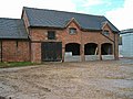
 "South Block", Cowley Hill Lane - geograph.org.uk - 231842.jpg 640 × 480; 138 KB
-
 350122 at Wolverhampton.jpg 1,280 × 811; 297 KB
-

-
 A bend in the A836 - geograph.org.uk - 257847.jpg 640 × 480; 55 KB
-
 A serpentine road heading eastwards. - geograph.org.uk - 229185.jpg 640 × 426; 93 KB
-
-
 A38 near Bittaford - geograph.org.uk - 234022.jpg 640 × 480; 114 KB
-
 Acorns and oak leaves, near Thame - geograph.org.uk - 228229.jpg 638 × 640; 140 KB
-
 Across the bridge to Lael Forest. - geograph.org.uk - 228670.jpg 640 × 426; 119 KB
-
-
 All Saints, Boughton, Norfolk - Porch - geograph.org.uk - 321399.jpg 591 × 640; 166 KB
-
 All Saints, Wretton, Norfolk - East end - geograph.org.uk - 321396.jpg 640 × 472; 119 KB
-
 All Saints, Wretton, Norfolk - geograph.org.uk - 321391.jpg 640 × 439; 128 KB
-
 All Saints, Wretton, Norfolk - geograph.org.uk - 321395.jpg 545 × 640; 145 KB
-
 All Saints, Wretton, Norfolk - Porch - geograph.org.uk - 321394.jpg 640 × 494; 154 KB
-
 An Empty Cattle Feeding Station - geograph.org.uk - 228330.jpg 640 × 427; 93 KB
-
 Ashton Farm near Maiden Castle - geograph.org.uk - 540374.jpg 640 × 426; 75 KB
-
 B3196 from Kitterford Cross - geograph.org.uk - 234629.jpg 640 × 480; 120 KB
-
 B4479 north of Paxford - geograph.org.uk - 233858.jpg 640 × 480; 143 KB
-
 Badsworth, Main Street - geograph.org.uk - 228208.jpg 640 × 415; 62 KB
-
 Barn at Higher Ashton Farm - geograph.org.uk - 540382.jpg 640 × 426; 93 KB
-
 Barn at Higher Ludbrook - geograph.org.uk - 232812.jpg 640 × 480; 123 KB
-
 Barn near Modbury - geograph.org.uk - 228703.jpg 640 × 480; 61 KB
-
 Barns, Dunwell - geograph.org.uk - 233367.jpg 640 × 480; 99 KB
-
 Beach at West Kirby - geograph.org.uk - 331192.jpg 640 × 480; 68 KB
-
 Beach huts at Chapel Point - geograph.org.uk - 233690.jpg 640 × 480; 55 KB
-
 Bend in the Road and a Pylon - geograph.org.uk - 228323.jpg 640 × 426; 97 KB
-
 Beside Den Beck - geograph.org.uk - 229265.jpg 640 × 480; 93 KB
-
 Bioda Buidhe - geograph.org.uk - 228149.jpg 640 × 480; 126 KB
-
 Bioda Buidhe - geograph.org.uk - 228158.jpg 640 × 480; 110 KB
-
 Black Hill House - geograph.org.uk - 229227.jpg 640 × 480; 96 KB
-
 Boats at Dinllaen bay - geograph.org.uk - 232587.jpg 640 × 479; 50 KB
-
 Bodanna Farm.jpg 640 × 427; 94 KB
-
 Bonar Bridge - geograph.org.uk - 240048.jpg 640 × 480; 43 KB
-
 Boswarthen cross near madron.jpg 1,877 × 2,816; 1.92 MB
-
 All Saints, Boughton, Norfolk - geograph.org.uk - 321397.jpg 640 × 421; 111 KB
-
-

-
 Brookmans Quarry, South Gloucestershire - panoramio.jpg 2,560 × 1,920; 2.43 MB
-
 Building at Marlpit House Farm - geograph.org.uk - 231382.jpg 640 × 480; 96 KB
-
 Building in progress at Ludbrook Mill - geograph.org.uk - 228676.jpg 640 × 480; 128 KB
-
 Builth Wells Castle - geograph.org.uk - 232922.jpg 640 × 480; 140 KB
-
 Builth Wells Cottage Hospital - geograph.org.uk - 232889.jpg 640 × 480; 123 KB
-
 Bullocks in Valley-bottom Pasture - geograph.org.uk - 228277.jpg 640 × 426; 99 KB
-
 Cannamore from Ugborough Footpath 4 - geograph.org.uk - 231798.jpg 640 × 480; 100 KB
-
 Cathedral tower - geograph.org.uk - 228815.jpg 480 × 640; 118 KB
-
 Cathedral towers - geograph.org.uk - 228813.jpg 480 × 640; 111 KB
-
 Cattle Grazing - geograph.org.uk - 229859.jpg 640 × 427; 103 KB
-
 Cattle grazing at Ennaton - geograph.org.uk - 234625.jpg 640 × 480; 116 KB
-
 Cattle near Trenithon Farm - geograph.org.uk - 229940.jpg 640 × 427; 94 KB
-
 Chafford Bridge over the River Medway - geograph.org.uk - 228469.jpg 640 × 480; 102 KB
-
 Channel Tunnel Rail Link - geograph.org.uk - 229966.jpg 640 × 480; 112 KB
-
 Chapel and War Memorial, Paxford - geograph.org.uk - 233866.jpg 640 × 450; 111 KB
-
 Chapel Town, Summercourt - geograph.org.uk - 228306.jpg 640 × 427; 88 KB
-

-

-
 Chipping Campden Fire Station - geograph.org.uk - 233891.jpg 640 × 480; 71 KB
-
 Church in Lochinver. - geograph.org.uk - 228845.jpg 640 × 417; 66 KB
-
 Church of St.Davids at Maesmynis - geograph.org.uk - 232872.jpg 640 × 480; 137 KB
-
 Church steps, Ugborough - geograph.org.uk - 233354.jpg 640 × 480; 131 KB
-
 Churchstanton, towards Buttle's Cross - geograph.org.uk - 228473.jpg 640 × 427; 259 KB
-
 Stone barn Cleveley Oxfordshire - geograph.org.uk - 231440.jpg 640 × 343; 87 KB
-
 Clock Garage - geograph.org.uk - 229849.jpg 640 × 427; 73 KB
-
 Cloud clearing from Bioda Buidhe - geograph.org.uk - 228161.jpg 640 × 480; 85 KB
-
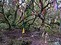 Cloutie tree near Madron Well - geograph.org.uk - 230753.jpg 640 × 480; 129 KB
-
 Clouties near madron well.jpg 1,877 × 2,816; 1.4 MB
-

-
 Comber bypass (2) - geograph.org.uk - 228242.jpg 640 × 426; 138 KB
-
 Converted chapel, Ugborough - geograph.org.uk - 234498.jpg 480 × 640; 99 KB
-
 Converted Methodist Chapel - geograph.org.uk - 229832.jpg 640 × 427; 92 KB
-
 Cornmarket, Pontefract - geograph.org.uk - 228225.jpg 640 × 423; 73 KB
-

-

-
 Cottage near The Pear Tree pub - geograph.org.uk - 765393.jpg 640 × 426; 109 KB
-
 Cottages in Wigginton - geograph.org.uk - 765388.jpg 640 × 426; 90 KB
-
 Crabbe Farm - geograph.org.uk - 229767.jpg 640 × 480; 133 KB
-
 Craig Tara holiday park, nr. Ayr - geograph.org.uk - 233261.jpg 640 × 480; 121 KB
-
 Cranberry Rough. - geograph.org.uk - 267022.jpg 640 × 480; 133 KB
-
 Criccieth - geograph.org.uk - 232574.jpg 640 × 479; 50 KB
-
 Criccieth - Looking West - geograph.org.uk - 232678.jpg 479 × 640; 50 KB
-
 Criccieth seafront - geograph.org.uk - 232672.jpg 479 × 640; 47 KB
-
 Croxden Abbey 2.jpg 480 × 640; 101 KB
-
 Croxden Abbey 3.jpg 480 × 640; 111 KB
-
 CroxdenAbbey(LindaBailey)Aug2006.jpg 480 × 640; 89 KB
-
 Crudely carved gatepost - geograph.org.uk - 229707.jpg 480 × 640; 127 KB
-
 Cuckoo Pint berries - geograph.org.uk - 229759.jpg 640 × 480; 194 KB
-
 Cuerden valley tree - geograph.org.uk - 229083.jpg 640 × 480; 124 KB
-
 Dartmoor from Roperidge Cross - geograph.org.uk - 239647.jpg 640 × 480; 136 KB
-
 Delarue Hall off Shipbourne Road - geograph.org.uk - 228570.jpg 640 × 480; 113 KB
-
 Dove bridge 231394 40b11970.jpg 640 × 480; 97 KB
-
 Druim an Ruma - geograph.org.uk - 228164.jpg 640 × 480; 122 KB
-
 Dun Dubh - geograph.org.uk - 228163.jpg 640 × 480; 103 KB
-
 Dunwell farm, near Ugborough - geograph.org.uk - 233366.jpg 480 × 640; 106 KB
-
 Cathedral towers - geograph.org.uk - 228809.jpg 640 × 480; 128 KB
-
 Durham Prison - geograph.org.uk - 228811.jpg 640 × 480; 224 KB
-
 East Hardwick Crossroads - geograph.org.uk - 228202.jpg 640 × 423; 50 KB
-
 Eden Valley Walk at Wat Stock - geograph.org.uk - 228428.jpg 640 × 480; 129 KB
-
 Eilean Donan Castle - geograph.org.uk - 548560.jpg 640 × 480; 70 KB
-
 Ennaton - geograph.org.uk - 234619.jpg 640 × 480; 126 KB
-
 Entrance to Northwick Park - geograph.org.uk - 233880.jpg 640 × 469; 125 KB
-
 Ermington Wood - geograph.org.uk - 228680.jpg 640 × 480; 160 KB
-
 Farm driveway, Venn - geograph.org.uk - 234025.jpg 640 × 480; 102 KB
-
 Farmland near Charingworth - geograph.org.uk - 233847.jpg 640 × 480; 103 KB
-
 Field at Ladydown - geograph.org.uk - 228627.jpg 640 × 480; 109 KB
-
 Field beside Well Cross - geograph.org.uk - 234612.jpg 640 × 480; 135 KB
-
 Field beside Woodland Barton - geograph.org.uk - 231762.jpg 640 × 480; 139 KB
-
 Field boundary wall at Ludbrook, Ugborough, Devon.jpg 640 × 480; 117 KB
-
 Field near Ludbrook Manor - geograph.org.uk - 233888.jpg 640 × 480; 103 KB
-
 Field near Moorland View - geograph.org.uk - 233211.jpg 640 × 480; 118 KB
-
 Field near Oakpark Cross - geograph.org.uk - 239651.jpg 640 × 480; 121 KB
-
 Fields towards Sole Beck - geograph.org.uk - 228402.jpg 640 × 480; 125 KB
-
 Fig tree at Crabbe Farm - geograph.org.uk - 229769.jpg 584 × 640; 152 KB
-

-
 Footpath near Woodland Barton - geograph.org.uk - 231772.jpg 640 × 480; 142 KB
-
 Ford into field across Shilston Brook - geograph.org.uk - 233956.jpg 480 × 640; 134 KB
-
 Forder - geograph.org.uk - 234015.jpg 640 × 480; 109 KB
-
 Forder Brook valley - geograph.org.uk - 234438.jpg 640 × 480; 122 KB
-
 Forder Lane - geograph.org.uk - 228634.jpg 480 × 640; 127 KB
-
 Forder Lane - geograph.org.uk - 234013.jpg 480 × 640; 167 KB
-
 Forder Lane - geograph.org.uk - 234019.jpg 640 × 480; 116 KB
-
 Fore Street, Ugborough - geograph.org.uk - 234466.jpg 640 × 480; 80 KB
-
 From Shilston Gate - geograph.org.uk - 228696.jpg 640 × 480; 89 KB
-
 From Spring Hill - geograph.org.uk - 229235.jpg 640 × 480; 82 KB
-
 Gara Rock - geograph.org.uk - 372414.jpg 640 × 480; 163 KB
-
 Gara Rock Lookout - geograph.org.uk - 372409.jpg 640 × 480; 121 KB
-
 Gateways at Stanway House - geograph.org.uk - 228381.jpg 640 × 480; 72 KB
-
 Grand Hotel, Tynemouth - geograph.org.uk - 232152.jpg 640 × 480; 105 KB
-
 Green lane near Rose Lane - geograph.org.uk - 229777.jpg 480 × 640; 172 KB
-
 Grewelthorpe Moor - geograph.org.uk - 228371.jpg 640 × 480; 59 KB
-
 Grimsby Crown & County Court.jpg 640 × 479; 487 KB
-
 Grimsby Central Library - geograph.org.uk - 228298.jpg 640 × 518; 116 KB
-

-
 Harebells (Campanula rotundifolia) - geograph.org.uk - 229841.jpg 640 × 480; 136 KB
-
 Harlaw Monument - geograph.org.uk - 475981.jpg 480 × 640; 102 KB
-

-

-
 Haye Farm, Ludbrook - geograph.org.uk - 233821.jpg 640 × 480; 138 KB
-
 Haye Farm, Ludbrook - geograph.org.uk - 233834.jpg 640 × 480; 118 KB
-
 Hedges near Lower Bowcombe - geograph.org.uk - 233386.jpg 480 × 640; 97 KB
-
 Higher Hill Wood - geograph.org.uk - 230679.jpg 640 × 480; 129 KB
-
 Higher Ludbrook - geograph.org.uk - 233185.jpg 640 × 480; 121 KB
-
 Hillhead Cross - geograph.org.uk - 234027.jpg 640 × 480; 133 KB
-
 Hillside in late August, North Pembs. - geograph.org.uk - 229667.jpg 640 × 480; 126 KB
-
 Holy Trinity churchyard - geograph.org.uk - 229820.jpg 640 × 481; 129 KB
-
 Holy Trinity, Charing Heath - geograph.org.uk - 229836.jpg 480 × 640; 129 KB
-
 Hookmoor Cross - geograph.org.uk - 234004.jpg 480 × 640; 149 KB
-
 Houses at Nercwys - geograph.org.uk - 228776.jpg 640 × 480; 73 KB
-
 Housing Enstone Oxfordshire - geograph.org.uk - 231410.jpg 640 × 480; 156 KB
-
 Huddleston Grange Mill.jpg 480 × 640; 156 KB
-
 Hundhill Cricket Club - geograph.org.uk - 228201.jpg 640 × 423; 45 KB
-
 Hundhill Cricket Club Gates - geograph.org.uk - 228203.jpg 423 × 640; 47 KB
-
 Ilton - geograph.org.uk - 228394.jpg 640 × 480; 114 KB
-
 Ilton Moor - geograph.org.uk - 228412.jpg 640 × 480; 65 KB
-
 Keepers Cottage From South - geograph.org.uk - 322543.jpg 640 × 427; 64 KB
-
 Kitterford Cross - geograph.org.uk - 239646.jpg 640 × 480; 80 KB
-
 Lane as it passes Dollynwydd - geograph.org.uk - 232853.jpg 640 × 480; 143 KB
-
 Lane at Ballintogher Upper near Saul - geograph.org.uk - 228278.jpg 640 × 426; 173 KB
-
 Lane at Langford Barton - geograph.org.uk - 233997.jpg 640 × 480; 159 KB
-
 Lane from Ludbrook to Penquit - geograph.org.uk - 233840.jpg 480 × 640; 112 KB
-
 Lane near Ennaton - geograph.org.uk - 234621.jpg 640 × 480; 126 KB
-
 Lane to Ennaton - geograph.org.uk - 234595.jpg 640 × 480; 121 KB
-
 Lane to North Huish - geograph.org.uk - 233328.jpg 640 × 480; 143 KB
-
 Langford Barton - geograph.org.uk - 231812.jpg 640 × 480; 97 KB
-
 Langford Gate - geograph.org.uk - 231777.jpg 640 × 480; 111 KB
-
 Lenham Heath - geograph.org.uk - 229357.jpg 640 × 480; 94 KB
-
 Level Crossing, Chipping Campden - geograph.org.uk - 233810.jpg 640 × 480; 134 KB
-
 Little Sheepham - geograph.org.uk - 233173.jpg 640 × 480; 100 KB
-
 Llanddewi'r Cwm Church - geograph.org.uk - 232858.jpg 640 × 480; 116 KB
-
 Llanelltyd - geograph.org.uk - 228996.jpg 640 × 480; 131 KB
-
 Llanuwchllyn - geograph.org.uk - 228444.jpg 640 × 480; 146 KB
-
 Loch Maree - geograph.org.uk - 1573636.jpg 640 × 480; 59 KB
-
 Long Tailed Tits - geograph.org.uk - 228046.jpg 640 × 473; 184 KB
-
 Looking across Ilton Moor - geograph.org.uk - 229310.jpg 640 × 480; 68 KB
-
 Looking over Haredon Cross - geograph.org.uk - 233379.jpg 640 × 480; 106 KB
-
 Looking over towards Shortlick Hill - geograph.org.uk - 228362.jpg 640 × 480; 81 KB
-
 Lower Bowcombe - geograph.org.uk - 228669.jpg 640 × 480; 126 KB
-
 Ludbrook - geograph.org.uk - 233802.jpg 480 × 640; 122 KB
-
 Ludbrook Cross - geograph.org.uk - 233784.jpg 480 × 640; 149 KB
-
 Ludbrook Manor - geograph.org.uk - 228684.jpg 640 × 480; 81 KB
-
 Ludbrook Manor from Ridge Road - geograph.org.uk - 233906.jpg 640 × 480; 121 KB
-
 Ludbrook Mill Farm - geograph.org.uk - 233792.jpg 640 × 480; 150 KB
-
 Lutterburn Street, Ugborough - geograph.org.uk - 234482.jpg 640 × 480; 76 KB
-
 Magritte seen in Kent countryside - geograph.org.uk - 229803.jpg 640 × 480; 56 KB
-
 Maidstone to Ashford railway - geograph.org.uk - 229618.jpg 640 × 480; 143 KB
-
 Maize field and view - geograph.org.uk - 233973.jpg 640 × 480; 101 KB
-
 Mast beside Forder Lane - geograph.org.uk - 234009.jpg 480 × 640; 95 KB
-
 Meadow near Cherry Farm - geograph.org.uk - 229785.jpg 640 × 480; 82 KB
-
 Memorial Baptist Church, Builth Wells - geograph.org.uk - 232912.jpg 480 × 640; 103 KB
-
 Memorial to Donald Campbell - geograph.org.uk - 490525.jpg 480 × 640; 120 KB
-
 Mey - geograph.org.uk - 243132.jpg 640 × 480; 76 KB
-

-
 Modbury from Ridge Road - geograph.org.uk - 233163.jpg 480 × 640; 90 KB
-
 Morfa Nefyn - geograph.org.uk - 232580.jpg 640 × 479; 44 KB
-
 Nearing Nedd. - geograph.org.uk - 229156.jpg 640 × 426; 77 KB
-
 Neat Enstone.jpg 640 × 480; 123 KB
-
 New Shelve Farm - geograph.org.uk - 229305.jpg 640 × 480; 89 KB
-

-
 North-north-east from Whitmore Barn - geograph.org.uk - 233920.jpg 640 × 480; 143 KB
-
 North-north-west from Whitmore Barn - geograph.org.uk - 233202.jpg 640 × 480; 112 KB
-
 Oakpark Cross - geograph.org.uk - 239649.jpg 640 × 480; 132 KB


_-_geograph.org.uk_-_228242.jpg)


Aug2006.jpg)


_-_geograph.org.uk_-_229841.jpg)


