Category:United Kingdom photographs taken on 2006-12-25
Countries of Europe: Austria · Belgium · Croatia · Finland · France‡ · Germany · Greece · Italy · Latvia · Netherlands‡ · Poland · Portugal‡ · Russia‡ · Spain‡ · Sweden · Turkey‡ · Ukraine · United Kingdom
Specific status: Isle of Man
‡: partly located in Europe
Specific status: Isle of Man
‡: partly located in Europe
| ← | 25 December 2006 | → | ||
| ← | December 2006 | → | ||

United Kingdom photographs taken on 25 December 2006.
Image files should be categorized here automatically using {{taken on}} template. Direct categorisation is also possible, if automatic is impossible.
Subcategories
This category has the following 3 subcategories, out of 3 total.
Media in category "United Kingdom photographs taken on 2006-12-25"
The following 200 files are in this category, out of 334 total.
(previous page) (next page)-
-

-
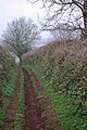
 A lane, Leysters - geograph.org.uk - 299752.jpg 640 × 480; 60 KB
-
 Abercrombie Christmas 2006 - geograph.org.uk - 298317.jpg 640 × 425; 54 KB
-
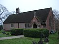
 Abercrombie Church - geograph.org.uk - 298366.jpg 500 × 640; 93 KB
-
 Abercrombie junction - geograph.org.uk - 298361.jpg 640 × 410; 40 KB
-
 Alien invasion in Nercwys - geograph.org.uk - 298279.jpg 480 × 640; 199 KB
-
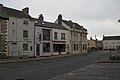
 All quiet on the Market Place - geograph.org.uk - 298287.jpg 640 × 480; 67 KB
-

-
 Bank on a Bank Holiday, Didsbury - geograph.org.uk - 301955.jpg 640 × 480; 116 KB
-
 Battersby - postbox and noticeboard - geograph.org.uk - 298448.jpg 640 × 427; 58 KB
-
 Beck Lane Keyingham.jpg 640 × 473; 144 KB
-
 Bedale Water Treatment Works - geograph.org.uk - 299048.jpg 640 × 480; 135 KB
-
 Beet field, Bleathwood - geograph.org.uk - 299991.jpg 640 × 480; 74 KB
-
 Birdcage bridge under demolition.jpg 2,048 × 1,536; 925 KB
-
 Birdcage bridge under demolition2.jpg 2,048 × 1,536; 884 KB
-
 Birdcage bridge under demolition3.jpg 2,048 × 1,536; 1.16 MB
-
 Boathouse at Loch Farr - geograph.org.uk - 298319.jpg 640 × 480; 79 KB
-
 Braid Burn, through the trees - geograph.org.uk - 299209.jpg 480 × 640; 109 KB
-

-
 Busby Hall - geograph.org.uk - 298457.jpg 640 × 427; 55 KB
-

-
 Carn Ghrantaich - geograph.org.uk - 947483.jpg 640 × 480; 100 KB
-
 Carn Ghrantaich and lower Strath Avon - geograph.org.uk - 947496.jpg 640 × 480; 98 KB
-
 Cattle at Aden Farm - geograph.org.uk - 298543.jpg 640 × 444; 51 KB
-

-
 Chiddingstone C of E VC Primary School - geograph.org.uk - 298528.jpg 640 × 428; 278 KB
-
 Chiddingstone Church, Christmas 2006 - geograph.org.uk - 298521.jpg 640 × 428; 277 KB
-
 Chiddingstone Shop and Post Office - geograph.org.uk - 298537.jpg 640 × 428; 323 KB
-
 Christmas Day Dog Walkers - geograph.org.uk - 298513.jpg 640 × 426; 102 KB
-
 Christmas day in Stokesley - geograph.org.uk - 298462.jpg 640 × 427; 55 KB
-
 Christmas Day on Burrough Hill 2006 - geograph.org.uk - 309703.jpg 640 × 480; 42 KB
-

-
 Christmas in London - geograph.org.uk - 308729.jpg 640 × 480; 70 KB
-

-
 Christmas Shopping Centre - geograph.org.uk - 298330.jpg 640 × 480; 250 KB
-
 Church at Ingleby Greenhow - geograph.org.uk - 298453.jpg 640 × 427; 52 KB
-
 Clermiston Road, Christmas Day - geograph.org.uk - 299149.jpg 480 × 640; 64 KB
-
 Co-op Supermarket in Stokesley - geograph.org.uk - 298466.jpg 640 × 427; 46 KB
-
 Compton - geograph.org.uk - 300115.jpg 640 × 428; 72 KB
-

-
 Creagan Bridge - geograph.org.uk - 300117.jpg 640 × 426; 62 KB
-
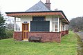
 Creagan Railway Station.jpg 640 × 426; 75 KB
-
 Creagan Station - geograph.org.uk - 298434.jpg 640 × 426; 111 KB
-
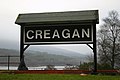 Creagan Station - geograph.org.uk - 298439.jpg 640 × 426; 61 KB
-
 Creagan Station - geograph.org.uk - 298445.jpg 640 × 426; 76 KB
-
 Cul de Sac, Exelby - geograph.org.uk - 299026.jpg 640 × 480; 61 KB
-
 Dere Street Hackforth North Yorks.jpg 640 × 480; 71 KB
-
 Dreel Bridge - geograph.org.uk - 298388.jpg 640 × 426; 72 KB
-
 Dreel by Balcaskie - geograph.org.uk - 298368.jpg 426 × 640; 65 KB
-
 Dunfermline - geograph.org.uk - 298346.jpg 640 × 424; 48 KB
-
 Dunfermline - geograph.org.uk - 298381.jpg 318 × 480; 28 KB
-

-
 Elloughton, Brantingham Road - geograph.org.uk - 300736.jpg 640 × 471; 77 KB
-
 Empty City - geograph.org.uk - 299138.jpg 640 × 480; 84 KB
-
 Entering Bedale from the South East - geograph.org.uk - 299042.jpg 640 × 480; 76 KB
-

-
 Exelby.jpg 640 × 480; 53 KB
-
 Farmland west of Pont Charlie - geograph.org.uk - 299593.jpg 640 × 379; 71 KB
-
 Fferm Erw Hywel, Llanrug - geograph.org.uk - 299242.jpg 640 × 402; 67 KB
-
 Fferm Llwynbedw Farm - geograph.org.uk - 298532.jpg 640 × 480; 41 KB
-
 Fferm Plas Gwyn Farm, Llanrug - geograph.org.uk - 299239.jpg 640 × 480; 52 KB
-
 Fields north of Exelby - geograph.org.uk - 299053.jpg 640 × 480; 86 KB
-

-

-
 Frozen Pond - geograph.org.uk - 298364.jpg 640 × 480; 80 KB
-
 Georgina, Chesterton Road, Cambridge - geograph.org.uk - 332040.jpg 640 × 427; 141 KB
-
 Gradient Marker, Invernahyle. - geograph.org.uk - 298417.jpg 640 × 426; 129 KB
-
 Great Ayton Cricket Pitch Seating - geograph.org.uk - 299050.jpg 480 × 640; 110 KB
-
 Grosvenor Bridge Lamp Cluster - geograph.org.uk - 299004.jpg 480 × 640; 97 KB
-
 Groyne on Hayling Beach - geograph.org.uk - 310153.jpg 640 × 465; 111 KB
-
 Hammersmith Bridge - geograph.org.uk - 310427.jpg 640 × 480; 61 KB
-
 Happy Xmas from 202 - geograph.org.uk - 308925.jpg 640 × 451; 50 KB
-
 Yo ho ho - geograph.org.uk - 298371.jpg 640 × 427; 101 KB
-
 Hayling Golf Club clubhouse - geograph.org.uk - 311235.jpg 640 × 391; 70 KB
-
 Houses at Ingleby Greenhow - geograph.org.uk - 298450.jpg 640 × 427; 52 KB
-
 Houses in Stokesley - geograph.org.uk - 298460.jpg 640 × 427; 44 KB
-

-
 Inglenook fireplace - geograph.org.uk - 298947.jpg 640 × 478; 156 KB
-
 Invernahyle - geograph.org.uk - 298428.jpg 640 × 426; 82 KB
-
 Kent Viaduct - geograph.org.uk - 599007.jpg 640 × 472; 62 KB
-
 Kildale Church - geograph.org.uk - 298440.jpg 640 × 422; 48 KB
-
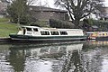
 King Orry.jpg 640 × 452; 106 KB
-
 Livermead - geograph.org.uk - 298321.jpg 640 × 480; 91 KB
-

-

-
 Looking back into the tunnel - geograph.org.uk - 299266.jpg 640 × 480; 56 KB
-
 Market Weighton, High Street - geograph.org.uk - 301029.jpg 640 × 464; 86 KB
-

-
 Methodist chapel at Chop Gate - geograph.org.uk - 298456.jpg 640 × 427; 81 KB
-

-
 Misty Castle from Salisbury Crags - geograph.org.uk - 299134.jpg 640 × 480; 65 KB
-
 Morley Roofscape. - geograph.org.uk - 300069.jpg 640 × 480; 81 KB
-
 New Industrial Estate at Tingley. - geograph.org.uk - 300072.jpg 640 × 480; 210 KB
-
 Offices at Roseberry Court - geograph.org.uk - 298472.jpg 600 × 363; 22 KB
-
 Old Stell - geograph.org.uk - 298992.jpg 640 × 480; 73 KB
-
 Old Village Road, Little Weighton.jpg 640 × 468; 104 KB
-
 Orchard, Leysters - geograph.org.uk - 299753.jpg 640 × 480; 93 KB
-
 Peacock - geograph.org.uk - 298281.jpg 640 × 424; 52 KB
-
 Penllyn railway tunnel - geograph.org.uk - 299260.jpg 640 × 480; 14 KB
-
 Pont-rug - geograph.org.uk - 298403.jpg 640 × 480; 101 KB
-
 Pony and paddock, Kyrewood - geograph.org.uk - 299686.jpg 640 × 438; 60 KB
-
 Pool Valley - geograph.org.uk - 298447.jpg 417 × 640; 89 KB
-

-
 Poultry Shed at Topcliffe. - geograph.org.uk - 299079.jpg 640 × 480; 69 KB
-
 Poultry Sheds at Topcliffe. - geograph.org.uk - 300062.jpg 640 × 480; 246 KB
-

-
 Railway - geograph.org.uk - 299005.jpg 640 × 512; 95 KB
-
 Railway Cutting - geograph.org.uk - 300122.jpg 640 × 426; 108 KB
-
 Railway Cutting - geograph.org.uk - 300308.jpg 640 × 426; 101 KB
-
 Retail Outlet at Tingley - geograph.org.uk - 300076.jpg 640 × 480; 215 KB
-
 Rheidol Valley on Christmas Day - geograph.org.uk - 298304.jpg 640 × 480; 157 KB
-
 Rhes Didfa - geograph.org.uk - 351055.jpg 640 × 458; 75 KB
-
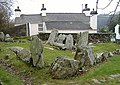
 The Drummer Boy's Stone - geograph.org.uk - 298374.jpg 640 × 479; 121 KB
-
 River Annan - geograph.org.uk - 298426.jpg 640 × 480; 243 KB
-
 River Annan - geograph.org.uk - 298431.jpg 640 × 480; 233 KB
-
 River Annan at The Creels - geograph.org.uk - 298414.jpg 640 × 480; 228 KB
-
 River Leven - geograph.org.uk - 299108.jpg 640 × 480; 152 KB
-
 Round bales, Bockleton - geograph.org.uk - 299970.jpg 640 × 480; 89 KB
-
 Rugby- Market Place - geograph.org.uk - 298665.jpg 640 × 480; 93 KB
-
 Rugby-High Street - geograph.org.uk - 299207.jpg 640 × 480; 111 KB
-

-
 Saltings, Sinah Lane, Hayling Island - geograph.org.uk - 311214.jpg 640 × 420; 126 KB
-
 Sheep on Dellagyle pasture by Speyside. - geograph.org.uk - 298455.jpg 640 × 446; 144 KB
-

-
 South Cave, Bear Lodge - geograph.org.uk - 300505.jpg 640 × 478; 101 KB
-
 South Cave, Market Place - geograph.org.uk - 300662.jpg 640 × 468; 98 KB
-
 South Cave, West End - geograph.org.uk - 299251.jpg 640 × 480; 98 KB
-
 South Cave, West End - geograph.org.uk - 299256.jpg 640 × 480; 88 KB
-
 Spare a thought for these lads - geograph.org.uk - 298409.jpg 640 × 480; 35 KB
-
 Spondon Railway Station.jpg 640 × 480; 85 KB
-
 St Mary's Parish Church - geograph.org.uk - 298288.jpg 640 × 480; 64 KB
-
 Stellasphere Denby 298622 b72c2e3b.jpg 480 × 640; 102 KB
-
 The Bull at Linton - geograph.org.uk - 365973.jpg 640 × 427; 140 KB
-
 The Caernarfon end of Bethel village - geograph.org.uk - 299285.jpg 640 × 307; 33 KB
-
 The Cemetery Chapel, South Cave - geograph.org.uk - 299144.jpg 640 × 480; 101 KB
-
 The cuttings on T and M canal - geograph.org.uk - 324780.jpg 640 × 480; 119 KB
-
 The Dingle Footbridge - geograph.org.uk - 299076.jpg 480 × 640; 99 KB
-
 The grey dawn beyond the tunnel - geograph.org.uk - 299261.jpg 640 × 494; 50 KB
-
 The Horses' field, Christmas Day 2006 - geograph.org.uk - 298397.jpg 640 × 480; 140 KB
-
 The House of Adam of Jesmond - geograph.org.uk - 299177.jpg 640 × 475; 143 KB
-

-

-
-

-

-
 The Thatch(ed Tavern) - geograph.org.uk - 298524.jpg 640 × 480; 97 KB
-

-

-
-

-
 Thurrock Yacht Club - geograph.org.uk - 299272.jpg 640 × 426; 83 KB
-
 Topcliffe Farm. - geograph.org.uk - 300056.jpg 640 × 480; 213 KB
-
 Topcliffe Farm. - geograph.org.uk - 300059.jpg 640 × 480; 217 KB
-
 Topcliffe Mill and Oak Mill. - geograph.org.uk - 299065.jpg 640 × 480; 228 KB
-
 Turnips, Leysters - geograph.org.uk - 299750.jpg 640 × 480; 101 KB
-
 Turnips, Leysters - geograph.org.uk - 299751.jpg 640 × 480; 109 KB
-
 Tynllidiart Arms - geograph.org.uk - 299171.jpg 640 × 480; 172 KB
-
 Tynllidiart Arms, Capel Bangor - geograph.org.uk - 299170.jpg 640 × 480; 178 KB
-

-
 Walmgate Bar - geograph.org.uk - 298421.jpg 640 × 427; 70 KB
-
 Wansdyke at Morgan's Hill - geograph.org.uk - 298298.jpg 640 × 480; 76 KB
-
 Welton, The Church - geograph.org.uk - 300811.jpg 640 × 469; 99 KB
-
 Welton, The Green - geograph.org.uk - 300838.jpg 639 × 479; 107 KB
-
 Wind farm view. - geograph.org.uk - 298985.jpg 640 × 480; 85 KB
-
 Windmill Lane, North Whilborough - geograph.org.uk - 300151.jpg 428 × 640; 105 KB
-
 Winter on Hayling Beach - geograph.org.uk - 310143.jpg 640 × 422; 89 KB
-

-

-
-
 Working Up an Appetite - geograph.org.uk - 299148.jpg 640 × 480; 59 KB
-
 Xmas Day 2006 - geograph.org.uk - 298333.jpg 640 × 480; 84 KB
-
 Youth Hostel, Ivinghoe - geograph.org.uk - 309419.jpg 640 × 480; 103 KB
-

-

-
 A march brook - geograph.org.uk - 299755.jpg 480 × 640; 144 KB
-

-
 A1, Leeming - geograph.org.uk - 299062.jpg 640 × 480; 67 KB
-
 A61 on Hutton Moor - geograph.org.uk - 298980.jpg 640 × 480; 74 KB
-
 Access point to a footpath - geograph.org.uk - 298596.jpg 480 × 640; 129 KB
-
 Afon Seiont - geograph.org.uk - 298540.jpg 640 × 480; 46 KB
-
 An eyesore just north of Exelby - geograph.org.uk - 299033.jpg 640 × 480; 104 KB
-
-

-
 Approaching Erw-Pwll-y-Glo - geograph.org.uk - 298548.jpg 640 × 480; 103 KB
-
 Approaching Pont Charlie from the west - geograph.org.uk - 299288.jpg 640 × 480; 126 KB
-
 Ardgay Christmas Day 2006 - geograph.org.uk - 298343.jpg 640 × 480; 176 KB
-
 Arthur's Seat from Dunsapie Crag - geograph.org.uk - 299130.jpg 640 × 480; 68 KB
-
 B6285 heading towards Burneston - geograph.org.uk - 298982.jpg 640 × 480; 56 KB
-
 Barn at Higher Crelly Farm - geograph.org.uk - 548389.jpg 640 × 480; 86 KB
-

-
 Black Knowe Head - geograph.org.uk - 298235.jpg 640 × 480; 88 KB
-
 Blackford Hill summit - geograph.org.uk - 299208.jpg 640 × 480; 41 KB
-
 Blagdon Farm - geograph.org.uk - 298987.jpg 1,259 × 999; 166 KB
-
 Bogland - geograph.org.uk - 298355.jpg 640 × 426; 57 KB
-
 Bridge Street at Christmas - geograph.org.uk - 298274.jpg 640 × 480; 112 KB
-
 Broadway Caravan Club site - geograph.org.uk - 361036.jpg 640 × 480; 160 KB
-
 Brrrrrrrrrrr - geograph.org.uk - 299132.jpg 480 × 640; 131 KB
-
 Bungalows at Pont-rug - geograph.org.uk - 299227.jpg 640 × 480; 60 KB
-
 Busby Wood - geograph.org.uk - 298383.jpg 640 × 420; 36 KB


_-_geograph.org.uk_-_298524.jpg)


