Category:United Kingdom photographs taken on 2007-06-16
Countries of Europe: Austria · Belgium · Bulgaria · Croatia · Czech Republic · Estonia · Finland · France‡ · Germany · Greece · Hungary · Iceland · Republic of Ireland · Italy · Latvia · Netherlands‡ · Norway · Poland · Portugal‡ · Romania · Russia‡ · Serbia · Slovakia · Spain‡ · Sweden · Switzerland · Turkey‡ · Ukraine · United Kingdom
Specific status: Isle of Man – Limited recognition: Kosovo
‡: partly located in Europe
Specific status: Isle of Man – Limited recognition: Kosovo
‡: partly located in Europe
| ← | 16 June 2007 | → | ||
| ← | June 2007 | → | ||

United Kingdom photographs taken on 16 June 2007.
Image files should be categorized here automatically using {{taken on}} template. Direct categorisation is also possible, if automatic is impossible.
Subcategories
This category has the following 2 subcategories, out of 2 total.
Media in category "United Kingdom photographs taken on 2007-06-16"
The following 200 files are in this category, out of 741 total.
(previous page) (next page)-
 1 - 36 Eldon Grove, Liverpool - geograph.org.uk - 471587.jpg 640 × 480; 86 KB
-
 390002 at South Hampstead.jpg 3,648 × 2,736; 4.48 MB
-

-
 A Coastal View - geograph.org.uk - 471301.jpg 640 × 427; 85 KB
-
 A View of Porthtowan - geograph.org.uk - 472170.jpg 640 × 427; 113 KB
-
 A Waterfall Crowden Little Brook - geograph.org.uk - 469213.jpg 480 × 640; 106 KB
-
 A30 at the Pheasant Hotel - geograph.org.uk - 468757.jpg 640 × 390; 115 KB
-

-

-
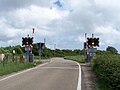
 Acton level crossing near Poyntzpass (3) - geograph.org.uk - 468435.jpg 640 × 427; 124 KB
-
 Affetside Cross - geograph.org.uk - 470162.jpg 640 × 480; 114 KB
-

-
 All Saints, Kirkgate - geograph.org.uk - 468909.jpg 640 × 505; 57 KB
-
 Alston from across River South Tyne - geograph.org.uk - 625169.jpg 640 × 480; 115 KB
-
 American Air Museum, Duxford - geograph.org.uk - 886788.jpg 640 × 424; 61 KB
-
 Anchorage Point - geograph.org.uk - 469339.jpg 425 × 640; 180 KB
-
 Approaching a summit, Cwmhir Road - geograph.org.uk - 468490.jpg 480 × 640; 132 KB
-
 Approaching Bottisham Lock - geograph.org.uk - 470928.jpg 640 × 426; 102 KB
-
 Approaching Kern - geograph.org.uk - 473413.jpg 640 × 477; 86 KB
-
 Avon Dam - geograph.org.uk - 1590820.jpg 640 × 480; 88 KB
-
 Avon Lwyd from the bridge - geograph.org.uk - 469471.jpg 640 × 480; 180 KB
-
 Avon riverside.jpg 2,560 × 1,920; 875 KB
-
 B6215, Greenmount - geograph.org.uk - 470388.jpg 480 × 640; 72 KB
-
 Back Silver Street - geograph.org.uk - 470482.jpg 476 × 640; 119 KB
-
 Baines Avenue, Irlam - geograph.org.uk - 468261.jpg 640 × 480; 63 KB
-
 Bangor Library (1) - geograph.org.uk - 468409.jpg 640 × 480; 92 KB
-
 Barcombe fire station - geograph.org.uk - 471959.jpg 640 × 426; 198 KB
-
 Barn at East Farm, Boscombe - geograph.org.uk - 469194.jpg 640 × 427; 126 KB
-
 Barn at Guildford Farm - geograph.org.uk - 472518.jpg 640 × 477; 113 KB
-
 Barn on byway near Boscombe - geograph.org.uk - 469152.jpg 640 × 427; 130 KB
-
 Bawden Rocks - geograph.org.uk - 469385.jpg 640 × 427; 59 KB
-
 Beehives in Little Glen Shee - geograph.org.uk - 469645.jpg 640 × 490; 162 KB
-
-

-
 Bembridge Airport in 2007.jpg 640 × 477; 77 KB
-

-
 Beoch - geograph.org.uk - 468621.jpg 640 × 480; 71 KB
-
 Beoch Lane - geograph.org.uk - 468771.jpg 640 × 480; 93 KB
-
 Beware of the Notices - geograph.org.uk - 469337.jpg 640 × 480; 68 KB
-
 Birstwith weir. - geograph.org.uk - 471071.jpg 640 × 480; 112 KB
-
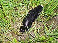 Black slug - geograph.org.uk - 469654.jpg 640 × 480; 190 KB
-
 Bondgate Fisheries - Bondgate - geograph.org.uk - 468530.jpg 640 × 620; 62 KB
-
 Botolph's Bridge Level Crossing on the RH&DR.jpg 630 × 470; 103 KB
-
 Bressay Gunnista.jpg 640 × 480; 41 KB
-
 Bridge in Ward Park - geograph.org.uk - 468414.jpg 640 × 480; 114 KB
-
-
 Bridge Street URC - Bridge Street - geograph.org.uk - 468553.jpg 459 × 640; 65 KB
-
 Brixham Trawler Race 2007 - geograph.org.uk - 796163.jpg 640 × 480; 68 KB
-
 Burgess Hill fire station - geograph.org.uk - 471946.jpg 640 × 427; 231 KB
-
 By Fittie - geograph.org.uk - 487679.jpg 640 × 480; 70 KB
-

-

-

-
 Cafe Med, Carlton Hill - geograph.org.uk - 530131.jpg 640 × 480; 107 KB
-
 "Hedgehog" Postbox - geograph.org.uk - 485132.jpg 425 × 639; 274 KB
-
 Camping near the basin - geograph.org.uk - 609866.jpg 640 × 480; 125 KB
-
 Canon Pyon Church - geograph.org.uk - 469980.jpg 640 × 426; 115 KB
-

-

-
 Carn Gowla - geograph.org.uk - 471289.jpg 640 × 426; 103 KB
-
 Carpenters Arms, Coed-y-paen - geograph.org.uk - 468464.jpg 640 × 480; 108 KB
-

-
 Castle Street from King's Square - geograph.org.uk - 937890.jpg 640 × 480; 255 KB
-
 Caterpillar on footpath - geograph.org.uk - 471654.jpg 640 × 426; 142 KB
-
 Cattle in Glen Shee - geograph.org.uk - 469683.jpg 640 × 480; 151 KB
-
 Cattle, Sunnyside Farm - geograph.org.uk - 469359.jpg 640 × 480; 67 KB
-

-
 Chapel Beck - geograph.org.uk - 468717.jpg 427 × 640; 303 KB
-
 Chapel Island - geograph.org.uk - 473050.jpg 640 × 480; 161 KB
-
 Chapel Porth - geograph.org.uk - 471377.jpg 640 × 427; 99 KB
-
 Cheddar Gorge - geograph.org.uk - 1009282.jpg 640 × 480; 341 KB
-
 Chevin Court - Boroughgate - geograph.org.uk - 468907.jpg 640 × 604; 63 KB
-
 Chimney at Pleasley Mill - geograph.org.uk - 468582.jpg 480 × 640; 178 KB
-
 Christchurch, Coed-y-paen - geograph.org.uk - 468461.jpg 480 × 640; 147 KB
-
-
 Clifftop near St Agnes - geograph.org.uk - 469252.jpg 640 × 427; 119 KB
-
 Clock on Mostyn Street Llandudno - geograph.org.uk - 468743.jpg 640 × 480; 138 KB
-
 Close-up of poppy in field - geograph.org.uk - 470935.jpg 640 × 426; 117 KB
-

-

-

-
 Cormorant, Loch Lennous - geograph.org.uk - 468801.jpg 640 × 446; 68 KB
-
 Cottage next to stream - geograph.org.uk - 470360.jpg 640 × 480; 156 KB
-
 Countryside view - geograph.org.uk - 471643.jpg 640 × 426; 108 KB
-
 Covered Mine Shafts on the Cliff Top - geograph.org.uk - 472206.jpg 640 × 427; 104 KB
-
 Cowberry flowers - geograph.org.uk - 469122.jpg 427 × 640; 132 KB
-
 Crawley fire station - geograph.org.uk - 471939.jpg 640 × 427; 236 KB
-
 Cross and village green at Stow Longa - geograph.org.uk - 468715.jpg 640 × 480; 124 KB
-
 Crowden Great Brook - geograph.org.uk - 469409.jpg 640 × 480; 98 KB
-
 Crowden Great Brook - geograph.org.uk - 469439.jpg 640 × 480; 108 KB
-
 Crowden Great Brook beneath the bend - geograph.org.uk - 469433.jpg 480 × 640; 107 KB
-
 Crowden Great Brook from Crowden Castles - geograph.org.uk - 469393.jpg 640 × 480; 113 KB
-
-

-

-
 Crowden Little Brook Waterfall - geograph.org.uk - 469219.jpg 640 × 480; 96 KB
-
 Cwmavon Cottages - geograph.org.uk - 469957.jpg 640 × 480; 99 KB
-
 Danes Lane Farm - geograph.org.uk - 915073.jpg 640 × 480; 75 KB
-

-
 Deanery Hotel, Ripon - geograph.org.uk - 471029.jpg 480 × 640; 107 KB
-

-
 Detail of Ely Cathedral - geograph.org.uk - 471656.jpg 640 × 426; 106 KB
-
 Diesel day on the Worth Valley - geograph.org.uk - 493188.jpg 640 × 427; 74 KB
-

-

-
 Disused Railway Bridge - geograph.org.uk - 469678.jpg 640 × 480; 111 KB
-
 Doreshill Farm - geograph.org.uk - 472499.jpg 640 × 477; 96 KB
-
 Drainage ditch - geograph.org.uk - 495692.jpg 640 × 480; 67 KB
-

-
 Dreich day on the Lang Wang - geograph.org.uk - 469342.jpg 640 × 480; 55 KB
-
 Dunstall Viaduct - geograph.org.uk - 468306.jpg 600 × 450; 222 KB
-
 East Drain - Summer - geograph.org.uk - 468775.jpg 425 × 640; 111 KB
-
 East Grinstead fire station - geograph.org.uk - 471956.jpg 640 × 427; 193 KB
-
 Ebor Mill chimney - geograph.org.uk - 470741.jpg 427 × 640; 73 KB
-
 Ebor Mill, Haworth - geograph.org.uk - 470736.jpg 640 × 427; 111 KB
-
 Edisford Bridge, Clitheroe - geograph.org.uk - 469869.jpg 640 × 480; 99 KB
-
 Engine Houses at Wheal Coates - geograph.org.uk - 471354.jpg 640 × 502; 94 KB
-
 English Congregational Church - geograph.org.uk - 1751284.jpg 1,024 × 768; 148 KB
-

-
 Entrance to Strathan village - geograph.org.uk - 502654.jpg 640 × 480; 125 KB
-

-
 Explanatory sign - geograph.org.uk - 495708.jpg 480 × 640; 74 KB
-
 Farm land and valley south of Boscombe - geograph.org.uk - 468765.jpg 640 × 427; 132 KB
-
 Farm, Affetside - geograph.org.uk - 470105.jpg 640 × 480; 46 KB
-
 Farmland at Canon Pyon - geograph.org.uk - 470136.jpg 640 × 426; 119 KB
-
 Farmland at Knapton Green - geograph.org.uk - 468729.jpg 640 × 426; 105 KB
-
 Farmland at Nunwell Farm - geograph.org.uk - 471546.jpg 640 × 477; 112 KB
-
 Farmland to the south of Monkland - geograph.org.uk - 468745.jpg 640 × 426; 97 KB
-

-
 Field - geograph.org.uk - 469634.jpg 640 × 480; 104 KB
-
 Finglands bus in Manchester 1780 reg R420 SOY.jpg 2,048 × 1,536; 1.56 MB
-
 Fishermen and houseboats by the River Cam - geograph.org.uk - 470918.jpg 640 × 426; 133 KB
-

-
 Flood Aftermath, Priest Lane Ford. - geograph.org.uk - 471050.jpg 640 × 480; 153 KB
-
 Footpath - seemingly well-trodden^ - geograph.org.uk - 468498.jpg 640 × 480; 104 KB
-
 Footpath and stile, 2k NE of Pontypool - geograph.org.uk - 468494.jpg 469 × 640; 111 KB
-

-
 Footpath down to the works - geograph.org.uk - 469455.jpg 640 × 480; 123 KB
-
 Footpath from Pack Horse - geograph.org.uk - 470287.jpg 640 × 480; 123 KB
-

-

-
 Forest ferns - geograph.org.uk - 468777.jpg 640 × 480; 112 KB
-
 Forest Row fire station - geograph.org.uk - 471960.jpg 640 × 427; 223 KB
-
 Former School - Cattle Market Street - geograph.org.uk - 468551.jpg 640 × 422; 41 KB
-
 Fort Redoubt Freshwater Bay - geograph.org.uk - 469303.jpg 640 × 480; 78 KB
-
 Four Horseshoes, Nursling - geograph.org.uk - 531202.jpg 623 × 493; 68 KB
-
 Francis Road, Irlam - geograph.org.uk - 468263.jpg 640 × 480; 74 KB
-
 From Chapel Porth Car Park - geograph.org.uk - 471440.jpg 640 × 427; 81 KB
-
 Gallowsbridge Farm - geograph.org.uk - 468886.jpg 640 × 480; 100 KB
-

-
 Godag - geograph.org.uk - 483410.jpg 640 × 431; 60 KB
-
 Grand Union Canal. - geograph.org.uk - 468932.jpg 640 × 480; 127 KB
-
 Grave at St Leonards Church - geograph.org.uk - 472360.jpg 640 × 480; 140 KB
-
 Gravestones at St Leonards Church - geograph.org.uk - 473440.jpg 640 × 480; 151 KB
-

-
 Great House, Canon Pyon - geograph.org.uk - 469981.jpg 640 × 426; 132 KB
-
 Great House, Canon Pyon - geograph.org.uk - 469983.jpg 640 × 426; 150 KB
-
 Green and leafy Waterworks Road - geograph.org.uk - 469488.jpg 640 × 480; 133 KB
-
 Hall Farm - geograph.org.uk - 469638.jpg 640 × 480; 129 KB
-
 Hamble Oil Jetty - geograph.org.uk - 733308.jpg 640 × 337; 58 KB
-
 Hawkhurst fire station - geograph.org.uk - 472004.jpg 640 × 427; 205 KB
-
 Hawkshaw village - geograph.org.uk - 470338.jpg 640 × 480; 102 KB
-

-
 Haywards Heath fire station - geograph.org.uk - 471952.jpg 640 × 426; 218 KB
-

-
-

-
 Henfield fire station - geograph.org.uk - 471936.jpg 640 × 427; 220 KB
-
 Herstmonceux fire station - geograph.org.uk - 472000.jpg 640 × 427; 219 KB
-
 Horeb Baptist Church - geograph.org.uk - 471190.jpg 480 × 640; 83 KB
-

-
 Horham village sign - geograph.org.uk - 472446.jpg 480 × 640; 114 KB
-
 Horley fire station from ground level - geograph.org.uk - 471942.jpg 640 × 427; 199 KB
-
 Horses graze on the valley bottom - geograph.org.uk - 471208.jpg 640 × 480; 109 KB
-

-
 House in Boroughgate - geograph.org.uk - 468570.jpg 640 × 559; 73 KB
-
 Howarth's Farm, Affetside - geograph.org.uk - 470094.jpg 640 × 480; 97 KB
-
 Hurn Gospel Mission Chapel - geograph.org.uk - 468278.jpg 640 × 480; 147 KB
-
 Hurn Railway Station 1.jpg 640 × 480; 85 KB
-
 Hurn Railway Station 2.jpg 640 × 480; 105 KB
-
 Hurn Stores - geograph.org.uk - 468321.jpg 640 × 480; 93 KB
-
 Hurstpierpoint fire station - geograph.org.uk - 471945.jpg 640 × 426; 194 KB
-

-
 Huthwaite - hosiery factory on North Street.jpg 2,132 × 1,632; 2.1 MB
-
 Ilfracombe - geograph.org.uk - 726450.jpg 640 × 480; 73 KB
-
 In the bend at Crowden Great Brook - geograph.org.uk - 469427.jpg 640 × 474; 116 KB
-
 Inside the railway tunnel - geograph.org.uk - 470694.jpg 640 × 477; 70 KB
-

-

-
 Junction with road from Newbridge - geograph.org.uk - 468806.jpg 640 × 480; 81 KB
-
 Keep at Scarborough Castle - geograph.org.uk - 482023.jpg 480 × 640; 77 KB
-

-
 Keymer fire station - geograph.org.uk - 471951.jpg 640 × 427; 172 KB
-
 Knapton Cutting.jpg 640 × 480; 147 KB
-
 Knighton - geograph.org.uk - 469639.jpg 640 × 477; 96 KB
-
 Knighton-Gorges.jpg 640 × 477; 132 KB
-
 Lancing fire station - geograph.org.uk - 471930.jpg 640 × 427; 187 KB
-

-
 Leaning Gravestone - geograph.org.uk - 473628.jpg 640 × 480; 120 KB
-
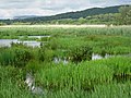 Leighton Moss - geograph.org.uk - 495714.jpg 640 × 480; 86 KB


_-_geograph.org.uk_-_468435.jpg)


_-_geograph.org.uk_-_468409.jpg)


_on_dry_heath,_New_Forest_-_geograph.org.uk_-_468937.jpg)


_-_geograph.org.uk_-_1750746.jpg)


_-_geograph.org.uk_-_1750720.jpg)


