Category:United Kingdom photographs taken on 2007-09-05
| ← | Wednesday 5 September 2007 | → | ||
| ← | September 2007 | → | ||

United Kingdom photographs taken on 5 September 2007.
Image files should be categorized here automatically using {{taken on}} template. Direct categorisation is also possible, if automatic is impossible.
Subcategories
This category has the following 3 subcategories, out of 3 total.
Media in category "United Kingdom photographs taken on 2007-09-05"
The following 200 files are in this category, out of 652 total.
(previous page) (next page)-
 121, North Street - geograph.org.uk - 1219201.jpg 640 × 480; 71 KB
-

-
-
 A Hairy Caterpillar on Dava. - geograph.org.uk - 547376.jpg 640 × 486; 157 KB
-
 A7 Middleton Moor - geograph.org.uk - 547018.jpg 640 × 480; 77 KB
-
 Abbeystead Village Hall.jpg 640 × 480; 204 KB
-
 Aberdeen Angus bull - geograph.org.uk - 546924.jpg 480 × 640; 82 KB
-

-
 Access control, Kershope Forest - geograph.org.uk - 547919.jpg 640 × 480; 147 KB
-
 Adam Horovitz.jpg 1,960 × 2,435; 613 KB
-
 Adam Yauch 1.jpg 3,681 × 2,454; 6.53 MB
-
 Adam Yauch 2.jpg 3,436 × 2,291; 4.07 MB
-
 Adam Yauch 2007 (cropped).jpg 1,077 × 1,529; 392 KB
-
 Adam Yauch crop.jpg 1,555 × 2,007; 1.41 MB
-
 Air Via LZ-MDT A320 Coventry(7) (31944121630).jpg 2,893 × 1,858; 1.01 MB
-
 Albert Dock, Hull - panoramio.jpg 1,000 × 683; 364 KB
-
 Allt na ceardaich to the east. - geograph.org.uk - 547369.jpg 640 × 426; 92 KB
-

-
 Ancient sheep pen south of Aittendow. - geograph.org.uk - 547396.jpg 640 × 426; 97 KB
-
 Ann's Hill Farm - geograph.org.uk - 548247.jpg 640 × 480; 122 KB
-
 Approaching Hunworth Green - geograph.org.uk - 546951.jpg 480 × 640; 96 KB
-
 B6367 - geograph.org.uk - 547015.jpg 640 × 480; 57 KB
-
 Back Lane - geograph.org.uk - 547147.jpg 640 × 480; 157 KB
-
 Back Lane - geograph.org.uk - 547150.jpg 640 × 480; 161 KB
-
 Back Lane approaching Woodside Farm - geograph.org.uk - 547174.jpg 640 × 480; 109 KB
-
 Back Lane view towards Bumper Castle - geograph.org.uk - 547183.jpg 640 × 480; 119 KB
-
 Beck Foot Farm - geograph.org.uk - 547586.jpg 640 × 480; 115 KB
-
 Beinn an Fhogharaidh - geograph.org.uk - 559447.jpg 640 × 480; 141 KB
-
 Ben Lomond coming out of the cloud - geograph.org.uk - 559470.jpg 640 × 480; 134 KB
-
 Benchmark on base of church tower - geograph.org.uk - 548283.jpg 640 × 447; 172 KB
-

-
 St Augustine's Church, Bexhill-on-Sea - geograph.org.uk - 662695.jpg 640 × 480; 74 KB
-
 Bollard^ - geograph.org.uk - 547588.jpg 640 × 480; 164 KB
-
 Boulder strewn beach, Llandanwg - geograph.org.uk - 562400.jpg 640 × 480; 97 KB
-
 St Annes Church - geograph.org.uk - 568166.jpg 640 × 480; 64 KB
-
 St Hubert's Church, Braithwaite - geograph.org.uk - 580267.jpg 640 × 480; 243 KB
-
 St Hubert's Church, Braithwaite - geograph.org.uk - 580285.jpg 640 × 480; 244 KB
-
 St Hubert's Church, Braithwaite, Font - geograph.org.uk - 580268.jpg 480 × 640; 156 KB
-
 St Hubert's Church, Braithwaite, Interior - geograph.org.uk - 580272.jpg 640 × 480; 159 KB
-
 St Hubert's Church, Braithwaite, Interior - geograph.org.uk - 580277.jpg 480 × 640; 168 KB
-
 St Hubert's Church, Braithwaite, Pulpit - geograph.org.uk - 580282.jpg 480 × 640; 157 KB
-
 Bridge - Kirkgate - geograph.org.uk - 547146.jpg 640 × 494; 63 KB
-
 BunkFest.jpg 604 × 453; 69 KB
-
 By Largo House - geograph.org.uk - 547145.jpg 640 × 428; 89 KB
-
 Cafe Paradiso - geograph.org.uk - 553925.jpg 480 × 640; 108 KB
-
 Cairn, Knott - geograph.org.uk - 654040.jpg 640 × 480; 54 KB
-
 Calke Abbey - geograph.org.uk - 553108.jpg 640 × 426; 77 KB
-
 Canal Boatyard - Keighley Road - geograph.org.uk - 547457.jpg 640 × 414; 42 KB
-

-
 Caradon Hill Transmitter Station - geograph.org.uk - 547104.jpg 640 × 427; 61 KB
-
 Cardale Woodland - geograph.org.uk - 547605.jpg 640 × 480; 181 KB
-
 Cattle in Silsden, West Yorkshire - geograph.org.uk - 547474.jpg 640 × 409; 42 KB
-
 Cattle under motorway - geograph.org.uk - 553859.jpg 640 × 480; 82 KB
-
-
 Clough Avenue - Skipton Road, Steeton - geograph.org.uk - 546936.jpg 640 × 437; 37 KB
-
 Colourful houses - geograph.org.uk - 550442.jpg 640 × 480; 66 KB
-
 Coming Next - geograph.org.uk - 553947.jpg 640 × 480; 84 KB
-
 Conservative Club - Briggate - geograph.org.uk - 547449.jpg 640 × 627; 60 KB
-
 Coots and swans - geograph.org.uk - 547051.jpg 640 × 403; 81 KB
-
 Cors Ian - geograph.org.uk - 547123.jpg 640 × 480; 51 KB
-
 Cottage at Ellercarr - geograph.org.uk - 547590.jpg 640 × 480; 131 KB
-
 Cremlyn House - geograph.org.uk - 550425.jpg 640 × 480; 120 KB
-
 Cricket Ground - Keighley Road - geograph.org.uk - 546991.jpg 640 × 392; 31 KB
-
 D-IFSH Piper PA42 Cheyenne 111 Coventry (31520889304) (cropped).jpg 2,267 × 1,514; 1.56 MB
-
 D-IFSH Piper PA42 Cheyenne 111 Coventry (31520889304).jpg 2,541 × 1,676; 901 KB
-
 Daisy Hill - Howden Road - geograph.org.uk - 546980.jpg 640 × 399; 41 KB
-
 Dalmeny House - geograph.org.uk - 1025783.jpg 640 × 476; 60 KB
-
 Damas Gill Bridge - geograph.org.uk - 580326.jpg 640 × 480; 215 KB
-
 Delaval Arms - Hartley - geograph.org.uk - 548339.jpg 640 × 480; 67 KB
-
 Derelict shipping offices St Andrews quay - panoramio.jpg 1,000 × 665; 359 KB
-
 Derrylough Hill near Banbridge - geograph.org.uk - 547151.jpg 640 × 426; 126 KB
-
 Dilapidated buildings - geograph.org.uk - 550396.jpg 640 × 480; 78 KB
-
 Disused byre at East Crosherie - geograph.org.uk - 547234.jpg 640 × 480; 134 KB
-

-
 Do Todays Work Today - geograph.org.uk - 554801.jpg 640 × 480; 170 KB
-

-
 Dolphinholme Methodist Church, Sign - geograph.org.uk - 580294.jpg 640 × 480; 222 KB
-
 Dolphinholme Methodist Church - geograph.org.uk - 580298.jpg 640 × 480; 226 KB
-
 Dolphinholme Methodist Church, Graveyard - geograph.org.uk - 580301.jpg 640 × 480; 188 KB
-
 Doocot by Largo Home Farm - geograph.org.uk - 547170.jpg 640 × 424; 96 KB
-
 Drumnadrochit near Loch Ness - geograph.org.uk - 1050789.jpg 640 × 480; 118 KB
-
 Dry ford at Holmehead - geograph.org.uk - 548252.jpg 640 × 480; 146 KB
-
 Ducks love Town Farm, Cranley - geograph.org.uk - 547562.jpg 640 × 480; 158 KB
-
 Early morning cyclist - geograph.org.uk - 555495.jpg 640 × 480; 146 KB
-
 East Crosherie - geograph.org.uk - 547118.jpg 640 × 480; 169 KB
-
 East Crosherie - geograph.org.uk - 547179.jpg 640 × 480; 152 KB
-
 East Parade - Steeton - geograph.org.uk - 546926.jpg 640 × 477; 54 KB
-
 Entrance to Holt Gravel Pit - geograph.org.uk - 546942.jpg 640 × 480; 87 KB
-
 Exeter Canal - geograph.org.uk - 553910.jpg 481 × 640; 110 KB
-
 Exeter Canal near Topsham - geograph.org.uk - 553040.jpg 640 × 473; 82 KB
-
 Eynsham Lock and Weir - geograph.org.uk - 747702.jpg 640 × 480; 54 KB
-
 F-BTME Beech99 Coventry (32324209896).jpg 2,425 × 1,633; 775 KB
-
 Farm buildings at East Crosherie - geograph.org.uk - 547278.jpg 640 × 480; 145 KB
-
 Fibres - geograph.org.uk - 547579.jpg 640 × 480; 122 KB
-
 Fields and old railway line - geograph.org.uk - 547258.jpg 640 × 324; 50 KB
-
 Fields by Lower Largo - geograph.org.uk - 547069.jpg 640 × 424; 88 KB
-
 Fishing The Mumbles - geograph.org.uk - 847141.jpg 640 × 415; 54 KB
-

-
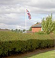 Flying the flag. - geograph.org.uk - 547060.jpg 606 × 640; 150 KB
-
-
 Ford on the River Lyne - geograph.org.uk - 547798.jpg 640 × 480; 163 KB
-
 Former Chapel - Keighley Road - geograph.org.uk - 547460.jpg 640 × 566; 68 KB
-
 Foyers across Loch Ness - geograph.org.uk - 1075277.jpg 640 × 480; 89 KB
-
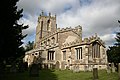 St.Peter's church, Gamston - geograph.org.uk - 547133.jpg 640 × 427; 63 KB
-

-
 Geograph - Steeton.jpg 640 × 442; 55 KB
-
 George VI postbox - geograph.org.uk - 547529.jpg 480 × 640; 104 KB
-
 Goat's Head - Skipton Road, Steeton - geograph.org.uk - 546928.jpg 640 × 530; 57 KB
-

-

-

-
 Half door at East Crosherie - geograph.org.uk - 547262.jpg 480 × 640; 140 KB
-
 Harlech Castle - geograph.org.uk - 553372.jpg 640 × 480; 115 KB
-
 Harvest Bales - geograph.org.uk - 547436.jpg 640 × 480; 97 KB
-
 Haws - geograph.org.uk - 547046.jpg 640 × 560; 87 KB
-
 Hazelton Sike - geograph.org.uk - 546765.jpg 640 × 480; 81 KB
-
 Heron in Thamesside water meadows - geograph.org.uk - 747707.jpg 640 × 480; 64 KB
-
 Highland Cattle - geograph.org.uk - 547120.jpg 640 × 480; 104 KB
-
 Honeysuckle - geograph.org.uk - 547185.jpg 640 × 474; 82 KB
-
 House - Keighley Road - geograph.org.uk - 547464.jpg 640 × 544; 55 KB
-
 House at Stanway Green - geograph.org.uk - 548314.jpg 640 × 480; 171 KB
-
 Houses in Timble - geograph.org.uk - 547596.jpg 640 × 480; 143 KB
-
 Housing development - geograph.org.uk - 547270.jpg 640 × 480; 104 KB
-
 Howden Road - geograph.org.uk - 546984.jpg 640 × 422; 63 KB
-
 Interior of Pit Barn near Gissing Farm - geograph.org.uk - 547485.jpg 480 × 640; 197 KB
-

-
 King John's Hunting Lodge Tea Room - geograph.org.uk - 568165.jpg 640 × 480; 114 KB
-
 Kings Arms - near Bell Square - geograph.org.uk - 547447.jpg 640 × 396; 37 KB
-
 Kirkapol - Circeabol - geograph.org.uk - 751851.jpg 640 × 426; 91 KB
-

-
 Kirkcowan woollen mills - geograph.org.uk - 547178.jpg 464 × 640; 45 KB
-
 Kirkgate - geograph.org.uk - 547138.jpg 640 × 433; 53 KB
-
 Kirkgate near Clog Lane - geograph.org.uk - 547454.jpg 548 × 640; 46 KB
-
 Lancaster Lodge - geograph.org.uk - 580556.jpg 640 × 480; 156 KB
-
 Largo Home Farm - geograph.org.uk - 547206.jpg 640 × 424; 94 KB
-
 Largo Home Farm - geograph.org.uk - 547213.jpg 640 × 424; 104 KB
-
 Largo Road - geograph.org.uk - 547109.jpg 640 × 444; 86 KB
-
 Largo Road - geograph.org.uk - 547129.jpg 640 × 422; 64 KB
-
 Library - Memorial Gardens - geograph.org.uk - 547446.jpg 640 × 505; 73 KB
-
 Little John's Well - geograph.org.uk - 549963.jpg 430 × 640; 184 KB
-
 Llandanwg - boulder strewn beach - geograph.org.uk - 562445.jpg 640 × 480; 120 KB
-
 Loch Ness - geograph.org.uk - 1075251.jpg 640 × 480; 79 KB
-
 Loch Ness - geograph.org.uk - 1075255.jpg 640 × 480; 91 KB
-
 Loch Ness - geograph.org.uk - 1075264.jpg 640 × 480; 95 KB
-
 Loch Shiel - geograph.org.uk - 673398.jpg 640 × 480; 37 KB
-
 Lochan a Sgeil - geograph.org.uk - 732573.jpg 640 × 480; 40 KB
-

-
 Long grass and heavy going - geograph.org.uk - 547027.jpg 640 × 480; 82 KB
-
 Long Green woods Dalmeny - geograph.org.uk - 1138032.jpg 640 × 480; 109 KB
-
 Longshaw Lodge - geograph.org.uk - 549956.jpg 640 × 430; 162 KB
-

-
-
 Lunt's Farm near Aston - geograph.org.uk - 547323.jpg 640 × 480; 92 KB
-
 Luxury housing near Baldwins Gate - geograph.org.uk - 547364.jpg 640 × 480; 150 KB
-
 Lych gate, St Tanwg's Church, Llandanwg - geograph.org.uk - 558647.jpg 640 × 480; 109 KB
-
 M5 across the Exe - geograph.org.uk - 553023.jpg 480 × 640; 76 KB
-

-
 Mallaig Harbour scene - geograph.org.uk - 673403.jpg 640 × 480; 32 KB
-
 Market Hall, Llanidloes - geograph.org.uk - 728679.jpg 640 × 425; 86 KB
-
 Methodist Church - Kirkgate - geograph.org.uk - 547158.jpg 640 × 375; 44 KB
-
 Michael Diamond 1 (cropped).jpg 1,381 × 1,995; 1.89 MB
-
 Michael Diamond 1.jpg 3,888 × 2,592; 5.58 MB
-
 Michael Diamond 2 (cropped).jpg 1,639 × 2,187; 2.62 MB
-
 Michael Diamond 2.jpg 3,280 × 2,187; 4.37 MB
-
 Michael Schwartz, Mix Master Mike (cropped).jpg 2,981 × 2,113; 4.59 MB
-
 Michael Schwartz, Mix Master Mike.jpg 3,726 × 2,484; 5.45 MB
-
 Milestone on Keighley Road - geograph.org.uk - 546988.jpg 456 × 640; 55 KB
-
 Mill off Howden Lane - geograph.org.uk - 547132.jpg 640 × 433; 33 KB
-
 Minehead Without, Selworthy Beacon - geograph.org.uk - 547643.jpg 640 × 427; 186 KB
-
 Moody Down Firing Range - Watertank - geograph.org.uk - 547106.jpg 640 × 512; 143 KB
-
 Mumbles Lighthouse. - geograph.org.uk - 862519.jpg 640 × 431; 57 KB
-
 Nanjulian, evening - geograph.org.uk - 548043.jpg 640 × 480; 54 KB
-
 Needham Market - Church of St John the Baptist.jpg 640 × 480; 86 KB
-
 Needham Market Evangelical Church - geograph.org.uk - 546811.jpg 640 × 359; 70 KB
-

-
 New Dungeon Ghyll hotel - panoramio.jpg 2,560 × 1,920; 2.41 MB
-
 Newcastle International Airport Control Tower.jpg 480 × 640; 66 KB
-
 Newhaven bus terminus, Edinburgh.jpg 640 × 480; 73 KB
-
 Newhaven Harbour - geograph.org.uk - 546973.jpg 640 × 480; 81 KB
-
 Newton Ings Panorama - geograph.org.uk - 548205.jpg 640 × 231; 37 KB
-
 No great welcome at Maggotts Farm - geograph.org.uk - 547419.jpg 640 × 480; 228 KB
-
 North Molton, above Span Head - geograph.org.uk - 547729.jpg 640 × 427; 155 KB
-
 Nun's Cave - geograph.org.uk - 584287.jpg 640 × 480; 181 KB
-

-
 Old railway line to Pipe Gate - geograph.org.uk - 547352.jpg 640 × 480; 166 KB
-
 On the Gonamena Incline - geograph.org.uk - 549718.jpg 640 × 427; 121 KB
-

-
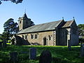 Christ Church, Over Wyresdale.jpg 640 × 480; 183 KB
-
 Ox Moor Farm, Sowerby. - geograph.org.uk - 546781.jpg 640 × 480; 111 KB
-
 Part of the city wall - geograph.org.uk - 548854.jpg 640 × 480; 80 KB
-
 Pasture fields - geograph.org.uk - 547201.jpg 640 × 480; 82 KB
-
 Pasture near to St Bega Church - geograph.org.uk - 579722.jpg 640 × 480; 253 KB
-
 Pastureland near Aston - geograph.org.uk - 547319.jpg 640 × 480; 120 KB
-
 Path - geograph.org.uk - 579725.jpg 640 × 480; 180 KB
-
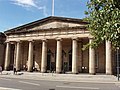 Perth sheriff court - geograph.org.uk - 566546.jpg 640 × 480; 112 KB
-
 Pigsty at East Crosherie - geograph.org.uk - 547260.jpg 640 × 480; 217 KB
-
 Ploughed fields and pylons - geograph.org.uk - 547172.jpg 640 × 427; 71 KB
-
 Ploughing the final corner - geograph.org.uk - 546901.jpg 640 × 479; 101 KB
-
 Ponies by the Cable Stays - geograph.org.uk - 547099.jpg 640 × 427; 73 KB
-
 Post Office - Kirkgate - geograph.org.uk - 547154.jpg 640 × 594; 77 KB


.jpg)

_(31944121630).jpg)


_(cropped).jpg)
.jpg)


.jpg)


.jpg)

.jpg)

.jpg)


