Category:United Kingdom photographs taken on 2007-09-13
Countries of Europe: Austria · Belgium · Croatia · Czech Republic · Denmark · Finland · France‡ · Germany · Greece · Hungary · Iceland · Republic of Ireland · Italy · Netherlands‡ · Norway · Poland · Portugal‡ · Russia‡ · Serbia · Slovakia · Spain‡ · Sweden · Switzerland · Ukraine · United Kingdom
‡: partly located in Europe
‡: partly located in Europe
| ← | 13 September 2007 | → | ||
| ← | September 2007 | → | ||

United Kingdom photographs taken on 13 September 2007.
Image files should be categorized here automatically using {{taken on}} template. Direct categorisation is also possible, if automatic is impossible.
Subcategories
This category has the following 3 subcategories, out of 3 total.
L
S
Media in category "United Kingdom photographs taken on 2007-09-13"
The following 200 files are in this category, out of 826 total.
(previous page) (next page)-
 "Island" near Farmyard - geograph.org.uk - 567951.jpg 640 × 480; 76 KB
-
 'New' entrance to Shadwell Basin - geograph.org.uk - 555936.jpg 640 × 427; 82 KB
-

-

-
 A short-cut to the summit of Y Ro Wen - geograph.org.uk - 566582.jpg 640 × 486; 93 KB
-
 A377 through Gratleigh Wood - geograph.org.uk - 555038.jpg 480 × 640; 135 KB
-
 Abbot's Marsh - geograph.org.uk - 554740.jpg 640 × 480; 102 KB
-
 Abbot's Marsh - geograph.org.uk - 555001.jpg 640 × 480; 100 KB
-
 Acrestripe - geograph.org.uk - 555527.jpg 640 × 427; 249 KB
-
 Adelante on the way to Paddington - geograph.org.uk - 554352.jpg 640 × 480; 358 KB
-
 Admiston Farmhouse - geograph.org.uk - 554757.jpg 640 × 480; 144 KB
-
 Afon Llechog - geograph.org.uk - 560019.jpg 640 × 480; 136 KB
-
 All change at Clogwyn Station - geograph.org.uk - 776303.jpg 640 × 426; 55 KB
-
-
-
 Ardestie2.jpg 640 × 396; 98 KB
-
 Ardinn - geograph.org.uk - 555222.jpg 640 × 427; 227 KB
-
 Ardinn - geograph.org.uk - 555225.jpg 640 × 427; 268 KB
-

-
 Autumn - panoramio - Alexander Reuss.jpg 2,048 × 1,536; 1.88 MB
-
 Autumn splendour - geograph.org.uk - 554736.jpg 640 × 397; 72 KB
-
 B3217 at Cowflop Cross - geograph.org.uk - 555525.jpg 640 × 480; 127 KB
-
 Badger Hills, Bridleway - geograph.org.uk - 554725.jpg 480 × 640; 123 KB
-
 Bagh Uisinis - geograph.org.uk - 1088449.jpg 640 × 428; 83 KB
-
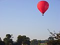 Balloon over Harpsden - geograph.org.uk - 559042.jpg 640 × 480; 73 KB
-
 Balnakeil Bay - geograph.org.uk - 1440614.jpg 640 × 422; 48 KB
-
 Barley field by Delgatie Castle - geograph.org.uk - 565906.jpg 640 × 480; 137 KB
-
 Barn at Austins - geograph.org.uk - 554546.jpg 640 × 480; 137 KB
-
 Batman, School Street, Dewsbury - geograph.org.uk - 554520.jpg 640 × 627; 111 KB
-
 Beech by the lane - geograph.org.uk - 554813.jpg 640 × 480; 120 KB
-
 Bends in the farm road - geograph.org.uk - 566957.jpg 640 × 480; 104 KB
-
 Beside the B3217 - geograph.org.uk - 554586.jpg 640 × 480; 114 KB
-

-
 Bishop's Tawton, Codden Beacon - geograph.org.uk - 555020.jpg 640 × 427; 115 KB
-
 Bishop's Tawton, Great Fisherton - geograph.org.uk - 555029.jpg 640 × 427; 210 KB
-
 Bishop's Tawton, Great Westacott - geograph.org.uk - 555033.jpg 640 × 427; 121 KB
-
 Bishop's Tawton, Higher Woolstone - geograph.org.uk - 555043.jpg 640 × 427; 174 KB
-
 Bishop's Tawton, lane near Heanton - geograph.org.uk - 555034.jpg 640 × 427; 233 KB
-
 Bishop's Tawton, lane to Heanton - geograph.org.uk - 555031.jpg 640 × 427; 245 KB
-
 Bishop's Tawton, Little Halmpstone - geograph.org.uk - 555040.jpg 640 × 427; 148 KB
-
 Bishop's Tawton, Lower Woolstone - geograph.org.uk - 555042.jpg 640 × 427; 225 KB
-
 Bishop's Tawton, on Martin's Hill - geograph.org.uk - 555028.jpg 640 × 427; 185 KB
-
 Bishop's Tawton, parkland at Herner - geograph.org.uk - 555046.jpg 640 × 427; 261 KB
-
 Bishop's Tawton, toward's Hangman's Hill - geograph.org.uk - 555019.jpg 640 × 427; 157 KB
-
 Bishop's Tawton, towards Codden Hill - geograph.org.uk - 555037.jpg 640 × 427; 149 KB
-
 Bishops Tawton - on Codden Hill - geograph.org.uk - 555015.jpg 640 × 427; 180 KB
-
 Blackwaterfoot Harbour - geograph.org.uk - 557219.jpg 640 × 268; 28 KB
-
 Blackwaterfoot Harbour - geograph.org.uk - 557223.jpg 640 × 268; 38 KB
-
 Boat House at Loch Achall - geograph.org.uk - 627809.jpg 640 × 480; 143 KB
-
 Boats moored at Brodick - geograph.org.uk - 557238.jpg 640 × 325; 33 KB
-
 Bottle Wall at Delgatie Castle - geograph.org.uk - 555504.jpg 640 × 427; 329 KB
-
 Bridge over Idoch Water - geograph.org.uk - 555250.jpg 640 × 427; 226 KB
-
 Bridleway On Badger Hills - geograph.org.uk - 554707.jpg 640 × 480; 113 KB
-
 Bridleways at Binns Pasture - geograph.org.uk - 557733.jpg 640 × 421; 191 KB
-
 Broadgate and Precincts - geograph.org.uk - 554599.jpg 640 × 480; 96 KB
-
 Brodick Ferry Port - geograph.org.uk - 557247.jpg 640 × 292; 32 KB
-
 Brodick, Isle of Arran - geograph.org.uk - 557232.jpg 640 × 290; 35 KB
-
 Bron-Llywelyn - a disused farmhouse - geograph.org.uk - 559020.jpg 640 × 480; 128 KB
-
 Bude Canal - geograph.org.uk - 563718.jpg 640 × 480; 126 KB
-
 Bude Canal - geograph.org.uk - 563719.jpg 640 × 480; 147 KB
-
 Bude Haven - geograph.org.uk - 563737.jpg 594 × 448; 122 KB
-
 Burn of Howemill - geograph.org.uk - 555570.jpg 640 × 427; 193 KB
-
 Burnside of Idoch - geograph.org.uk - 555245.jpg 640 × 427; 222 KB
-

-

-
 Cac Carn Mor from Cac Carn Beag(1155m MSL) - panoramio.jpg 2,048 × 1,536; 1.86 MB
-
 Canada Water station - geograph.org.uk - 555567.jpg 640 × 427; 78 KB
-
 Canada Water transport interchange - geograph.org.uk - 555575.jpg 640 × 427; 91 KB
-
 Capel Moreia, Dolwyddelan - geograph.org.uk - 568120.jpg 640 × 273; 59 KB
-

-
 Car park near Bunker's Hill - geograph.org.uk - 554100.jpg 640 × 480; 111 KB
-

-
-
 Cattle by Station Road - geograph.org.uk - 555756.jpg 640 × 480; 97 KB
-
 Cattle Pen in Sudbury Common Lands - geograph.org.uk - 580623.jpg 640 × 480; 152 KB
-
 The 'Caulkers', Southwark - geograph.org.uk - 555351.jpg 640 × 427; 97 KB
-
 Chapel of Seggat - geograph.org.uk - 555602.jpg 640 × 427; 232 KB
-
 Chawleigh Week Mill Cross - geograph.org.uk - 554643.jpg 640 × 480; 88 KB
-
-
 Christmas trees in the mist - geograph.org.uk - 555632.jpg 640 × 480; 82 KB
-
 Clar Loch Mhor - geograph.org.uk - 1444562.jpg 640 × 315; 43 KB
-
 Clootie Well, The Black Isle - geograph.org.uk - 602344.jpg 640 × 481; 149 KB
-
 Clovelly Cottage, 19 Park Road Barnet EN5 5RY.jpg 581 × 444; 106 KB
-

-
 Corwen's new statue of Owain Glyndwr - geograph.org.uk - 628404.jpg 480 × 640; 70 KB
-
 Cottage at Delgatie Castle - geograph.org.uk - 555512.jpg 640 × 529; 285 KB
-
 Country Road - geograph.org.uk - 554772.jpg 640 × 480; 86 KB
-
 County Hall, Cuckoo Lane - geograph.org.uk - 554583.jpg 640 × 480; 95 KB
-

-
 Holy Trinity spire - geograph.org.uk - 555875.jpg 456 × 640; 97 KB
-
 Holy Trinity and Hillman House - geograph.org.uk - 560185.jpg 480 × 640; 94 KB
-
 Cowflop Cross - geograph.org.uk - 554633.jpg 640 × 480; 134 KB
-
 Cowflop Cross - geograph.org.uk - 555519.jpg 480 × 640; 136 KB
-
 Crags and screes below Esgair Felen - geograph.org.uk - 555705.jpg 640 × 480; 102 KB
-
 Cropped image of Capel Moreia, Dolwyddelan 568120 1662f890.jpg 328 × 268; 56 KB
-
 Dairy House - geograph.org.uk - 554529.jpg 640 × 480; 93 KB
-
 Darra - geograph.org.uk - 555339.jpg 640 × 427; 239 KB
-
 Dartridge Lane - geograph.org.uk - 555551.jpg 640 × 480; 148 KB
-
-
-
 Derelict cottage on Beaford Moor - geograph.org.uk - 555533.jpg 640 × 472; 135 KB
-

-
 Doocot at Delgatie Castle - geograph.org.uk - 555445.jpg 427 × 640; 299 KB
-
 Drive to Hoarstone - geograph.org.uk - 554484.jpg 640 × 480; 108 KB
-
 Dubford - geograph.org.uk - 555299.jpg 640 × 427; 214 KB
-
 Dykeside - geograph.org.uk - 555581.jpg 640 × 427; 221 KB
-
 East Pitdoulzie - geograph.org.uk - 555518.jpg 640 × 427; 209 KB
-
 East Wing, Delgatie Castle - geograph.org.uk - 555484.jpg 427 × 640; 261 KB
-
 Eden Castle near Banff - geograph.org.uk - 555861.jpg 480 × 640; 193 KB
-
 Edge of maize field, Pitt - geograph.org.uk - 556837.jpg 640 × 480; 141 KB
-
 Efford Down - geograph.org.uk - 563735.jpg 640 × 480; 126 KB
-
 Eglwys Sant Gwyddelan, Dolwyddelan - geograph.org.uk - 554892.jpg 640 × 480; 126 KB
-

-
 Electricity substation - geograph.org.uk - 554685.jpg 640 × 480; 90 KB
-
 Elements Hotel - geograph.org.uk - 563744.jpg 589 × 441; 119 KB
-

-
 Entrance, Tudor V.C. Primary School - geograph.org.uk - 562460.jpg 640 × 480; 83 KB
-

-
 Fallen trees alongside a forest walk - geograph.org.uk - 558108.jpg 640 × 480; 151 KB
-
 Farm Reservoir - geograph.org.uk - 554764.jpg 640 × 480; 108 KB
-
 Farmland Northeast Of Keelby - geograph.org.uk - 554620.jpg 640 × 480; 104 KB
-
 Farmland south of Prees - geograph.org.uk - 554508.jpg 640 × 480; 104 KB
-
 Farmland View From Badger Hills - geograph.org.uk - 554715.jpg 480 × 640; 96 KB
-
 Farmland, Badger Hills - geograph.org.uk - 554737.jpg 640 × 480; 105 KB
-
 Ffynnon Gybi Llangybi St Cybi's Well - geograph.org.uk - 554293.jpg 640 × 428; 179 KB
-
 Ffynnon Gybi Llangybi St Cybi's Well - geograph.org.uk - 554300.jpg 640 × 428; 180 KB
-
 Ffynnon Gybi Llangybi St Cybi's Well - geograph.org.uk - 554301.jpg 640 × 428; 174 KB
-
 Ffynnon Gybi Llangybi St Cybi's Well - geograph.org.uk - 554310.jpg 640 × 428; 165 KB
-
 Ffynnon Gybi Llangybi St Cybi's Well - geograph.org.uk - 554311.jpg 640 × 428; 173 KB
-

-
 Field alongside the roman road (A49) - geograph.org.uk - 554577.jpg 640 × 480; 111 KB
-
 Field and view near Northcote Manor - geograph.org.uk - 555414.jpg 640 × 480; 109 KB
-
 Field at Elstone - geograph.org.uk - 555676.jpg 640 × 480; 134 KB
-
 Field at Pyne Meadow Cross - geograph.org.uk - 555755.jpg 640 × 480; 111 KB
-
 Field Entrance - geograph.org.uk - 555714.jpg 640 × 427; 257 KB
-
 Field near Chulmleigh - geograph.org.uk - 555558.jpg 640 × 480; 86 KB
-
 Field near Furze Cottage Farm - geograph.org.uk - 554629.jpg 640 × 480; 72 KB
-
 Field near Great Halfsbury - geograph.org.uk - 554562.jpg 640 × 480; 109 KB
-
 Field near Hill Farm - geograph.org.uk - 554909.jpg 640 × 480; 89 KB
-
 Field near Northcote Cross - geograph.org.uk - 554702.jpg 640 × 480; 130 KB
-
 Foel Post Office - geograph.org.uk - 560095.jpg 640 × 480; 110 KB
-

-
 Forage Harvester, near Llangadfan - geograph.org.uk - 560348.jpg 640 × 480; 97 KB
-
 Forches Cross - geograph.org.uk - 554902.jpg 640 × 480; 99 KB
-
 Fore Street, Totnes - geograph.org.uk - 751725.jpg 640 × 480; 80 KB
-
 Forest crossroads - geograph.org.uk - 558178.jpg 640 × 480; 68 KB
-

-
 Forestry road east of Blaen Glasgwm - geograph.org.uk - 557694.jpg 640 × 480; 132 KB
-
 Forestry road on Llechweddhafod - geograph.org.uk - 554631.jpg 640 × 501; 119 KB
-

-
 Frome Hill Cottage - geograph.org.uk - 554845.jpg 640 × 480; 168 KB
-
 Fungus, Huntly, Banbridge (1) - geograph.org.uk - 554671.jpg 640 × 426; 108 KB
-
 Fungus, Huntly, Banbridge (2) - geograph.org.uk - 554681.jpg 640 × 427; 103 KB
-
 Fungus, Huntly, Banbridge (3) - geograph.org.uk - 554693.jpg 640 × 427; 96 KB
-
 Garden at Delgatie Castle - geograph.org.uk - 555467.jpg 640 × 427; 315 KB
-
 Garlogie cottage - geograph.org.uk - 588686.jpg 640 × 480; 192 KB
-
 Given Dale - geograph.org.uk - 555700.jpg 640 × 480; 111 KB
-
 Gratleigh Wood - geograph.org.uk - 555022.jpg 640 × 480; 155 KB
-
 Greek Street, Castleford - geograph.org.uk - 559444.jpg 640 × 480; 94 KB
-
 Green Lane living up to its name - geograph.org.uk - 554490.jpg 640 × 480; 127 KB
-

-
 Hailes Street - geograph.org.uk - 1302397.jpg 640 × 480; 79 KB
-
 Hansford Plantation - geograph.org.uk - 555757.jpg 640 × 480; 114 KB
-
 Haremoss - geograph.org.uk - 555235.jpg 640 × 427; 160 KB
-
-
 Heathlane - geograph.org.uk - 554649.jpg 640 × 480; 103 KB
-
 Heathwood Road joins the A41 - geograph.org.uk - 554697.jpg 640 × 480; 100 KB
-
 Henllys Guesthouse - geograph.org.uk - 556050.jpg 640 × 480; 114 KB
-
 High Street, Totnes - geograph.org.uk - 751733.jpg 480 × 640; 65 KB
-
 Higher Hacknell - geograph.org.uk - 554721.jpg 640 × 426; 100 KB
-
 Hillsborough masonic hall - geograph.org.uk - 554551.jpg 640 × 426; 109 KB
-
 Hillsborough war memorial - geograph.org.uk - 554513.jpg 640 × 426; 95 KB
-
 Hitchcock Place - geograph.org.uk - 562476.jpg 640 × 480; 99 KB
-
 Hook Farm - geograph.org.uk - 554682.jpg 640 × 480; 96 KB
-
 Horses by Dartridge Lane - geograph.org.uk - 555552.jpg 640 × 480; 97 KB
-
 Houses beside the B5065 - geograph.org.uk - 554550.jpg 640 × 480; 104 KB
-
 Howegarden - geograph.org.uk - 555529.jpg 640 × 427; 206 KB
-
 Idoch Water - geograph.org.uk - 555242.jpg 640 × 427; 223 KB
-
 Ilsington Farm - geograph.org.uk - 554786.jpg 480 × 640; 193 KB
-
 In Memory - geograph.org.uk - 556820.jpg 640 × 409; 154 KB
-
 Inverleith House - geograph.org.uk - 554914.jpg 640 × 480; 91 KB
-
 Inverleith House - geograph.org.uk - 554920.jpg 640 × 480; 103 KB
-
 Isle of Arran Distillery - geograph.org.uk - 557208.jpg 640 × 268; 27 KB
-
 Isle of Arran Distillery - geograph.org.uk - 557212.jpg 640 × 480; 54 KB
-
 Jubilee Way, Scunthorpe (geograph 559571).jpg 640 × 514; 134 KB
-
 Kingsford - geograph.org.uk - 555537.jpg 640 × 427; 252 KB
-
 Kingsford - geograph.org.uk - 555576.jpg 640 × 427; 237 KB
-
 Kingsford - geograph.org.uk - 555579.jpg 640 × 427; 257 KB
-
 Knockdamph Bothy - geograph.org.uk - 627864.jpg 640 × 480; 67 KB
-
 Lake in Southwark Park, South London - geograph.org.uk - 555549.jpg 640 × 427; 148 KB
-
 Lancaster Bomber War Memorial - geograph.org.uk - 556819.jpg 640 × 470; 171 KB
-
 Land near Lacon Hall - geograph.org.uk - 554543.jpg 640 × 480; 127 KB
-
 Landkey, Higher Bableigh - geograph.org.uk - 555025.jpg 640 × 427; 213 KB
-
 Landkey, old limekiln - geograph.org.uk - 555007.jpg 640 × 427; 281 KB
-
 Landkey, ruin by Venn Quarry - geograph.org.uk - 555006.jpg 640 × 427; 281 KB
-
 Landkey, St Paul's church, Landkey Town - geograph.org.uk - 554998.jpg 640 × 427; 183 KB
-
 Landkey, Tarka Trail - geograph.org.uk - 555012.jpg 640 × 427; 270 KB
-
 Landkey, towards Landkey Newland - geograph.org.uk - 554996.jpg 640 × 427; 145 KB
-
 Landkey, towards Venn Quarry - geograph.org.uk - 555000.jpg 640 × 427; 202 KB
-
 Landkey, Venn Quarry - geograph.org.uk - 555004.jpg 640 × 427; 188 KB


_-_panoramio.jpg)


_-_geograph.org.uk_-_554577.jpg)


_-_geograph.org.uk_-_554671.jpg)
_-_geograph.org.uk_-_554681.jpg)
_-_geograph.org.uk_-_554693.jpg)


.jpg)


