Category:United Kingdom photographs taken on 2007-10-03
Countries of Europe: Austria · Belgium · Czech Republic · Denmark · Finland · France‡ · Germany · Republic of Ireland · Italy · Malta · Netherlands‡ · North Macedonia · Norway · Poland · Portugal‡ · Russia‡ · Slovakia · Spain‡ · Sweden · Switzerland · Ukraine · United Kingdom
‡: partly located in Europe
‡: partly located in Europe
| ← | 3 October 2007 | → | ||
| ← | October 2007 | → | ||

United Kingdom photographs taken on 3 October 2007.
Image files should be categorized here automatically using {{taken on}} template. Direct categorisation is also possible, if automatic is impossible.
Subcategories
This category has the following 2 subcategories, out of 2 total.
Media in category "United Kingdom photographs taken on 2007-10-03"
The following 200 files are in this category, out of 496 total.
(previous page) (next page)-
-

-
 A Recognition Stone - geograph.org.uk - 573741.jpg 640 × 509; 170 KB
-
 Abbey Road - geograph.org.uk - 916869.jpg 640 × 480; 101 KB
-
 Abbotsford Church, Clydebank - geograph.org.uk - 574929.jpg 640 × 480; 49 KB
-

-
 Across the fields to the A390 - geograph.org.uk - 574170.jpg 640 × 341; 37 KB
-
-
 Adelphi Bridge - geograph.org.uk - 586340.jpg 640 × 480; 94 KB
-
 All Saints Church Aughton.jpg 640 × 480; 75 KB
-
 All Saints' church nave - geograph.org.uk - 573823.jpg 640 × 427; 64 KB
-
 Former Chapel - Allerton Road - geograph.org.uk - 575235.jpg 515 × 640; 33 KB
-
 St Peter's Church - Allerton Road - geograph.org.uk - 575242.jpg 480 × 640; 26 KB
-

-

-

-

-
 Allt Loch na Caillich - geograph.org.uk - 863417.jpg 640 × 480; 147 KB
-

-
 Approaching the Fort - geograph.org.uk - 586711.jpg 640 × 480; 57 KB
-
 Asda, Clydebank - geograph.org.uk - 574934.jpg 640 × 480; 57 KB
-

-
 Back drive to Sennowe Hall - geograph.org.uk - 573799.jpg 640 × 480; 152 KB
-
 Back entrance to Sennowe Park - geograph.org.uk - 574458.jpg 640 × 480; 131 KB
-
 Back entrance to Sennowe Park - geograph.org.uk - 574461.jpg 640 × 480; 117 KB
-
 Back Lane - geograph.org.uk - 574353.jpg 603 × 640; 33 KB
-
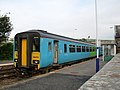 Barrow bound train at St Bees Station - geograph.org.uk - 573537.jpg 640 × 480; 102 KB
-
 Bassenthwaite - geograph.org.uk - 577414.jpg 640 × 480; 167 KB
-
 Bassenthwaite Methodist Chapel - geograph.org.uk - 576761.jpg 640 × 480; 184 KB
-
 Bassenthwaite Methodist Chapel, Doorway - geograph.org.uk - 576763.jpg 470 × 628; 208 KB
-
 Blackpool Pit - geograph.org.uk - 574494.jpg 640 × 257; 35 KB
-
 Bostock Hall, South Lodge - geograph.org.uk - 573587.jpg 640 × 463; 115 KB
-

-
 Brean Down car park - geograph.org.uk - 584939.jpg 640 × 480; 70 KB
-

-

-

-
 Bridleway to Brouncey - geograph.org.uk - 573656.jpg 640 × 480; 93 KB
-
 Bridleway to the A614 - geograph.org.uk - 573753.jpg 640 × 480; 110 KB
-
 Buchanan Galleries shopping centre - geograph.org.uk - 573833.jpg 640 × 480; 92 KB
-
 Buchanan Street Bus Station - geograph.org.uk - 574907.jpg 640 × 480; 62 KB
-
 Bus Shelter - Main Street, Wilsden - geograph.org.uk - 574384.jpg 640 × 430; 37 KB
-
 Bus shelter at Ruthwaite - geograph.org.uk - 577416.jpg 640 × 480; 202 KB
-
 Bus stop at Warren Corner, Hampshire - geograph.org.uk - 578023.jpg 640 × 480; 96 KB
-
 Caledonian University - geograph.org.uk - 574900.jpg 640 × 480; 66 KB
-
 Calm after the storm - geograph.org.uk - 1358724.jpg 640 × 427; 53 KB
-
 Canalside Willow Tree - geograph.org.uk - 573912.jpg 640 × 480; 109 KB
-
 Car park at Clyde Shopping centre - geograph.org.uk - 574932.jpg 640 × 480; 63 KB
-
 Caravans at Brean - geograph.org.uk - 586698.jpg 640 × 480; 95 KB
-

-
 Castell Deudraeth - geograph.org.uk - 597024.jpg 640 × 480; 69 KB
-
 Castle Shuttle Sign - geograph.org.uk - 575283.jpg 640 × 480; 70 KB
-
 Chapel Screen - geograph.org.uk - 573849.jpg 640 × 427; 65 KB
-

-
-

-
 Chuan-Vista caravan site - geograph.org.uk - 573838.jpg 640 × 480; 93 KB
-
 Cinema and "Running Clock" - geograph.org.uk - 574911.jpg 480 × 640; 129 KB
-

-

-

-
 Clinnick Viaduct - geograph.org.uk - 574536.jpg 640 × 480; 126 KB
-
 Coat's Bridge Lock - geograph.org.uk - 573872.jpg 640 × 480; 96 KB
-

-

-
 Coptotriche marginea, larva. (2524317216).jpg 3,538 × 2,653; 4.55 MB
-
 Coptotriche marginea, mine. (2523489819).jpg 3,538 × 2,653; 3.69 MB
-
 Cottingwith Lock - geograph.org.uk - 1070022.jpg 640 × 480; 101 KB
-

-
 Criterion Restaurant in 2007.jpg 1,280 × 960; 317 KB
-
 Curious House - geograph.org.uk - 574511.jpg 640 × 403; 96 KB
-
 Cycle Track to Moor Row - geograph.org.uk - 573556.jpg 640 × 480; 168 KB
-
 Dairy cattle on Crift Downs - geograph.org.uk - 574154.jpg 640 × 363; 89 KB
-
 Dales Way - geograph.org.uk - 757612.jpg 640 × 426; 64 KB
-
 Death in the tunnel - geograph.org.uk - 574307.jpg 426 × 640; 100 KB
-
 Deer and pheasants near Wootton Lodge - geograph.org.uk - 574072.jpg 640 × 442; 246 KB
-
 Deer Park at Wootton Lodge - geograph.org.uk - 574059.jpg 640 × 428; 189 KB
-
 Derricombe Viaduct - geograph.org.uk - 574554.jpg 640 × 480; 147 KB
-
 Distington War Memorial - geograph.org.uk - 573570.jpg 480 × 640; 70 KB
-

-
 Dry stone walls - geograph.org.uk - 576215.jpg 640 × 427; 130 KB
-
 Duddingston Station - geograph.org.uk - 573859.jpg 640 × 480; 83 KB
-
 Dunsapie Loch - geograph.org.uk - 574512.jpg 480 × 640; 43 KB
-

-

-
 Edric House, Page Street - geograph.org.uk - 573517.jpg 640 × 480; 94 KB
-
 Egremont Town hall - geograph.org.uk - 573562.jpg 480 × 640; 76 KB
-
 Elusendai Llangybi Almshouses - geograph.org.uk - 575138.jpg 640 × 428; 138 KB
-
 Engine Lane Goldthorpe - geograph.org.uk - 573977.jpg 640 × 480; 111 KB
-
 Entrance to Euston railway station - geograph.org.uk - 574010.jpg 640 × 480; 147 KB
-
 Entrance to University College Hospital - geograph.org.uk - 574005.jpg 427 × 640; 105 KB
-
 Evolving campus.jpg 2,592 × 1,944; 2.41 MB
-
 Farm Track - geograph.org.uk - 573922.jpg 640 × 480; 85 KB
-
-

-
 Footbridge over the River Foulness - geograph.org.uk - 573792.jpg 640 × 480; 139 KB
-
 Footpath entrance to Wootton Lodge park - geograph.org.uk - 574082.jpg 640 × 428; 230 KB
-
 Footpath to Seaton Ross - geograph.org.uk - 573660.jpg 640 × 480; 96 KB
-
 Ford over stream near Preston, Wiltshire - geograph.org.uk - 574232.jpg 480 × 640; 318 KB
-

-
 Forestry clearance south of Airdrie Farm - geograph.org.uk - 574287.jpg 640 × 426; 113 KB
-
-
 Fozy Moss - geograph.org.uk - 573991.jpg 640 × 480; 86 KB
-
 Freddie Mercury - geograph.org.uk - 574056.jpg 444 × 640; 118 KB
-
 Free-range beef - geograph.org.uk - 574568.jpg 640 × 407; 75 KB
-
 From near Alltmaen towards Pant-bach - geograph.org.uk - 577386.jpg 640 × 480; 127 KB
-
 Fulham Football Club - geograph.org.uk - 577777.jpg 640 × 480; 82 KB
-
 Fungus on a log - geograph.org.uk - 575930.jpg 640 × 479; 125 KB
-
 Gate on Goonhilly Downs - geograph.org.uk - 573781.jpg 640 × 360; 70 KB
-
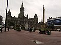
 George Square - geograph.org.uk - 573820.jpg 640 × 480; 70 KB
-
 Glasgow Royal Concert Hall - geograph.org.uk - 573837.jpg 640 × 480; 71 KB
-
 Graveyard - Lane End - geograph.org.uk - 574354.jpg 640 × 480; 48 KB
-

-

-
 Greenlee Lough Nature Reserve - geograph.org.uk - 578420.jpg 640 × 480; 82 KB
-
 Greensplat has gone^ - geograph.org.uk - 574498.jpg 640 × 358; 52 KB
-

-
 Hagg Bridge over Pocklington Canal - geograph.org.uk - 1070044.jpg 640 × 480; 100 KB
-
 Hammersmith Bridge - geograph.org.uk - 581294.jpg 640 × 431; 74 KB
-
 Hammersmith Terrace - geograph.org.uk - 580269.jpg 640 × 480; 87 KB
-
 Hanson aggregate train en route to London - geograph.org.uk - 574076.jpg 640 × 480; 110 KB
-

-
 Harrington Pond - geograph.org.uk - 573515.jpg 640 × 480; 107 KB
-
 Harrington Railway Station.jpg 640 × 480; 130 KB
-
 Harrington Railway Viaduct - geograph.org.uk - 573524.jpg 640 × 480; 83 KB
-
 Harrington Station Footbridge - geograph.org.uk - 573521.jpg 640 × 480; 107 KB
-
 Hays Park - geograph.org.uk - 573841.jpg 640 × 480; 88 KB
-

-
 Hugh llewelyn 313 110 (6296128228).jpg 2,592 × 1,944; 1.2 MB
-
 Hugh llewelyn 315 804 (6296125218).jpg 2,592 × 1,944; 1.21 MB
-
 Hugh llewelyn 317 505 (6296129470).jpg 2,592 × 1,944; 1.21 MB
-
 Hugh llewelyn 317 512 (6295436055).jpg 2,592 × 1,944; 1.21 MB
-
 Hugh llewelyn 317 515 (6296136830).jpg 2,592 × 1,944; 1.25 MB
-
 Hugh llewelyn 317 722 (6295604551).jpg 2,592 × 1,944; 1.07 MB
-
 Hugh llewelyn 317 8 (6296555038).jpg 2,592 × 1,944; 670 KB
-
 Hugh llewelyn 321 (6295436061).jpg 2,592 × 1,944; 1.25 MB
-
 Hugh llewelyn 321 323 (6295436081).jpg 2,592 × 1,944; 1.25 MB
-
 Hugh llewelyn 360 (6295436077).jpg 2,592 × 1,944; 1.24 MB
-
 Hugh llewelyn 360 110 (6295590825).jpg 2,592 × 1,944; 1.23 MB
-
 Hugh llewelyn 90 007 (5612650531).jpg 2,592 × 1,944; 1.22 MB
-
 Hugh llewelyn 90 008 (5613231130).jpg 2,207 × 1,673; 930 KB
-
 ItalianViceConsulateFlagsBedford.JPG 1,280 × 960; 158 KB
-
 Kew Bridge Station.jpg 640 × 480; 128 KB
-

-
 Kingussie Station - geograph.org.uk - 575324.jpg 640 × 480; 58 KB
-
 Kingussie Station - geograph.org.uk - 575328.jpg 640 × 480; 59 KB
-
 Kingussie Station - geograph.org.uk - 575345.jpg 640 × 480; 68 KB
-
 Ladyhill Park - Allerton Road - geograph.org.uk - 575252.jpg 640 × 450; 54 KB
-
 Lane from Guist Bottom to Stibbard - geograph.org.uk - 574445.jpg 640 × 480; 111 KB
-
 Ley Top Lane - geograph.org.uk - 575244.jpg 640 × 480; 26 KB
-
 Library books^ - geograph.org.uk - 574015.jpg 315 × 640; 86 KB
-
 Lindisfarne Castle from the East - geograph.org.uk - 575275.jpg 640 × 480; 78 KB
-
 Littlejohns China Clay Works - geograph.org.uk - 574480.jpg 640 × 480; 51 KB
-
 London Criterion Theatre 2007.jpg 1,280 × 960; 330 KB
-
 London Novello Theatre 2007 detail.jpg 1,280 × 960; 320 KB
-
 London Novello Theatre 2007 sign.jpg 960 × 1,280; 425 KB
-
 London Theatre Museum stage door 2007.jpg 747 × 1,191; 363 KB
-
 Long dead sheep - geograph.org.uk - 575964.jpg 640 × 480; 121 KB
-
-
 Lots to see - geograph.org.uk - 574039.jpg 640 × 480; 97 KB
-
 Low Tide at Lambeth Bridge - geograph.org.uk - 573532.jpg 640 × 480; 101 KB
-
 Maclise House, Millbank Estate - geograph.org.uk - 573529.jpg 640 × 480; 108 KB
-
 Main entrance to Caledonian University.jpg 640 × 480; 65 KB
-
 Main Street - Wilsden - geograph.org.uk - 574397.jpg 640 × 503; 41 KB
-
-
 Manor Farm, High Ireby - geograph.org.uk - 577418.jpg 640 × 480; 160 KB
-
 Mar Dike - geograph.org.uk - 574086.jpg 640 × 427; 63 KB
-
 Master of the slopes - geograph.org.uk - 584961.jpg 640 × 475; 42 KB
-
 Memorial to The Redmen - geograph.org.uk - 573568.jpg 640 × 480; 134 KB
-
 Molly Malone's, Hope Street - geograph.org.uk - 574888.jpg 640 × 480; 82 KB
-
 Monty Python's Spamalot - geograph.org.uk - 574063.jpg 640 × 480; 122 KB
-
 National Piping Centre.jpg 547 × 430; 46 KB
-

-
 Niddrie Mill Crescent - geograph.org.uk - 573706.jpg 640 × 480; 66 KB
-
 Oakshott, Hampshire - geograph.org.uk - 577999.jpg 640 × 480; 91 KB
-
 Off to Devon - geograph.org.uk - 576264.jpg 640 × 512; 142 KB
-
 Old barn, Oakshott - geograph.org.uk - 578005.jpg 640 × 480; 71 KB
-
 Old Bilton-Bawnmore Road - geograph.org.uk - 573384.jpg 640 × 480; 114 KB
-
 Old Bilton-David Road - geograph.org.uk - 576550.jpg 480 × 640; 99 KB
-
 Old Bilton-Deepmore Road - geograph.org.uk - 576560.jpg 640 × 480; 95 KB
-
 Old mine chimney at Trehane - geograph.org.uk - 574571.jpg 480 × 640; 55 KB
-
 Outside Kings Cross railway station - geograph.org.uk - 576252.jpg 640 × 430; 84 KB
-
 Owlethall Lane (footpath) - geograph.org.uk - 573665.jpg 640 × 480; 140 KB
-
 Owlethall Lane - geograph.org.uk - 573830.jpg 640 × 480; 161 KB
-
 Partick(2).jpg 640 × 480; 60 KB
-
 Parton Signal Box - geograph.org.uk - 573549.jpg 480 × 640; 59 KB
-

-

-
 Peffermill and Craigmillar Courts - geograph.org.uk - 573927.jpg 480 × 640; 52 KB
-
 Pengethley Farm Shop - geograph.org.uk - 575553.jpg 640 × 382; 98 KB
-
 Pigs grazing on the road at Bramshaw - geograph.org.uk - 654209.jpg 640 × 457; 110 KB
-

-

-
 Pitlochry In Bloom - geograph.org.uk - 575391.jpg 640 × 480; 117 KB
-
 Pitlochry railway station - geograph.org.uk - 575430.jpg 640 × 480; 85 KB
-
 Pitlochry railway station sign - geograph.org.uk - 575423.jpg 640 × 480; 58 KB
-
 Pocklington Canal (disused) Bridge - geograph.org.uk - 573860.jpg 640 × 480; 103 KB
-
 Pocklington Canal Towpath - geograph.org.uk - 573855.jpg 640 × 480; 128 KB
-
 Porch view - geograph.org.uk - 573771.jpg 427 × 640; 62 KB
-
 Portamaggie Bay - geograph.org.uk - 1478923.jpg 640 × 420; 84 KB


.jpg)
.jpg)


_-_geograph.org.uk_-_578408.jpg)


.jpg)
.jpg)
.jpg)
.jpg)
.jpg)
.jpg)
.jpg)
.jpg)
.jpg)
.jpg)
.jpg)
.jpg)
.jpg)


_-_geograph.org.uk_-_573665.jpg)

.jpg)


_Bridge_-_geograph.org.uk_-_573860.jpg)


