Category:United Kingdom photographs taken on 2007-10-29
Countries of Europe: Czech Republic · Denmark · Finland · France‡ · Germany · Greece · Hungary · Italy · Latvia · Luxembourg · Netherlands‡ · Poland · Portugal‡ · Russia‡ · Slovakia · Spain‡ · Sweden · Switzerland · Turkey‡ · Ukraine · United Kingdom
‡: partly located in Europe
‡: partly located in Europe
| ← | 29 October 2007 | → | ||
| ← | October 2007 | → | ||

United Kingdom photographs taken on 29 October 2007.
Image files should be categorized here automatically using {{taken on}} template. Direct categorisation is also possible, if automatic is impossible.
Subcategories
This category has the following 2 subcategories, out of 2 total.
Media in category "United Kingdom photographs taken on 2007-10-29"
The following 200 files are in this category, out of 587 total.
(previous page) (next page)-
 "Mirage", Kielder Forest - geograph.org.uk - 604993.jpg 480 × 640; 191 KB
-
 "Ramblers Rest", Harlow Hill - geograph.org.uk - 1027882.jpg 640 × 480; 58 KB
-
 "Two Hoots" - geograph.org.uk - 1028038.jpg 640 × 480; 81 KB
-
 "Waterstones", Kielder Dam - geograph.org.uk - 605000.jpg 640 × 480; 116 KB
-
 "Waterstones", Kielder Dam - geograph.org.uk - 605002.jpg 640 × 480; 128 KB
-
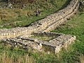
 (The site of) Turret 39a - geograph.org.uk - 599514.jpg 640 × 480; 99 KB
-
 (The site of) Turret 39b - geograph.org.uk - 599723.jpg 640 × 480; 124 KB
-
 A steamy affair (1813006907) (2).jpg 528 × 790; 250 KB
-
 A259 Littlehampton Road, Ferring - geograph.org.uk - 607422.jpg 640 × 480; 82 KB
-

-
 A69 near Heddon-on-the-Wall - geograph.org.uk - 1028050.jpg 640 × 480; 95 KB
-
 A7 approaching a sharp bend - geograph.org.uk - 600968.jpg 640 × 480; 86 KB
-
 Across Esthwaite Water-01 - geograph.org.uk - 859135.jpg 640 × 426; 45 KB
-
 Across Esthwaite Water-02 - geograph.org.uk - 859143.jpg 640 × 426; 48 KB
-
 Approaching Eppies Hill - geograph.org.uk - 1027897.jpg 640 × 480; 110 KB
-
 Autumn colour, Fen Lane - geograph.org.uk - 597902.jpg 640 × 446; 137 KB
-
 Autumn colours, High Seat - geograph.org.uk - 1028035.jpg 640 × 480; 109 KB
-
 Autumnal colours at Kielder - geograph.org.uk - 604991.jpg 480 × 640; 206 KB
-
 Bakethin Weir - geograph.org.uk - 604994.jpg 640 × 480; 124 KB
-
 Barn on the Whitton Road - geograph.org.uk - 597729.jpg 640 × 387; 63 KB
-
 Baschurch fire station - geograph.org.uk - 607219.jpg 640 × 427; 181 KB
-
 Bealach Mor on Suilven - geograph.org.uk - 1246704.jpg 640 × 480; 88 KB
-
 Belmont Crescent, Old Town, Swindon - geograph.org.uk - 597947.jpg 640 × 479; 109 KB
-
 Belsize Road - geograph.org.uk - 600631.jpg 640 × 480; 94 KB
-
 Bidford On Avon old fire station - geograph.org.uk - 607337.jpg 640 × 427; 271 KB
-
 Big Ben in London at night - panoramio.jpg 2,560 × 1,920; 1.74 MB
-
 Bike stand, Mountjoy Road, Omagh - geograph.org.uk - 597819.jpg 640 × 480; 69 KB
-
 Birdham Signpost - geograph.org.uk - 603397.jpg 640 × 480; 160 KB
-
 Birds On An Aerial - geograph.org.uk - 597865.jpg 527 × 427; 189 KB
-
 Bishops Castle fire station - geograph.org.uk - 607315.jpg 640 × 427; 255 KB
-
 Bishops Castle old fire station - geograph.org.uk - 607318.jpg 640 × 427; 238 KB
-
 Black Clough - geograph.org.uk - 600541.jpg 480 × 640; 78 KB
-
 Black Grain - geograph.org.uk - 600839.jpg 427 × 640; 91 KB
-
 Black History Mural, Reading - geograph.org.uk - 605875.jpg 640 × 480; 130 KB
-
 Blaenhonddan Primary School, Bryncoch. - geograph.org.uk - 597677.jpg 600 × 402; 217 KB
-
 Boathouse north of Colbost Jetty - geograph.org.uk - 597839.jpg 640 × 425; 330 KB
-

-

-
 Brickyard House, Burton Constable - geograph.org.uk - 600244.jpg 464 × 640; 98 KB
-
 Bridge at Whittle Dene Reservoirs - geograph.org.uk - 1027780.jpg 640 × 480; 82 KB
-

-

-
 Business units at Vallum Farm - geograph.org.uk - 1027227.jpg 640 × 480; 58 KB
-
 Cairn - geograph.org.uk - 598244.jpg 640 × 480; 95 KB
-
 Calverley Lane - geograph.org.uk - 597924.jpg 640 × 379; 22 KB
-
 Cambo Sands - geograph.org.uk - 624702.jpg 640 × 480; 49 KB
-
 Capped mine on Axe Edge Moor - geograph.org.uk - 600460.jpg 640 × 480; 144 KB
-
 Car boot sale - geograph.org.uk - 1145264.jpg 640 × 480; 71 KB
-

-
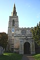
 Tower of St. Andrews, Caxton - geograph.org.uk - 598087.jpg 640 × 480; 83 KB
-

-
 Church Crescent Island, Newtown - geograph.org.uk - 1280598.jpg 480 × 640; 71 KB
-
 Clock, Shankill parish church, Lurgan - geograph.org.uk - 597960.jpg 640 × 402; 98 KB
-
 Clun fire station - geograph.org.uk - 607312.jpg 640 × 427; 203 KB
-
-
 Coble Landing, Filey - geograph.org.uk - 754577.jpg 640 × 480; 83 KB
-
 Coley Avenue, Reading - geograph.org.uk - 604004.jpg 640 × 480; 173 KB
-
 Coley Hill, Reading - geograph.org.uk - 603996.jpg 640 × 480; 168 KB
-
 Crag Lough (2) - geograph.org.uk - 599760.jpg 640 × 480; 89 KB
-
 Crail Harbour - geograph.org.uk - 625394.jpg 480 × 640; 88 KB
-
 Crawforth's Plump - geograph.org.uk - 600253.jpg 640 × 435; 62 KB
-
 Creag Martach - geograph.org.uk - 598149.jpg 640 × 480; 119 KB
-
 Crook Lane, Smithy Briggs - geograph.org.uk - 600208.jpg 640 × 460; 111 KB
-
 Cross at Caldy village green - geograph.org.uk - 617291.jpg 640 × 480; 91 KB
-
 Crown and Anchor - Dell Quay - geograph.org.uk - 603524.jpg 640 × 476; 70 KB
-
 Culvert at Whittle Dene Reservoirs - geograph.org.uk - 1027782.jpg 640 × 480; 64 KB
-
 Dane Bower - geograph.org.uk - 600651.jpg 640 × 480; 90 KB
-
 Dane Bower colliery chimney - geograph.org.uk - 600619.jpg 480 × 640; 84 KB
-
 Dduallt (1814966888).jpg 792 × 523; 511 KB
-
 Dead tree and daytime moon - geograph.org.uk - 598592.jpg 640 × 498; 68 KB
-
 Deeping St.James cross - geograph.org.uk - 622722.jpg 640 × 427; 65 KB
-
 Eastgate house - geograph.org.uk - 622723.jpg 640 × 427; 58 KB
-
 Diggers on the bridge - geograph.org.uk - 601349.jpg 640 × 480; 44 KB
-
 Dinsdale railway station - geograph.org.uk - 598239.jpg 640 × 426; 88 KB
-
 Distant view of Creeting St Mary church - geograph.org.uk - 597959.jpg 640 × 530; 122 KB
-
 Disused church in Harlow Hill - geograph.org.uk - 1027880.jpg 640 × 480; 90 KB
-
 Ditton Manor, Slough, UK - panoramio - HunNomad (1).jpg 2,048 × 1,536; 1.55 MB
-
 Ditton Manor, Slough, UK - panoramio - HunNomad (2).jpg 2,048 × 1,536; 1.44 MB
-
 Ditton Manor, Slough, UK - panoramio - HunNomad (3).jpg 2,048 × 1,536; 1.45 MB
-
 Ditton Manor, Slough, UK - panoramio - HunNomad (4).jpg 2,048 × 1,536; 1.44 MB
-
 Ditton Manor, Slough, UK - panoramio - HunNomad (5).jpg 2,048 × 1,536; 1.54 MB
-
 Ditton Manor, Slough, UK - panoramio - HunNomad.jpg 2,048 × 1,536; 1.52 MB
-
 Ditton Manor, Slough, UK - panoramio.jpg 2,048 × 1,536; 1.48 MB
-
 Downhill (1814126339) (2).jpg 788 × 523; 113 KB
-
 Droitwich Barge Canal - geograph.org.uk - 619968.jpg 640 × 480; 119 KB
-
 Droitwich Barge Canal at Salwarpe - geograph.org.uk - 619962.jpg 640 × 480; 111 KB
-
 Droitwich Barge Canal south of Salwarpe - geograph.org.uk - 619972.jpg 640 × 480; 104 KB
-
 Dry Stane Wall - geograph.org.uk - 598122.jpg 640 × 480; 128 KB
-
 Dry Stane Wall - geograph.org.uk - 598140.jpg 640 × 480; 102 KB
-
 Dun Totaig - geograph.org.uk - 597893.jpg 640 × 425; 274 KB
-
 Dunston House (Centre Left) - geograph.org.uk - 598090.jpg 640 × 480; 85 KB
-
 Durisdeer Roman Fortlet - geograph.org.uk - 600832.jpg 640 × 427; 70 KB
-
 East Fife shoreline. - geograph.org.uk - 625382.jpg 640 × 480; 89 KB
-
 East Sockburn Farm - geograph.org.uk - 598442.jpg 640 × 426; 54 KB
-
 Embleton Bay and Dunstanburgh Castle - geograph.org.uk - 1132340.jpg 640 × 480; 47 KB
-
 Engineers Way - geograph.org.uk - 604863.jpg 640 × 480; 71 KB
-
 Near Whitton - geograph.org.uk - 597784.jpg 640 × 480; 100 KB
-
 Entrance and driveway to The Hall - geograph.org.uk - 597678.jpg 480 × 640; 131 KB
-
 Entry to Heddon-on-the-Wall - geograph.org.uk - 1028064.jpg 640 × 480; 80 KB
-
 Eric Street - Leeds and Bradford Road - geograph.org.uk - 597937.jpg 640 × 429; 30 KB
-

-

-
 Estate track - geograph.org.uk - 598179.jpg 640 × 480; 83 KB
-
 Estate Track - geograph.org.uk - 598195.jpg 640 × 480; 93 KB
-
 Estate Track - geograph.org.uk - 598240.jpg 640 × 480; 91 KB
-
 Allhallows churchyard - geograph.org.uk - 598192.jpg 640 × 469; 143 KB
-
 Allhallows churchyard - geograph.org.uk - 598829.jpg 640 × 480; 155 KB
-
 Express bus, Lurgan - geograph.org.uk - 597921 crop 1.jpg 400 × 262; 107 KB
-
 Express bus, Lurgan - geograph.org.uk - 597921 crop 2.jpg 130 × 211; 29 KB
-
 Express bus, Lurgan - geograph.org.uk - 597921.jpg 640 × 376; 62 KB
-
 Fen Alder Carr local nature reserve - geograph.org.uk - 597915.jpg 640 × 527; 142 KB
-
 Field edge by footpath from Low Lane - geograph.org.uk - 597827.jpg 640 × 458; 110 KB
-
 Field of stubble - geograph.org.uk - 1027889.jpg 640 × 480; 108 KB
-
 Final jobs nearly completed - geograph.org.uk - 601687.jpg 640 × 480; 136 KB
-
 Folkestone harbour - geograph.org.uk - 1566436.jpg 640 × 480; 80 KB
-
 Footbridge over the March Burn - geograph.org.uk - 1028032.jpg 480 × 640; 115 KB
-

-
 Former Palace of Industry building - geograph.org.uk - 602433.jpg 640 × 480; 85 KB
-

-

-
 FR TYBDD tunnel 1.jpg 533 × 800; 41 KB
-
 FR TYBDD tunnel 2.jpg 786 × 520; 108 KB
-
 FR TYBDD tunnel 3.jpg 524 × 790; 141 KB
-
 Frazier Street, Waterloo - geograph.org.uk - 600878.jpg 640 × 480; 117 KB
-
 Garnet Street, Reading - geograph.org.uk - 603972.jpg 640 × 480; 156 KB
-
 Gasholder, Iffley Road, Swindon - geograph.org.uk - 597943.jpg 640 × 480; 89 KB
-
 Gasholder, Iffley Road, Swindon - geograph.org.uk - 597944.jpg 640 × 480; 53 KB
-
 George Eliot Infants School - geograph.org.uk - 602869.jpg 640 × 480; 138 KB
-

-
 Gravestone at the parish church, Flash - geograph.org.uk - 600444.jpg 640 × 480; 165 KB
-
 St.Peter and St.Paul's church - geograph.org.uk - 599917.jpg 640 × 427; 53 KB
-
 War Memorial gates - geograph.org.uk - 599963.jpg 427 × 640; 87 KB
-
 Green patch in the moor - geograph.org.uk - 600536.jpg 640 × 480; 104 KB
-
 Greenstiles Lane - geograph.org.uk - 597831.jpg 640 × 480; 107 KB
-
 Hadrian's Wall and turret near Peel (2) - geograph.org.uk - 599483.jpg 480 × 640; 132 KB
-
 Hadrian's Wall and turret near Peel (3) - geograph.org.uk - 599486.jpg 640 × 480; 137 KB
-
 Hadrian's Wall and turret near Peel (4) - geograph.org.uk - 599528.jpg 640 × 480; 128 KB
-

-

-

-

-
 Hadrian's Wall west of Peel Crags (2) - geograph.org.uk - 738256.jpg 640 × 480; 93 KB
-
 Halton Shields - geograph.org.uk - 1026743.jpg 640 × 480; 99 KB
-
 Hanbury Hall - Snobs tunnel - geograph.org.uk - 599920.jpg 640 × 480; 99 KB
-
 Hawkshead Parish Church-01 - geograph.org.uk - 861889.jpg 640 × 426; 74 KB
-
 Hawkshead Parish Church-02 - geograph.org.uk - 861892.jpg 640 × 426; 84 KB
-
 Hawkshead Parish Church-03 - geograph.org.uk - 861895.jpg 640 × 426; 64 KB
-
 Hawkshead Parish Church-04 - geograph.org.uk - 861897.jpg 640 × 426; 72 KB
-
 Hawthorn berries and mole hills - geograph.org.uk - 1028047.jpg 640 × 480; 126 KB
-
 Heading toward Danebower Quarry - geograph.org.uk - 600601.jpg 640 × 480; 91 KB
-
 Henley In Arden fire station - geograph.org.uk - 607344.jpg 640 × 427; 266 KB
-

-
 Holywell - geograph.org.uk - 599810.jpg 640 × 427; 68 KB
-

-
 Hotel Construction, Euston - geograph.org.uk - 600806.jpg 421 × 640; 124 KB
-
 Humber View - geograph.org.uk - 597777.jpg 640 × 480; 103 KB
-
 Humber VTS - geograph.org.uk - 1358380.jpg 423 × 640; 104 KB
-
 Hunting Butts Tunnel now in use - geograph.org.uk - 598102.jpg 640 × 466; 159 KB
-
 Hurworth Grange and playing field - geograph.org.uk - 598159.jpg 640 × 424; 32 KB
-
 Ike Weir plaque, Lurgan - geograph.org.uk - 597966.jpg 640 × 486; 97 KB
-
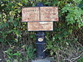
 Information display at Blakehope Nick - geograph.org.uk - 605004.jpg 640 × 480; 134 KB
-
 Ings Lane, Whitton - geograph.org.uk - 597789.jpg 640 × 481; 92 KB
-
 Inside the tunnel (1813001335).jpg 792 × 526; 552 KB
-
 Iron Sign Farm - geograph.org.uk - 1028039.jpg 640 × 480; 100 KB
-
 Kenpas Highway - geograph.org.uk - 598369.jpg 640 × 475; 97 KB
-
 Kielder Castle - geograph.org.uk - 604115.jpg 480 × 640; 177 KB
-
 Kincraigie Farm - geograph.org.uk - 598201.jpg 640 × 480; 75 KB
-
 L Dike Bridge, Smithy Briggs - geograph.org.uk - 600223.jpg 640 × 454; 146 KB
-
 St.Michael's tower - geograph.org.uk - 623376.jpg 427 × 640; 47 KB
-
 Last lap to the Cat and Fiddle - geograph.org.uk - 600676.jpg 477 × 640; 45 KB
-
 Last mud^^ - geograph.org.uk - 1028057.jpg 640 × 480; 97 KB
-
 Leaving St Abb's harbour - geograph.org.uk - 919855.jpg 640 × 427; 61 KB
-

-

-
 Loch Fyne and Riverside House, Reading - geograph.org.uk - 603952.jpg 640 × 480; 148 KB
-
 Lodge Farm, Sproatley - geograph.org.uk - 600299.jpg 640 × 460; 100 KB
-
 Londglands and Cross Hill Hall Farms - geograph.org.uk - 598461.jpg 640 × 426; 40 KB
-

-
 Looking towards Herbert Hole - geograph.org.uk - 597749.jpg 640 × 480; 139 KB
-

-
 Looking west towards Harlow Hill - geograph.org.uk - 1027887.jpg 640 × 480; 89 KB
-
 Low tide north of Herbert Hole - geograph.org.uk - 597761.jpg 640 × 480; 140 KB
-
 Ludlow old fire station - geograph.org.uk - 607323.jpg 640 × 427; 220 KB
-
 Main roads converge - geograph.org.uk - 1028052.jpg 640 × 480; 74 KB
-
 Malvern Wells old fire station - geograph.org.uk - 607331.jpg 640 × 427; 198 KB
-
 Matthews Linn, Kielder Water - geograph.org.uk - 604992.jpg 640 × 480; 147 KB
-

-
 Memorial Park playing fields - geograph.org.uk - 598381.jpg 640 × 475; 96 KB
-
 Milecastle 39 (2) - geograph.org.uk - 599789.jpg 640 × 480; 101 KB
-
 Milecastle 39 (3) - geograph.org.uk - 738266.jpg 640 × 480; 84 KB
-
 Milecastle 39 (close-up) - geograph.org.uk - 599794.jpg 640 × 480; 143 KB
-
 Milecastle 39 - geograph.org.uk - 599728.jpg 640 × 480; 81 KB
-
 Milestone, Kenilworth Road - geograph.org.uk - 598382.jpg 640 × 480; 100 KB
-
 Minotaur Maze, Kielder Castle (Detail) - geograph.org.uk - 604990.jpg 480 × 640; 200 KB
-
 Minsterley fire station - geograph.org.uk - 607217.jpg 640 × 427; 242 KB
-
 Moat Farm, Tansterne - geograph.org.uk - 600205.jpg 640 × 443; 67 KB
-
 Montgomery Canal 11 Mile Milepost - geograph.org.uk - 601671.jpg 640 × 480; 136 KB
-
 Moorland pool - geograph.org.uk - 600618.jpg 640 × 480; 101 KB
-
 Moorland track across Axe Edge Moor - geograph.org.uk - 600459.jpg 640 × 480; 62 KB
-
 Mount Pleasant Sedgley - geograph.org.uk - 796602.jpg 480 × 640; 58 KB


_Turret_39a_-_geograph.org.uk_-_599514.jpg)
_Turret_39b_-_geograph.org.uk_-_599723.jpg)
_(2).jpg)


_-_geograph.org.uk_-_599760.jpg)


.jpg)


.jpg)
.jpg)
.jpg)
.jpg)
.jpg)


_(2).jpg)


_-_geograph.org.uk_-_598090.jpg)


_-_geograph.org.uk_-_599483.jpg)
_-_geograph.org.uk_-_599486.jpg)
_-_geograph.org.uk_-_599528.jpg)


_-_geograph.org.uk_-_738256.jpg)


.jpg)


_-_geograph.org.uk_-_599789.jpg)
_-_geograph.org.uk_-_738266.jpg)
_-_geograph.org.uk_-_599794.jpg)


_-_geograph.org.uk_-_604990.jpg)


