Category:United Kingdom photographs taken on 2007-11-28
Countries of Europe: Austria · Belgium · Cyprus‡ · France‡ · Germany · Hungary · Republic of Ireland · Italy · Netherlands‡ · Poland · Portugal‡ · Romania · Russia‡ · Spain‡ · Sweden · Switzerland · Turkey‡ · United Kingdom
‡: partly located in Europe
‡: partly located in Europe
| ← | 28 November 2007 | → | ||
| ← | November 2007 | → | ||

United Kingdom photographs taken on 28 November 2007.
Image files should be categorized here automatically using {{taken on}} template. Direct categorisation is also possible, if automatic is impossible.
Subcategories
This category has the following 2 subcategories, out of 2 total.
S
Media in category "United Kingdom photographs taken on 2007-11-28"
The following 200 files are in this category, out of 367 total.
(previous page) (next page)-
 "The Gymnasium" by St Pancras Station - geograph.org.uk - 627032.jpg 640 × 480; 71 KB
-

-
 A wet winter afternoon in Carlisle - geograph.org.uk - 624383.jpg 640 × 480; 252 KB
-
 A28 at Armagh - geograph.org.uk - 623043.jpg 640 × 479; 63 KB
-
 A28 Newry Road, Armagh - geograph.org.uk - 623039.jpg 640 × 479; 64 KB
-

-

-
 Alexandria Road - geograph.org.uk - 623184.jpg 640 × 480; 70 KB
-
 All in a row - geograph.org.uk - 622618.jpg 454 × 640; 105 KB
-
 Apperley Church Gloucestershire - geograph.org.uk - 622313.jpg 640 × 480; 62 KB
-
 Armagh Baptist Church - geograph.org.uk - 623025.jpg 640 × 479; 40 KB
-
 Armagh City - geograph.org.uk - 623062.jpg 640 × 479; 73 KB
-
 Armagh City - geograph.org.uk - 623071.jpg 640 × 479; 65 KB
-
 Armagh City - geograph.org.uk - 623082.jpg 640 × 295; 32 KB
-
 Armagh City Hotel - geograph.org.uk - 623051.jpg 640 × 479; 61 KB
-
 Armagh Court - geograph.org.uk - 623784.jpg 640 × 479; 78 KB
-
 Armagh Gospel Hall - geograph.org.uk - 623798.jpg 640 × 479; 65 KB
-
 Armagh Museum - geograph.org.uk - 623779.jpg 640 × 479; 63 KB
-
 Armagh Prison - geograph.org.uk - 623818.jpg 640 × 479; 57 KB
-
 Aylsham Antiques - geograph.org.uk - 622433.jpg 640 × 480; 47 KB
-
 Ballymoran Road - geograph.org.uk - 622970.jpg 640 × 479; 57 KB
-
 Ballymoran Townland - geograph.org.uk - 622922.jpg 640 × 271; 37 KB
-
 Ballynagalliagh Townland - geograph.org.uk - 622930.jpg 640 × 294; 42 KB
-
 Barkby Beach - geograph.org.uk - 1230882.jpg 640 × 480; 75 KB
-
 The 'Barking Dog', Barking - geograph.org.uk - 622849.jpg 640 × 427; 75 KB
-
 Barking station - geograph.org.uk - 622842.jpg 640 × 427; 87 KB
-
 Barking, station exterior - geograph.org.uk - 622843.jpg 640 × 427; 70 KB
-
 Barn conversion at Froghall - geograph.org.uk - 623155.jpg 640 × 480; 92 KB
-
 Bench Mark - geograph.org.uk - 653325.jpg 640 × 480; 295 KB
-
 Bordering onto the churchyard - geograph.org.uk - 622514.jpg 640 × 480; 66 KB
-
 Boston Market Day - geograph.org.uk - 623972.jpg 640 × 480; 99 KB
-
 Brathens Business Park entrance - geograph.org.uk - 1064183.jpg 640 × 480; 103 KB
-
 Bridleway to Papley - geograph.org.uk - 622744.jpg 640 × 480; 84 KB
-
 Broghan Townland - geograph.org.uk - 622936.jpg 640 × 479; 67 KB
-
 Broughan Townland - geograph.org.uk - 622934.jpg 640 × 479; 52 KB
-
 Cannon, Armagh - geograph.org.uk - 623763.jpg 640 × 479; 75 KB
-
 Carrollsland housing development - geograph.org.uk - 623825.jpg 640 × 359; 42 KB
-
 Champagne Bar, St Pancras Station - geograph.org.uk - 626996.jpg 640 × 480; 104 KB
-
 Charlemont Arms, Armagh - geograph.org.uk - 623749.jpg 640 × 479; 56 KB
-

-

-

-
-

-

-

-

-

-

-

-
 Clifford and Farleigh Terraces - geograph.org.uk - 622410.jpg 640 × 480; 48 KB
-
 Clock tower, Armagh - geograph.org.uk - 623748.jpg 640 × 479; 43 KB
-
 Clock tower, Armagh - geograph.org.uk - 623806.jpg 479 × 640; 70 KB
-
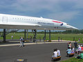 Concorde at filton noseview arp.jpg 2,288 × 1,712; 535 KB
-
 Contented cattle at Thurso East - geograph.org.uk - 652463.jpg 640 × 480; 156 KB
-
 Corner Shop - geograph.org.uk - 623192.jpg 640 × 480; 65 KB
-
 Corner Shop in Brookvale - geograph.org.uk - 623188.jpg 640 × 480; 80 KB
-
 Countryside east of Armagh - geograph.org.uk - 623021.jpg 640 × 479; 77 KB
-
 Credit Union, Armagh - geograph.org.uk - 623811.jpg 640 × 287; 31 KB
-
 Cromer Road - geograph.org.uk - 622522.jpg 480 × 640; 113 KB
-

-
 Culag by Loch Lomond - geograph.org.uk - 627409.jpg 640 × 480; 58 KB
-
 Dartington Cider Press Centre - geograph.org.uk - 623845.jpg 640 × 480; 94 KB
-

-
 Diorama - geograph.org.uk - 622719.jpg 640 × 480; 95 KB
-
 Dismantled railway, Earby - geograph.org.uk - 623685.jpg 640 × 480; 122 KB
-
 Disused auction mart - geograph.org.uk - 623850.jpg 640 × 480; 148 KB
-
 Disused cattle pens and siding at Thurso - geograph.org.uk - 624386.jpg 640 × 480; 220 KB
-
 Dobbin Street, Armagh - geograph.org.uk - 623805.jpg 640 × 276; 29 KB
-
 Drumbee Townland - geograph.org.uk - 623019.jpg 640 × 479; 57 KB
-
 Drumconwell Townland - geograph.org.uk - 622924.jpg 640 × 479; 47 KB
-
 Drumconwell Townland - geograph.org.uk - 622926.jpg 640 × 479; 58 KB
-
 Dun Skudiburgh - geograph.org.uk - 622336.jpg 640 × 425; 102 KB
-
 Dunchurch-Sandford Way - geograph.org.uk - 626546.jpg 640 × 480; 60 KB
-
 Dunchurch-Toft Lane - geograph.org.uk - 622201.jpg 640 × 480; 123 KB
-
 St Patricks RC Church, Earby - geograph.org.uk - 623686.jpg 640 × 480; 147 KB
-
 St Patricks RC Church, Earby - geograph.org.uk - 623688.jpg 480 × 640; 116 KB
-

-
 Edge of the estate - geograph.org.uk - 622386.jpg 640 × 480; 79 KB
-
 Edge of town - geograph.org.uk - 623201.jpg 640 × 480; 70 KB
-
 Ennisclare Road at Drumconwell - geograph.org.uk - 622927.jpg 640 × 479; 48 KB
-
 Entrance to the Bure Valley School - geograph.org.uk - 622385.jpg 638 × 440; 53 KB
-
 Ermington village - geograph.org.uk - 623830.jpg 640 × 324; 56 KB
-

-
 Fire and Ambulance Station - geograph.org.uk - 622439.jpg 638 × 458; 44 KB
-
-
 Flooding at Latmacollum - geograph.org.uk - 622954.jpg 640 × 479; 50 KB
-
 Fold Building, Armagh - geograph.org.uk - 623078.jpg 640 × 479; 48 KB
-
 Forbury Road, Reading - geograph.org.uk - 626405.jpg 640 × 480; 135 KB
-
 Former Methodist Chapel - geograph.org.uk - 622425.jpg 637 × 458; 41 KB
-
 Garren Brook from Llangunnock Bridge - geograph.org.uk - 622856.jpg 480 × 640; 200 KB
-
 Garstone Lane - geograph.org.uk - 622651.jpg 640 × 358; 91 KB
-
-
 Glyntaff Crematorium - geograph.org.uk - 622673.jpg 640 × 480; 96 KB
-
 Glyntaff Crematorium - geograph.org.uk - 622694.jpg 640 × 480; 53 KB
-
 Great Portland Street Station - geograph.org.uk - 622652.jpg 640 × 480; 90 KB
-
 Great Western Hotel - geograph.org.uk - 622708.jpg 640 × 480; 66 KB
-
 Hammer and Tongs - geograph.org.uk - 622524.jpg 640 × 480; 76 KB
-

-
 Heinkel Trojan - geograph.org.uk - 623498.jpg 640 × 480; 282 KB
-
 High Street, Inverness - geograph.org.uk - 653318.jpg 640 × 480; 193 KB
-
 Highfields - New Housing - geograph.org.uk - 622374.jpg 640 × 480; 76 KB
-
 Hillcrest Walk - geograph.org.uk - 622687.jpg 480 × 640; 122 KB
-
 Historic House, Caledon - geograph.org.uk - 623827.jpg 640 × 479; 72 KB
-
 House at Ballynagalliagh - geograph.org.uk - 622929.jpg 640 × 479; 87 KB
-
 How much^ - geograph.org.uk - 622615.jpg 640 × 458; 147 KB
-
 Hugh llewelyn 319 373 (6332121118).jpg 2,592 × 1,944; 1.22 MB
-
 Hugh llewelyn 375 703 (6331369577).jpg 2,592 × 1,944; 1.01 MB
-
 Hugh llewelyn 466 042 (6331370317).jpg 2,592 × 1,944; 1.16 MB
-
 Interior of "The Gymnasium" - geograph.org.uk - 627036.jpg 480 × 640; 61 KB
-
-
 Kenilworth Road - geograph.org.uk - 622362.jpg 640 × 480; 88 KB
-
 Kent's Oak Telephone Box - geograph.org.uk - 622392.jpg 640 × 487; 83 KB
-
 Killycapple Road - geograph.org.uk - 623011.jpg 640 × 479; 39 KB
-
 Killycapple Townland - geograph.org.uk - 622963.jpg 640 × 303; 27 KB
-
 Killycapple Townland - geograph.org.uk - 622966.jpg 640 × 479; 54 KB
-
 Killycapple Townland - geograph.org.uk - 622973.jpg 640 × 479; 65 KB
-
 Killycapple Townland - geograph.org.uk - 622977.jpg 640 × 479; 63 KB
-
 Killycapple Townland - geograph.org.uk - 623008.jpg 640 × 479; 68 KB
-
 Killyfaddy Townland - geograph.org.uk - 622945.jpg 640 × 479; 56 KB
-
 Killyfaddy Townland - geograph.org.uk - 622946.jpg 640 × 479; 54 KB
-
 Kings Cross (Thameslink) station - geograph.org.uk - 623193.jpg 640 × 427; 56 KB
-
 Latmacollum old school - geograph.org.uk - 622939.jpg 640 × 479; 52 KB
-
 Latmacollum Road - geograph.org.uk - 622959.jpg 640 × 479; 60 KB
-
 Latmacollum Townland - geograph.org.uk - 622938.jpg 640 × 479; 55 KB
-
 Latmacollum Townland - geograph.org.uk - 622949.jpg 640 × 479; 55 KB
-
 Latmacollum Townland - geograph.org.uk - 622961.jpg 640 × 479; 68 KB
-
 Lincoln - Big Wheel - geograph.org.uk - 623985.jpg 480 × 640; 94 KB
-
 Linking Footpath - geograph.org.uk - 622521.jpg 480 × 640; 93 KB
-
 Lisnadill Full Gospel Hall - geograph.org.uk - 622968.jpg 640 × 479; 39 KB
-
 Lisnadill Townland - geograph.org.uk - 622942.jpg 640 × 479; 57 KB
-
 Lisnadill Townland - geograph.org.uk - 622955.jpg 640 × 479; 51 KB
-
 Llwydcoed Crematorium - geograph.org.uk - 622669.jpg 640 × 480; 51 KB
-
 Local Playground - geograph.org.uk - 623197.jpg 640 × 480; 78 KB
-
 Local short cut - geograph.org.uk - 623200.jpg 640 × 480; 77 KB
-
 Look at the time - geograph.org.uk - 622641.jpg 640 × 542; 126 KB
-
 Looking across The Mall, Armagh - geograph.org.uk - 623780.jpg 640 × 479; 86 KB
-
 Looking down to Ru Idrigill - geograph.org.uk - 622330.jpg 640 × 425; 131 KB
-
 Looking east along Mill Road - geograph.org.uk - 622421.jpg 640 × 480; 99 KB
-

-
 Looking north on Hungate Street - geograph.org.uk - 622366.jpg 480 × 640; 53 KB
-

-
 Looking west along Cawston Road - geograph.org.uk - 622413.jpg 639 × 445; 40 KB
-
 Many down - geograph.org.uk - 622356.jpg 640 × 480; 62 KB
-
 Martock fire station.jpg 640 × 480; 49 KB
-
 Memorial Plaque - geograph.org.uk - 623874.jpg 640 × 480; 216 KB
-
 Modern forestry - geograph.org.uk - 622470.jpg 640 × 480; 111 KB
-
 Monaughty House - geograph.org.uk - 623756.jpg 640 × 427; 153 KB
-
 Mrs Johnstons cottage - geograph.org.uk - 622505.jpg 640 × 476; 39 KB
-
 New 4 bed homes - geograph.org.uk - 622384.jpg 640 × 480; 76 KB
-
 New housing on farmland. - geograph.org.uk - 626630.jpg 640 × 480; 75 KB
-
 Old building at Broughan - geograph.org.uk - 622933.jpg 640 × 479; 59 KB
-
 Old mans bench - geograph.org.uk - 622314.jpg 640 × 480; 88 KB
-
 Old Post Office - geograph.org.uk - 622393.jpg 640 × 480; 64 KB
-
-

-
 Platform 1 at Barking Station - geograph.org.uk - 623098.jpg 640 × 427; 79 KB
-
 The Poor School 1.jpg 480 × 640; 101 KB
-
 Porkies Sandwich Shop - geograph.org.uk - 622525.jpg 640 × 480; 54 KB
-

-
 Postbox on the A466 at Llancloudy - geograph.org.uk - 622306.jpg 640 × 480; 94 KB
-
 Princess Street, Thurso - geograph.org.uk - 653360.jpg 640 × 480; 176 KB
-
 RC Church at Killyfaddy - geograph.org.uk - 622948.jpg 640 × 478; 51 KB
-
 Repton House - geograph.org.uk - 622489.jpg 640 × 480; 48 KB
-
 Ringway West - geograph.org.uk - 622352.jpg 640 × 480; 81 KB
-
 River Erme - geograph.org.uk - 623828.jpg 640 × 480; 134 KB
-
 River Parrett Trail - geograph.org.uk - 622665.jpg 640 × 480; 87 KB
-
 River Thurso - geograph.org.uk - 623832.jpg 640 × 480; 108 KB
-
 Road at Ballynagalliagh - geograph.org.uk - 622928.jpg 640 × 299; 38 KB
-
 Road at Ballynagalliagh - geograph.org.uk - 622931.jpg 640 × 479; 83 KB
-
 Road at Drumbee - geograph.org.uk - 623016.jpg 640 × 479; 109 KB
-
 Road at Latmacollum - geograph.org.uk - 622952.jpg 640 × 479; 53 KB
-
 Road at Lisnadill - geograph.org.uk - 622957.jpg 640 × 479; 65 KB
-
 Road Junction in Thurso - geograph.org.uk - 652476.jpg 640 × 480; 175 KB
-
 Roman Road - geograph.org.uk - 622359.jpg 640 × 480; 72 KB
-
 Row of Beeches on the Dorset downs - geograph.org.uk - 622343.jpg 640 × 480; 105 KB
-
 Ru Idrigill - geograph.org.uk - 622322.jpg 640 × 426; 95 KB
-
 Sandy's Road roundabout - geograph.org.uk - 622355.jpg 640 × 480; 67 KB
-
 Scollock West memorial (1) - geograph.org.uk - 622937.jpg 640 × 480; 113 KB
-
 Scollock West memorial (10) detail - geograph.org.uk - 623123.jpg 480 × 640; 78 KB
-
 Scollock West memorial (2) - geograph.org.uk - 622941.jpg 640 × 480; 74 KB
-
 Scollock West memorial (3) - geograph.org.uk - 622944.jpg 640 × 480; 85 KB
-
 Scollock West memorial (4) inscription - geograph.org.uk - 622951.jpg 480 × 640; 106 KB
-

-

-
 Scollock West memorial (7) Martha's dress - geograph.org.uk - 623096.jpg 480 × 640; 106 KB
-

-
 Scollock West memorial (9) - geograph.org.uk - 623112.jpg 640 × 480; 91 KB
-
 Scotch Street, Armagh - geograph.org.uk - 623074.jpg 640 × 479; 73 KB
-
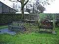 Seat and stocks, West Marton - geograph.org.uk - 623646.jpg 640 × 480; 164 KB
-
 Section of Dobbin Street, Armagh - geograph.org.uk - 623810.jpg 640 × 479; 70 KB
-
 Sheep below Verjuice Bank Farm - geograph.org.uk - 623680.jpg 640 × 480; 225 KB
-
 Site of Prospect Terrace, Omagh - geograph.org.uk - 623843.jpg 640 × 280; 32 KB
-
 Slipway at Culag. - geograph.org.uk - 627410.jpg 640 × 480; 53 KB
-
 South View Allotments - geograph.org.uk - 622531.jpg 640 × 480; 72 KB
-
 Southbound Grantham railway station - geograph.org.uk - 624096.jpg 640 × 512; 93 KB
-
 The 'Spotted Dog', Barking - geograph.org.uk - 622845.jpg 640 × 427; 66 KB
-

-
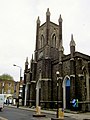 St Mary's church Somers Town London - geograph.org.uk - 622643.jpg 480 × 640; 86 KB
-
 St Michael's Church - geograph.org.uk - 622507.jpg 640 × 480; 60 KB


.jpg)
.jpg)
.jpg)


_station_-_geograph.org.uk_-_623193.jpg)


_-_geograph.org.uk_-_622937.jpg)
_detail_-_geograph.org.uk_-_623123.jpg)
_-_geograph.org.uk_-_622941.jpg)
_-_geograph.org.uk_-_622944.jpg)
_inscription_-_geograph.org.uk_-_622951.jpg)
_John_Llewellin_-_geograph.org.uk_-_622956.jpg)
_Martha_Llewellin_-_geograph.org.uk_-_622958.jpg)
_Martha%27s_dress_-_geograph.org.uk_-_623096.jpg)
_yeoman_garb_-_geograph.org.uk_-_623105.jpg)
_-_geograph.org.uk_-_623112.jpg)


