Category:United Kingdom photographs taken on 2008-12-01
| ← | Monday 1 December 2008 | → | ||
| ← | December 2008 | → | ||

United Kingdom photographs taken on 1 December 2008.
Image files should be categorized here automatically using {{taken on}} template. Direct categorisation is also possible, if automatic is impossible.
Subcategories
This category has the following 2 subcategories, out of 2 total.
Media in category "United Kingdom photographs taken on 2008-12-01"
The following 200 files are in this category, out of 760 total.
(previous page) (next page)-
 Shirehampton railway station MMB 02.jpg 1,728 × 2,304; 1.81 MB
-
 Shirehampton railway station MMB 05 143611.jpg 2,304 × 1,728; 1.69 MB
-
 Bristol MMB R6 Avon Gorge.jpg 2,304 × 1,728; 1.15 MB
-
 Bristol MMB R9 Clifton Down Tunnel.jpg 2,304 × 1,728; 1.46 MB
-
 Bristol MMB S2 The Downs.jpg 1,728 × 2,304; 970 KB
-
 Bristol MMB S5 The Downs.jpg 2,304 × 1,728; 1.61 MB
-

-
 A few saplings - geograph.org.uk - 1066310.jpg 640 × 472; 109 KB
-
 A house in Eldon Square, Reading - geograph.org.uk - 1075451.jpg 480 × 640; 130 KB
-
 A Yorkshire Milestone - geograph.org.uk - 1066551.jpg 640 × 480; 69 KB
-
 A Yorkshire Milestone - geograph.org.uk - 1066555.jpg 640 × 480; 64 KB
-
 A Yorkshire Milestone - geograph.org.uk - 1066556.jpg 640 × 480; 96 KB
-
 A4136 at Worrall Hill - geograph.org.uk - 1095406.jpg 640 × 481; 174 KB
-
 Access road, Ladram Bay caravan site - geograph.org.uk - 1066841.jpg 640 × 480; 80 KB
-
 Access turning for Winklebury Centre - geograph.org.uk - 1065883.jpg 640 × 490; 76 KB
-

-
 All Saints Church, Great Thurlow - geograph.org.uk - 1067199.jpg 427 × 640; 94 KB
-
 All Saints Church, Little Bradley - geograph.org.uk - 1067244.jpg 640 × 427; 108 KB
-
 Allotments off Tiverton Road - geograph.org.uk - 1066005.jpg 640 × 453; 107 KB
-
-
 Approaching the end of Tiverton Road - geograph.org.uk - 1065910.jpg 640 × 468; 77 KB
-
 Arable land north of Bromesberrow Heath - geograph.org.uk - 1066690.jpg 640 × 480; 149 KB
-
 Arable land, Ryton - geograph.org.uk - 1066992.jpg 640 × 480; 140 KB
-

-
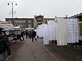
 Ashton Market - geograph.org.uk - 1066197.jpg 583 × 640; 120 KB
-
 Ashton Market - geograph.org.uk - 1066212.jpg 640 × 480; 104 KB
-
 Ashton Market Hall - geograph.org.uk - 1066237.jpg 640 × 536; 114 KB
-
 Ashurst Beacon on frosty morning - geograph.org.uk - 1537123.jpg 640 × 428; 74 KB
-
 Aston Road - Lower Town Street, Bramley - geograph.org.uk - 1066609.jpg 640 × 430; 185 KB
-
 ATTENTION CHAT EN PSYCHANALYSE - geograph.org.uk - 1069600.jpg 640 × 498; 175 KB
-
 B4084 south of Pershore - geograph.org.uk - 1162354.jpg 640 × 480; 68 KB
-
 B4432 at Shortstanding - geograph.org.uk - 1095448.jpg 640 × 481; 183 KB
-
 B507, Abbey Road - geograph.org.uk - 1066592.jpg 640 × 480; 90 KB
-
 Baberton Mains - geograph.org.uk - 1065745.jpg 640 × 480; 107 KB
-

-
 Balbirnie burn - geograph.org.uk - 1069827.jpg 640 × 480; 107 KB
-
 Bank House Lane - geograph.org.uk - 1070218.jpg 640 × 480; 95 KB
-
 Barnardo Road, Exeter - geograph.org.uk - 1069219.jpg 640 × 461; 76 KB
-
 Barnardo Road, Exeter - geograph.org.uk - 1069243.jpg 640 × 480; 81 KB
-
 Bath Lane - Stanningley Road, Bramley - geograph.org.uk - 1066596.jpg 640 × 423; 215 KB
-
 Bath Road - Stanningley Road, Bramley - geograph.org.uk - 1066594.jpg 640 × 472; 181 KB
-
 Bedford Street, Exeter - geograph.org.uk - 1069771.jpg 500 × 640; 101 KB
-
 Bell Street, Otterton - geograph.org.uk - 1066850.jpg 640 × 480; 53 KB
-
 Bicknor Street - geograph.org.uk - 1095468.jpg 640 × 481; 166 KB
-

-
 Blackburn Road - geograph.org.uk - 1066344.jpg 640 × 480; 62 KB
-
 Blue is the colour^ - geograph.org.uk - 1066347.jpg 640 × 475; 54 KB
-

-
 Brent Valley golf course - geograph.org.uk - 1066429.jpg 640 × 480; 103 KB
-
 Bridge House, Torphins - geograph.org.uk - 1067239.jpg 640 × 480; 69 KB
-
 Bristol MMB R4 Avon Gorge.jpg 2,304 × 1,728; 1.36 MB
-
 Bristol MMB R5 Avon Gorge.jpg 1,728 × 2,304; 1.6 MB
-
 Bristol MMB R7 Clifton Down Tunnel.jpg 1,728 × 2,304; 1.83 MB
-
 Bristol MMB R8 Clifton Down Tunnel.jpg 1,728 × 2,304; 1.17 MB
-
 Bristol MMB S0 The Downs.jpg 2,304 × 1,728; 1.8 MB
-
 Bristol MMB S1 The Downs.jpg 2,304 × 1,728; 1.47 MB
-
 Bristol MMB S3 The Downs.jpg 2,304 × 1,728; 1.72 MB
-
 Bristol MMB S4 The Downs.jpg 2,304 × 1,728; 1.82 MB
-
 Bristol MMB S6 River Avon.jpg 1,728 × 2,304; 1.64 MB
-
 British Electricity Authority - geograph.org.uk - 1176643.jpg 640 × 480; 97 KB
-
 Bromesberrow Heath - geograph.org.uk - 1066683.jpg 640 × 480; 84 KB
-
 Brompton Beck - geograph.org.uk - 1067640.jpg 640 × 480; 95 KB
-
 Brompton Cottages - geograph.org.uk - 1067641.jpg 640 × 482; 63 KB
-

-
 Burberry, Bond Street, Mayfair - geograph.org.uk - 1066465.jpg 640 × 480; 64 KB
-

-
 Byland Moor Plantation - geograph.org.uk - 1066546.jpg 640 × 473; 102 KB
-
 Byland Moor Plantation - geograph.org.uk - 1066550.jpg 640 × 480; 100 KB
-
 Cae Brynton Road - geograph.org.uk - 1135824.jpg 640 × 480; 69 KB
-
 Cairn on Beinn a' Chapuill - geograph.org.uk - 1065889.jpg 640 × 480; 141 KB
-
 Cakes to the people - geograph.org.uk - 1066673.jpg 640 × 456; 167 KB
-
 Caravan site, Ladram Bay - geograph.org.uk - 1066800.jpg 640 × 480; 76 KB
-
 Cardiff Road, Newport - geograph.org.uk - 1135814.jpg 640 × 480; 91 KB
-
 Carlton Hill - geograph.org.uk - 1066924.jpg 640 × 427; 51 KB
-
 Carrick House - geograph.org.uk - 1067643.jpg 640 × 475; 85 KB
-
 Castle Hill Junior School - geograph.org.uk - 1066318.jpg 640 × 475; 66 KB
-
 Castle Hill playing fields - geograph.org.uk - 1066313.jpg 640 × 421; 48 KB
-
 Cat i' th' Well - geograph.org.uk - 1070228.jpg 640 × 480; 92 KB
-
 Cat, Marlborough Road, Exeter - geograph.org.uk - 1069365.jpg 640 × 505; 84 KB
-
 Cattle and Cockburn Law - geograph.org.uk - 1065955.jpg 640 × 359; 76 KB
-
 Caty Well Bridge - geograph.org.uk - 1070229.jpg 640 × 480; 119 KB
-
 Christmas lights, Belfast (2008) - geograph.org.uk - 1066111.jpg 640 × 403; 70 KB
-
 Christmas lights, Belfast (2008) - geograph.org.uk - 1066118.jpg 640 × 369; 75 KB
-
 Christmas lights, Belfast (2008) - geograph.org.uk - 1066185.jpg 640 × 385; 85 KB
-
 Christmas lights, Belfast (2008) - geograph.org.uk - 1066211.jpg 640 × 411; 90 KB
-
 Church at Christchurch - geograph.org.uk - 1095442.jpg 640 × 481; 124 KB
-
 Church Farm, Snailwell - geograph.org.uk - 1067282.jpg 640 × 427; 111 KB
-
 Church of Life, Sycamore Avenue - geograph.org.uk - 1080148.jpg 640 × 480; 60 KB
-
 Church Street - geograph.org.uk - 1167850.jpg 640 × 473; 74 KB
-
 Church sundial, Weston Colville - geograph.org.uk - 1067188.jpg 427 × 640; 126 KB
-
 Classic impermeable surface - geograph.org.uk - 1066293.jpg 640 × 491; 72 KB
-
 Closed footpath, East Grove Road - geograph.org.uk - 1069232.jpg 480 × 640; 85 KB
-
 Clouds in the loch - geograph.org.uk - 1066047.jpg 640 × 480; 40 KB
-
 Coffee Shop, Inverhoulin - geograph.org.uk - 1066145.jpg 640 × 417; 113 KB
-
 Collection of signs - geograph.org.uk - 1066689.jpg 578 × 640; 105 KB
-
 Colleton Hill, Exeter - geograph.org.uk - 1069188.jpg 640 × 480; 86 KB
-
 Corner Shop in Harome - geograph.org.uk - 1066942.jpg 640 × 480; 113 KB
-
 Corsham Park - geograph.org.uk - 1077360.jpg 640 × 465; 259 KB
-
 Cote Lane Milestone - geograph.org.uk - 1066553.jpg 640 × 480; 105 KB
-
 Cottage Hospital (deceased) - geograph.org.uk - 1162285.jpg 640 × 480; 80 KB
-
 Cottages, Fore Street, Otterton - geograph.org.uk - 1066855.jpg 640 × 480; 66 KB
-
 Country road near Biddestone - geograph.org.uk - 1076494.jpg 640 × 513; 209 KB
-
 Cow Hill Gate Lane - geograph.org.uk - 1069443.jpg 640 × 480; 55 KB
-
 Creagan na Sloich Eastern Face - geograph.org.uk - 1066046.jpg 640 × 480; 85 KB
-
 Cross Bath Road - Hough Lane, Bramley - geograph.org.uk - 1066107.jpg 640 × 478; 180 KB
-

-
 Crossroads at Chequers Farm - geograph.org.uk - 1077334.jpg 640 × 475; 199 KB
-

-
 Cypress avenue - geograph.org.uk - 1070292.jpg 640 × 480; 88 KB
-
 December view of Ryton Coppice - geograph.org.uk - 1065964.jpg 640 × 480; 196 KB
-
 Deerplay Quarry Wood, Sign - geograph.org.uk - 1070233.jpg 640 × 480; 79 KB
-
 Defford Road - geograph.org.uk - 1162212.jpg 640 × 480; 76 KB
-
 Denny House, Hobb Lane, Hedge End - geograph.org.uk - 1068165.jpg 640 × 427; 113 KB
-
 Disused rifle range below Wig Fach - geograph.org.uk - 1066464.jpg 640 × 415; 111 KB
-
 Dockside Development - geograph.org.uk - 1066714.jpg 640 × 480; 98 KB
-
 Douglas Water, Glen Douglas - geograph.org.uk - 1066980.jpg 640 × 480; 88 KB
-
 Drain cover - detail - geograph.org.uk - 1066809.jpg 640 × 480; 98 KB
-
 Drain outflow into the River Brent - geograph.org.uk - 1066791.jpg 640 × 480; 119 KB
-
 Duke Road, Hedge End - geograph.org.uk - 1068042.jpg 640 × 427; 88 KB
-
 Duneland trees by Wig Fach - geograph.org.uk - 1140069.jpg 640 × 427; 124 KB
-
 Dyke House Lane, Bromesberrow Heath - geograph.org.uk - 1066698.jpg 640 × 480; 179 KB
-
 East end of Exeter Quay - geograph.org.uk - 1069202.jpg 477 × 640; 87 KB
-
 East on the A4 at Corsham - geograph.org.uk - 1069613.jpg 640 × 465; 215 KB
-
 Easton Lane - geograph.org.uk - 1076587.jpg 640 × 479; 179 KB
-
 Eckington Bridge - geograph.org.uk - 1168625.jpg 640 × 480; 68 KB
-
 Eckington cemetery - geograph.org.uk - 1167880.jpg 640 × 480; 137 KB
-
 Eckington play area - geograph.org.uk - 1167894.jpg 640 × 407; 69 KB
-
 Eckington village centre - geograph.org.uk - 1167830.jpg 640 × 480; 87 KB
-
 Eckington Wharf picnic site - 1 - geograph.org.uk - 1162941.jpg 640 × 458; 90 KB
-
 Eckington Wharf picnic site - 2 - geograph.org.uk - 1162953.jpg 640 × 480; 94 KB
-

-
 Eightlands Lane - Bramley Town End - geograph.org.uk - 1066615.jpg 640 × 447; 187 KB
-
 Empty Office Buildings - geograph.org.uk - 1066720.jpg 640 × 480; 97 KB
-
 End of the block - geograph.org.uk - 1065975.jpg 640 × 474; 70 KB
-
 English Bicknor Castle.jpg 640 × 481; 185 KB
-
 Entrance to Birlingham Close - geograph.org.uk - 1162208.jpg 640 × 480; 80 KB
-
 Entrance to Deerplay Landfill Site - geograph.org.uk - 1070231.jpg 640 × 480; 74 KB
-

-
 Entrance to Low Farm - geograph.org.uk - 1070227.jpg 640 × 480; 89 KB
-

-
 Entrance to Mill Lane - geograph.org.uk - 1167717.jpg 640 × 480; 104 KB
-
 Entrance to Pershore Cemetery - geograph.org.uk - 1161582.jpg 640 × 480; 114 KB
-
 Entrance to Tiddesley Wood - 2 - geograph.org.uk - 1158349.jpg 640 × 480; 145 KB
-
 Entrance to Tiddesley Wood - geograph.org.uk - 1158334.jpg 640 × 480; 160 KB
-

-
 Estate garages - geograph.org.uk - 1066351.jpg 464 × 640; 52 KB
-
 Exit from Guildhall shopping centre - geograph.org.uk - 1069146.jpg 640 × 427; 66 KB
-

-
 Farm in Totardor - geograph.org.uk - 1065986.jpg 640 × 480; 81 KB
-

-
 Farmland near Brinkley - geograph.org.uk - 1067037.jpg 640 × 427; 102 KB
-
 Farmland near Brinkley - geograph.org.uk - 1067164.jpg 640 × 427; 99 KB
-
 Farmland near Eaves Green - geograph.org.uk - 1066066.jpg 640 × 428; 106 KB
-
 Farmland north of Eckington - geograph.org.uk - 1167901.jpg 640 × 480; 137 KB
-
 Farmland west of Pershore - geograph.org.uk - 1161536.jpg 640 × 480; 86 KB
-
 Fawe Park Road railway - geograph.org.uk - 1079259.jpg 640 × 480; 81 KB
-
 Felled area in Tiddesley Wood - geograph.org.uk - 1159961.jpg 640 × 480; 123 KB
-
 Field drain run-off at Glassel - geograph.org.uk - 1065633.jpg 640 × 480; 134 KB
-
 Field margin, Weston Colville - geograph.org.uk - 1067177.jpg 427 × 640; 83 KB
-
 Field near Biddestone - geograph.org.uk - 1065841.jpg 640 × 480; 220 KB
-
 Field near Chalk Pit Farm - geograph.org.uk - 1067064.jpg 640 × 427; 90 KB
-
 Fields and Walls, Duddon Valley - geograph.org.uk - 1762759.jpg 640 × 427; 148 KB
-
 Fields near Weston Colville - geograph.org.uk - 1067170.jpg 640 × 427; 109 KB
-

-

-

-
 Firkin Point , Loch Lomond - geograph.org.uk - 1066926.jpg 640 × 473; 100 KB
-
 Firkin Point , Loch Lomond - geograph.org.uk - 1066954.jpg 640 × 471; 163 KB
-
 Fish and Chips, 1 St Elmo Road W12 - geograph.org.uk - 1076787.jpg 640 × 480; 67 KB
-
 Fishing stand near Strensham - geograph.org.uk - 1167104.jpg 640 × 480; 126 KB
-
 Fleetwood Road, Padiham - geograph.org.uk - 1080141.jpg 640 × 480; 95 KB
-
 Footbridge near the River Avon - geograph.org.uk - 1158273.jpg 640 × 480; 115 KB
-
 Footbridge over Strontian River - geograph.org.uk - 1065795.jpg 640 × 480; 140 KB
-
 Footbridge over Strontian River - geograph.org.uk - 1065803.jpg 640 × 480; 144 KB
-
 Footpath - Ashby View, Bramley - geograph.org.uk - 1066604.jpg 480 × 640; 275 KB
-
 Footpath - Lower Town Street, Bramley - geograph.org.uk - 1066605.jpg 480 × 640; 308 KB
-
 Footpath approaching school gates - geograph.org.uk - 1066384.jpg 640 × 477; 130 KB
-
 Footpath at the rear of Tiverton houses - geograph.org.uk - 1065952.jpg 479 × 640; 127 KB
-

-
-
 Footpath from Tiddesley Wood - geograph.org.uk - 1161524.jpg 640 × 480; 128 KB
-
 Footpath in Deerplay Quarry Wood - geograph.org.uk - 1070232.jpg 640 × 480; 61 KB
-

-

-
 Footpath on the edge of Tiddesley Wood - geograph.org.uk - 1161127.jpg 640 × 480; 116 KB
-

-
 Footpath safety railings - geograph.org.uk - 1066392.jpg 640 × 487; 153 KB
-
 Footpath through Upper Heys Wood - geograph.org.uk - 1070226.jpg 480 × 640; 144 KB
-
 Footpath to Bradley Park Wood - geograph.org.uk - 1066856.jpg 640 × 427; 69 KB
-
 Footpath to Harome - geograph.org.uk - 1066561.jpg 640 × 480; 106 KB
-
 Footpath to Kirtling Church - geograph.org.uk - 1066909.jpg 640 × 427; 87 KB
-

-
 Footpath to Snailwell Church - geograph.org.uk - 1067274.jpg 427 × 640; 133 KB
-
 Footpath to Snailwell Church - geograph.org.uk - 1067277.jpg 427 × 640; 141 KB
-
 Footpath to the golf course - geograph.org.uk - 1070174.jpg 640 × 480; 110 KB
-

-
 Ford at Little Thurlow - geograph.org.uk - 1067209.jpg 640 × 427; 120 KB
-
 Forest fence - geograph.org.uk - 1066658.jpg 640 × 480; 104 KB
-
 Forest of Dean near Edge End - geograph.org.uk - 1095421.jpg 640 × 481; 255 KB
-
 Forest of Dean near Edge End - geograph.org.uk - 1095426.jpg 640 × 481; 270 KB


_-_geograph.org.uk_-_1066111.jpg)
_-_geograph.org.uk_-_1066118.jpg)
_-_geograph.org.uk_-_1066185.jpg)
_-_geograph.org.uk_-_1066211.jpg)


_-_geograph.org.uk_-_1162285.jpg)


