Category:United Kingdom photographs taken on 2009-01-20
Countries of Europe: Belgium · Bulgaria · Denmark · France‡ · Germany · Greece · Italy · Latvia · Netherlands‡ · Poland · Portugal‡ · Romania · Russia‡ · Spain‡ · Switzerland · Ukraine · United Kingdom
‡: partly located in Europe
‡: partly located in Europe
| ← | 20 January 2009 | → | ||
| ← | January 2009 | → | ||

United Kingdom photographs taken on 20 January 2009.
Image files should be categorized here automatically using {{taken on}} template. Direct categorisation is also possible, if automatic is impossible.
Subcategories
This category has the following 2 subcategories, out of 2 total.
Media in category "United Kingdom photographs taken on 2009-01-20"
The following 200 files are in this category, out of 696 total.
(previous page) (next page)-
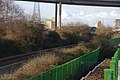
 Bristol MMB «44 River Avon.jpg 2,291 × 1,470; 1.34 MB
-
 A closed pub - geograph.org.uk - 1133442.jpg 640 × 471; 50 KB
-
 A3102 Sandridge Road, Melksham - geograph.org.uk - 1135509.jpg 640 × 498; 162 KB
-
 Acker - geograph.org.uk - 1127451.jpg 640 × 437; 175 KB
-
 Adrian Social Club - North Lane - geograph.org.uk - 1127946.jpg 640 × 398; 186 KB
-
 Ahmed's cash and carry - geograph.org.uk - 1128961.jpg 640 × 407; 42 KB
-
-

-

-
 Allt a' Chùil Track going West - geograph.org.uk - 1128002.jpg 640 × 480; 57 KB
-
 Amberfield Granary - geograph.org.uk - 1130995.jpg 640 × 481; 117 KB
-
 Andover Road, Norwood Road Junction - geograph.org.uk - 1127416.jpg 640 × 360; 190 KB
-
 Approaching Martin Top Farm - geograph.org.uk - 1150783.jpg 425 × 640; 202 KB
-
-

-
 Arlington Grove - Gipton Wood Road - geograph.org.uk - 1127697.jpg 640 × 449; 189 KB
-
 Arlington Road - Easterly Road - geograph.org.uk - 1127665.jpg 640 × 433; 181 KB
-

-
 Arvalee Townland - geograph.org.uk - 1128365.jpg 640 × 480; 84 KB
-
 Arvalee Townland - geograph.org.uk - 1128368.jpg 640 × 480; 87 KB
-
 Ashgrove Way - geograph.org.uk - 1127819.jpg 640 × 480; 187 KB
-
 Asket Hill - Easterly Road - geograph.org.uk - 1128279.jpg 640 × 434; 235 KB
-

-
 Back Wetherby Road - Oakwood Lane - geograph.org.uk - 1128613.jpg 640 × 477; 248 KB
-
 Bakers Mill - panoramio.jpg 2,592 × 1,944; 808 KB
-
 Baldwin's Wood - geograph.org.uk - 1150506.jpg 425 × 640; 179 KB
-
 Bankhall Lane, Hale - geograph.org.uk - 1129836.jpg 640 × 480; 190 KB
-
 Barton Upon Humber Tower Mill - geograph.org.uk - 1127838.jpg 640 × 534; 85 KB
-

-
 Bath Terrace Car Park, Cheltenham - geograph.org.uk - 1127552.jpg 640 × 425; 224 KB
-
 Beaters Bothy on Allt a' Chùil Track - geograph.org.uk - 1127921.jpg 640 × 480; 125 KB
-
 Beaters to the east of Clashdhu Wood - geograph.org.uk - 1127728.jpg 640 × 418; 64 KB
-
-
 Bedford Drive, Timperley - geograph.org.uk - 1129895.jpg 640 × 480; 188 KB
-
-
 Beech Hedge - geograph.org.uk - 1127275.jpg 640 × 480; 111 KB
-
 Belks House - geograph.org.uk - 1130901.jpg 640 × 481; 113 KB
-

-
 Birds over Bow Creek - geograph.org.uk - 1128032.jpg 640 × 430; 64 KB
-
 Blackmore Road, Melksham - geograph.org.uk - 1135545.jpg 640 × 488; 140 KB
-
 Blizzard Approaching from SW - geograph.org.uk - 1129539.jpg 640 × 480; 46 KB
-
 Blocked track - geograph.org.uk - 1127529.jpg 640 × 360; 108 KB
-
 Blocked track - geograph.org.uk - 1127534.jpg 640 × 360; 104 KB
-
 Boarded up house, Rathbone St - geograph.org.uk - 1127974.jpg 640 × 430; 66 KB
-

-
 Boughton Mount Farm - geograph.org.uk - 1131144.jpg 640 × 481; 59 KB
-
 Bow Green Road - geograph.org.uk - 1129813.jpg 640 × 480; 266 KB
-
 Bow Green Road - geograph.org.uk - 1129823.jpg 640 × 480; 242 KB
-
 Bow Green Road meets the A56 - geograph.org.uk - 1129809.jpg 640 × 480; 221 KB
-

-
 Bridge, Eathorpe - geograph.org.uk - 1127647.jpg 640 × 467; 182 KB
-
 Bridleway beside Grand Union Canal - geograph.org.uk - 1127662.jpg 640 × 497; 194 KB
-
 Bridleway descent of Hollycombe Hanger - geograph.org.uk - 1127571.jpg 640 × 360; 113 KB
-
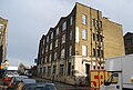
 Bristol Brewery - Georges and Co - geograph.org.uk - 1127914.jpg 640 × 465; 207 KB
-
 Bristol MMB «35 Portway Park & Ride.jpg 2,400 × 1,600; 1.07 MB
-
 Bristol MMB «36 Portway Park & Ride.jpg 2,400 × 1,600; 1.13 MB
-
 Bristol MMB «37 Portway Park & Ride.jpg 2,400 × 1,600; 1.1 MB
-
 Bristol MMB «38 M5 Avonmouth Bridge.jpg 2,400 × 1,600; 723 KB
-
 Bristol MMB «39 Rivers Avon and Trym.jpg 2,400 × 1,436; 1.6 MB
-
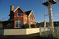 Bristol MMB «40 Sea Mills signal station.jpg 2,400 × 1,600; 1.04 MB
-
 Bristol MMB «41 River Trym.jpg 2,335 × 1,524; 2.19 MB
-
 Bristol MMB «42 River Avon.jpg 2,400 × 1,600; 1.34 MB
-
 Bristol MMB «43 River Avon.jpg 2,400 × 1,600; 698 KB
-
 Bristol MMB «45 Rivers Avon and Trym.jpg 1,600 × 2,400; 696 KB
-
 Bristol MMB «46 River Trym.jpg 2,400 × 1,600; 2.38 MB
-
 Bristol MMB «47 River Trym.jpg 2,400 × 1,600; 2.25 MB
-
 Brookfield Avenue - Harehills Lane - geograph.org.uk - 1127648.jpg 640 × 475; 227 KB
-
 Brooklands Road from Whitehall Road - geograph.org.uk - 1129900.jpg 640 × 480; 242 KB
-
 Holy Trinity Church, Buckfastleigh - geograph.org.uk - 1222250.jpg 427 × 640; 69 KB
-
-
 Buffalo's Head Pub, Chart Sutton - geograph.org.uk - 1130975.jpg 640 × 481; 69 KB
-
 Buildings on Victoria Street - geograph.org.uk - 1127976.jpg 640 × 489; 200 KB
-
 Bunbury cottage - geograph.org.uk - 1127269.jpg 640 × 503; 102 KB
-
 Burn, Arvalee - geograph.org.uk - 1128370.jpg 640 × 480; 79 KB
-
 Burnbank Terrace, North Woodside - geograph.org.uk - 1131551.jpg 640 × 480; 122 KB
-
-

-
 Carn Moraig across Frozen Moorland - geograph.org.uk - 1127830.jpg 640 × 480; 51 KB
-

-
 Carrington Street, Woodlands - geograph.org.uk - 1131554.jpg 640 × 480; 130 KB
-
 Castle Street - geograph.org.uk - 1128696.jpg 640 × 457; 172 KB
-
 Castle Street, Castletown - geograph.org.uk - 1128688.jpg 640 × 457; 180 KB
-

-
 Cemetery Chapel - geograph.org.uk - 1127446.jpg 640 × 480; 53 KB
-
 Central Electric Lighting Station - geograph.org.uk - 1127844.jpg 640 × 480; 222 KB
-
 Chart Sutton Memorial Playing Field - geograph.org.uk - 1130985.jpg 640 × 481; 105 KB
-
 Chenies Avenue - geograph.org.uk - 1150431.jpg 640 × 428; 183 KB
-
 Choppy water - Scar House Reservoir - geograph.org.uk - 1127925.jpg 640 × 480; 78 KB
-
 Choppy waters, Scar House Reservoir - geograph.org.uk - 1127967.jpg 640 × 480; 64 KB
-
 Christ Church Tintwhistle - geograph.org.uk - 1128920.jpg 640 × 427; 73 KB
-
 Christ Church, Park Wood - geograph.org.uk - 1131049.jpg 640 × 481; 67 KB
-
 Citigroup building, Canary wharf - geograph.org.uk - 1128538.jpg 430 × 640; 64 KB
-
 Clarence Road, Hale - geograph.org.uk - 1129857.jpg 640 × 480; 148 KB
-
 Cleveland Road, Hale - geograph.org.uk - 1129861.jpg 640 × 480; 158 KB
-

-

-
 Communication Mast in Police HQ - geograph.org.uk - 1131174.jpg 481 × 640; 48 KB
-
 Cormorant and surf, Tarbat Ness - geograph.org.uk - 1137657.jpg 640 × 427; 149 KB
-
 Corner of a field with trees - geograph.org.uk - 1127364.jpg 640 × 480; 143 KB
-
 Corner of Peel Street and Railway Street - geograph.org.uk - 1128660.jpg 640 × 457; 168 KB
-
 Corner of Peel Street and South Street. - geograph.org.uk - 1128669.jpg 640 × 457; 168 KB
-
 Could you bike it^ - geograph.org.uk - 1127606.jpg 640 × 480; 98 KB
-
 Could you walk it^ - geograph.org.uk - 1127611.jpg 640 × 480; 95 KB
-
 County boundary near Liphook - geograph.org.uk - 1127521.jpg 640 × 360; 84 KB
-
 Craysmarsh Farm - geograph.org.uk - 1136533.jpg 640 × 463; 163 KB
-

-

-
 Damaged footbridge in Langley Park Farm - geograph.org.uk - 1130949.jpg 640 × 481; 143 KB
-
 Danley Farm, Linchmere - geograph.org.uk - 1127484.jpg 640 × 360; 73 KB
-
 Deverney road, Recarson - geograph.org.uk - 1128350.jpg 640 × 480; 81 KB
-
 Deverney road, Recarson - geograph.org.uk - 1128353.jpg 640 × 480; 85 KB
-
 Deverney road, Recarson - geograph.org.uk - 1128355.jpg 640 × 480; 47 KB
-

-
 Devonshire Avenue, Thornton - geograph.org.uk - 1128257.jpg 640 × 480; 60 KB
-
 Diggle Brook Valley - geograph.org.uk - 1127464.jpg 640 × 377; 114 KB
-
 Disappearing ice - geograph.org.uk - 1127641.jpg 640 × 360; 88 KB
-
 Dismantled Railway Fochriw - geograph.org.uk - 1127509.jpg 640 × 427; 49 KB
-

-
-
 DLR platform 4, Stratford - geograph.org.uk - 1128390.jpg 640 × 430; 58 KB
-
 DLR train approaches Poplar Station - geograph.org.uk - 1128059.jpg 640 × 430; 63 KB
-

-

-
 Drumragh Avenue, Omagh - geograph.org.uk - 1128345.jpg 640 × 480; 52 KB
-
 Drumragh Avenue, Omagh - geograph.org.uk - 1128348.jpg 640 × 288; 35 KB
-
 Dudley Road, Timperley - geograph.org.uk - 1129882.jpg 640 × 480; 191 KB
-
 Dunkirk Mill - geograph.org.uk - 1243824.jpg 640 × 430; 108 KB
-
 Durlett Road looking north - geograph.org.uk - 1136760.jpg 640 × 473; 224 KB
-
 East on Cock Road - geograph.org.uk - 1130677.jpg 640 × 495; 145 KB
-
 Easterly Avenue - Gipton Wood Avenue - geograph.org.uk - 1127675.jpg 640 × 449; 196 KB
-
 Easterly Crescent - Arlington Road - geograph.org.uk - 1127666.jpg 640 × 455; 178 KB
-
 Easterly Grove - Easterly Road - geograph.org.uk - 1127660.jpg 640 × 441; 176 KB
-

-
 Elmete Grove - Elmete Avenue - geograph.org.uk - 1128292.jpg 640 × 468; 199 KB
-
 Elmete Hill - Asket Hill - geograph.org.uk - 1128282.jpg 640 × 465; 256 KB
-
 Elmete Lane - Wetherby Road - geograph.org.uk - 1128285.jpg 640 × 445; 243 KB
-
 Elmete Mount - Asket Hill - geograph.org.uk - 1128280.jpg 640 × 480; 298 KB
-
 Elmete Walk - Elmete Drive - geograph.org.uk - 1128290.jpg 640 × 614; 275 KB
-
 Elmete Way - Asket Hill - geograph.org.uk - 1128284.jpg 640 × 430; 227 KB
-
 Elmwood Court - Wetherby Road - geograph.org.uk - 1128607.jpg 640 × 410; 215 KB
-
 Elmwood House Nursing Home - geograph.org.uk - 1128605.jpg 640 × 480; 316 KB
-
-
 Empire Direct - Easterly Road - geograph.org.uk - 1127655.jpg 640 × 432; 187 KB
-
 Entrance to Anchor Farm, Kentford - geograph.org.uk - 1128425.jpg 427 × 640; 132 KB
-
 Entrance to Placehouse Copse - geograph.org.uk - 1150806.jpg 640 × 426; 177 KB
-

-
 Eros - geograph.org.uk - 1130455.jpg 640 × 480; 65 KB
-
 Evening Post Newspaper Offices - geograph.org.uk - 1127930.jpg 640 × 480; 257 KB
-
 Exercise bars, Highway to Health - geograph.org.uk - 1128388.jpg 640 × 480; 77 KB
-
-

-
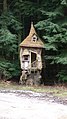 Fairytale house in the woods - geograph.org.uk - 1127557.jpg 360 × 640; 68 KB
-
 Farm track, Herringswell - geograph.org.uk - 1128433.jpg 427 × 640; 114 KB
-
 Farmland near Latimer Park Farm - geograph.org.uk - 1150452.jpg 640 × 426; 166 KB
-
 Farmland near Stafford Castle - geograph.org.uk - 1136268.jpg 640 × 480; 168 KB
-
 Farmland south of Flaunden - geograph.org.uk - 1150770.jpg 640 × 427; 168 KB
-

-
 Fern on footpath - geograph.org.uk - 1131118.jpg 640 × 481; 93 KB
-
 Ffos y Fran Open Cast Mine workings - geograph.org.uk - 1128297.jpg 640 × 427; 43 KB
-
 Ffos y Fran Open Cast Mine workings - geograph.org.uk - 1128298.jpg 640 × 427; 30 KB
-
 Field and woodland boundary - geograph.org.uk - 1127448.jpg 640 × 500; 82 KB
-
 Field and woodland boundary - geograph.org.uk - 1127458.jpg 640 × 480; 63 KB
-

-
 Field boundary, Herringswell - geograph.org.uk - 1128445.jpg 640 × 427; 78 KB
-
 Field near Herringswell - geograph.org.uk - 1128430.jpg 640 × 427; 104 KB
-
 Fields by the M56 - geograph.org.uk - 1129800.jpg 640 × 480; 163 KB
-
 Filling station on the A3102 - geograph.org.uk - 1129592.jpg 640 × 535; 191 KB
-

-
 Fitzroy Drive - Gledhow Lane - geograph.org.uk - 1128629.jpg 640 × 427; 234 KB
-

-
 Flats on Aimson Road West, Timperley - geograph.org.uk - 1129885.jpg 640 × 480; 181 KB
-
 Flaunden village centre - geograph.org.uk - 1150754.jpg 640 × 427; 185 KB
-
 Flooded Pond Skirlington.jpg 4,000 × 3,000; 2.59 MB
-
 Folkeston holiday chalets - geograph.org.uk - 1127167.jpg 640 × 480; 44 KB
-
-

-
 Footbridge in Boughton Manor Land - geograph.org.uk - 1131126.jpg 640 × 481; 128 KB
-
 Footbridge over A229 Loose Road - geograph.org.uk - 1131232.jpg 640 × 481; 85 KB
-
 Footpath and Hedge Line - geograph.org.uk - 1130937.jpg 640 × 481; 121 KB
-
 Footpath junction in East Wood, Otham - geograph.org.uk - 1130895.jpg 640 × 481; 150 KB
-
 Footpath near Iden Farm - geograph.org.uk - 1131014.jpg 640 × 481; 119 KB
-
 Footpath off Mansfield Road - geograph.org.uk - 1127817.jpg 640 × 480; 102 KB
-
 Footpath on Back Lane - geograph.org.uk - 1131004.jpg 640 × 481; 128 KB
-
 Footpath on Church Road - geograph.org.uk - 1130883.jpg 640 × 481; 145 KB
-
 Footpath on Pested Bars Road - geograph.org.uk - 1131108.jpg 640 × 481; 125 KB
-
 Footpath on Pheasant Lane - geograph.org.uk - 1131210.jpg 640 × 481; 117 KB
-
 Footpath to Holden Wood Reservoir - geograph.org.uk - 1127420.jpg 640 × 436; 85 KB
-
 Footpath to Kennett Church - geograph.org.uk - 1128408.jpg 640 × 427; 93 KB
-
 Footpath to the footbridge - geograph.org.uk - 1131812.jpg 640 × 480; 91 KB
-
 Footpath towards Baldwin's Wood - geograph.org.uk - 1150786.jpg 640 × 426; 160 KB
-
 Footpath towards Latimer - geograph.org.uk - 1150511.jpg 640 × 428; 234 KB
-

-
 Forest edge with cows - geograph.org.uk - 1127395.jpg 640 × 480; 90 KB
-
 Forest lead from Pitmurchie Road - geograph.org.uk - 1127371.jpg 640 × 480; 133 KB
-
 Forest track from Pitmurchie Road - geograph.org.uk - 1127340.jpg 640 × 521; 124 KB
-
 Foresters Arms, Sandridge Road, Melksham - geograph.org.uk - 1135498.jpg 640 × 496; 183 KB
-
 Former Lodge Keepers Cottages - geograph.org.uk - 1130817.jpg 640 × 481; 79 KB
-
-
 Former Possil Railway Station - geograph.org.uk - 1127839.jpg 640 × 480; 108 KB
-
 From Terminal Three - geograph.org.uk - 1196114.jpg 640 × 427; 311 KB


