Category:United Kingdom photographs taken on 2009-03-25
Countries of Europe: Austria · Belgium · Denmark · France‡ · Germany · Greece · Hungary · Republic of Ireland · Italy · Netherlands‡ · Poland · Portugal‡ · Romania · Russia‡ · Serbia · Spain‡ · Sweden · Turkey‡ · Ukraine · United Kingdom · Vatican City
‡: partly located in Europe
‡: partly located in Europe
| ← | 25 March 2009 | → | ||
| ← | March 2009 | → | ||

United Kingdom photographs taken on 25 March 2009.
Image files should be categorized here automatically using {{taken on}} template. Direct categorisation is also possible, if automatic is impossible.
Subcategories
This category has the following 2 subcategories, out of 2 total.
L
Media in category "United Kingdom photographs taken on 2009-03-25"
The following 200 files are in this category, out of 821 total.
(previous page) (next page)-
 'End of Cycle Route' sign - geograph.org.uk - 1220719.jpg 640 × 464; 78 KB
-
 'Shropshire Way' stile at Stanbatch - geograph.org.uk - 1222015.jpg 600 × 450; 339 KB
-

-
 -2009-03-25 Looking north along Cabbell Road, Cromer (1).JPG 1,920 × 2,560; 883 KB
-
 -2009-03-25 Looking north along Cabbell Road, Cromer (2).JPG 1,920 × 2,560; 1,023 KB
-
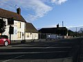
 -2009-03-25 The Ship public house, Bacton, Norfolk (1).JPG 2,560 × 1,920; 2.33 MB
-
 -2009-03-25 The Ship public house, Bacton, Norfolk (2).JPG 2,560 × 1,920; 3.43 MB
-
 -2009-03-25 Westbrook house, Cabell Road, Cromer.JPG 1,920 × 2,560; 1.04 MB
-
 A 89 - geograph.org.uk - 1220803.jpg 640 × 480; 93 KB
-

-
 A new driveway - geograph.org.uk - 1283469.jpg 640 × 479; 64 KB
-
 A public byway known as Back Lane - geograph.org.uk - 1221824.jpg 640 × 449; 52 KB
-
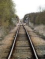
 A Train approaches Barton Station - geograph.org.uk - 1222136.jpg 479 × 640; 95 KB
-

-
 Abandoned cottage, Tullyglush - geograph.org.uk - 1221414.jpg 640 × 479; 96 KB
-

-
 Abingdon Bridge - geograph.org.uk - 1221255.jpg 640 × 427; 71 KB
-
 Abingdon Town Football Ground - geograph.org.uk - 1221265.jpg 640 × 427; 40 KB
-
 Access denied - geograph.org.uk - 1221949.jpg 600 × 450; 316 KB
-
 Access road along Nut Batch - geograph.org.uk - 1222027.jpg 600 × 450; 243 KB
-
 Access to Drumshalloch Croft - geograph.org.uk - 1220663.jpg 640 × 480; 102 KB
-
 Access to Myndtown Cottages - geograph.org.uk - 1221936.jpg 600 × 450; 230 KB
-
 Access to St Fillans - geograph.org.uk - 1220683.jpg 640 × 537; 104 KB
-
 Achmelvich beach - geograph.org.uk - 1398479.jpg 640 × 480; 40 KB
-
 Achmelvich beach - geograph.org.uk - 1398494.jpg 640 × 480; 61 KB
-
 Achmelvich beach - geograph.org.uk - 1398503.jpg 640 × 480; 38 KB
-
 Aircraft stands at Edinburgh Airport.jpg 3,296 × 2,472; 3.58 MB
-
 Alfred Street, Wantage - geograph.org.uk - 1321108.jpg 640 × 480; 306 KB
-

-
 Allt a' Mhuilinn. - geograph.org.uk - 1221671.jpg 640 × 480; 179 KB
-
 Allt Ach' a' Bhathaidh - geograph.org.uk - 1221599.jpg 640 × 480; 194 KB
-
 Allt Ach' a' Bhathaidh. - geograph.org.uk - 1221626.jpg 640 × 480; 187 KB
-
 Altagore Townland - geograph.org.uk - 1221540.jpg 640 × 479; 59 KB
-
 Alwinton village green and Hosedon Burn - geograph.org.uk - 1222147.jpg 640 × 480; 114 KB
-
 Anchorage Blocks - geograph.org.uk - 1222127.jpg 493 × 640; 115 KB
-
 Animal feeds - geograph.org.uk - 1223235.jpg 640 × 480; 91 KB
-
 Approach to A980 junction - geograph.org.uk - 1220868.jpg 640 × 486; 87 KB
-

-
 Approach to Woodend junction - geograph.org.uk - 1220697.jpg 640 × 368; 72 KB
-
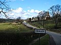 Approaching Healey - geograph.org.uk - 1223132.jpg 640 × 480; 82 KB
-
 Aspinall House - geograph.org.uk - 1221278.jpg 640 × 480; 52 KB
-
 At the end of the Line - geograph.org.uk - 1222086.jpg 484 × 640; 97 KB
-
 Auchenhay, Corsock - geograph.org.uk - 1220755.jpg 640 × 480; 112 KB
-
 Ballymacilroy Townland - geograph.org.uk - 1221380.jpg 640 × 479; 57 KB
-
 Ballyreagh Townland - geograph.org.uk - 1220741.jpg 640 × 479; 88 KB
-
 Banchory Business Centre - geograph.org.uk - 1220721.jpg 640 × 480; 83 KB
-
 Barfad - geograph.org.uk - 1220974.jpg 640 × 423; 64 KB
-
 Barfad Loch and Farm - geograph.org.uk - 1220941.jpg 640 × 480; 76 KB
-
 Bay of Stoer - geograph.org.uk - 1238901.jpg 640 × 480; 79 KB
-
 Bayfield salmon station - geograph.org.uk - 1221193.jpg 640 × 480; 214 KB
-
 Beach at Clachtoll - geograph.org.uk - 1241891.jpg 640 × 480; 38 KB
-
 Bedford Purlieus - geograph.org.uk - 1228190.jpg 640 × 457; 140 KB
-
 Bedford Purlieus National Nature Reserve - geograph.org.uk - 1228183.jpg 640 × 457; 167 KB
-
 Main Road through World's End - geograph.org.uk - 1271587.jpg 640 × 480; 57 KB
-
 Beet Harvesting near Seavington St Mary - geograph.org.uk - 1222494.jpg 640 × 428; 112 KB
-
 Bent Mote Fields - geograph.org.uk - 1220765.jpg 640 × 480; 97 KB
-
 Big Wednesday - geograph.org.uk - 1228264.jpg 640 × 429; 109 KB
-
 Bin day, Green Lane - geograph.org.uk - 1226742.jpg 640 × 480; 107 KB
-
 Bishopsgate Institute, Bishopsgate, EC2.jpg 2,520 × 3,776; 3.53 MB
-
 Black Burn - geograph.org.uk - 1224073.jpg 640 × 480; 101 KB
-
 Black Burn - geograph.org.uk - 1224074.jpg 640 × 480; 60 KB
-
 Black horse and Fearby - geograph.org.uk - 1222185.jpg 640 × 480; 103 KB
-
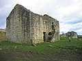 Black Middens Bastle - geograph.org.uk - 1224658.jpg 640 × 480; 80 KB
-
 Black Middens Bastle - geograph.org.uk - 1224666.jpg 640 × 480; 93 KB
-
 Blackburnhead Mountaim Bothy - geograph.org.uk - 1224080.jpg 640 × 480; 86 KB
-
 Bluebell public house, North Walsham, 25th March 2009.JPG 2,560 × 1,920; 3.05 MB
-
 Boathouse on Barfad Loch - geograph.org.uk - 1221079.jpg 640 × 480; 113 KB
-
 Boats on East Drain near Ferriby Sluice - geograph.org.uk - 1221317.jpg 640 × 480; 134 KB
-
 Bockets Road, Innishmagh - geograph.org.uk - 1221576.jpg 640 × 479; 50 KB
-

-

-
-

-
 BP station, Milngavie Road - geograph.org.uk - 1220473.jpg 640 × 480; 133 KB
-
 Bramhope Puritan Chapel - geograph.org.uk - 1603796.jpg 640 × 479; 75 KB
-

-
 Bridge crossing Pott Beck - geograph.org.uk - 1223165.jpg 640 × 480; 111 KB
-
 Bridge Street - geograph.org.uk - 1228041.jpg 640 × 457; 165 KB
-
 Bridleway near Smallacombe - geograph.org.uk - 1228208.jpg 480 × 640; 153 KB
-
 Bridleway to Smallacombe - geograph.org.uk - 1228217.jpg 480 × 640; 145 KB
-
 Briggate Water mill, 25th March 2009.JPG 2,560 × 1,920; 2.98 MB
-
 Brigton Farm - geograph.org.uk - 1221954.jpg 640 × 480; 114 KB
-
 Broad Street, Leominster - geograph.org.uk - 1221471.jpg 640 × 455; 106 KB
-
 Broadmeadow dog-walking path - geograph.org.uk - 1220319.jpg 640 × 480; 203 KB
-
 Broadmeadow dog-walking path 2 - geograph.org.uk - 1220324.jpg 640 × 480; 228 KB
-
 Broadmires Farm - geograph.org.uk - 1223177.jpg 640 × 480; 87 KB
-
 Brookhill Wood - geograph.org.uk - 1220713.jpg 640 × 480; 144 KB
-
 Brox Burn - geograph.org.uk - 1220783.jpg 640 × 480; 181 KB
-
 Building near to Etnam Street - geograph.org.uk - 1221477.jpg 640 × 519; 135 KB
-
 Burnden Way - geograph.org.uk - 1221269.jpg 640 × 480; 59 KB
-
 Bus Shelter, Knockonny Road - geograph.org.uk - 1221544.jpg 640 × 479; 54 KB
-
 Bus stop by Banchory Business Centre - geograph.org.uk - 1220726.jpg 640 × 474; 73 KB
-
 Business office by A980 - geograph.org.uk - 1220880.jpg 640 × 440; 88 KB
-
 Butterbur on the banks of the Lour Burn - geograph.org.uk - 1220911.jpg 640 × 490; 130 KB
-
 Bye^ bye^ Barnsley College - geograph.org.uk - 1588750.jpg 640 × 480; 86 KB
-
 Byway from North Heath - geograph.org.uk - 1271526.jpg 640 × 480; 76 KB
-
 Byway on to Cholsey Downs - geograph.org.uk - 1271764.jpg 640 × 480; 87 KB
-
 Cairn at Summit of Hill of Fare - geograph.org.uk - 1220970.jpg 640 × 426; 93 KB
-
 Cairn on Landshot Hill - geograph.org.uk - 1220334.jpg 640 × 480; 108 KB
-
 Cameron St, Barrow-in-Furness - geograph.org.uk - 1265170.jpg 640 × 480; 47 KB
-
 Camowen Road, Camowen - geograph.org.uk - 1220569.jpg 640 × 479; 69 KB
-
 Camowen Road, Camowen - geograph.org.uk - 1220574.jpg 640 × 479; 72 KB
-
 Camowen Townland - geograph.org.uk - 1220561.jpg 640 × 479; 69 KB
-
 Canal and towpath near Acton - geograph.org.uk - 1221074.jpg 640 × 360; 83 KB
-
 Canal and towpath near Scarva - geograph.org.uk - 1221025.jpg 640 × 342; 104 KB
-
 Canongate Primary - geograph.org.uk - 1221901.jpg 640 × 480; 54 KB
-
 Cantelo Nurseries - geograph.org.uk - 1221428.jpg 640 × 428; 77 KB
-
 Car Park - geograph.org.uk - 1220950.jpg 640 × 480; 76 KB
-
 Carlisle Avenue, Hull - geograph.org.uk - 1220425.jpg 518 × 640; 114 KB
-
 Carn Ban Mor summit - geograph.org.uk - 1221790.jpg 640 × 480; 76 KB
-
 Cascade on Allt a' Mhuilinn. - geograph.org.uk - 1221663.jpg 640 × 480; 196 KB
-
 Cattle grid on 'The Jack Mytton Way' - geograph.org.uk - 1221921.jpg 600 × 450; 269 KB
-
 Cattle in barn at Shaw's Farm - geograph.org.uk - 1222174.jpg 640 × 480; 81 KB
-
 Caution sign in Myndtown, Shropshire, England.jpg 600 × 450; 197 KB
-
 Cavey Road, Knockonny - geograph.org.uk - 1221545.jpg 640 × 479; 62 KB
-
 Centre Court at Craiglockhart - geograph.org.uk - 1220415.jpg 640 × 480; 79 KB
-
 Chambered Grave at Shantavny Scotch - geograph.org.uk - 1220586.jpg 640 × 479; 73 KB
-
 Chambered Grave, Shantavny Scotch - geograph.org.uk - 1220585.jpg 640 × 479; 59 KB
-
 Cherry Tree Road - geograph.org.uk - 1220856.jpg 640 × 480; 71 KB
-
 Cheviot landscape - geograph.org.uk - 1222129.jpg 640 × 480; 112 KB
-
 Chieveley Playing Fields - geograph.org.uk - 1271484.jpg 640 × 480; 67 KB
-
 Chorley New Road - geograph.org.uk - 1221281.jpg 640 × 480; 53 KB
-
 Churchmoor Gutter - geograph.org.uk - 1222049.jpg 600 × 450; 312 KB
-
 Clachtoll - geograph.org.uk - 1392399.jpg 640 × 480; 73 KB
-
 Clachtoll with Loch an Aigeil - geograph.org.uk - 1392414.jpg 640 × 480; 60 KB
-
 Clear fell in Kidland Forest - geograph.org.uk - 1221882.jpg 640 × 480; 121 KB
-
 Clennell Hall - geograph.org.uk - 1222137.jpg 640 × 480; 71 KB
-
 Clennell Hall from Clennell Street - geograph.org.uk - 1221955.jpg 640 × 480; 80 KB
-
 Clennell Hill from Clennell Street - geograph.org.uk - 1221947.jpg 640 × 480; 100 KB
-
 Clennell Street - geograph.org.uk - 1221913.jpg 640 × 480; 84 KB
-

-
 Coach company compound - geograph.org.uk - 1220309.jpg 640 × 480; 200 KB
-
 Coach Gate Lane - geograph.org.uk - 1321529.jpg 640 × 480; 81 KB
-
-

-
 Colster Cleugh - geograph.org.uk - 1221147.jpg 640 × 480; 106 KB
-

-
 Cottages at Abbotstone - geograph.org.uk - 1248499.jpg 640 × 480; 85 KB
-
 Cottages near Grantshouse - geograph.org.uk - 1220863.jpg 573 × 640; 98 KB
-
 Crackrawer Road, Ballymacilroy - geograph.org.uk - 1221375.jpg 640 × 479; 64 KB
-
 Crackrawer Road, Ballymacilroy - geograph.org.uk - 1221389.jpg 640 × 479; 56 KB
-
 Craig House and Old Craig - geograph.org.uk - 1220430.jpg 640 × 480; 61 KB
-
 Craiglockhart Hills Conservation Area - geograph.org.uk - 1220467.jpg 640 × 480; 116 KB
-
 Craiglockhart Nature Trail - geograph.org.uk - 1220464.jpg 640 × 480; 108 KB
-
 Craiglockhart Nature Trail - geograph.org.uk - 1220607.jpg 640 × 489; 72 KB
-
 Craiglockhart Pond - geograph.org.uk - 1220406.jpg 640 × 480; 71 KB
-
 Craiglockhart Pond - geograph.org.uk - 1220588.jpg 640 × 480; 106 KB
-

-
 Craiglockhart Pond from the dam - geograph.org.uk - 1220619.jpg 640 × 480; 125 KB
-

-
 Crazy Bear, Fitzrovia, W1 (3408004602).jpg 2,292 × 3,437; 3.02 MB
-
 Crevenagh Road - geograph.org.uk - 1220558.jpg 640 × 479; 71 KB
-
 Crevenagh Road - geograph.org.uk - 1220560.jpg 640 × 479; 91 KB
-
 Crevenagh Road - geograph.org.uk - 1220572.jpg 640 × 479; 71 KB
-
 Crevenagh Road, Camowen - geograph.org.uk - 1220565.jpg 640 × 479; 62 KB
-
 Crossroads at Wentnor Prolley Moor - geograph.org.uk - 1221989.jpg 600 × 450; 224 KB
-
 Crown Hotel - geograph.org.uk - 1221282.jpg 640 × 480; 52 KB
-
 Crown Hotel, Sign - geograph.org.uk - 1221285.jpg 640 × 480; 91 KB
-
 Crown Hotel, Stone - geograph.org.uk - 1221286.jpg 640 × 480; 85 KB
-
 Cryals Road - geograph.org.uk - 1220532.jpg 640 × 427; 106 KB
-
 Cuddy Point - geograph.org.uk - 1221177.jpg 640 × 480; 172 KB
-
 Cul-de-sac off Hill of Banchory West - geograph.org.uk - 1220871.jpg 640 × 480; 72 KB
-
 The White Lion, Culham - geograph.org.uk - 1221292.jpg 640 × 437; 101 KB
-
 Village Green, Culham - geograph.org.uk - 1221293.jpg 640 × 427; 83 KB
-
 Culham Cut from Sutton Bridge - geograph.org.uk - 1221297.jpg 640 × 427; 72 KB
-
 Culham Lock on Culham Cut - geograph.org.uk - 1221298.jpg 640 × 427; 83 KB
-
 Curious cows, Camowen - geograph.org.uk - 1220562.jpg 640 × 479; 71 KB
-
 Customs House under wraps - geograph.org.uk - 1256856.jpg 640 × 480; 69 KB
-
 Cycle path, Uphall - geograph.org.uk - 1220798.jpg 640 × 480; 151 KB
-
 Daffodils in Winklebury - geograph.org.uk - 1283468.jpg 640 × 475; 137 KB
-
 Dead tree near Brook Green - geograph.org.uk - 1222437.jpg 640 × 426; 66 KB
-
 Deep Pink (3385458574).jpg 2,232 × 2,168; 2.63 MB
-
 Deer shooting seat - geograph.org.uk - 1220830.jpg 640 × 480; 91 KB
-
 Descending from Carn Ban Mor - geograph.org.uk - 1221798.jpg 640 × 480; 74 KB
-
 Detail of HSBC Bank frontage - geograph.org.uk - 1321077.jpg 640 × 480; 313 KB
-

-
 Disused turbine house at Ascoile. - geograph.org.uk - 1221745.jpg 640 × 480; 197 KB
-
 Disused turbine house at Ascoile. - geograph.org.uk - 1221757.jpg 640 × 480; 188 KB
-
 Division Road, Hull - geograph.org.uk - 1220498.jpg 640 × 450; 99 KB
-
 Drain from Loch of Leys to Bo Burn - geograph.org.uk - 1220566.jpg 640 × 480; 116 KB
-
 Drumlins south of the Tregele road - geograph.org.uk - 1221222.jpg 640 × 163; 20 KB
-
 Dry Stone Wall, Muirshiel - geograph.org.uk - 1221356.jpg 640 × 480; 127 KB
-
 Drystones walls near Castlewellan - geograph.org.uk - 1220985.jpg 640 × 335; 82 KB
-
 Dungannon Road - geograph.org.uk - 1221581.jpg 640 × 479; 49 KB
-
 Dungannon Road, Ballygawley - geograph.org.uk - 1221578.jpg 640 × 479; 68 KB
-
 Dunn's Sike - geograph.org.uk - 1224071.jpg 640 × 480; 91 KB
-
 Dutch deaths - geograph.org.uk - 1221997.jpg 640 × 480; 93 KB
-
 East Allen Dale at Sinderhope (2) - geograph.org.uk - 1221979.jpg 640 × 480; 58 KB
-
 East Allen Dale at Sinderhope (6) - geograph.org.uk - 1227425.jpg 640 × 480; 74 KB
-
 East Allen Dale at Sinderhope (7) - geograph.org.uk - 1227429.jpg 640 × 480; 81 KB
-
 East Allen Dale at Sinderhope (8) - geograph.org.uk - 1227463.jpg 640 × 480; 73 KB
-
 East Allen Dale at Sinderhope (9) - geograph.org.uk - 1227475.jpg 640 × 480; 84 KB
-
 East Allen Dale at Sinderhope - geograph.org.uk - 1221958.jpg 640 × 479; 68 KB
-
 Eastern edge of Loch of Leys - geograph.org.uk - 1220583.jpg 640 × 480; 119 KB
-
 Edgcumbe Avenue, Newquay - geograph.org.uk - 1228536.jpg 640 × 427; 92 KB
-
 Edgcumbe Avenue, Newquay - geograph.org.uk - 1228537.jpg 640 × 428; 114 KB
-
 Edge of Glenmuckloch opencast - geograph.org.uk - 1220417.jpg 640 × 480; 37 KB
-
 Edinburgh Airport Flybe and Ryanair aircraft.jpg 3,296 × 2,472; 1.04 MB
-
 Eingangsbereich Kathedrale Sailsbury - panoramio.jpg 3,840 × 2,880; 1.18 MB
-


.JPG)
.JPG)
.JPG)
.JPG)


_-_geograph.org.uk_-_1220646.jpg)


.jpg)


.jpg)


_-_geograph.org.uk_-_1221979.jpg)
_-_geograph.org.uk_-_1227425.jpg)
_-_geograph.org.uk_-_1227429.jpg)
_-_geograph.org.uk_-_1227463.jpg)
_-_geograph.org.uk_-_1227475.jpg)


