Category:United Kingdom photographs taken on 2009-08-04
Countries of Europe: Austria · Belarus · Belgium · Bulgaria · Croatia · Cyprus‡ · Czech Republic · Denmark · Estonia · Finland · France‡ · Germany · Greece · Hungary · Republic of Ireland · Italy · Latvia · Lithuania · Montenegro · Netherlands‡ · North Macedonia · Norway · Poland · Portugal‡ · Romania · Russia‡ · Serbia · Slovakia · Spain‡ · Sweden · Switzerland · Turkey‡ · Ukraine · United Kingdom · Vatican City
Specific status: Isle of Man · Jersey
‡: partly located in Europe
Specific status: Isle of Man · Jersey
‡: partly located in Europe
| ← | 4 August 2009 | → | ||
| ← | August 2009 | → | ||

United Kingdom photographs taken on 4 August 2009.
Image files should be categorized here automatically using {{taken on}} template. Direct categorisation is also possible, if automatic is impossible.
Subcategories
This category has only the following subcategory.
Media in category "United Kingdom photographs taken on 2009-08-04"
The following 200 files are in this category, out of 562 total.
(previous page) (next page)-
 "Black Prince" at Cheltenham - geograph.org.uk - 1463003.jpg 640 × 480; 92 KB
-
 "Newcastle Airport. Your Airport" - geograph.org.uk - 1452780.jpg 640 × 480; 71 KB
-
 "The Lighthouse" (Glasgow) (3802870175).jpg 1,600 × 1,200; 535 KB
-
 "The Lighthouse" (Glasgow) (3802871083).jpg 1,954 × 2,592; 1.71 MB
-
 "The Lighthouse" (Glasgow) (3803685346).jpg 1,800 × 1,200; 584 KB
-
 'Corner House', east of Hunningham - geograph.org.uk - 1428972.jpg 640 × 411; 86 KB
-
 'Newhaven', a cottage in Hunningham - geograph.org.uk - 1480907.jpg 640 × 466; 137 KB
-
 'Step-Aside', a cottage in Hunningham - geograph.org.uk - 1480911.jpg 640 × 427; 106 KB
-

-
 A popular route^ - geograph.org.uk - 1430340.jpg 640 × 480; 134 KB
-
 A Rural Scene - geograph.org.uk - 1429337.jpg 640 × 480; 84 KB
-
 A19 near Went Bridge - geograph.org.uk - 1429019.jpg 640 × 480; 36 KB
-
 A19, Norton Common - geograph.org.uk - 1429021.jpg 640 × 480; 40 KB
-
 A822, Sma Glen - geograph.org.uk - 1429642.jpg 640 × 480; 91 KB
-
 A944 Road junction - geograph.org.uk - 1430150.jpg 640 × 425; 95 KB
-
 Ackergillshore slipway - geograph.org.uk - 1428647.jpg 640 × 427; 69 KB
-
 Ainley Top Roundabout - geograph.org.uk - 1428970.jpg 640 × 480; 49 KB
-
 Alberta Terrace in Alpington - geograph.org.uk - 1428043.jpg 640 × 480; 88 KB
-
 Alien Resurrection - geograph.org.uk - 1428505.jpg 640 × 480; 73 KB
-
 All Saints Church Londesborough 2.jpg 640 × 442; 66 KB
-
 Approach to Thorns Wood - geograph.org.uk - 1429339.jpg 640 × 480; 79 KB
-

-
 Arable land, Easter Buchanty - geograph.org.uk - 1430134.jpg 640 × 480; 104 KB
-
 Aspire Golf Club target range - geograph.org.uk - 1429165.jpg 640 × 469; 120 KB
-
 At the end of Sandy Lane - geograph.org.uk - 1428472.jpg 640 × 402; 62 KB
-
 Back buildings at Blairs - geograph.org.uk - 1429174.jpg 640 × 480; 128 KB
-
 Badger Lane - geograph.org.uk - 1429018.jpg 640 × 480; 70 KB
-
 Ballintoy Harbour - geograph.org.uk - 1755397.jpg 3,456 × 2,304; 1.32 MB
-
 Balls Farm Road crossing Crabb Lane - geograph.org.uk - 1432656.jpg 640 × 480; 182 KB
-
 Balls Farm Road looking east - geograph.org.uk - 1433184.jpg 640 × 480; 164 KB
-
 Balls Farm Road looking west - geograph.org.uk - 1433186.jpg 640 × 480; 178 KB
-
 Barley Lane looking north - geograph.org.uk - 1433205.jpg 640 × 480; 169 KB
-
 Barley Lane looking south - geograph.org.uk - 1433204.jpg 640 × 480; 186 KB
-

-
 Beacon Road, Chatham - geograph.org.uk - 1429647.jpg 640 × 480; 59 KB
-
 Bent tree - panoramio.jpg 1,957 × 1,920; 901 KB
-

-

-
 Betws-y-Coed Station - geograph.org.uk - 1436209.jpg 640 × 480; 210 KB
-
 Birch Services Eastbound Travelodge - geograph.org.uk - 1430220.jpg 640 × 480; 52 KB
-
 Black Heath to Goat Hill End - geograph.org.uk - 1428903.jpg 640 × 480; 63 KB
-
 Bleakedgate Moor - geograph.org.uk - 1428214.jpg 640 × 480; 39 KB
-
 Bleakedgate Moor - geograph.org.uk - 1428219.jpg 640 × 480; 26 KB
-
 Bleakedgate Moor towards the M62 - geograph.org.uk - 1428212.jpg 640 × 480; 30 KB
-
 Bloomfield Baptist Church, Belfast - geograph.org.uk - 1427850.jpg 640 × 411; 71 KB
-
 Boscombe Chine - geograph.org.uk - 1428201.jpg 640 × 480; 81 KB
-
 Boscombe, postbox inside Sainsbury's - geograph.org.uk - 1430157.jpg 480 × 640; 74 KB
-
 Boulder, Coire Glas - geograph.org.uk - 1457788.jpg 480 × 640; 89 KB
-
 Bratt Wood, Nunburnholme - geograph.org.uk - 1430320.jpg 640 × 409; 93 KB
-
 Breakfast time near Malham - panoramio - Immanuel Giel.jpg 1,673 × 1,746; 452 KB
-
 Briars Cottage, Balls Farm Road - geograph.org.uk - 1432645.jpg 640 × 480; 176 KB
-
 Bridge House apartments, Hunningham - geograph.org.uk - 1480900.jpg 640 × 431; 120 KB
-

-
 Bridleway and lane near Rowhorne - geograph.org.uk - 1434466.jpg 640 × 480; 178 KB
-
 Brightlingsea Village Sign - geograph.org.uk - 1431673.jpg 480 × 640; 47 KB
-
 Burne Moss - geograph.org.uk - 1428898.jpg 640 × 480; 41 KB
-
 Buses at Cowes Co-op 2.JPG 3,712 × 2,088; 3.02 MB
-
 Buses at Cowes Co-op 3.JPG 3,712 × 2,088; 3.11 MB
-
 Buses at Cowes Co-op.JPG 3,712 × 2,088; 3.09 MB
-
 Butcher Lane, Whitley - geograph.org.uk - 1428987.jpg 640 × 480; 71 KB
-
 Canterbury Street, Belfast - geograph.org.uk - 1428248.jpg 640 × 419; 91 KB
-

-
 Car Park at Asda Bolton Superstore - geograph.org.uk - 1430192.jpg 640 × 480; 58 KB
-

-
 Cardiff, UK - panoramio - Shiroi Hane.jpg 1,600 × 1,200; 187 KB
-
 Carpenters Arms, Fitzrovia, London (3822810630).jpg 3,498 × 2,332; 3.18 MB
-
 Cast Iron Kerb, Clifton, Bristol - geograph.org.uk - 1431875.jpg 640 × 484; 114 KB
-

-
-
 Church Lane, Nunburnholme - geograph.org.uk - 1429389.jpg 640 × 480; 61 KB
-
 Church Road, Alphington - geograph.org.uk - 1432615.jpg 640 × 480; 142 KB
-
 Church Road, Alphington - geograph.org.uk - 1432623.jpg 640 × 480; 173 KB
-
 Church Street - geograph.org.uk - 1428457.jpg 640 × 480; 78 KB
-
 Church Street - geograph.org.uk - 1428468.jpg 640 × 480; 91 KB
-
 Citroen dealer, Hennock Road - geograph.org.uk - 1432609.jpg 640 × 480; 146 KB
-
 Cliburn Moss - geograph.org.uk - 1427987.jpg 640 × 480; 58 KB
-
 Clough Head and Old Lindley Moor - geograph.org.uk - 1428952.jpg 640 × 480; 40 KB
-
 Colenso Parade, Belfast (2) - geograph.org.uk - 1427885.jpg 640 × 386; 67 KB
-
 Colourful MINI, Belfast - geograph.org.uk - 1428481.jpg 640 × 509; 112 KB
-
 Commondale railway station - geograph.org.uk - 1598482.jpg 640 × 427; 78 KB
-

-
 Converted water tower - geograph.org.uk - 1428152.jpg 480 × 640; 83 KB
-
 Conwy Valley Railway Museum - geograph.org.uk - 1436213.jpg 640 × 480; 217 KB
-

-

-
 Courtyard, Linlithgow Palace - geograph.org.uk - 1429728.jpg 640 × 426; 83 KB
-
 Covered footbridge, Omagh - geograph.org.uk - 1432876.jpg 640 × 480; 71 KB
-
 Crakehall Bridge - geograph.org.uk - 1452771.jpg 640 × 480; 132 KB
-
 Crankwood Road, Bickershaw - geograph.org.uk - 1428483.jpg 640 × 426; 71 KB
-
 Crinan sunset - geograph.org.uk - 1450735.jpg 640 × 480; 70 KB
-
 Crossroads St.Osyth - geograph.org.uk - 1431967.jpg 640 × 480; 82 KB
-
 Culvert, Geal Charn - geograph.org.uk - 1446675.jpg 480 × 640; 94 KB
-
 DAF Duple Coach G967 KJX at Egypt House 3.JPG 3,712 × 2,088; 3.01 MB
-
 DAF Duple Coach G967 KJX rear at Egypt House.JPG 3,712 × 2,088; 3.12 MB
-
 Deanhead Moss - geograph.org.uk - 1428900.jpg 640 × 480; 82 KB
-
 Denmark Avenue - Steep Hill 10^ - geograph.org.uk - 1435649.jpg 640 × 400; 82 KB
-
 Denshaw Moor - geograph.org.uk - 1428889.jpg 640 × 480; 33 KB
-
 Detail Of Finger Post - geograph.org.uk - 1431971.jpg 640 × 479; 80 KB
-
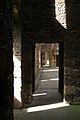 Doorways, Linlithgow Palace - geograph.org.uk - 1429739.jpg 426 × 640; 59 KB
-
 Dowry Castle Hill - geograph.org.uk - 1428888.jpg 640 × 480; 37 KB
-
 Dowry reservoir - geograph.org.uk - 1428887.jpg 640 × 480; 72 KB
-
 Drop box and pillar box, Belfast - geograph.org.uk - 1428545.jpg 627 × 406; 102 KB
-
 Dry Stone Wall, West Tempar - geograph.org.uk - 1446706.jpg 480 × 640; 89 KB
-
 Dunvegan, Isle of Skye - geograph.org.uk - 1463546.jpg 640 × 223; 73 KB
-
 Durham - Cathedral - panoramio.jpg 3,275 × 2,192; 1.15 MB
-
 Easter Buchanty - geograph.org.uk - 1430135.jpg 640 × 480; 89 KB
-
 Edimburgo - North Bridge, by night, from my caravan - panoramio.jpg 3,615 × 1,908; 829 KB
-
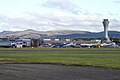 Edinburgh Airport - geograph.org.uk - 1429873.jpg 640 × 426; 55 KB
-
 Electrified fields near Eastacott - geograph.org.uk - 1435038.jpg 640 × 480; 160 KB
-
 End of Hennock Road East - geograph.org.uk - 1432602.jpg 640 × 480; 179 KB
-
 Entering Outlane - geograph.org.uk - 1428929.jpg 640 × 480; 51 KB
-

-
 Entrance to Londesborough Park - geograph.org.uk - 1430478.jpg 640 × 480; 75 KB
-

-
 Entrance to The Old Rectory - geograph.org.uk - 1430329.jpg 640 × 480; 111 KB
-

-
 Exeter Cathedral - geograph.org.uk - 1434937.jpg 640 × 424; 67 KB
-
 Farm Buildings along the Wolds Way - geograph.org.uk - 1429329.jpg 640 × 480; 59 KB
-
 Fence Corner, Near West Tempar - geograph.org.uk - 1446701.jpg 640 × 480; 92 KB
-
 Fence Corner, Tempar Burn - geograph.org.uk - 1446725.jpg 480 × 640; 87 KB
-
 Fence, Botanic Gardens, Belfast - geograph.org.uk - 1427927.jpg 640 × 462; 111 KB
-
 Field entrance on Rowhorne Farm - geograph.org.uk - 1433250.jpg 640 × 480; 183 KB
-
 Fields and rain clouds - geograph.org.uk - 1433235.jpg 640 × 480; 155 KB
-
 Fields at Kingscavil, west of Linlithgow - geograph.org.uk - 1429834.jpg 640 × 426; 110 KB
-
 Fields Near Crossmount - geograph.org.uk - 1446739.jpg 640 × 480; 85 KB
-
 Fields near Eastacott - geograph.org.uk - 1434552.jpg 640 × 480; 179 KB
-
 Fields near Eastacott - geograph.org.uk - 1435033.jpg 640 × 480; 147 KB
-
 Fields of wheat next to Shobrooke Park - geograph.org.uk - 1435006.jpg 640 × 480; 150 KB
-
 Fields off the A19 Selby Road - geograph.org.uk - 1429016.jpg 640 × 480; 50 KB
-

-

-
 Fishing boats, Linlithgow Loch - geograph.org.uk - 1429805.jpg 640 × 426; 75 KB
-
 Flowers in the rain 1 - geograph.org.uk - 1428251.jpg 640 × 640; 316 KB
-
 Flowers in the rain 2 - geograph.org.uk - 1428262.jpg 640 × 551; 270 KB
-
 Flowers in the rain 3 - geograph.org.uk - 1428266.jpg 640 × 480; 191 KB
-
 Flowers outside the Camden Head - geograph.org.uk - 1428890.jpg 640 × 480; 133 KB
-
 Foliate capital - geograph.org.uk - 1429857.jpg 640 × 426; 72 KB
-
 Footbridge near Beck Wood - geograph.org.uk - 1430375.jpg 640 × 480; 144 KB
-
 Footbridge over Nunburnholme Beck - geograph.org.uk - 1429376.jpg 640 × 480; 105 KB
-

-
 Footpath gate west of Hunningham - geograph.org.uk - 1480902.jpg 640 × 422; 113 KB
-

-

-

-
 Forge Lane, Bredhurst - geograph.org.uk - 1429656.jpg 640 × 480; 69 KB
-
 Former Pole Moor Baptist Chapel - geograph.org.uk - 1428921.jpg 640 × 480; 50 KB
-
 Former pumping station by River Lark - geograph.org.uk - 1428785.jpg 640 × 427; 76 KB
-

-
-
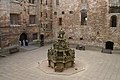
 Fountain, Linlithgow Palace - geograph.org.uk - 1429679.jpg 426 × 640; 72 KB
-
 Four Winds bus, Belfast - geograph.org.uk - 1428515.jpg 593 × 419; 102 KB
-
 Fowlis Wester village hall - geograph.org.uk - 1434291.jpg 640 × 480; 71 KB
-
-
 Garage at Upland Square. - geograph.org.uk - 1443586.jpg 640 × 480; 101 KB
-
 Garage at Upland Square. - geograph.org.uk - 1443589.jpg 640 × 480; 115 KB
-
 Garage at Upland Square. - geograph.org.uk - 1443592.jpg 480 × 640; 99 KB
-
 Gate on public footpath - geograph.org.uk - 1428178.jpg 640 × 453; 86 KB
-

-

-
 Great Hall, Linlithgow Palace - geograph.org.uk - 1429708.jpg 426 × 640; 74 KB
-
 Great Hall, Linlithgow Palace - geograph.org.uk - 1429723.jpg 426 × 640; 69 KB
-
 Green Lane, near Pennington Flash - geograph.org.uk - 1428462.jpg 640 × 426; 64 KB
-
 Guidestone, Castlebergh Lane, Settle - geograph.org.uk - 1451870.jpg 492 × 640; 164 KB
-
 Hambeer Lane - geograph.org.uk - 1433196.jpg 640 × 480; 171 KB
-

-

-
 Harbour wall, Boscastle - geograph.org.uk - 1470144.jpg 640 × 480; 133 KB
-
 Hemerocallis sp. 'Malja' - geograph.org.uk - 1428256.jpg 638 × 640; 326 KB
-
 Hewell Grange - geograph.org.uk - 1717511.jpg 640 × 480; 84 KB
-
 High Street, Littlehampton - geograph.org.uk - 1441431.jpg 640 × 480; 71 KB
-
 High visibility markings^ - geograph.org.uk - 1432880.jpg 480 × 640; 107 KB
-
 Highfield Lane - geograph.org.uk - 1428992.jpg 640 × 480; 87 KB
-
 Hillside, Langcliffe - geograph.org.uk - 1448569.jpg 640 × 480; 112 KB
-

-
 Hollyhocks in Hunningham - geograph.org.uk - 1480904.jpg 640 × 426; 131 KB
-

-
 Hull Marina's Entrance Swing Bridge - geograph.org.uk - 1428879.jpg 640 × 480; 117 KB
-
 Hull Marina's Entrance Swing Bridge - geograph.org.uk - 1428880.jpg 640 × 479; 113 KB
-

-
 Hunningham sewage pumping station - geograph.org.uk - 1480909.jpg 640 × 435; 94 KB
-
 Jedburgh Woollen Mill - geograph.org.uk - 1452837.jpg 640 × 480; 76 KB
-
 Jubilee Cave, Langcliffe - geograph.org.uk - 1448572.jpg 640 × 480; 108 KB
-
 Jubilee Cave, Langcliffe - geograph.org.uk - 1448575.jpg 640 × 480; 140 KB
-
 Junction 4, M2 Motorway, Kent - geograph.org.uk - 1429664.jpg 640 × 480; 68 KB
-

-

-

-
 Kentish Town stn tube roundel.JPG 1,200 × 1,600; 604 KB
-
 Kildale railway station - geograph.org.uk - 1600307.jpg 3,888 × 2,592; 4.14 MB
-
 King's Head, Bedale - geograph.org.uk - 1452755.jpg 480 × 640; 89 KB
-
 King's House, Forth Banks - geograph.org.uk - 1436077.jpg 640 × 480; 68 KB
-
 Lane at Nadderwater - geograph.org.uk - 1433225.jpg 640 × 480; 171 KB
-
 Lane at Nadderwater - geograph.org.uk - 1433228.jpg 640 × 480; 164 KB
-
 Lane at Rowhorne Farm - geograph.org.uk - 1433252.jpg 640 × 480; 173 KB
-

-
 Lane heading north-west at Bowlish - geograph.org.uk - 1434517.jpg 640 × 480; 174 KB
-
 Lane heading south at Bowlish - geograph.org.uk - 1434515.jpg 640 × 480; 145 KB
-
 Lane heading to Eastacott - geograph.org.uk - 1434555.jpg 640 × 480; 162 KB
-

-
 Lane in Enmore - geograph.org.uk - 1440421.jpg 640 × 480; 100 KB


_(3802870175).jpg)
_(3802871083).jpg)
_(3803685346).jpg)


.jpg)


_-_geograph.org.uk_-_1427885.jpg)


